Explore the World Through Geography, Natural Resources & Daily History
Clear, reliable and engaging guides that help you understand our planet — from UK geography education to global natural resources and On This Day history events.
Explore, discover, and learn about the wonders of our world! At Earth Site, we’re passionate about bringing geography, history, and science to life for curious minds of all ages. Whether you’re delving into historical events, uncovering the mysteries of the natural world, or seeking interactive resources, you’re in the right place.
Here, you can uncover the stories behind historical events, explore the natural wonders of our planet, and gain valuable insights into how the Earth’s systems shape our daily lives. From the towering peaks of mountain ranges to the far-reaching impacts of human innovation, we aim to make every topic both engaging and informative.
Start your journey of discovery with us today, and let’s make learning an adventure!
What We Cover
Earth Site brings together engaging and accessible educational content designed to help you understand the world, its history, and its natural systems.
🌍 Geography Education (UK & Worldwide)
We publish clear, easy-to-understand geography resources for students, teachers and curious learners. Our guides support geography education in the UK and cover physical geography, climate, ecosystems, population, and global development.
⛏️ Natural Resources & Environmental Geography
Explore detailed country profiles covering natural resources, mining, energy, geology and global environmental challenges. We show how nations manage minerals, water, land and ecosystems, and why these resources matter.
📅 On This Day in History
Every day has a story. Our On This Day history series features major events, anniversaries, traditions, and cultural milestones from around the world — with timelines, context, and fun facts.
TIMELINE

Tropical Climate Zones
Tropical climate zones are regions of the Earth situated between the Tropic of Cancer and the Tropic of Capricorn. These areas are characterised by warm temperatures, high humidity, and distinct wet and dry seasons. The tropical climate is typically found in countries near the equator, such as Brazil, Indonesia, and Nigeria. The climate in these regions is influenced by the sun’s direct rays, which result in consistently warm temperatures throughout the year. The tropical climate is also characterised by heavy rainfall, which contributes to the lush vegetation and diverse ecosystems found in these areas. Tropical climate zones are popular tourist destinations due to their beautiful beaches, vibrant cultures, and unique wildlife. However, these regions also face significant challenges, including deforestation, loss of biodiversity, and the impact of climate change. Understanding the characteristics, biodiversity, challenges, and conservation efforts in tropical climate zones is crucial for preserving these valuable ecosystems for future generations. Summary Tropical climate zones are typically found near the equator and are characterised by high temperatures and humidity throughout the year. The characteristics of tropical climate zones include distinct wet and dry seasons, lush vegetation, and a wide variety of animal species. Biodiversity in tropical climate zones is incredibly rich, with a high number of endemic species and unique ecosystems such as rainforests and coral reefs. Challenges and threats in tropical climate zones include deforestation, habitat loss, poaching, and the impact of climate change on vulnerable species. Conservation efforts in tropical climate zones focus on protecting and restoring natural habitats, implementing sustainable practices, and raising awareness about the importance of preserving biodiversity. Characteristics of Tropical Climate Zones Tropical...

What Effect Climate Zones
Climate zones are geographical areas with distinct weather patterns and climatic conditions. These zones are determined by factors such as temperature, precipitation and humidity, and they play a crucial role in shaping the natural environment and human activities within a region. There are several different climate classification systems, but the most widely used is the Köppen climate classification, which divides the world into five primary climate zones: tropical, dry, temperate, continental and polar. Each of these zones has its own unique characteristics and influences on the environment, wildlife, agriculture and human settlements. The tropical climate zone is typically found near the equator and is characterised by high temperatures and heavy rainfall throughout the year. The dry climate zone, on the other hand, experiences minimal precipitation and is often associated with desert landscapes. The temperate climate zone has moderate temperatures and distinct seasons, whilst the continental climate zone is known for its extreme temperature variations between summer and winter. Finally, the polar climate zone is located near the North and South Poles and is characterised by freezing temperatures and little to no vegetation. Understanding these climate zones is essential for comprehending the diverse natural environments and human activities that exist within them. Summary Climate zones are geographical areas with distinct weather patterns and temperatures, determined by factors such as latitude, altitude, and proximity to water bodies. Climate zones have a significant impact on agriculture, influencing the types of crops that can be grown and the farming practices that can be employed in different regions. Wildlife is greatly influenced by climate zones, with different species adapted to thrive in specific climates,...

Political Boundaries of Nicaragua: Provinces, Districts, or Historical Boundaries.
Nicaragua, situated in Central America, boasts a rich history and diverse culture. The nation’s political boundaries are delineated by its borders with Honduras to the north and Costa Rica to the south, as well as its coastlines along the Caribbean Sea to the east and the Pacific Ocean to the west. The country is administratively divided into 15 departments, including two autonomous regions, which are further subdivided into municipalities and districts. Nicaragua‘s political boundaries have evolved throughout history, shaped by colonial influences, historical events, and conflicts with neighbouring countries. A comprehensive understanding of Nicaragua’s political boundaries is crucial for grasping its governance structure, societal dynamics, and economic landscape. Summary Nicaragua is a country located in Central America with political boundaries that have evolved over time. The country is divided into 15 provinces, each with its own unique characteristics and cultural identity. Within these provinces, there are 153 districts that play a crucial role in local governance and administration. Nicaragua’s historical boundaries have been shaped by colonialism, conflicts, and treaties with neighbouring countries. Changes and controversies in Nicaragua’s political boundaries have sparked debates and tensions among different groups within the country. The political boundaries of Nicaragua have a significant impact on the country’s society and economy, influencing issues such as resource distribution and infrastructure development. The future of Nicaragua’s political boundaries is uncertain, with ongoing discussions and negotiations that could potentially lead to changes in the country’s administrative divisions. Provinces of Nicaragua Provincial Governance and Administration The provinces of Nicaragua play a crucial role in the country’s governance and administration, as they are responsible for implementing national policies and programmes...

Climate Zones of Nicaragua: Different climate regions Of Nicaragua
Nicaragua is a country situated in Central America, renowned for its diverse climate zones that span from tropical rainforests to semi-arid regions. The nation’s distinctive geographical position, with coastlines on both the Caribbean Sea and the Pacific Ocean, contributes to the variety of climates found within its borders. Comprehending the different climate zones in Nicaragua is crucial for appreciating the country’s natural beauty and biodiversity. From the lush rainforests of the Caribbean lowlands to the dry tropical climate of the Pacific lowlands, each region presents its own distinct characteristics and attractions. By examining the various climate zones in Nicaragua, one can develop a deeper understanding of the country’s natural diversity and the impact of climate on its ecosystems and landscapes. Nicaragua’s climate can be broadly categorised into six main zones, each with its own unique characteristics and weather patterns. These zones include the tropical rainforest climate in the Caribbean lowlands, the dry tropical climate in the Pacific lowlands, the highland climate in the central region, the subtropical climate in the northern mountains, and the semi-arid climate in the central and southern Pacific regions. Each of these climate zones plays a vital role in shaping Nicaragua’s natural environment, from its dense rainforests to its arid plains. By understanding the distinct features of each climate zone, one can gain a deeper insight into Nicaragua’s ecological diversity and the challenges posed by climate change and environmental conservation efforts. Summary Nicaragua has diverse climate zones, including tropical rainforest, dry tropical, highland, subtropical, and semi-arid climates. The Caribbean lowlands experience a tropical rainforest climate with high temperatures, heavy rainfall, and high humidity throughout the...

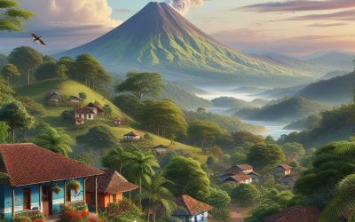
Terrain and Topography of Nicaragua: mountains, valleys, and plains.
Nicaragua, situated in Central America, is a nation renowned for its diverse and striking terrain and topography. From towering mountains to verdant valleys and expansive plains, Nicaragua‘s landscape is a remarkable sight. The country’s terrain is a consequence of its geological formation, which has influenced its climate and biodiversity. This article shall examine the various aspects of Nicaragua’s terrain and topography, exploring the impact it has on the country’s natural environment and the experiences it offers to visitors. Nicaragua’s terrain is characterised by its varied topography, which encompasses mountains, valleys, and plains. The country is home to several mountain ranges, including the Cordillera Isabelia and the Cordillera Dariense, which dominate the northern region. In contrast, the central and southern regions are marked by extensive plains and fertile valleys. The diverse terrain of Nicaragua provides a rich tapestry of natural landscapes, offering a range of outdoor activities and awe-inspiring scenery for visitors to explore. In the following sections, we shall examine the different elements of Nicaragua’s terrain and topography in greater detail, from its imposing mountains to its lush valleys and vast plains. Summary Nicaragua’s terrain is diverse, ranging from mountains and valleys to vast plains. The majestic mountains of Nicaragua offer stunning views and are popular for hiking and adventure activities. The lush valleys of Nicaragua are home to rich biodiversity and fertile land for agriculture. The vast plains of Nicaragua provide important grazing land for livestock and are essential for the country’s economy. The geological formation of Nicaragua’s terrain is influenced by tectonic activity and volcanic processes. The Majestic Mountains of Nicaragua Mountainous Landscapes The Cordillera Isabelia, located...

History of Nicaragua
Nicaragua possesses a rich and diverse history dating back to the Pre-Columbian era. The region was inhabited by various indigenous groups, including the Nahuatl-speaking Aztecs and the Chibcha-speaking peoples. These indigenous groups had established complex societies with advanced agricultural practices, trade networks and political structures. The Aztecs, in particular, had a significant influence on the region, with their cultural and religious practices shaping the beliefs and traditions of the local population. The indigenous people of Nicaragua were adept at pottery, weaving and metalworking, and they had a profound connection to the land and natural world. They lived in harmony with nature, relying on the fertile soil for their sustenance and constructing their communities around abundant water sources. The region was also home to several powerful chiefdoms, such as the Nicaraos and the Chorotegas, who controlled vast territories and engaged in trade with neighbouring groups. The Pre-Columbian era in Nicaragua was characterised by a rich tapestry of cultures, traditions and beliefs. The indigenous people had a deep spiritual connection to the land and worshipped a pantheon of gods and spirits. They also had complex social structures, with chiefs and shamans playing important roles in their communities. The arrival of the Spanish conquistadors in the 16th century would irrevocably alter the course of Nicaraguan history, but the legacy of the indigenous people continues to endure in the country’s art, music and traditions. Summary Pre-Columbian Nicaragua was home to several indigenous groups, including the Nahuatl-speaking Aztecs and the Chibchan-speaking people of the Caribbean coast. Spanish colonization in the 16th century led to the establishment of cities such as Granada and León, and...

Natural Resources of Nicaragua: Where Natural Resources are Located in Nicaragua
Nicaragua possesses abundant natural resources, encompassing a diverse array of agricultural, mineral, forest, water, energy, and coastal and marine assets. These resources are integral to the nation’s economy, providing employment and sustenance for a substantial portion of the populace. Moreover, Nicaragua‘s natural resources are vital for the country’s biodiversity and environmental sustainability. The Nicaraguan government has implemented measures to manage and conserve these resources, aiming to ensure their sustainable utilisation for future generations. Agriculture stands as one of Nicaragua’s most significant natural resources, with the sector employing a large segment of the population and contributing substantially to the country’s economy. Nicaragua’s fertile soil and favourable climate render it suitable for cultivating various crops, including coffee, bananas, sugar cane, and tobacco. The nation also boasts a considerable livestock industry, with cattle, pigs, and poultry serving as important agricultural products. In recent years, there has been an increasing emphasis on sustainable agricultural practices to safeguard the sector’s long-term viability. Summary Nicaragua is rich in natural resources, including agricultural, mineral, forest, water, energy, and coastal and marine resources. The agricultural sector in Nicaragua is a significant contributor to the country’s economy, with key products including coffee, bananas, sugarcane, and beef. Nicaragua has significant mineral resources, including gold, silver, copper, and zinc, with mining playing a crucial role in the country’s economy. The country’s forest resources are diverse and valuable, providing timber, medicinal plants, and habitat for a wide range of wildlife. Nicaragua’s water resources are abundant, with the country being home to numerous rivers, lakes, and lagoons, providing opportunities for hydroelectric power generation and irrigation for agriculture. Energy resources in Nicaragua are...

Cultural or Historical Sites of Nicaragua: Important Cultural Landmarks or Historical Sites In Nicaragua
Nicaragua boasts a rich cultural and historical heritage, offering a diverse array of sites that showcase its vibrant past. The country’s landscape encompasses colonial cities, ancient ruins, volcanic terrain and indigenous communities, providing visitors with a wealth of cultural and historical experiences to explore. Nicaragua‘s unique cultural identity has been shaped by a blend of indigenous, Spanish and African influences, rendering it a captivating destination for those with an interest in history, art and architecture. This article shall examine some of Nicaragua’s most significant cultural and historical sites, exploring the stories and importance behind each one. Summary Nicaragua is home to a rich cultural and historical heritage, with a variety of sites to explore. The colonial city of Granada is a must-visit, with its colourful architecture and vibrant atmosphere. The ruins of León Viejo offer a fascinating glimpse into Nicaragua’s colonial past and are a UNESCO World Heritage Site. The Masaya Volcano National Park is a unique natural attraction, where visitors can witness the active volcano up close. The indigenous community of Solentiname provides an opportunity to learn about traditional Nicaraguan culture and art. The Colonial City of Granada A City Steeped in History The city’s historic centre is a labyrinth of cobbled streets, pastel-coloured buildings, and charming plazas, all of which exude an old-world charm that transports visitors back in time. Landmarks and Cultural Attractions The city is home to a number of significant landmarks, including the stunning Granada Cathedral, which dates back to the 16th century and is a prime example of Spanish colonial architecture. Visitors can also explore the San Francisco Convent, which houses a fascinating...

Population Density of Nicaragua
Nicaragua, situated in Central America, is a nation renowned for its diverse culture, striking landscapes and rich history. With a population exceeding 6 million inhabitants, Nicaragua stands as one of the most densely populated countries in the region. The population density of Nicaragua is approximately 52 people per square kilometre, ranking it amongst the most densely populated nations in Central America. Over the years, Nicaragua’s population density has been steadily increasing, presenting both challenges and opportunities for the country. This article shall examine the factors contributing to population density in Nicaragua, the impact of population density on infrastructure and resources, and the challenges and opportunities associated with high population density in the nation. Summary Nicaragua has a population density of 52 people per square kilometre, making it one of the least densely populated countries in Central America. Factors contributing to population density in Nicaragua include urbanisation, agricultural activities, and natural resource distribution. The majority of Nicaragua’s population is concentrated in urban areas, with the capital city of Managua being the most densely populated. High population density in Nicaragua puts a strain on infrastructure and resources, leading to challenges in providing adequate services and amenities. Despite the challenges, high population density in Nicaragua also presents opportunities for economic growth and development, particularly in urban areas. Factors Contributing to Population Density in Nicaragua Demographic Factors One of the primary factors contributing to the high population density in Nicaragua is the country’s high fertility rate, which is above the global average. This has led to a large and growing population, thereby contributing to the overall population density. Migration and Urbanisation Additionally, internal...
Nicaragua
Nicaragua (República de Nicaragua (Republic of Nicaragua)) Capital: Managua Population (Estimated July 2012): 5,727,707 Area: 130,373km2 or 50,337mi2 Currency: Córdoba (C$) Official Language: Spanish Political Information: Presidential Republic Official Religion: No Official Religion(approximately 58.5% of the population are Roman Catholic, 23.2% are Protestant, 15.7% have no religion, 0.9% are Jehovah’s Witnesses and 1.7% follow other faiths) Highest Mountain: Mogotón at 2,107m or 6,913ft GDP Official Exchange Rate (OER is more precise at gauging a country’s economic power) (Estimated 2011): $7.08 billion (US$) or (GBP) GDP (OER) Per Capita (per member of the population estimated 2011): (US$) or (GBP) GDP Purchasing Power Parity (PPP is good for gauging living conditions and the use of resources but is not as accurate as OER. This data has been calculated based on the sum value of all goods and services produced in the country valued at prices prevailing in the United States) (Estimated 2011): $18.77 billion (US$) or (GBP) GDP (PPP) Per Capita (per member of the population estimated 2011): $3,200 (US$) or (GBP) Time Zone (GMT/UTC): -6:00 Wildlife: Counties/Provinces/States: 15 departments (departamentos, singular – departamento) and 2 autonomous regions* (regiones autonomistas, singular – region autonoma); Atlantico Norte*, Atlantico Sur*, Boaco, Carazo, Chinandega, Chontales, Esteli, Granada, Jinotega, Leon, Madriz, Managua, Masaya, Matagalpa, Nueva Segovia, Rio San Juan, Rivas Leaders: President Daniel Ortega and Vice President Jaime Morales Carazo. Additional: Gained independence from Spain on the 15th of September 1821. Sources: CIA World Fact Book, Encyclopaedia Britannica. Nicaragua Nicaragua, officially known as the Republic of Nicaragua, is the largest country in Central America. It shares borders with Honduras to the north and Costa Rica to the south, with the Pacific Ocean to the west and the Caribbean Sea to...
Global Climate Zones
The Earth is divided into various climate zones, each possessing unique characteristics and weather patterns. These climate zones are determined by a combination of factors, including latitude, altitude, proximity to bodies of water, and prevailing wind patterns. Understanding these climate zones is crucial for predicting weather patterns, studying biodiversity, and planning for human settlements and agriculture. There are five primary climate zones: tropical, arid, temperate, continental, and polar. Each of these zones exhibits distinct temperature and precipitation patterns, which in turn influence the types of flora and fauna that can thrive in these areas. Climate zones play a vital role in shaping the natural environment and have a significant impact on human societies and their way of life. Summary Global climate zones are geographical areas with similar climatic conditions, including temperature, precipitation, and vegetation patterns. The five main climate zones are tropical, dry, temperate, continental, and polar, each with distinct characteristics and weather patterns. Factors influencing climate zones include latitude, altitude, ocean currents, and prevailing winds, which all contribute to the distribution of heat and moisture across the Earth. Climate zones have a significant impact on biodiversity, influencing the types of plants and animals that can thrive in different regions. Human adaptation to climate zones involves the development of specific cultural practices, architecture, and agricultural techniques to cope with the challenges of different climates. The Five Main Climate Zones The tropical climate zone is located near the equator and is characterized by high temperatures and heavy rainfall throughout the year. This climate zone is home to lush rainforests, diverse wildlife, and a variety of tropical fruits and crops. The...

Political Boundaries of New Zealand: Provinces, Districts, or Historical Boundaries.
New Zealand, a picturesque island nation situated in the southwestern Pacific Ocean, is renowned for its breathtaking landscapes, rich Māori culture and dynamic urban centres. The country’s political boundaries have evolved over time, shaping its governance and administration. These boundaries encompass provinces, districts and historical demarcations that have significantly influenced New Zealand‘s modern political landscape. A thorough understanding of the historical and current significance of these political boundaries is essential for comprehending the nation’s governance structure and the contemporary challenges it faces. This article shall examine the intricate details of New Zealand’s political boundaries, exploring their historical origins, current administrative divisions and the ongoing debates surrounding their development. Summary New Zealand’s political boundaries are defined by its provinces, districts, and historical boundaries, which have evolved over time. Provinces have historical significance and continue to play a role in local governance, while districts are modern administrative divisions that help manage local services and resources. Historical boundaries have had a lasting impact on modern governance, shaping the distribution of power and resources within the country. The evolution of New Zealand’s political boundaries reflects the country’s changing social, economic, and political landscape. Challenges and debates surrounding political boundaries in New Zealand highlight the need for ongoing discussion and adaptation to meet the needs of a changing society. Provinces: Historical and Current Significance The Legacy of Provinces Despite this, the legacy of provinces still lingers in New Zealand’s political landscape. Today, the country is divided into 16 regions, each with its own regional council responsible for environmental management, land use planning, and other local governance functions. These regions have historical significance as they...