Explore the World Through Geography, Natural Resources & Daily History
Clear, reliable and engaging guides that help you understand our planet — from UK geography education to global natural resources and On This Day history events.
Explore, discover, and learn about the wonders of our world! At Earth Site, we’re passionate about bringing geography, history, and science to life for curious minds of all ages. Whether you’re delving into historical events, uncovering the mysteries of the natural world, or seeking interactive resources, you’re in the right place.
Here, you can uncover the stories behind historical events, explore the natural wonders of our planet, and gain valuable insights into how the Earth’s systems shape our daily lives. From the towering peaks of mountain ranges to the far-reaching impacts of human innovation, we aim to make every topic both engaging and informative.
Start your journey of discovery with us today, and let’s make learning an adventure!
What We Cover
Earth Site brings together engaging and accessible educational content designed to help you understand the world, its history, and its natural systems.
🌍 Geography Education (UK & Worldwide)
We publish clear, easy-to-understand geography resources for students, teachers and curious learners. Our guides support geography education in the UK and cover physical geography, climate, ecosystems, population, and global development.
⛏️ Natural Resources & Environmental Geography
Explore detailed country profiles covering natural resources, mining, energy, geology and global environmental challenges. We show how nations manage minerals, water, land and ecosystems, and why these resources matter.
📅 On This Day in History
Every day has a story. Our On This Day history series features major events, anniversaries, traditions, and cultural milestones from around the world — with timelines, context, and fun facts.
TIMELINE

Cultural or Historical Sites of Libya: Important Cultural Landmarks or Historical Sites in Libya
The ancient city of Leptis Magna, situated in present-day Libya, was once a flourishing Roman metropolis and one of the most significant in the region. Established by the Phoenicians in the 7th century BC, it later developed into a major urban centre under Roman governance. The city’s prosperity stemmed from its strategic position on the Mediterranean coast, which rendered it a focal point for trade and commerce. Leptis Magna reached its zenith during the reign of Emperor Septimius Severus, who was born in the city and subsequently became one of Rome’s most influential emperors. Under his rule, the city experienced a period of remarkable affluence and underwent extensive architectural development, including the construction of a magnificent triumphal arch, a basilica, and a circus. The ruins of Leptis Magna stand as a testament to the city’s former grandeur and offer a captivating insight into the daily life of its inhabitants. The city’s well-preserved archaeological remains encompass impressive structures such as the Severan Basilica, the Arch of Septimius Severus, and the amphitheatre, which could accommodate up to 16,000 spectators. The city’s layout, with its well-preserved streets, squares, and public buildings, provides valuable information about Roman urban planning and architecture. The site also houses numerous mosaics, sculptures, and other artefacts that offer a vivid depiction of life in ancient Leptis Magna. Today, the ancient city is a UNESCO World Heritage Site and attracts visitors from across the globe who come to admire its impressive ruins and learn about its rich history. Summary Leptis Magna is an ancient city with well-preserved ruins, including a theatre, basilica, and market. The Roman Theatre of Sabratha...

Libya
Libya (Al-Jumhūriyyah al-Lībiyyah (The Libyan Republic)) Capital: Tripoli Population (Estimated July 2012): 6,733,620 Area: 1,676,198 km2 or 647,184mi2 Currency: Libyan Dinar (LD) Official Language: Arabic Political Information: National Transitional Council (Political face of the revolutionaries against Gaddafi’s government) Official Religion: Islam(approximately 97% of the population is Sunni and 3% have other religious beliefs) Highest Mountain: Bikku Bitti (Bette Peak) at 2,267m or 7,438ft GDP Purchasing Power Parity (PPP is good for gauging living conditions and use of resources but not as accurate as OER. This data has been calculated based on the sum value of all goods and services produced in the country valued at prices prevailing in the United States) (Estimated 2010): $92.62 billion (US$) or (GBP) GDP (PPP) Per Capita (per member of the population estimated 2010): $14,100 (US$) or (GBP) Time Zone (GMT/UTC): +2:00 Wildlife: Counties/Provinces/States: 22 districts (shabiyat, singular – shabiyat); Al Butnan, Al Jabal al Akhdar, Al Jabal al Gharbi, Al Jafarah, Al Jufrah, Al Kufrah, Al Marj, Al Marqab, Al Wahat, An Nuqat al Khams, Az Zawiyah, Banghazi, Darnah, Ghat, Misratah, Murzuq, Nalut, Sabha, Surt, Tarabulus, Wadi al Hayat, Wadi ash Shati Leaders: Chairman Mustafa Abdul Jalil with Prime Minister Abdurrahim El-Keib. Sources: CIA World Fact Book, Encyclopaedia Britannica. Libya Libya, officially known as the State of Libya, is a country situated in North Africa. The history of Libya extends back to ancient times, with evidence of human habitation dating back to at least 12,000 years ago. The region has been inhabited by various ancient civilisations, including the Phoenicians, Greeks, Romans, and Byzantines. In the 7th century, Libya became part of the Islamic Caliphate and was ruled by various Islamic dynasties. In the 16th century,...

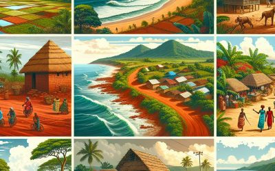
Population Density of Liberia
Liberia, a nation situated on the western coast of Africa, possesses a population density of approximately 50 individuals per square kilometre. The distribution of population density in Liberia is uneven, with the majority of inhabitants concentrated in urban centres such as Monrovia, the capital city, and its surrounding areas. The country’s population density is influenced by various factors, including historical events, economic opportunities, and governmental policies. Comprehending the population density in Liberia is vital for policymakers and urban planners to address the challenges and opportunities associated with population distribution in the country. Liberia’s population density has been shaped by its history of colonisation, slavery, and civil conflict. The nation was established by emancipated American slaves in the 19th century, resulting in a concentration of population in coastal regions. The legacy of this settlement pattern continues to influence the population density in Liberia today, with the majority of inhabitants residing in urban and coastal areas. Furthermore, the civil war that devastated the country from 1989 to 2003 led to mass displacement and migration, further impacting the distribution of the population. Consequently, there exists a stark contrast between the densely populated urban areas and the sparsely populated rural regions in Liberia. Understanding these historical factors is essential for addressing the challenges of population density and planning for sustainable development in the country. Summary Liberia has a population density of 50.9 people per square kilometre, with the majority of the population living in rural areas. Factors affecting population density in Liberia include natural resources, economic opportunities, and historical settlement patterns. Urban areas in Liberia have a higher population density compared to rural...

History of Liberia
Liberia, situated on the western coast of Africa, possesses a complex and intriguing history dating back to the early 19th century. The region now known as Liberia was initially inhabited by various indigenous tribes, including the Kpelle, Bassa, and Vai peoples. In 1822, the American Colonisation Society (ACS) established a settlement in the area for emancipated African-American slaves. The settlement was christened Monrovia, in honour of James Monroe, the fifth President of the United States. The ACS believed that repatriating freed slaves to Africa would address racial inequality in the United States and provide economic opportunities for the settlers in Africa. The early years of the settlement were characterised by challenges, including conflicts with indigenous tribes and the harsh conditions of the African climate. Nevertheless, the settlers persevered and established a thriving community, with a unique blend of American and African cultures. The settlement also attracted other freed slaves from the United States, as well as African-Americans seeking a new beginning in Africa. This early period of colonisation laid the foundation for the formation of the Republic of Liberia and the distinctive identity of its people. The early settlement and colonisation of Liberia were marked by both successes and difficulties. The establishment of Monrovia as a haven for freed slaves was a bold and ambitious undertaking that aimed to address the injustices of slavery in America. However, the settlers faced numerous challenges, including conflicts with indigenous tribes and the harsh realities of building a new society in a foreign land. Despite these obstacles, the settlers persevered and built a thriving community that would eventually become the foundation for the...

Terrain and Topography of Liberia: mountains, valleys, and plains.
Liberia, situated on the western coast of Africa, is renowned for its diverse topography. The terrain of Liberia comprises a mixture of mountain ranges, valleys, lowlands and coastal plains, rendering it a country of considerable geographical significance. The topography of Liberia exerts a substantial influence on the environment, agriculture and overall development of the nation. A comprehensive understanding of the various aspects of Liberia’s terrain is essential for appreciating the country’s natural beauty and recognising the challenges and opportunities it presents. Liberia’s terrain is a consequence of its geological history, with the country forming part of the West African Craton. The landscape is characterised by a series of parallel mountain ranges extending from the northwest to the southeast, interspersed with valleys and lowlands. The coastal plains along the Atlantic Ocean complete Liberia’s diverse topography. This varied terrain has shaped the country’s environment and influenced the way people live and work in different regions of the nation. A thorough comprehension of the specific features of Liberia’s terrain is crucial for appreciating the country’s natural diversity and its impact on various aspects of life. Summary Liberia’s terrain is diverse, with mountain ranges, valleys, lowlands, and coastal plains. The mountain ranges of Liberia include the Nimba Range and the Wologizi Range, offering scenic beauty and potential for tourism. The valleys and lowlands of Liberia are fertile and suitable for agriculture, with the Lofa Valley being a key agricultural region. The coastal plains of Liberia are home to the country’s capital, Monrovia, and are important for trade and economic activities. The varied topography of Liberia impacts the environment and agriculture, presenting both challenges...

Climate Zones Of Liberia: Different Climate Regions Of Liberia
Liberia, situated on the western coast of Africa, possesses diverse climate zones. The nation’s climate is influenced by its proximity to the equator, the Atlantic Ocean and the West African monsoon. Liberia‘s climate can be broadly categorised into six main climate zones: equatorial, tropical rainforest, tropical monsoon, savanna, semi-arid and coastal. Each of these climate zones has its own distinct characteristics, including temperature, precipitation and vegetation. Understanding these climate zones is crucial for comprehending the environmental diversity and challenges faced by Liberia. Liberia’s equatorial climate zone is characterised by high temperatures and heavy rainfall throughout the year. This climate zone is located in the southern part of the country, near the equator. The equatorial climate zone experiences little variation in temperature, with average temperatures ranging from 25°C to 28°C. The high levels of rainfall in this region support lush vegetation, including dense tropical rainforests and diverse wildlife. The equatorial climate zone is also prone to tropical storms and hurricanes, which can cause significant damage to the region. Understanding the equatorial climate zone is important for comprehending the unique environmental challenges faced by this region, including deforestation, habitat loss and biodiversity conservation. Summary Liberia has diverse climate zones, each with its own unique characteristics and impact on the environment. The Equatorial Climate Zone in Liberia is characterised by high temperatures and heavy rainfall throughout the year. The Tropical Rainforest Climate Zone experiences consistent high temperatures and heavy rainfall, supporting lush vegetation and biodiversity. The Tropical Monsoon Climate Zone in Liberia has a distinct wet and dry season, with heavy rainfall during the wet season and drier conditions during the dry...

Political Boundaries of Liberia: Provinces, Districts, or Historical Boundaries.
Liberia, situated on the western coast of Africa, possesses a rich and intricate political history. The nation’s political boundaries have evolved over time, influencing its governance structure and shaping its political landscape. The present-day political boundaries of Liberia were established during the colonial era and have undergone various modifications since that period. The country is divided into 15 counties, each holding distinct political and administrative importance. These political divisions play a crucial role in moulding the governance and political framework of Liberia, affecting various aspects from local administration to national elections. The political boundaries of Liberia are not merely geographical demarcations but also hold cultural, historical, and administrative significance. A thorough understanding of Liberia’s political boundaries is essential for comprehending the country’s political system and the allocation of power and resources. These boundaries also play a vital role in shaping the identity and representation of different regions within the nation. As Liberia continues to progress and develop, the political boundaries will remain a significant factor in influencing the country’s political landscape and governance structure. Summary Liberia’s political boundaries have evolved over time and have a significant impact on the country’s political landscape. Provinces play a key role in Liberia’s political structure, serving as administrative units with their own local governments. Districts are important in Liberia’s political system, as they are the primary units for local governance and representation. Historical boundaries continue to influence Liberia’s political landscape, shaping the distribution of power and resources. Challenges and controversies surrounding Liberia’s political boundaries include disputes over land ownership and ethnic tensions. Provinces and Their Role in Liberia’s Political Structure Liberia is divided...

Natural Resources of Liberia: Where Natural Resources are Located in Liberia
Liberia, situated on the western coast of Africa, possesses a diverse array of natural resources. These include mineral deposits, forests, agricultural land, water bodies and energy sources. The nation’s natural resources have been instrumental in its economy and hold significant potential for future development. However, proper management and conservation of these resources are essential to ensure sustainable utilisation and prevent environmental degradation. If managed effectively, Liberia‘s natural resources could drive economic growth and enhance the standard of living for its citizens. The potential for economic development inherent in Liberia’s natural resources has garnered interest from both domestic and international investors. The country’s mineral resources, comprising iron ore, gold, diamonds and bauxite, have been a substantial source of revenue. Liberian forests are also valuable assets, providing timber for export and supporting local communities’ livelihoods. Moreover, the nation’s agricultural resources, including fertile soil and favourable climate conditions, have the capacity to contribute to food security and economic advancement. Water resources, such as rivers and lakes, are crucial for agriculture, industry and domestic consumption. Additionally, Liberia possesses untapped energy resources, including hydroelectric power and renewable energy sources. The effective management and conservation of these natural resources are paramount for Liberia’s sustainable development. Summary Liberia is rich in natural resources, including minerals, forests, agriculture, water, and energy. The country’s mineral resources include iron ore, gold, and diamonds, which are key contributors to the economy. Liberia’s forest resources are vast and diverse, providing valuable timber and supporting biodiversity. Agriculture is a significant part of Liberia’s economy, with crops such as rubber, cocoa, and coffee being major exports. Water resources in Liberia are abundant, with...

Cultural or Historical Sites of Liberia: Important Cultural Landmarks or Historical Sites in Liberia
Liberia, situated on the western coast of Africa, boasts a wealth of cultural and historical sites that provide insight into its intriguing past. From the colonial period to contemporary times, Liberia‘s diverse and dynamic history is reflected in its numerous cultural landmarks and historical sites. These locations not only showcase the nation’s heritage but also offer visitors the opportunity to learn about its distinctive traditions, customs and way of life. Notable attractions include Providence Island, the National Museum of Liberia and the Kendeja Cultural Village, amongst a plethora of other cultural and historical points of interest in this captivating country. Liberia’s cultural and historical sites stand as a testament to the resilience and fortitude of its people, who have surmounted numerous challenges throughout the nation’s history. From the impact of the transatlantic slave trade to the struggle for independence and the civil war, Liberia’s cultural landmarks and historical sites offer a window into the country’s past and its journey towards progress and development. These sites are not only crucial for preserving Liberia’s heritage but also for educating future generations about the nation’s history and the lessons that can be gleaned from it. As such, they form an integral part of Liberia’s identity and serve as a source of national pride. Summary Liberia is home to a rich cultural and historical heritage, with a variety of sites to explore. The Providence Island is a significant historical site, marking the arrival of freed slaves from America in 1822. The National Museum of Liberia offers a fascinating insight into the country’s history and culture through its diverse collection. The Ducor Palace Hotel...
Liberia
Liberia (Republic of Liberia) Capital: Monrovia Population (Estimated July 2012): 3,887,886 Area: 96,917 km2 or 37,420 mi2 Currency: Liberian Dollar (L$) Official Language: English Political Information: Presidential Constitutional Republic Official Religion: No Official Religion (approximately 85% of the population are Christian, 12.2% are Muslim, 1.4% have no religious beliefs and 0.8% have other religious beliefs) Highest Mountain: Mount Wuteve at 1440m or 4724ft GDP Official Exchange Rate (OER is more precise at gauging a country’s economic power) (Estimated 2011): $1.2 billion (US$) or (GBP) GDP (OER) Per Capita (per member of the population estimated 2011): (US$) or (GBP) GDP Purchasing Power Parity (PPP is good for gauging living conditions and the use of resources but is not as accurate as OER. This data has been calculated based on the sum value of all goods and services produced in the country valued at prices prevailing in the United States) (Estimated 2011): $1.836 billion (US$) or (GBP) GDP (PPP) Per Capita (per member of the population estimated 2011): $400 (US$) or (GBP) Time Zone (GMT/UTC): GMT Wildlife: Counties/Provinces/States: 15 counties; Bomi, Bong, Gbarpolu, Grand Bassa, Grand Cape Mount, Grand Gedeh, Grand Kru, Lofa, Margibi, Maryland, Montserrado, Nimba, River Cess, River Gee, Sinoe Leaders: President Ellen Johnson Sirleaf with Vice President Joseph Boakai. Additional: Gained Independance from the USA on the 26th of July 1847. Mount Nimba in Liberia is a one mile high Iron rich mountain. It is has the highest grade iron ore deposit in the world and approximately 1% of the world’s iron production comes from Mount Nimba. Sources: CIA World Fact Book, Encyclopaedia Britannica. Liberia Liberia, officially known as the Republic of Liberia, is a country situated on the west coast of Africa....

Political Boundaries of Lesotho: Provinces, Districts, or Historical Boundaries.
Lesotho, a landlocked country in Southern Africa, is renowned for its distinctive political boundaries. The nation is completely encircled by South Africa, rendering it one of the few enclave countries globally. Lesotho‘s political borders are delineated by the natural terrain, with the Drakensberg mountains forming a natural frontier between Lesotho and South Africa. The political boundaries of Lesotho have developed over time, influenced by historical, cultural and geopolitical factors. These borders play a crucial role in shaping the governance and administration of the country, as well as impacting the lives of its citizens. Lesotho’s political boundaries have been of historical and contemporary significance, moulding the country’s identity and influencing its development. The unique geographical position of Lesotho, entirely encompassed by South Africa, has had a profound impact on its political borders. The country’s boundaries are defined by the natural landscape, with the Drakensberg mountains serving as a natural barrier between Lesotho and South Africa. This geographical feature has not only shaped the political boundaries of Lesotho but has also influenced its cultural and historical development. The political borders of Lesotho have been a source of national pride and identity for its people, as they have maintained their independence and sovereignty despite being wholly surrounded by another nation. Summary Lesotho is a landlocked country surrounded by South Africa, with a total area of 30,355 square kilometers. The country is divided into 10 administrative districts, each with its own capital and local government structure. Lesotho’s historical boundaries have been a source of contention, particularly in relation to the border with South Africa. Challenges and controversies surrounding Lesotho’s political boundaries include disputes...

Climate Zones Of Lesotho: Different climate regions Of Lesotho
Lesotho, a landlocked country in Southern Africa, is renowned for its diverse and distinctive climate zones. The nation’s topography, which spans from lowlands to highlands and mountains, contributes to the variation in climate across different regions. Lesotho experiences a temperate climate with four distinct seasons, including a dry winter and a wet summer. The country’s climate zones play a crucial role in shaping the landscape, vegetation, and livelihoods of its inhabitants. Understanding the different climate zones in Lesotho is essential for comprehending the nation’s agricultural practices, conservation efforts, and overall environmental sustainability. Summary Lesotho’s climate is diverse, with four main climate zones: lowland and foothill, highland, mountain, and semi-arid and arid. The lowland and foothill regions experience hot summers and mild winters, with most of the country’s population and agricultural activity located here. The highland region is characterized by cold temperatures and frequent snowfall, making it unsuitable for most agricultural activities. The mountain region is the coldest and receives the highest amount of snowfall, with limited agricultural potential and harsh living conditions. The semi-arid and arid regions in the lowlands experience low rainfall and high temperatures, posing challenges for agriculture and livelihoods. Lowland and Foothill Climate Regions Climate and Agriculture The lowland and foothill regions of Lesotho are characterised by relatively lower altitudes and milder temperatures compared to the highlands and mountains. These areas experience a moderate climate with warm summers and mild winters. The lowland and foothill regions receive higher levels of precipitation, making them suitable for agriculture and livestock farming. The fertile soils and favourable climate in these regions support the cultivation of crops such as maize,...