Explore the World Through Geography, Natural Resources & Daily History
Clear, reliable and engaging guides that help you understand our planet — from UK geography education to global natural resources and On This Day history events.
Explore, discover, and learn about the wonders of our world! At Earth Site, we’re passionate about bringing geography, history, and science to life for curious minds of all ages. Whether you’re delving into historical events, uncovering the mysteries of the natural world, or seeking interactive resources, you’re in the right place.
Here, you can uncover the stories behind historical events, explore the natural wonders of our planet, and gain valuable insights into how the Earth’s systems shape our daily lives. From the towering peaks of mountain ranges to the far-reaching impacts of human innovation, we aim to make every topic both engaging and informative.
Start your journey of discovery with us today, and let’s make learning an adventure!
What We Cover
Earth Site brings together engaging and accessible educational content designed to help you understand the world, its history, and its natural systems.
🌍 Geography Education (UK & Worldwide)
We publish clear, easy-to-understand geography resources for students, teachers and curious learners. Our guides support geography education in the UK and cover physical geography, climate, ecosystems, population, and global development.
⛏️ Natural Resources & Environmental Geography
Explore detailed country profiles covering natural resources, mining, energy, geology and global environmental challenges. We show how nations manage minerals, water, land and ecosystems, and why these resources matter.
📅 On This Day in History
Every day has a story. Our On This Day history series features major events, anniversaries, traditions, and cultural milestones from around the world — with timelines, context, and fun facts.
TIMELINE

Cultural or Historical Sites of Kiribati: Important Cultural Landmarks or Historical Sites in Kiribati
Kiribati, officially the Republic of Kiribati, is a small island nation situated in the central Pacific Ocean. Comprising 33 atolls and reef islands, Kiribati spans an area of 3.5 million square kilometres, rendering it one of the largest countries globally in terms of its exclusive economic zone. The country’s population is approximately 110,000, with the majority of inhabitants residing on the Gilbert Islands. The capital of Kiribati is South Tarawa, which is also the most densely populated area in the country. The economy of Kiribati is predominantly reliant on fishing and copra production, with tourism playing a minor but expanding role. The country is renowned for its remarkable natural beauty, boasting unspoilt beaches, crystalline waters, and diverse marine life. However, Kiribati faces considerable challenges due to climate change, as rising sea levels pose a threat to the low-lying islands. Despite these difficulties, the people of Kiribati are recognised for their resilience and strong sense of community, and the country’s rich cultural heritage continues to flourish. Summary Kiribati is a small island nation in the central Pacific Ocean, known for its stunning natural beauty and rich cultural heritage. The Betio War Memorial is a significant historical site in Kiribati, commemorating the Battle of Tarawa during World War II. Sacred sites and traditional meeting places hold great importance in Kiribati’s culture, serving as gathering spots for community events and ceremonies. The Kiribati National Museum offers a fascinating insight into the country’s history, showcasing traditional artefacts and exhibits on the nation’s past. The House of Parliament is a key political institution in Kiribati, where important decisions are made for the nation’s governance...

History of Kiribati
Kiribati, an island nation situated in the central Pacific Ocean, possesses a rich history of early settlement and colonisation. The initial settlers are thought to have arrived in the region circa 3000 BCE, and over the centuries, the islands were inhabited by people of Micronesian descent. These early settlers were adept navigators and fishermen, dependent on the ocean for their sustenance. The islands were divided into chiefdoms, each with its own leader and distinct cultural practices. European exploration of the region commenced in the 16th century, with Spanish explorers being the first to arrive in the area. However, it was not until the 18th century that European colonisation of Kiribati began in earnest. The islands were first visited by British explorers in the late 18th century, and in the 19th century, British and American whalers and traders began to establish a presence in the region. This led to increased contact between the islanders and European traders, and eventually, the islands came under British colonial rule. Summary Early settlement in Kiribati dates back over 2,000 years, with the first inhabitants believed to have migrated from Southeast Asia. European exploration and colonization in the 19th century had a significant impact on Kiribati, leading to the introduction of Christianity and the establishment of British and Gilbertese colonies. Kiribati gained independence from the United Kingdom in 1979 and has since faced challenges such as overpopulation and the threat of rising sea levels due to climate change. During World War II, Kiribati played a crucial role as a base for Allied forces in the Pacific, particularly in the Battle of Tarawa. Kiribati’s cultural and...

Population Density of Kiribati
Kiribati, officially the Republic of Kiribati, is a small island nation situated in the central Pacific Ocean. Comprising 33 atolls and reef islands, Kiribati spans a vast area of the Pacific, rendering it one of the largest countries in terms of exclusive economic zone. The country’s population is estimated at approximately 120,000, with the majority residing in the capital city of South Tarawa. Kiribati is renowned for its stunning natural beauty, boasting pristine beaches, crystal-clear waters, and a rich marine ecosystem. The country’s economy relies heavily on fishing and copra production, and it faces considerable challenges due to its vulnerability to climate change and rising sea levels. Kiribati’s unique geographical location and limited land area render it particularly susceptible to the impacts of climate change, including rising sea levels, coastal erosion, and extreme weather events. These factors significantly influence the population density in Kiribati, as well as the distribution of urban and rural populations. The high population density in urban areas, coupled with limited resources and infrastructure, presents both challenges and opportunities for the country’s development. The government of Kiribati has implemented various policies and initiatives to manage population density and address the associated challenges, whilst also seeking to harness the potential opportunities for sustainable development. Summary Kiribati is a small island nation in the Pacific with a unique culture and way of life. Factors influencing population density in Kiribati include limited land availability, climate change, and economic opportunities. The majority of the population in Kiribati resides in rural areas, with only a small percentage living in urban centres. High population density in Kiribati puts a strain on infrastructure...

Kiribati
Kiribati (Republic of Kiribati) Capital: Tarawa Population (Estimated July 2012): 101,998 Area: 811km2 or 313mi2 Currency: Australian Dollar ($A) Official Language: English Political Information: Parliamentary Republic Official Religion: No Official Religion(approximately 55% of the population is Roman Catholic, and 36% are Protestant. 7.2% have other Christian beliefs and 1.8% have other religious beliefs) Highest Point: unnamed area on Banaba at 81m or 266ft GDP Official Exchange Rate (OER is more precise at gauging a country’s economic power) (Estimated 2011): $200 million (US$) or (GBP) GDP (OER) Per Capita (per member of the population estimated 2011): (US$) or (GBP) GDP Purchasing Power Parity (PPP is good for gauging living conditions and the use of resources but is not as accurate as OER. This data has been calculated based on the sum value of all goods and services produced in the country valued at prices prevailing in the United States) (Estimated 2011): $612 million (US$) or (GBP) GDP (PPP) Per Capita (per member of the population estimated 2011): $6,200 (US$) or (GBP) Time Zone (GMT/UTC): Between +12:00 to +14:00 Wildlife: Counties/Provinces/States: 3 units; Gilbert Islands, Line Islands, Phoenix Islands; note – in addition, there are 6 districts (Banaba, Central Gilberts, Line Islands, Northern Gilberts, Southern Gilberts, Tarawa) and 21 island councils – one for each of the inhabited islands (Abaiang, Abemama, Aranuka, Arorae, Banaba, Beru, Butaritari, Kanton, Kiritimati, Kuria, Maiana, Makin, Marakei, Nikunau, Nonouti, Onotoa, Tabiteuea, Tabuaeran, Tamana, Tarawa, Teraina) Leaders: President Anote Tong with Vice President Teima Onorio. Additional: Gained Independence from the UK on the 12th of July 1979. Sources: CIA World Fact Book, Encyclopaedia Britannica. Kiribati Kiribati, officially the Republic of Kiribati, is a small island nation situated in the...

Political Boundaries of Kenya: Provinces, Districts, or Historical Boundaries.
Kenya, a nation situated in East Africa, is renowned for its varied landscapes, wildlife and rich cultural heritage. The political boundaries of Kenya play a vital role in shaping the country’s governance, development and identity. These boundaries delineate the territorial limits within which the government exercises its authority and provide a framework for administrative divisions, resource allocation and representation. Understanding the historical evolution, current structure and challenges surrounding Kenya’s political boundaries is essential for comprehending the country’s political landscape and its impact on governance and development. Summary Kenya’s political boundaries have evolved over time, shaping the country’s governance and development. The historical boundaries of Kenya have been influenced by colonialism and post-independence restructuring. Kenya is divided into provinces and districts, each with its own administrative and political significance. The evolution of Kenya’s political boundaries has been marked by challenges and controversies, including disputes over land and resource allocation. The impact of political boundaries on governance and development in Kenya is significant, affecting issues such as representation and resource distribution. Historical Boundaries of Kenya Colonial Era Boundaries During the colonial era, Kenya was under British rule, and the boundaries were demarcated to serve the interests of the colonial administration, often disregarding the traditional territories and ethnic divisions of the indigenous communities. The arbitrary drawing of boundaries led to the fragmentation of ethnic groups and the creation of artificial divisions that continue to influence Kenya’s political dynamics to this day. Post-Independence Administrative Reforms After gaining independence in 1963, Kenya inherited the colonial boundaries, which were further consolidated through administrative reforms and the creation of provinces and districts. Legacy of Historical Boundaries...

Climate Zones Of Kenya: Different climate regions Of Kenya
Kenya, situated in East Africa, is renowned for its varied landscapes and abundant wildlife. The nation is partitioned into several distinct climatic zones, each possessing unique characteristics and meteorological patterns. These climatic zones play a crucial role in shaping the country’s ecosystems, agriculture and overall lifestyle of its inhabitants. A thorough understanding of Kenya‘s diverse climatic zones is essential for visitors and business entities alike, as it significantly influences travel itineraries, agricultural practices and the distribution of flora and fauna across different regions. Summary Kenya has diverse climate zones, each with its own unique characteristics and weather patterns. The Equatorial Climate Zone in Kenya experiences high temperatures and heavy rainfall throughout the year. The Arid and Semi-Arid Climate Zone in Kenya is characterized by low rainfall and high temperatures, making it prone to droughts. The Highlands Climate Zone in Kenya has cooler temperatures and moderate rainfall, making it suitable for agriculture. The Coastal Climate Zone in Kenya experiences high temperatures and high humidity, with two distinct rainy seasons. The Equatorial Climate Zone Location and Characteristics This climate zone is situated near the equator and encompasses regions such as the western part of the country and the coastal areas. The equatorial climate zone experiences little variation in temperature, with average temperatures ranging from 24°C to 30°C. Vegetation and Wildlife The high levels of rainfall in this region support lush vegetation and dense forests, making it an ideal habitat for a wide variety of plant and animal species. National Parks and Landscapes The equatorial climate zone is also home to some of Kenya’s most famous national parks, such as the Maasai...

History of Kenya
Kenya boasts a rich and diverse history dating back to prehistoric times. The region now known as Kenya has been inhabited by various indigenous communities for millennia. The earliest evidence of human habitation in Kenya dates to the Lower Palaeolithic period, approximately 2.5 million years ago. The Rift Valley region of Kenya is particularly significant in the study of human evolution, as it is home to some of the earliest known human ancestors, such as the Turkana Boy and the famous fossilised footprints at Laetoli. The Bantu migration from West Africa around 2,000 years ago introduced new agricultural techniques and ironworking to the region, leading to the establishment of various Bantu-speaking communities in what is now Kenya. These communities formed the basis of many of the modern ethnic groups in Kenya, such as the Kikuyu, Luhya, and Kamba. The coastal region of Kenya also has a long history of trade and interaction with other cultures, including Arab and Persian traders who established trading settlements along the coast. This early history laid the foundation for the diverse cultural landscape that is present in Kenya today. During the pre-colonial period, various kingdoms and chiefdoms emerged in different parts of Kenya, each with its own unique social and political structures. The most well-known of these kingdoms were the Swahili city-states along the coast, which were heavily influenced by Arab and Persian traders and played a key role in the Indian Ocean trade network. Inland, the Maasai and other pastoralist communities developed their own distinct way of life, based on cattle herding and a semi-nomadic lifestyle. These early societies had complex social hierarchies...

Natural Resources of Kenya: Where Natural Resources are located In Kenya
Kenya boasts a diverse array of natural resources that are integral to its economy and the well-being of its citizens. The country’s assets include fertile agricultural land, mineral deposits, plentiful water resources, potential for renewable energy, and a wealth of wildlife and forests. These natural resources are not only a source of national pride but also present significant economic opportunities. However, the sustainable management of these assets is paramount to ensure their long-term availability. This article shall examine the varied natural resources found in Kenya, their importance to the nation, and the challenges and prospects for their sustainable utilisation. Summary Kenya is rich in natural resources, including land, minerals, water, renewable energy potential, and biodiversity. Agriculture and livestock play a significant role in Kenya’s economy, with a diverse range of crops and livestock being produced. Kenya has a wealth of mineral resources, including soda ash, fluorspar, and titanium, which are extracted through mining activities. The country is blessed with abundant water resources, including rivers, lakes, and aquifers, which are crucial for agriculture, industry, and domestic use. Kenya has great potential for renewable energy, particularly geothermal, solar, and wind power, which can help meet the country’s energy needs in a sustainable way. The country’s rich biodiversity, including iconic wildlife and diverse forests, presents both conservation challenges and opportunities for sustainable management. Kenya faces challenges in managing its natural resources sustainably, but there are also opportunities for economic development and environmental conservation through responsible resource management. The Riches of Kenya’s Land: Agriculture and Livestock Agriculture and Livestock: The Backbone of Kenya’s Economy The agricultural and livestock sectors are vital to Kenya’s...

Cultural or Historical Sites of Kenya: Important Cultural Landmarks or Historical Sites in Kenya
Kenya boasts a rich cultural and historical heritage, encompassing a diverse array of sites that provide insight into the nation’s past. From ancient ruins to colonial fortifications, Kenya‘s cultural and historical landmarks serve as a testament to the country’s multifaceted history. These sites not only offer a window into Kenya’s past but also provide visitors with the opportunity to learn about the nation’s traditions, customs and way of life. Notable examples include the ancient ruins of Gedi and the colonial-era Fort Jesus in Mombasa, both of which are essential visits for those interested in Kenya’s rich heritage. Kenya’s cultural and historical sites play a crucial role in preserving the nation’s past and promoting tourism and economic development. Many of these locations are UNESCO World Heritage Sites, attracting visitors from across the globe. By maintaining and promoting these sites, Kenya showcases its rich cultural heritage and draws tourists keen to explore the country’s history. Furthermore, these sites serve an important educational function for the local population, fostering a sense of pride and identity among Kenyans. In essence, Kenya’s cultural and historical sites form an integral part of the nation’s identity and are vital in promoting tourism and preserving the country’s rich heritage. Summary Kenya is home to a rich tapestry of cultural and historical sites that offer a glimpse into the country’s diverse heritage. The Great Rift Valley is a geological wonder that stretches across Kenya, offering breathtaking landscapes and unique wildlife viewing opportunities. Fort Jesus in Mombasa is a UNESCO World Heritage Site that bears witness to the region’s tumultuous history and the influence of Portuguese colonialism. Lamu Old...

Population Density of Kenya
Population density refers to the number of people living per square kilometre in a given area. In Kenya, population density varies significantly across different regions, with some areas being densely populated whilst others are sparsely populated. The country’s population density is influenced by various factors such as geographical features, economic activities, and government policies. Understanding population density in Kenya is crucial for planning and development, as it directly impacts infrastructure, resources, and the overall well-being of the population. Kenya is a country situated in East Africa, with a population exceeding 50 million people. The population density in Kenya is unevenly distributed, with the majority of the population concentrated in urban areas such as Nairobi, Mombasa, and Kisumu. The rural areas also have varying population densities, with some regions being densely populated due to agricultural activities, whilst others are sparsely populated due to harsh climatic conditions or limited economic opportunities. The distribution of population density in Kenya has implications for resource allocation, service delivery, and environmental sustainability. It is essential to understand the factors influencing population density in Kenya to effectively address the challenges and opportunities associated with high population density. Summary Kenya has a high population density, with an average of 94 people per square kilometre, making it one of the most densely populated countries in Africa. Factors influencing population density in Kenya include urbanization, economic opportunities, and natural resources, leading to uneven distribution across the country. Regional variations in population density in Kenya are evident, with higher densities in urban areas like Nairobi and Mombasa, and lower densities in rural regions. High population density in Kenya puts pressure...
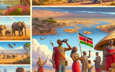
Kenya
Kenya (Jamhuri ya Kenya (Swahili); Republic of Kenya (English)) Capital: Nairobi Population (Estimated July 2012): 43,013,341 Area: 582,646 km2 or 224,961 mi2 Currency: Kenyan Shilling (KSh) Official Language: Swahili; English Political Information: Semi-Presidential Republic Official Religion: No Official Religion(approximately 45% of the population is Protestant and 33% Roman Catholic, 10% are Muslim and 12% have other religious beliefs) Highest Mountain: Mount Kenya at 5,199m or 17,057 ft GDP Official Exchange Rate (OER is more precise at gauging a country’s economic power) (Estimated 2011): $36.1 billion (US$) or (GBP) GDP (OER) Per Capita (per member of the population estimated 2011): (US$) or (GBP) GDP Purchasing Power Parity (PPP is good for gauging living conditions and use of resources but is not as accurate as OER. This data has been calculated based on the sum value of all goods and services produced in the country valued at prices prevailing in the United States) (Estimated 2011): $70.85 billion (US$) or (GBP) GDP (PPP) Per Capita (per member of the population estimated 2011): $1,700 (US$) or (GBP) Time Zone (GMT/UTC): +3:00 WildlifeBig Five Mammals African Elephant, African Lion, African Leopard, African Buffalo, Rhinoceros (both Black and White). Other Large Mammals Giraffe (Masai and Reticulated), Hippopotamus, Cheetah, Zebra (Common and Grevy’s), Wildebeest. Primates Olive Baboon, Vervet Monkey, Colobus Monkey (Black and White), Patas Monkey, Sykes’ Monkey. Antelopes and Other Herbivores Impala, Grant’s Gazelle, Thomson’s Gazelle, Waterbuck, Dik-dik, Eland, Hartebeest, Kudu. Carnivores Hyena (Spotted and Striped), African Wild Dog, Serval, Caracal, Genet, Jackal (Black-backed, Side-striped, and Golden). Birds of Prey Martial Eagle, Crowned Eagle, Secretary Bird, Vultures (White-backed, Rüppell’s, Hooded, and Lappet-faced). Other Notable Birds Flamingo (Greater and Lesser), Ostrich, Marabou Stork, Hornbills, Kingfishers, African Fish...
Terrain and Topography of Kazakhstan: mountains, valleys, and plains.
Kazakhstan, the ninth largest country in the world, is situated in Central Asia and is renowned for its diverse terrain and topography. The nation shares borders with Russia to the north, China to the east, Kyrgyzstan, Uzbekistan, and Turkmenistan to the south, and the Caspian Sea to the west. Kazakhstan’s landscape is remarkably varied, comprising mountains, valleys, and expansive plains. The country’s topography is the result of millions of years of geological processes, including tectonic movements, erosion, and glaciation, which have shaped its distinctive features. The terrain of Kazakhstan offers a wide range of geographical elements, from the Tian Shan mountains in the southeast to the vast steppes that cover much of the country. The Kazakh Uplands, a region of low mountains and hilly plains, dominate the central and eastern parts of the country. In the west, the Caspian Depression, which includes areas below sea level, presents a unique topographical feature. Kazakhstan’s diverse landscapes support a rich variety of flora and fauna, contributing to the country’s biodiversity. The terrain provides opportunities for various outdoor activities, including hiking, mountaineering, and wildlife observation. The country’s natural features also play a significant role in its economy, influencing agriculture, mineral extraction, and energy production. The topography of Kazakhstan has had a profound impact on the nation’s history, culture, and development. It has shaped traditional nomadic lifestyles, influenced trade routes, and continues to affect modern infrastructure and urban planning. As Kazakhstan continues to develop, the preservation and sustainable use of its varied terrain remain important considerations for environmental and economic policies. Summary Kazakhstan’s terrain and topography are incredibly diverse, ranging from majestic mountains to...