Explore the World Through Geography, Natural Resources & Daily History
Clear, reliable and engaging guides that help you understand our planet — from UK geography education to global natural resources and On This Day history events.
Explore, discover, and learn about the wonders of our world! At Earth Site, we’re passionate about bringing geography, history, and science to life for curious minds of all ages. Whether you’re delving into historical events, uncovering the mysteries of the natural world, or seeking interactive resources, you’re in the right place.
Here, you can uncover the stories behind historical events, explore the natural wonders of our planet, and gain valuable insights into how the Earth’s systems shape our daily lives. From the towering peaks of mountain ranges to the far-reaching impacts of human innovation, we aim to make every topic both engaging and informative.
Start your journey of discovery with us today, and let’s make learning an adventure!
What We Cover
Earth Site brings together engaging and accessible educational content designed to help you understand the world, its history, and its natural systems.
🌍 Geography Education (UK & Worldwide)
We publish clear, easy-to-understand geography resources for students, teachers and curious learners. Our guides support geography education in the UK and cover physical geography, climate, ecosystems, population, and global development.
⛏️ Natural Resources & Environmental Geography
Explore detailed country profiles covering natural resources, mining, energy, geology and global environmental challenges. We show how nations manage minerals, water, land and ecosystems, and why these resources matter.
📅 On This Day in History
Every day has a story. Our On This Day history series features major events, anniversaries, traditions, and cultural milestones from around the world — with timelines, context, and fun facts.
TIMELINE
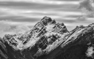
Terrain and Topography of Kazakhstan: mountains, valleys, and plains.
Kazakhstan, the ninth largest country in the world, is situated in Central Asia and is renowned for its diverse terrain and topography. The nation shares borders with Russia to the north, China to the east, Kyrgyzstan, Uzbekistan, and Turkmenistan to the south, and the Caspian Sea to the west. Kazakhstan’s landscape is remarkably varied, comprising mountains, valleys, and expansive plains. The country’s topography is the result of millions of years of geological processes, including tectonic movements, erosion, and glaciation, which have shaped its distinctive features. The terrain of Kazakhstan offers a wide range of geographical elements, from the Tian Shan mountains in the southeast to the vast steppes that cover much of the country. The Kazakh Uplands, a region of low mountains and hilly plains, dominate the central and eastern parts of the country. In the west, the Caspian Depression, which includes areas below sea level, presents a unique topographical feature. Kazakhstan’s diverse landscapes support a rich variety of flora and fauna, contributing to the country’s biodiversity. The terrain provides opportunities for various outdoor activities, including hiking, mountaineering, and wildlife observation. The country’s natural features also play a significant role in its economy, influencing agriculture, mineral extraction, and energy production. The topography of Kazakhstan has had a profound impact on the nation’s history, culture, and development. It has shaped traditional nomadic lifestyles, influenced trade routes, and continues to affect modern infrastructure and urban planning. As Kazakhstan continues to develop, the preservation and sustainable use of its varied terrain remain important considerations for environmental and economic policies. Summary Kazakhstan’s terrain and topography are incredibly diverse, ranging from majestic mountains to...
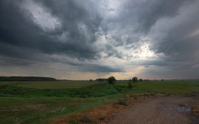
Climate Zones of Kazakhstan: Different climate regions Of Kazakhstan
Kazakhstan, the ninth largest country in the world, is situated in Central Asia and is characterised by diverse climate zones. The nation’s expansive territory extends from the Caspian Sea in the west to the Altai Mountains in the east, and from the Siberian taiga in the north to the deserts of Central Asia in the south. This geographical diversity results in a wide range of climate zones, each with its own distinct characteristics and challenges. Understanding Kazakhstan’s climate zones is essential for both residents and visitors, as it influences various aspects of life, including agriculture, industry, daily activities and travel. Kazakhstan’s climate can be broadly categorised into six main zones: the continental climate of northern Kazakhstan, the arid climate of central Kazakhstan, the mountainous climate of eastern Kazakhstan, the semi-arid climate of southern Kazakhstan, and the steppe climate of western Kazakhstan. Each of these zones exhibits unique weather patterns, temperature ranges and precipitation levels, making them suitable for different types of flora, fauna and human activities. As global climate change continues, Kazakhstan’s climate zones are also experiencing shifts, which may have significant implications for the country’s environment, economy and society. This article will examine each of Kazakhstan’s climate zones in detail, exploring their unique characteristics and the potential impact of climate change on these regions. Summary Kazakhstan has diverse climate zones, including continental, arid, mountainous, semi-arid, and steppe climates. Northern Kazakhstan experiences a continental climate with cold winters and hot summers. Central Kazakhstan has an arid climate with low precipitation and extreme temperature variations. Eastern Kazakhstan is characterised by mountainous climate with cold winters and mild summers. Southern Kazakhstan...

Political Boundaries of Kazakhstan: Provinces, Districts, or Historical Boundaries.
Kazakhstan, the largest landlocked country in the world, is situated in Central Asia. It shares borders with Russia to the north, China to the east, Kyrgyzstan, Uzbekistan, and Turkmenistan to the south, and the Caspian Sea to the west. The country is administratively divided into 14 provinces (oblystar) and 3 cities (qalalar) with provincial status. The political boundaries in Kazakhstan have evolved over time, influenced by historical, cultural, and administrative factors. These boundaries play a crucial role in governance, administration, and the distribution of resources within the country. Understanding the political boundaries of Kazakhstan is essential for comprehending the country’s complex administrative structure and its impact on governance and development. Kazakhstan’s political boundaries have been shaped by a variety of factors, including historical conquests, cultural diversity, and administrative needs. The country’s vast territory has historically been inhabited by various ethnic groups, each with its own distinct cultural identity. As a result, the political boundaries in Kazakhstan have been influenced by the need to accommodate these diverse cultural regions whilst maintaining a unified administrative structure. The country’s transition from a Soviet republic to an independent nation in 1991 also had a significant impact on its political boundaries, as it led to the establishment of new administrative divisions and the reorganisation of existing ones. This complex history has contributed to the diverse and intricate political boundaries that exist in Kazakhstan today. Summary Kazakhstan is a vast country with diverse political boundaries, including provinces and administrative districts. Historical boundaries and cultural regions have played a significant role in shaping Kazakhstan’s political landscape. The impact of political boundaries on governance and administration has...
History of Kazakhstan
Kazakhstan possesses a rich and diverse history spanning thousands of years. The region was inhabited by nomadic tribes as early as the 1st millennium BC, with evidence of early human settlement found in the form of ancient petroglyphs and archaeological sites. The Scythians, a nomadic people renowned for their horsemanship and martial prowess, were among the earliest known inhabitants of the region. They left behind a legacy of intricate gold jewellery and other artefacts that have been unearthed by archaeologists. The Silk Road, an ancient network of trade routes connecting the East and West, traversed Kazakhstan, fostering cultural exchange and economic prosperity. The region became a melting pot of diverse cultures and ethnicities, with influences from China, Persia, and the Middle East shaping Kazakhstan’s development. The ancient city of Otrar, situated in present-day southern Kazakhstan, served as a major trading hub along the Silk Road and a centre of commerce and cultural exchange. The city was renowned for its bustling markets and its role in facilitating trade between East and West. Summary Kazakhstan has a rich early history dating back to the Bronze Age, with evidence of ancient settlements and trade routes. The Mongol Empire and the Golden Horde had a significant impact on Kazakhstan, shaping its culture and society. The Kazakh Khanate emerged as a powerful state in the 15th century, eventually coming under the control of the Russian Empire in the 18th century. Soviet rule brought significant changes to Kazakhstan, including industrialization and the establishment of the Kazakh SSR. Kazakhstan gained independence from the Soviet Union in 1991 and has since focused on modernization and economic development....

Population Density of Kazakhstan
Population density refers to the number of people living in a specific area, typically measured in square kilometres or square miles. It is a crucial demographic indicator that offers insights into the distribution of people within a country or region. In Kazakhstan, population density varies significantly across the country, with some areas being densely populated whilst others are sparsely populated. Understanding population density is essential for policymakers, urban planners and researchers, as it aids in making informed decisions about resource allocation, infrastructure development and social services provision. Kazakhstan, the ninth largest country in the world by land area, has a relatively low population density compared to many other countries. The country’s population density stands at approximately 6 people per square kilometre, with the majority of the population concentrated in urban areas. However, there are significant regional variations in population density, with the southern regions being more densely populated compared to the northern and eastern parts of the country. This variation in population density is influenced by a range of factors, including geographical features, historical settlement patterns and economic opportunities. Understanding these factors is crucial for gaining insights into the dynamics of population distribution in Kazakhstan. Summary Population density refers to the number of people living in a specific area, usually measured in square kilometres. Factors affecting population density in Kazakhstan include natural resources, climate, economic opportunities, and government policies. Urban areas in Kazakhstan have higher population density compared to rural areas, where the population is more spread out. High population density can put a strain on infrastructure such as transportation, housing, and healthcare facilities. Challenges of high population density...

Natural Resources of Kazakhstan: Where Natural Resources are located In Kazakhstan
Kazakhstan, the ninth largest country in the world, is abundant in natural resources. The nation’s diverse landscape encompasses vast steppes, deserts, mountains and forests, which harbour a wide variety of natural assets. Kazakhstan’s natural resources play a crucial role in the country’s economy and have the potential to contribute significantly to its future development. From oil and gas reserves to mineral resources, agricultural resources, water resources and renewable energy potential, Kazakhstan’s natural wealth is a key factor in shaping its economic and environmental future. Kazakhstan’s natural resources have been a driving force behind the country’s economic growth and development. The exploitation of these resources has led to significant foreign investment and has helped to establish Kazakhstan as a major player in the global energy market. However, the sustainable use and conservation of these resources are essential to ensure their availability for future generations. This article will explore the various natural resources found in Kazakhstan, their significance to the country’s economy and the importance of conservation and sustainable use for the future. Summary Kazakhstan is rich in natural resources, including oil, gas, minerals, agriculture, water, and renewable energy potential. The country has significant oil and gas reserves, making it a major player in the global energy market. Kazakhstan also boasts abundant mineral resources, including coal, iron ore, copper, and gold. The country’s agricultural resources are diverse, with vast tracts of arable land and a variety of crops and livestock. Kazakhstan has ample water resources, with numerous rivers, lakes, and reservoirs providing water for irrigation and other uses. Oil and Gas Reserves in Kazakhstan Oil and Gas Reserves These fields are...
Cultural or Historical Sites of Kazakhstan: Important Cultural Landmarks or Historical Sites In Kazakhstan
Kazakhstan, the ninth largest country in the world, boasts a rich cultural and historical heritage. The nation is home to a diverse array of cultural and historical sites that reflect its long and varied past. From ancient mausoleums to stunning natural landscapes, Kazakhstan offers a wealth of attractions for visitors to explore. The country’s cultural and historical sites stand as a testament to its rich history and the diverse influences that have shaped its identity over the centuries. Kazakhstan’s cultural and historical sites reflect the country’s unique blend of Eastern and Western influences. From the ancient Silk Road to the Soviet era, Kazakhstan has been moulded by a variety of cultural and historical forces. The country’s cultural and historical sites offer a glimpse into its past, from the ancient traditions of the Kazakh people to the legacy of the Soviet Union. Visitors to Kazakhstan can explore a wide range of cultural and historical sites, each offering a unique insight into the country’s rich heritage. Summary Kazakhstan is home to a rich array of cultural and historical sites that showcase its diverse heritage. The Mausoleum of Khoja Ahmed Yasawi is a UNESCO World Heritage site and an important pilgrimage destination for Muslims. The Aisha-Bibi Mausoleum is a stunning example of ancient architecture and a symbol of love and devotion. The Petroglyphs of Tamgaly offer a glimpse into the ancient rock art and spiritual practices of the region. The Kazakh traditional dwellings, known as yurts, are a fascinating insight into the nomadic lifestyle of the Kazakh people. The Mausoleum of Khoja Ahmed Yasawi Architectural Significance The mausoleum is a stunning example...

Political Boundaries of Jordan: Provinces, Districts, or Historical Boundaries.
Jordan, officially known as the Hashemite Kingdom of Jordan, is a country located in the Middle East, bordered by Saudi Arabia to the south and east, Iraq to the north-east, Syria to the north, and Israel and Palestine to the west. The country has a rich history and is known for its diverse cultural heritage, ancient ruins, and stunning landscapes. Jordan’s political boundaries have evolved over time, influenced by historical, geographical, and geopolitical factors. The country’s borders have been shaped by various treaties, agreements, and conflicts, which have had a significant impact on its governance and administration. The political boundaries of Jordan play a crucial role in defining the country’s territorial integrity and sovereignty. They determine the extent of Jordan’s jurisdiction and authority over its territory, as well as its relationships with neighbouring countries. The delineation of these boundaries has been a complex and contentious issue, shaped by historical events, colonial legacies, and regional power dynamics. Understanding Jordan’s political boundaries is essential for comprehending the country’s governance structure, administrative divisions, and historical context. Summary Jordan’s political boundaries have evolved over time, shaping the country’s governance and administration. The administrative divisions of Jordan are divided into 12 provinces, each with its own governor appointed by the central government. Local governance in Jordan is further divided into districts, each with its own council responsible for local administration and development. The historical boundaries of Jordan have been influenced by ancient and modern geopolitical factors, impacting the country’s territorial integrity and sovereignty. The political boundaries of Jordan have significant implications for the country’s governance, including challenges and controversies surrounding border disputes and refugee...

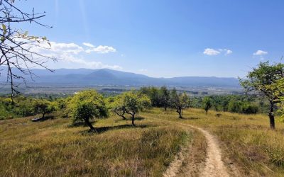
Terrain and Topography of Jordan: mountains, valleys, and plains.
Jordan is a country located in the Middle East, with a diverse and varied terrain and topography that makes it a unique and fascinating destination for travellers and nature enthusiasts. The country is home to a wide range of landscapes, including majestic mountains, magnificent valleys, and vast plains, each with its own distinct characteristics and beauty. From the towering peaks of the Jordanian highlands to the sprawling deserts of the east, Jordan’s terrain and topography offer a rich tapestry of natural wonders that are waiting to be explored and appreciated. The terrain of Jordan is largely defined by its location at the crossroads of three continents – Africa, Asia, and Europe. This geographical position has resulted in a diverse and varied landscape that is characterised by dramatic contrasts and breathtaking scenery. From the rugged mountains of the north to the arid deserts of the south, Jordan’s terrain and topography are a testament to the country’s rich natural heritage and geological history. With its diverse range of ecosystems and habitats, Jordan is home to a wide variety of plant and animal species, making it a haven for biodiversity and a paradise for nature lovers. Summary Jordan’s terrain and topography are diverse, ranging from mountains to valleys and plains. The majestic mountains of Jordan, such as the Ajloun and Dana mountains, offer stunning natural beauty and opportunities for outdoor activities. The magnificent valleys of Jordan, including the Jordan Valley and Wadi Rum, are known for their unique landscapes and historical significance. The vast plains of Jordan, like the Jordanian Desert and the Eastern Desert, contribute to the country’s diverse terrain and...

Climate Zones of Jordan: Different climate regions Of Jordan
Jordan is a country located in the Middle East, with a diverse range of climate zones due to its varied topography and geographical location. The climate in Jordan can be classified into several distinct regions, each with its own unique characteristics and weather patterns. These climate zones include the Mediterranean, desert, highland, arid, semi-arid, and steppe regions. Each of these regions has a significant impact on the environment, agriculture, and daily life of the people living in these areas. The diverse climate zones in Jordan are a result of the country’s location between the Mediterranean Sea and the Arabian Desert. The varying elevations and geographical features also contribute to the different climate patterns experienced across the country. Understanding these climate zones is crucial for anyone looking to visit or live in Jordan, as it can greatly affect travel plans, outdoor activities, and overall comfort. In this article, we will explore each of these climate regions in detail, providing insight into the unique characteristics and weather patterns of each area. Summary Jordan has diverse climate zones, including the Mediterranean, Desert, Highland, Arid, Semi-arid, and Steppe regions. The Mediterranean climate region in Jordan is characterized by mild, wet winters and hot, dry summers. The Desert climate region in Jordan experiences extremely hot and dry conditions, with very little rainfall. The Highland climate region in Jordan has cooler temperatures and more precipitation due to its higher elevation. The Arid climate region in Jordan is extremely dry and experiences very high temperatures, with little to no rainfall. The Mediterranean Climate Region The Mediterranean climate region in Jordan is located in the northwest part...

History of Jordan
Jordan has a rich and diverse history that dates back to ancient times. The region that is now Jordan was home to several ancient civilizations, including the Ammonites, Edomites, and Moabites. These ancient peoples left behind a wealth of archaeological treasures, including impressive ruins, temples, and tombs. The city of Jerash, for example, is home to some of the best-preserved Roman ruins in the world, while the ancient city of Petra is a UNESCO World Heritage site and one of the New Seven Wonders of the World. The ancient civilizations of Jordan were known for their advanced architecture, art, and engineering. The Nabateans, in particular, were skilled builders and craftsmen, as evidenced by the intricate carvings and structures at Petra. The region was also an important trade route, connecting the Mediterranean world with the Arabian Peninsula and beyond. This made it a melting pot of cultures and ideas, leading to a rich tapestry of traditions and beliefs. The ancient civilizations of Jordan laid the foundation for the region’s cultural and historical identity, and their legacy can still be seen and felt today. Jordan’s ancient civilizations also made significant contributions to art, literature, and philosophy. The Nabateans, for example, were known for their intricate rock-cut architecture and sophisticated water management systems. The city of Petra, their most famous achievement, is a testament to their engineering prowess and artistic sensibilities. The ancient city is home to impressive structures such as the Treasury and the Monastery, which showcase the Nabateans’ mastery of stone carving and design. Additionally, the region was a hub for trade and commerce, leading to the exchange of ideas...

Natural Resources of Jordan: Where Natural Resources are Located in Jordan
Jordan is a country rich in natural resources, despite its arid climate and limited land area. The country is strategically located in the Middle East, sharing borders with Israel, Syria, Iraq, and Saudi Arabia. Jordan‘s natural resources include water, minerals, agriculture, energy, and stunning landscapes that attract tourists from around the world. The sustainable management of these resources is crucial for the country’s economic development and environmental preservation. Summary Jordan is rich in natural resources, including water, minerals, agriculture, energy, and tourism attractions. Water scarcity is a major challenge in Jordan, with the country being one of the most water-poor in the world. Jordan has significant mineral resources, including phosphate, potash, and oil shale, which are important for the country’s economy. Agriculture is a vital sector in Jordan, with the country producing a variety of crops despite its arid climate. Jordan is working towards developing its renewable energy sector to reduce its reliance on imported energy resources. Water Resources in Jordan Water is a precious resource in Jordan, where the climate is predominantly arid. The country faces significant challenges in meeting the water needs of its growing population and agricultural sector. Jordan’s main sources of water include surface water from the Jordan River and underground water from aquifers. However, these sources are under pressure due to over-extraction, pollution, and climate change. The government has implemented various water management strategies, such as water conservation measures, wastewater treatment, and the development of desalination plants. Additionally, international cooperation with neighbouring countries on water sharing agreements is essential for ensuring sustainable access to water resources in the region. Jordan’s water resources are vital...