Explore the World Through Geography, Natural Resources & Daily History
Clear, reliable and engaging guides that help you understand our planet — from UK geography education to global natural resources and On This Day history events.
Explore, discover, and learn about the wonders of our world! At Earth Site, we’re passionate about bringing geography, history, and science to life for curious minds of all ages. Whether you’re delving into historical events, uncovering the mysteries of the natural world, or seeking interactive resources, you’re in the right place.
Here, you can uncover the stories behind historical events, explore the natural wonders of our planet, and gain valuable insights into how the Earth’s systems shape our daily lives. From the towering peaks of mountain ranges to the far-reaching impacts of human innovation, we aim to make every topic both engaging and informative.
Start your journey of discovery with us today, and let’s make learning an adventure!
What We Cover
Earth Site brings together engaging and accessible educational content designed to help you understand the world, its history, and its natural systems.
🌍 Geography Education (UK & Worldwide)
We publish clear, easy-to-understand geography resources for students, teachers and curious learners. Our guides support geography education in the UK and cover physical geography, climate, ecosystems, population, and global development.
⛏️ Natural Resources & Environmental Geography
Explore detailed country profiles covering natural resources, mining, energy, geology and global environmental challenges. We show how nations manage minerals, water, land and ecosystems, and why these resources matter.
📅 On This Day in History
Every day has a story. Our On This Day history series features major events, anniversaries, traditions, and cultural milestones from around the world — with timelines, context, and fun facts.
TIMELINE

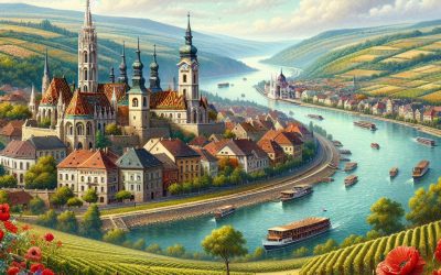
Cultural or Historical Sites of Hungary: Important Cultural Landmarks or Historical Sites In Hungary
Hungary is a country rich in cultural and historical heritage, with a plethora of sites that showcase its fascinating past. From medieval castles to stunning palaces, and from picturesque national parks to renowned wine regions, Hungary offers a diverse range of attractions for history enthusiasts and nature lovers alike. The country’s strategic location in the heart of Europe has made it a melting pot of different cultures and influences, resulting in a unique blend of architectural styles, traditions, and customs. Whether you’re exploring the bustling streets of Budapest or venturing into the tranquil countryside, Hungary’s cultural and historical sites are sure to leave a lasting impression on visitors. Hungary’s history dates back to ancient times, with evidence of human settlement dating back to the Paleolithic era. Over the centuries, the country has been shaped by various rulers and empires, including the Romans, the Huns, the Magyars, and the Ottoman Empire. This rich tapestry of influences is reflected in Hungary’s diverse cultural landscape, with a mix of Romanesque, Gothic, Baroque, and Ottoman architecture. The country’s historical sites offer a glimpse into its tumultuous past, from the medieval fortresses that once guarded its borders to the grand palaces that served as seats of power. Whether you’re interested in exploring ancient ruins or admiring opulent royal residences, Hungary’s cultural and historical sites provide a captivating journey through time. Summary Hungary is home to a rich tapestry of cultural and historical sites, each with its own unique story to tell. The Buda Castle in Budapest is a stunning example of Hungarian architecture and offers breathtaking views of the city. The Hungarian Parliament Building...
Hungary
Hungary (Magyarország) Capital: Budapest Population (Estimated July 2012): 9,958,453 Area: 93,030 km2 or 35,919 mi2 Currency: Forint (Ft) Official Language: Hungarian Political Information: Parliamentary Republic Official Religion: No Official Religion (approximately 51.9% of the population are Roman Catholic, 15.9% are Calvinist, 6.6% have other Christian beliefs and 25.6% have other or no religious beliefs) Highest Mountain: Kékes at 1,014m or 3,327ft GDP Official Exchange Rate (OER is more precise at gauging a countries economic power) (Estimated 2011): $133.1 billion (US$) or (GBP) GDP (OER) Per Capita (per member of the population estimated 2011): (US$) or (GBP) GDP Purchasing Power Parity (PPP is good for gauging living conditions and use of resources but not as accurate as OER. This data has been calculated based on the sum value of all goods and services produced in the country valued at prices prevailing in the United States) (Estimated 2011): $195.3 billion (US$) or (GBP) GDP (PPP) Per Capita (per member of the population estimated 2011): $19,600 (US$) or (GBP) Time Zone (GMT/UTC): +1:00 Wildlife: Counties/Provinces/States: 19 counties (megyek, singular – megye), 23 urban counties (singular – megyei varos), and 1 capital city (fovaros) Counties: Bacs-Kiskun, Baranya, Bekes, Borsod-Abauj-Zemplen, Csongrad, Fejer, Gyor-Moson-Sopron, Hajdu-Bihar, Heves, Jasz-Nagykun-Szolnok, Komarom-Esztergom, Nograd, Pest, Somogy, Szabolcs-Szatmar-Bereg, Tolna, Vas, Veszprem, Zala Urban counties: Bekescsaba, Debrecen, Dunaujvaros, Eger, Erd, Gyor, Hodmezovasarhely, Kaposvar, Kecskemet, Miskolc, Nagykanizsa, Nyiregyhaza, Pecs, Salgotarjan, Sopron, Szeged, Szekesfehervar, Szekszard, Szolnok, Szombathely, Tatabanya, Veszprem, Zalaegerszeg Capital city: Budapest Leaders: President Pál Schmitt with Prime Minister Viktor Orbán. Additional: The capital city of Budapest is made up of two areas divided by a river known as Buda and Pest. Sources: CIA World Fact Book, Encyclopaedia Britannica. Hungary Hungary, a landlocked country in Central Europe, is...

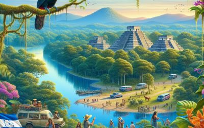
Cultural or Historical Sites of Honduras: Important Cultural Landmarks or Historical Sites In Honduras
Honduras, located in Central America, is a country known for its rich history, diverse culture, and stunning natural landscapes. With a population of over 9 million people, Honduras is a melting pot of indigenous, European, African, and Caribbean influences. The country is bordered by Guatemala to the west, El Salvador to the southwest, Nicaragua to the southeast, the Pacific Ocean to the south, and the Caribbean Sea to the north. The capital city, Tegucigalpa, is a bustling metropolis with a mix of modern amenities and colonial charm. Honduras is also home to some of the most well-preserved Mayan ruins in the world, making it a popular destination for history enthusiasts and archaeology buffs. The country’s economy is largely based on agriculture, with coffee, bananas, and shrimp being some of its main exports. Honduras also boasts a diverse range of ecosystems, including tropical rainforests, cloud forests, mangroves, and coral reefs. The natural beauty of Honduras attracts eco-tourists and adventure seekers from around the world. With its warm climate, friendly locals, and vibrant culture, Honduras offers a unique and unforgettable travel experience for those willing to explore its many wonders. Summary Honduras is a country in Central America known for its rich history and diverse cultural heritage. The Mayan ruins of Copán are a UNESCO World Heritage site and offer a fascinating glimpse into the ancient Mayan civilization. The Garifuna culture and settlements in Honduras are a vibrant and unique part of the country’s cultural tapestry. The Fortress of San Fernando de Omoa is a well-preserved colonial-era fort that offers insight into Honduras’ colonial history. The Cathedral of Tegucigalpa is a...

Natural Resources of Honduras: Where Natural Resources are Located in Honduras
Honduras is a country rich in natural resources, with a diverse range of minerals, forests, agricultural land, water sources, and energy reserves. The country’s natural resources play a crucial role in its economy, providing employment and contributing to its overall development. Honduras is known for its mineral wealth, including gold, silver, zinc, lead, and iron ore. The country also boasts extensive forest cover, which supports a thriving timber industry and provides habitat for diverse wildlife. In addition, Honduras has fertile agricultural land that supports the production of coffee, bananas, palm oil, and other crops. The country’s water resources are also abundant, with numerous rivers and lakes that provide water for irrigation, hydroelectric power generation, and other uses. Finally, Honduras has significant potential for renewable energy production, including solar, wind, and geothermal resources. Honduras faces challenges in managing its natural resources sustainably, including deforestation, soil erosion, water pollution, and the impact of climate change. However, the government and various stakeholders are working to address these issues through conservation efforts, sustainable land management practices, and the promotion of renewable energy. Overall, Honduras’s natural resources are a vital asset for the country’s development and offer significant potential for economic growth and environmental conservation. Summary Honduras is rich in natural resources, including minerals, forests, agriculture, water, energy, and biodiversity. The mineral resources in Honduras include gold, silver, zinc, lead, and iron ore, with potential for further exploration and development. The forest resources in Honduras are diverse and include valuable hardwoods, pine, and mahogany, but deforestation is a significant issue. Honduras has a diverse range of agricultural resources, including bananas, coffee, sugar cane, and...

Political Boundaries of Honduras: Provinces, Districts, or Historical Boundaries.
Honduras, a Central American country, is known for its diverse and complex political boundaries. These boundaries play a crucial role in the administrative and governance structure of the country. The political boundaries of Honduras are defined by its provinces and districts, which are further subdivided into municipalities and villages. These boundaries have evolved over time and have significant implications for the governance and administration of the country. Understanding the political boundaries of Honduras is essential for comprehending its political landscape and the challenges it faces in terms of governance and administration. The political boundaries of Honduras are not only administrative divisions but also reflect the historical, cultural, and social diversity of the country. The provinces and districts of Honduras are integral to the functioning of the government and the delivery of public services. Moreover, these boundaries also influence political representation, resource allocation, and decision-making processes at the local, regional, and national levels. Therefore, a comprehensive understanding of the political boundaries of Honduras is essential for analysing its political dynamics and the impact of these boundaries on governance and administration. Summary Honduras is divided into 18 administrative divisions known as departments, each with its own capital city. The departments are further divided into 298 municipalities, which are then subdivided into smaller administrative units known as districts. The historical boundaries of Honduras have evolved over time, often reflecting political and social changes within the country. Challenges and controversies surrounding political boundaries in Honduras include disputes over land rights and resource allocation. The impacts of political boundaries on governance and administration in Honduras can be seen in the distribution of public services...

Climate Zones of Honduras: Different Climate Regions Of Honduras
Honduras, located in Central America, is a country known for its diverse climate zones. The country’s geographical location and topography contribute to the variety of climates found within its borders. Honduras is home to tropical rainforests, savannahs, subtropical highlands, semi-arid regions, and coastal areas, each with its own unique climate characteristics. Understanding these climate zones is crucial for various reasons, including agriculture, tourism, and environmental conservation. By delving into the distinct features of each climate zone, we can gain a deeper appreciation for the natural diversity of Honduras and the impact it has on the country’s ecosystems and inhabitants. Summary Honduras has diverse climate zones, including tropical rainforest, tropical savannah, subtropical highlands, semi-arid, and coastal climates. The tropical rainforest climate in Honduras is characterised by high temperatures, heavy rainfall, and lush vegetation, making it an important biodiversity hotspot. The tropical savannah climate in Honduras features distinct wet and dry seasons, with grasslands and scattered trees dominating the landscape. The subtropical highlands climate in Honduras experiences cooler temperatures and is known for its coffee and pine forests. The semi-arid climate in Honduras is characterised by low rainfall and high temperatures, leading to dry and arid landscapes with limited vegetation. The coastal climate in Honduras is influenced by the Caribbean Sea and features warm temperatures and high humidity, making it a popular tourist destination. Understanding Honduras’ diverse climate zones is important for conservation efforts, agriculture, tourism, and disaster preparedness in the region. Tropical Rainforest Climate in Honduras The tropical rainforest climate in Honduras is characterized by high temperatures and abundant rainfall throughout the year. This climate zone is found in the...

Terrain and Topography of Honduras: mountains, valleys, and plains.
Honduras, located in Central America, is a country known for its diverse and varied terrain. The topography of Honduras is characterized by its mountain ranges, valleys, lowlands, and plains, which collectively contribute to the country’s unique landscape. The terrain of Honduras is a result of tectonic activity and volcanic eruptions, which have shaped the land over millions of years. The country’s terrain not only influences its climate and ecosystems but also plays a significant role in the development of human settlements and infrastructure. Understanding the terrain and topography of Honduras is essential for comprehending the country’s natural beauty and the opportunities it offers for tourism and outdoor activities. Summary Honduras has diverse terrain and topography, including mountain ranges, valleys, lowlands, and plains. The mountain ranges of Honduras, such as the Sierra de Agalta and the Celaque National Park, offer stunning natural beauty and opportunities for outdoor activities. The valleys and lowlands of Honduras, including the Sula Valley and the Aguan Valley, are important for agriculture and human settlements. The plains of Honduras, such as the Sula Valley and the Comayagua Valley, are vital for agricultural production and transportation infrastructure. The varied terrain of Honduras has a significant impact on its climate and ecosystems, influencing factors such as rainfall patterns and biodiversity. The Mountain Ranges of Honduras Honduras is home to several mountain ranges, with the most prominent being the Sierra de Agalta, Sierra de Omoa, and the Celaque Mountain Range. These mountain ranges are characterized by their rugged terrain, steep slopes, and dense vegetation, making them ideal for hiking and adventure activities. The highest peak in Honduras, Cerro Las...

History of Honduras
The pre-Columbian era in Mexico is a fascinating period in the country’s history, characterized by the rise and fall of several advanced civilizations. The Olmec civilization, which emerged around 1200 BCE, is considered to be one of the earliest complex societies in Mesoamerica. They are known for their colossal stone heads and intricate jade carvings, which reflect their advanced artistic and engineering skills. The Olmecs were followed by the Zapotecs and the Mixtecs, who flourished in the Oaxaca region and left behind impressive architectural and artistic legacies. Another significant pre-Columbian civilization in Mexico is the Maya, who built remarkable cities with elaborate palaces, temples, and observatories. The Maya excelled in astronomy, mathematics, and hieroglyphic writing, leaving behind a rich legacy of knowledge and culture. The city of Chichen Itza, with its iconic pyramid known as El Castillo, is a testament to the architectural and engineering prowess of the Maya civilization. In addition to the Olmec, Zapotec, Mixtec, and Maya civilizations, the Aztecs also rose to power in the central valley of Mexico. Their capital city of Tenochtitlan, located on an island in Lake Texcoco, was a marvel of urban planning and engineering, with causeways connecting it to the mainland and a system of canals for transportation. The pre-Columbian era in Mexico was a time of great cultural and technological achievements, with each civilization leaving behind a rich legacy of art, architecture, and knowledge. The intricate stone carvings, impressive pyramids, and advanced astronomical knowledge of these ancient peoples continue to fascinate and inspire people around the world. Summary Pre-Columbian Era: Indigenous peoples in the Americas developed complex societies with advanced...

Population Density of Honduras
Population density refers to the number of people living in a specific area, usually measured in square miles or square kilometers. It is an important demographic indicator that provides insights into the distribution of people within a given region. Population density can vary significantly from one place to another, and it is influenced by a variety of factors such as geographical features, economic opportunities, and government policies. In the case of Honduras, a Central American country known for its rich cultural heritage and natural beauty, population density plays a crucial role in shaping the social, economic, and environmental landscape of the nation. Honduras has a population of over 9 million people, with a land area of approximately 112,492 square kilometers. This translates to a population density of around 82 people per square kilometer, making it one of the most densely populated countries in Central America. The distribution of people within Honduras is not uniform, with some regions experiencing high population density while others remain sparsely populated. Understanding the factors influencing population density in Honduras is essential for policymakers, urban planners, and community leaders to make informed decisions about resource allocation, infrastructure development, and environmental conservation. Summary Population density refers to the number of people living in a specific area, usually measured in square kilometres or square miles. Factors influencing population density in Honduras include natural resources, economic opportunities, and infrastructure development. Urban areas in Honduras have higher population density compared to rural areas due to better access to jobs, education, and healthcare. High population density can strain infrastructure and resources, leading to issues such as traffic congestion, water scarcity,...
Honduras
Honduras (República de Honduras (Republic of Honduras)) Capital: Tegucigalpa Population (Estimated July 2012): 8,296,693 Area: 112,492 km2 or 43,433 mi2 Currency: Lempira (L) Official Language: Spanish Political Information: Constitutional Republic Official Religion: No Official Religion (approximately 97% of the population are Roman Catholic and 3% are Protestant) Highest Mountain: Cerro Las Minas at 2,870m or 9,416ft GDP Official Exchange Rate (OER is more precise at gauging a countries economic power) (Estimated 2011): $17.3 billion (US$) or (GBP) GDP (OER) Per Capita (per member of the population estimated 2011): (US$) or (GBP) GDP Purchasing Power Parity (PPP is good for gauging living conditions and use of resources but not as accurate as OER. This data has been calculated based on the sum value of all goods and services produced in the country valued at prices prevailing in the United States) (Estimated 2011): $35.6 billion (US$) or (GBP) GDP (PPP) Per Capita (per member of the population estimated 2011): $4,300 (US$) or (GBP) Time Zone (GMT/UTC): -6:00 Wildlife: Counties/Provinces/States: 18 departments (departamentos, singular – departamento); Atlantida, Choluteca, Colon, Comayagua, Copan, Cortes, El Paraiso, Francisco Morazan, Gracias a Dios, Intibuca, Islas de la Bahia, La Paz, Lempira, Ocotepeque, Olancho, Santa Barbara, Valle and Yoro. Leaders: President Porfirio Lobo Sosa with Vice President Maria Antonieta de Bográn. Additional: Gained independence from Spain on the 15th of September 1821. Sources: CIA World Fact Book, Encyclopaedia Britannica. Honduras Honduras, officially known as the Republic of Honduras, is a country located in Central America. It is bordered by Guatemala to the west, El Salvador to the southwest, Nicaragua to the southeast, the Pacific Ocean to the south, and the Caribbean Sea to the north. The capital and...

Population Density of Haiti
Haiti, located on the western third of the island of Hispaniola in the Caribbean, is a country with a population density that ranks among the highest in the world. With an estimated population of over 11 million people and a land area of approximately 27,750 square kilometers, Haiti’s population density stands at around 400 people per square kilometer. This high population density is largely attributed to the country’s limited land area and the concentration of people in urban areas. The population density in Haiti has significant implications for the country’s infrastructure, resources, and overall development. Understanding the factors influencing population density, the distribution of people in urban and rural areas, and the impact on infrastructure and resources is crucial for addressing the challenges and opportunities associated with managing population density in Haiti. Summary Haiti has a high population density, with over 11 million people living in a small area of 27,750 square kilometers. Factors influencing population density in Haiti include limited arable land, natural disasters, and urbanization. The majority of Haiti’s population is concentrated in urban areas, leading to challenges in infrastructure and resource management. High population density in Haiti puts a strain on infrastructure, healthcare, and access to basic resources such as clean water and sanitation. Managing population density in Haiti presents both challenges, such as poverty and environmental degradation, and opportunities, such as potential for economic growth and development. Factors influencing population density in Haiti Several factors contribute to the high population density in Haiti. One of the primary factors is the limited availability of arable land for agriculture and settlement. The mountainous terrain and rugged landscape...

History of Haiti
The history of Haiti dates back to the pre-Columbian era, when the island was inhabited by the indigenous Taíno people. The Taíno were a peaceful and agricultural society, known for their advanced farming techniques and intricate artwork. They lived in small villages and were skilled in fishing, hunting, and gathering. The Taíno people also had a complex social structure, with a chief or cacique leading each village. They worshipped a pantheon of deities and believed in the existence of an afterlife. The arrival of the Spanish in 1492 marked the beginning of the end for the Taíno people. Christopher Columbus claimed the island for Spain and established the first European settlement in the Americas, naming it La Isla Española (Hispaniola). The Spanish colonizers brought with them diseases such as smallpox, which decimated the indigenous population. They also enslaved the Taíno people and forced them to work in gold mines and on plantations. As a result, the Taíno population rapidly declined, and their culture and way of life were nearly wiped out. Today, the legacy of the Taíno people lives on in the language, cuisine, and customs of the Haitian people. Summary The Indigenous Taíno people were the original inhabitants of Haiti before the arrival of European colonizers. The Spanish and French were the first European powers to colonize Haiti, leading to a complex history of colonial rule and exploitation. The Haitian Revolution was a pivotal moment in the fight for independence, leading to Haiti becoming the first independent nation in Latin America and the Caribbean. Political instability and economic hardship have been ongoing challenges for Haiti since gaining independence,...