Explore the World Through Geography, Natural Resources & Daily History
Clear, reliable and engaging guides that help you understand our planet — from UK geography education to global natural resources and On This Day history events.
Explore, discover, and learn about the wonders of our world! At Earth Site, we’re passionate about bringing geography, history, and science to life for curious minds of all ages. Whether you’re delving into historical events, uncovering the mysteries of the natural world, or seeking interactive resources, you’re in the right place.
Here, you can uncover the stories behind historical events, explore the natural wonders of our planet, and gain valuable insights into how the Earth’s systems shape our daily lives. From the towering peaks of mountain ranges to the far-reaching impacts of human innovation, we aim to make every topic both engaging and informative.
Start your journey of discovery with us today, and let’s make learning an adventure!
What We Cover
Earth Site brings together engaging and accessible educational content designed to help you understand the world, its history, and its natural systems.
🌍 Geography Education (UK & Worldwide)
We publish clear, easy-to-understand geography resources for students, teachers and curious learners. Our guides support geography education in the UK and cover physical geography, climate, ecosystems, population, and global development.
⛏️ Natural Resources & Environmental Geography
Explore detailed country profiles covering natural resources, mining, energy, geology and global environmental challenges. We show how nations manage minerals, water, land and ecosystems, and why these resources matter.
📅 On This Day in History
Every day has a story. Our On This Day history series features major events, anniversaries, traditions, and cultural milestones from around the world — with timelines, context, and fun facts.
TIMELINE
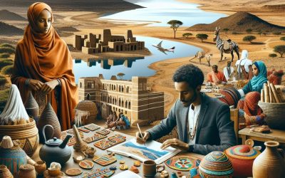
Eritrea
Eritrea (State of Eritrea) Capital: Asmara Population (Estimated July 2012): 6,086,495 Area: 121,144 km2 or 46,774 mi2 Currency: Nakfa (Nfa) Official Language: Tigrinya, Arabic or English Political Information: Single party Provisional Government Official Religion: No Official Religion (Predominantly Muslim, Coptic Christian, Roman Catholic, Protestant) Highest Mountain: Dega at 3047m or 9997ft GDP Official Exchange Rate (OER is more precise at gauging a countries economic power) (Estimated 2011): $2.6 billion (US$) or (GBP) GDP (OER) Per Capita (per member of the population estimated 2011): (US$) or (GBP) GDP Purchasing Power Parity (PPP is good for gauging living conditions and use of resources but not as accurate as OER. This data has been calculated based on the sum value of all goods and services produced in the country valued at prices prevailing in the United States) (Estimated 2011): $3.978 billion (US$) or (GBP) GDP (PPP) Per Capita (per member of the population estimated 2011): $700 (US$) or (GBP) Time Zone (GMT/UTC): +3:00 Wildlife: Counties/Provinces/States: 6 regions (zobatat, singular – zoba); Anseba, Debub (South), Debubawi K’eyih Bahri (Southern Red Sea), Gash Barka, Ma’akel (Central), Semenawi Keyih Bahri (Northern Red Sea) Leaders: President Isaias Afewerki Sources: CIA World Fact Book, Encyclopaedia Britannica. Eritrea Eritrea, officially known as the State of Eritrea, is a country located in the Horn of Africa. It is bordered by Sudan to the west, Ethiopia to the south, and Djibouti to the southeast. The northeastern and eastern parts of the country have a coastline along the Red Sea. Asmara, the capital city, is situated in the central highlands and is known for its well-preserved Italian colonial architecture. Eritrea gained independence from Ethiopia in 1993 after a long and...
Political Boundaries of Eritrea: Provinces, Districts, or Historical Boundaries.
Eritrea, located in the Horn of Africa, is a country with a rich history and diverse cultural heritage. The political boundaries of Eritrea have evolved over time, influenced by colonialism, independence movements, and geopolitical factors. The country is bordered by Sudan to the west, Ethiopia to the south, and Djibouti to the southeast, with a coastline along the Red Sea to the east. Eritrea’s political boundaries have been a source of both pride and contention, shaping the country’s governance, development, and international relations. Understanding the complexities of Eritrea’s political boundaries is essential for comprehending the country’s history and current challenges. Eritrea’s political boundaries have been shaped by a combination of historical, cultural, and geopolitical factors. The country’s diverse ethnic groups and linguistic communities have contributed to the complexity of its political divisions. Eritrea’s borders have been influenced by colonial powers, including Italy and Britain, as well as by the struggle for independence from Ethiopia. The legacy of these historical forces continues to impact Eritrea’s political boundaries and has contributed to ongoing challenges and controversies. As Eritrea seeks to navigate its future, the issue of political boundaries remains a central concern for the country’s governance and development. Summary Eritrea’s political boundaries have been influenced by colonialism and independence, shaping the country’s administrative divisions. The administrative divisions of Eritrea are divided into six provinces, each with its own unique characteristics and governance structure. Within the provinces, there are districts that further subdivide the regions, each with its own local government and administrative functions. The historical boundaries of Eritrea have been a source of challenges and controversies, impacting the country’s governance and...
Climate Zones Of Eritrea: Different climate regions Of Eritrea
Eritrea, located in the Horn of Africa, is a country with diverse climate zones due to its varied topography and geographical location. The country can be divided into five main climate regions: the coastal region, the highlands region, the lowlands region, the semi-arid region, and the arid region. Each of these regions has its own unique climate, vegetation, and wildlife, making Eritrea a country of great ecological diversity. Understanding these climate zones is crucial for various reasons, including agriculture, tourism, and conservation efforts. By understanding the different climate zones in Eritrea, it becomes possible to appreciate the country’s natural beauty and to develop sustainable strategies for development and preservation. Summary Eritrea has diverse climate zones, including coastal, highlands, lowlands, semi-arid, and arid regions. The coastal climate region experiences hot and humid weather, with minimal temperature fluctuations throughout the year. The highlands climate region is characterised by cooler temperatures and significant rainfall, making it suitable for agriculture. The lowlands climate region is hot and dry, with very little rainfall and high temperatures, posing challenges for agriculture and water availability. The semi-arid and arid climate regions experience minimal rainfall and high temperatures, making agriculture difficult and water scarcity a significant issue. Understanding Eritrea’s climate zones is crucial for effective agricultural planning, resource management, and infrastructure development. The Coastal Climate Region The coastal region of Eritrea is characterized by its hot and humid climate, with temperatures often exceeding 40 degrees Celsius during the summer months. The region experiences very little rainfall, with most of it occurring during the winter months. The vegetation in this region is adapted to the arid conditions, with...
Natural Resources of Eritrea: Where Natural Resources are located In Eritrea
Eritrea, located in the Horn of Africa, is a country rich in natural resources. From mineral deposits to fertile agricultural land, Eritrea boasts a diverse range of natural assets that contribute to its economy and livelihoods of its people. The country’s natural resources have played a significant role in shaping its history, culture, and development. Eritrea’s strategic location along the Red Sea has also made it a hub for trade and commerce, further enhancing the value of its natural resources. However, despite its abundance of natural wealth, Eritrea faces challenges in managing and sustaining these resources for the long term. This article will explore the various natural resources of Eritrea, their significance, and the challenges they face in terms of sustainability. Summary Eritrea is rich in natural resources, including minerals, agriculture, water, energy, and wildlife. The country’s mineral resources include gold, copper, zinc, and potash, making it an attractive destination for mining investment. Eritrea’s agricultural resources are diverse, with the potential for increased production and export of crops such as sorghum, millet, and barley. Water resources in Eritrea are limited, with the majority of the population relying on rainfall for agriculture and domestic use. Eritrea has the potential for renewable energy development, including solar and wind power, to meet its energy needs sustainably. Mineral Resources in Eritrea Eritrea is endowed with a wide variety of mineral resources, making it a potential hotspot for mining and extraction activities. The country is known for its rich deposits of gold, copper, zinc, and potash, among other minerals. The Bisha mine, one of the largest gold mines in Eritrea, has been a major...
Cultural or Historical Sites of Eritrea: Important Cultural Landmarks or Historical Sites in Eritrea
Eritrea, located in the Horn of Africa, is a country with a rich cultural and historical heritage. The country’s diverse history and strategic location have contributed to the presence of numerous cultural and historical sites that attract visitors from around the world. From ancient archaeological sites to colonial-era architecture, Eritrea offers a wealth of cultural and historical attractions that provide insight into the country’s past and present. In this article, we will explore some of the most significant cultural and historical sites in Eritrea, shedding light on their historical significance and cultural importance. Eritrea’s cultural and historical sites are a testament to the country’s rich and diverse heritage, reflecting the influences of various civilizations and historical periods. These sites offer a glimpse into Eritrea’s past, showcasing the country’s unique blend of African, Middle Eastern, and European influences. From ancient ruins to colonial-era buildings, Eritrea’s cultural and historical sites provide a fascinating window into the country’s history and cultural identity. Whether you are interested in archaeology, architecture, or history, Eritrea’s cultural and historical sites offer something for everyone, making it a must-visit destination for anyone interested in exploring the rich tapestry of African heritage. Summary Eritrea is home to a rich cultural and historical heritage, with a number of significant sites to explore. The ancient city of Adulis is a key archaeological site, offering insights into Eritrea’s ancient history and trade connections. The Great Mosque of Asmara is a stunning example of Islamic architecture and an important religious site in the country. The Dahlak Archipelago is a beautiful and historically significant group of islands, offering opportunities for diving and exploring...
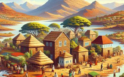
Terrain and Topography of Eritrea: mountains, valleys, and plains.
Eritrea, located in the Horn of Africa, is a country known for its diverse and stunning terrain. The topography of Eritrea is characterized by a combination of mountains, valleys, and plains, making it a unique and visually captivating landscape. The country is bordered by the Red Sea to the east, which has a significant influence on its climate and topography. Eritrea’s terrain plays a crucial role in shaping its climate, biodiversity, and even its history and culture. Understanding the different aspects of Eritrea’s terrain and topography is essential to appreciate the country’s natural beauty and its impact on the lives of its people. Summary Eritrea’s terrain is diverse, ranging from mountains to valleys and vast plains. The spectacular mountains of Eritrea offer breathtaking views and unique ecosystems. The breathtaking valleys of Eritrea are home to diverse flora and fauna. The vast plains of Eritrea provide important agricultural and grazing land. Eritrea’s diverse terrain has a significant impact on its climate, influencing temperature and rainfall patterns. The Spectacular Mountains of Eritrea Eritrea is home to a series of spectacular mountain ranges that dominate its landscape. The most prominent of these is the Ethiopian Highlands, which extend into Eritrea and form the central part of the country. The highest peak in Eritrea is Mount Soira, standing at an impressive 3,018 meters above sea level. The mountains not only provide breathtaking views but also play a crucial role in the country’s climate and water resources. The steep slopes and rugged terrain of the mountains make them a challenging yet rewarding destination for hikers and adventure seekers. The mountains also hold cultural significance...

History of Eritrea
Eritrea, located in the Horn of Africa, has a rich and diverse history that dates back to ancient times. The region was home to several powerful kingdoms, including the Kingdom of D’mt and the Kingdom of Aksum, which were influential in the trade routes that connected Africa with the Middle East and Asia. These kingdoms were known for their advanced agricultural practices, sophisticated architecture, and strong trade networks. The Aksumite Kingdom, in particular, was a major player in the Red Sea trade, controlling key ports and dominating the trade of goods such as ivory, gold, and slaves. The region’s strategic location made it a target for various colonizers throughout history. In the 7th century, the rise of Islam brought Arab traders and settlers to the region, influencing the local culture and religion. Later, the Ottoman Empire established control over parts of Eritrea, further shaping the region’s cultural and political landscape. The Italian colonization of Eritrea in the late 19th century marked a significant turning point in the country’s history, as it led to a period of intense struggle for independence and self-determination. The ancient kingdoms of Eritrea left a lasting legacy on the region, shaping its culture, language, and traditions. The influence of these kingdoms can still be seen in the architecture of ancient ruins, the local language of Ge’ez, and the traditional practices of the Eritrean people. The colonization of Eritrea by various powers has also had a profound impact on the country, shaping its modern identity and fueling its quest for independence. Summary Ancient Kingdoms and Colonization: Eritrea has a rich history of ancient kingdoms and was...
Population Density of Eritrea
Eritrea is a small country located in the Horn of Africa, bordered by Sudan, Ethiopia, and Djibouti. With a population of over 6 million people, Eritrea is one of the most densely populated countries in Africa. The country has a diverse landscape, ranging from the highlands in the central region to the coastal plains along the Red Sea. Eritrea has a rich cultural heritage, with nine recognized ethnic groups and a history of colonization and struggle for independence. The country gained independence from Ethiopia in 1993 after a long and bloody war, and since then, it has been working towards rebuilding its economy and infrastructure. Summary Eritrea is a country located in the Horn of Africa, with a population of around 3.5 million people. Population density refers to the number of people living per square kilometre, and in Eritrea, it is relatively low at 35 people per square kilometre. Factors affecting population density in Eritrea include climate, topography, and economic opportunities. The majority of the population in Eritrea is concentrated in the highland areas, with the lowest population density in the western lowlands. High population density in Eritrea presents challenges such as pressure on resources and infrastructure, but also opportunities for economic growth and development. Understanding Population Density Population density refers to the number of people living in a given area, usually measured in square kilometers. It is an important indicator of the distribution of people within a country and can have significant implications for social, economic, and environmental factors. High population density can lead to increased competition for resources, strain on infrastructure, and pressure on the environment. On...
Equatorial Guinea
Equatorial Guinea (República de Guinea Ecuatorial (Spanish); République du Guinée Équatoriale (French) (Republic of Equatorial Guinea)) Capital: Malabo Population (Estimated July 2012): 685,991 Area: 28,051 km2 or 10,831 mi2 Currency: CFA franc (CFAF) Official Language: Spanish; French Political Information: Unitary Presidential Republic Official Religion: No Official Religion Highest Mountain: Pico Basile at 3,008m or 9,869ft GDP Official Exchange Rate (OER is more precise at gauging a countries economic power) (Estimated 2011): $19.4 billion (US$) or (GBP) GDP (OER) Per Capita (per member of the population estimated 2011): (US$) or (GBP) GDP Purchasing Power Parity (PPP is good for gauging living conditions and use of resources but not as accurate as OER. This data has been calculated based on the sum value of all goods and services produced in the country valued at prices prevailing in the United States) (Estimated 2011): $26.11 billion (US$) or (GBP) GDP (PPP) Per Capita (per member of the population estimated 2011): $19,300 (US$) or (GBP) Time Zone (GMT/UTC): +1:00 Wildlife: Counties/Provinces/States: 7 provinces (provincias, singular – provincia); Annobon, Bioko Norte, Bioko Sur, Centro Sur, Kie-Ntem, Litoral, Wele-Nzas Leaders: President Teodoro Obiang Nguema Mbasogo with Ignacio Milam Tang as Prime Minister. Additional: Gained Independence from Spain on the 12th of October 1968. Sources: CIA World Fact Book, Encyclopaedia Britannica. Equatorial Guinea Equatorial Guinea is a small country located on the west coast of Central Africa. It is made up of a mainland region, known as Rio Muni, and several islands, the largest of which is Bioko Island. The country is bordered by Cameroon to the north and Gabon to the south and east, with the Gulf of Guinea to the west. Equatorial Guinea...

Political Boundaries of Equatorial Guinea: Provinces, Districts, or Historical Boundaries.
Equatorial Guinea is a small country located on the west coast of Central Africa. It is bordered by Cameroon to the north and Gabon to the south and east, with the Gulf of Guinea to the west. The country is made up of a mainland region, known as Rio Muni, and several islands, the largest of which is Bioko Island. Equatorial Guinea’s political boundaries have evolved over time, influenced by colonial powers and the country’s own internal political dynamics. The current political boundaries of Equatorial Guinea were established after gaining independence from Spain in 1968. The country is divided into two regions, the mainland region of Rio Muni and the insular region consisting of Bioko Island and several smaller islands. These regions are further divided into provinces and districts, each with its own administrative boundaries. Equatorial Guinea’s political boundaries have played a significant role in shaping the country’s governance and administration. The diverse geographical features of the country, including dense rainforests, coastal plains, and volcanic islands, have influenced the distribution of population and economic activities. The political boundaries have also been a source of contention and conflict, particularly in relation to resource allocation and representation. Understanding the political boundaries of Equatorial Guinea is crucial for comprehending the country’s social, economic, and political dynamics. Summary Equatorial Guinea is a small country located in Central Africa, with political boundaries that have evolved over time. The country is divided into two provinces, namely Bioko Norte and Centro Sur, each with its own unique characteristics and challenges. Within these provinces, there are several districts that play a crucial role in the governance and...

Climate Zones of Equatorial Guinea: Different climate regions Of Equatorial Guinea
Equatorial Guinea is a small country located on the west coast of Central Africa. Despite its small size, the country is home to a diverse range of climate zones, each with its own unique characteristics and environmental significance. The country’s climate can be broadly categorized into four main zones: equatorial, coastal, continental, and montane. Each of these zones plays a crucial role in shaping the country’s natural environment, biodiversity, and the livelihoods of its people. Understanding the distinct features of each climate zone is essential for appreciating the country’s rich natural heritage and for developing sustainable strategies for environmental conservation and management. Summary Equatorial Guinea has four main climate zones: equatorial, coastal, continental, and montane. The equatorial climate is characterised by high temperatures, heavy rainfall, and high humidity throughout the year. The coastal climate experiences milder temperatures and lower rainfall due to the influence of the Atlantic Ocean. The continental region has a more pronounced dry season and lower humidity compared to the equatorial and coastal zones. The montane climate is found in the elevated areas of Equatorial Guinea and is characterised by cooler temperatures and lower humidity. Climate change poses a significant threat to Equatorial Guinea’s diverse climate zones, including increased temperatures, changes in rainfall patterns, and potential impacts on biodiversity. It is crucial to take proactive measures to protect and preserve Equatorial Guinea’s diverse climate zones, including sustainable land use practices and conservation efforts. Equatorial Guinea’s Equatorial Climate The equatorial climate zone in Equatorial Guinea is characterized by high temperatures, heavy rainfall, and high humidity throughout the year. This climate zone is located near the equator and...

History of Equatorial Guinea
The history of Venezuela dates back to around 15,000 BC when the first indigenous people settled in the region. These early settlers were hunter-gatherers and lived in small communities. The arrival of the Spanish in the 16th century marked the beginning of the colonization of Venezuela. The Spanish conquistadors, led by Christopher Columbus, arrived in the region in 1498 and claimed it for the Spanish crown. They established the first permanent Spanish settlement in Venezuela in 1522, and over the next few decades, more settlements were established, and the indigenous population was subjugated and forced to work in mines and plantations. The Spanish colonization had a profound impact on the indigenous population, as diseases brought by the Europeans decimated their numbers, and they were also subjected to forced labor and exploitation. The Spanish also brought African slaves to work in the plantations, further shaping the ethnic and cultural makeup of Venezuela. The Spanish colonial period lasted for over 300 years, during which time Venezuela became a major producer of cocoa, coffee, and sugar, which were exported to Europe. This period also saw the emergence of a distinct Venezuelan identity, blending European, African, and indigenous influences. Summary Early settlement and colonization in British English language refers to the initial arrival and establishment of British settlers in a new territory. Spanish colonial rule in British English language refers to the period when Spain governed and controlled the territory as a colony. Independence and post-colonial era in British English language refers to the time when the territory gained independence from colonial rule and the subsequent period of development and change. Political instability...