Explore the World Through Geography, Natural Resources & Daily History
Clear, reliable and engaging guides that help you understand our planet — from UK geography education to global natural resources and On This Day history events.
Explore, discover, and learn about the wonders of our world! At Earth Site, we’re passionate about bringing geography, history, and science to life for curious minds of all ages. Whether you’re delving into historical events, uncovering the mysteries of the natural world, or seeking interactive resources, you’re in the right place.
Here, you can uncover the stories behind historical events, explore the natural wonders of our planet, and gain valuable insights into how the Earth’s systems shape our daily lives. From the towering peaks of mountain ranges to the far-reaching impacts of human innovation, we aim to make every topic both engaging and informative.
Start your journey of discovery with us today, and let’s make learning an adventure!
What We Cover
Earth Site brings together engaging and accessible educational content designed to help you understand the world, its history, and its natural systems.
🌍 Geography Education (UK & Worldwide)
We publish clear, easy-to-understand geography resources for students, teachers and curious learners. Our guides support geography education in the UK and cover physical geography, climate, ecosystems, population, and global development.
⛏️ Natural Resources & Environmental Geography
Explore detailed country profiles covering natural resources, mining, energy, geology and global environmental challenges. We show how nations manage minerals, water, land and ecosystems, and why these resources matter.
📅 On This Day in History
Every day has a story. Our On This Day history series features major events, anniversaries, traditions, and cultural milestones from around the world — with timelines, context, and fun facts.
TIMELINE

Population Density of Ecuador
Population density refers to the number of people living in a specific area, usually measured per square kilometer. It is an important indicator of how crowded or sparsely populated an area is. Understanding population density is crucial for policymakers and planners as it helps them make informed decisions about resource allocation, infrastructure development, and service provision. In the case of Ecuador, a country located in South America, population density plays a significant role in shaping its social, economic, and environmental landscape. Summary Ecuador has a diverse population density, with factors such as geography, climate, and economic opportunities influencing distribution. Urban areas in Ecuador have higher population density compared to rural areas, leading to challenges in infrastructure and service provision. There are regional variations in population density across Ecuador, with the Sierra region being the most densely populated. High population density in Ecuador presents challenges such as strain on infrastructure, but also opportunities for economic growth and development. Government policies and initiatives are being implemented to manage population density and promote sustainable development in Ecuador. Factors Influencing Population Distribution in Ecuador Several factors influence population distribution in Ecuador. One of the key factors is geographic features. The country’s diverse topography, which includes the Andes Mountains, the Amazon Rainforest, and the Pacific coastline, has a significant impact on where people choose to live. The coastal region, with its access to ports and fertile agricultural land, attracts a large number of people. The highlands, with their cooler climate and opportunities for agriculture and tourism, also have a relatively high population density. On the other hand, the Amazon Rainforest, with its dense vegetation...

Cultural or Historical Sites of Ecuador: Important Cultural Landmarks or Historical Sites in Ecuador
Ecuador is a country rich in cultural and natural heritage. From the stunning Galapagos Islands to the historic cities of Quito and Cuenca, Ecuador offers a diverse range of UNESCO World Heritage Sites that showcase its unique history and culture. These sites play a crucial role in preserving Ecuador’s heritage for future generations and attracting tourists from around the world. In this article, we will explore some of Ecuador’s most significant UNESCO World Heritage Sites and delve into the importance of preserving and appreciating their cultural and natural value. Summary The Galapagos Islands are a UNESCO World Heritage Site, known for their unique and diverse wildlife. Quito’s Historic Centre is dedicated to preserving colonial architecture, offering a glimpse into Ecuador’s rich history. Ingapirca is home to the largest Inca ruins in Ecuador, providing a fascinating insight into ancient Incan culture. Cuenca’s Historic District is a UNESCO World Heritage Site, showcasing the city’s well-preserved colonial architecture. The Temple of the Sun offers a chance to explore ancient Incan culture and history in Ecuador. The Galapagos Islands: A UNESCO World Heritage Site The Galapagos Islands are perhaps one of the most famous UNESCO World Heritage Sites in Ecuador. Known for their unique biodiversity and natural beauty, these islands have captivated the imaginations of scientists, explorers, and nature enthusiasts for centuries. The islands are home to a wide variety of species, many of which are found nowhere else on Earth. This makes the Galapagos Islands a living laboratory for the study of evolution and a testament to the power of nature. The significance of the Galapagos Islands is further enhanced by their...

Natural Resources of Ecuador: Where Natural Resources are located In Ecuador
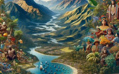
Ecuador, a small country located in South America, is known for its rich and diverse natural resources. From the lush Amazon rainforest to the towering Andes mountains and the pristine Galapagos Islands, Ecuador is home to a wide range of natural wonders. These resources play a crucial role in the country’s economy and provide opportunities for sustainable development. In this article, we will explore the various natural resources found in Ecuador and discuss their significance. Summary Ecuador is rich in natural resources, including the Amazon Rainforest, Andes Mountains, Coastal Region, and Galapagos Islands. The Amazon Rainforest in Ecuador is home to a diverse range of flora and fauna, making it one of the most biodiverse regions in the world. The Andes Mountains in Ecuador are abundant in mineral resources such as gold, silver, and copper, contributing to the country’s economy. The Coastal Region of Ecuador boasts fertile agricultural land, making it a key area for agricultural production and export. The Galapagos Islands are known for their diverse marine resources, including unique wildlife and ecosystems that attract ecotourism. Overview of Natural Resources in Ecuador Ecuador is blessed with a diverse range of natural resources, thanks to its unique geographical location. The country can be divided into four distinct regions: the Amazon rainforest, the Andes mountains, the coastal region, and the Galapagos Islands. Each region has its own set of natural resources that contribute to Ecuador’s economy. Rich Biodiversity in the Amazon Rainforest The Amazon rainforest in Ecuador is one of the most biodiverse regions on Earth. It is home to thousands of plant and animal species, many of which are...
Ecuador
Ecuador (República del Ecuador (Republic of Ecuador)) Capital: Quito Population (Estimated July 2012): 15,223,680 Area: 256,370 km2 or 98,985 mi2 Currency: Dollar (U.S.$) Official Language: Spanish Political Information: Unitary Presidential Republic Official Religion: No Official Religion (approximately 95% of the population are Roman Catholic and 5% have other religious beliefs) Highest Mountain: Mount Chimborazo at 6,267m or 20,561ft (see Additional info). GDP Official Exchange Rate (OER is more precise at gauging a country’s economic power) (Estimated 2011): $65.9 billion (US$) or (GBP) GDP (OER) Per Capita (per member of the population estimated 2011): (US$) or (GBP) GDP Purchasing Power Parity (PPP is good for gauging living conditions and the use of resources but is not as accurate as OER. This data has been calculated based on the sum value of all goods and services produced in the country valued at prices prevailing in the United States) (Estimated 2011): $125.8 billion (US$) or (GBP) GDP (PPP) Per Capita (per member of the population estimated 2011): $8,300 (US$) or (GBP) Time Zone (GMT/UTC): -5:00 Wildlife: Counties/Provinces/States: 24 provinces (provincias, singular – provincia); Azuay, Bolivar, Canar, Carchi, Chimborazo, Cotopaxi, El Oro, Esmeraldas, Galapagos, Guayas, Imbabura, Loja, Los Rios, Manabi, Morona-Santiago, Napo, Orellana, Pastaza, Pichincha, Santa Elena, Santo Domingo de los Tsachilas, Sucumbios, Tungurahua, Zamora-Chinchipe Leaders: President is Rafael Correa with Lenin Moreno as Vice President. Additional: Independence from Spain was recognised on the 16th of February 1830. The peak of Ecuador’s highest mountain, Mount Chimborazo, is the furthest distance from the centre of the Earth. Mount Everest is the highest mountain above sea level but due to the Earth’s bulge at the Equator Mount Chimborazo is the closest point to space. The Galapagos...
Timor-Leste ( East Timor )
Timor-Leste (East Timor) (Repúblika Demokrátika Timor Lorosa’e (Tetum); República Democrática de Timor-Leste (Portuguese) (Democratic Republic of Timor-Leste) Capital: Dili Population (Estimated July 2012): 1,201,255 Area: 14,919km2 or 5,760mi2 Currency: United States Dollar (U.S.$) Official Language: Tetum and Portuguese Political Information: Parliamentary Republic Official Religion: No Official Religion(approximately 98% of the population are Roman Catholic, 1% are Protestant and 1% are Muslim) Highest Mountain: Foho Tatamailau at 2,986m or 9,797ft GDP Official Exchange Rate (OER is more precise at gauging a countries economic power) (Estimated 2011): $700 million (US$) or (GBP) GDP (OER) Per Capita (per member of the population estimated 2011): (US$) or (GBP) GDP Purchasing Power Parity (PPP is good for gauging living conditions and use of resources but not as accurate as OER. This data has been calculated based on the sum value of all goods and services produced in the country valued at prices prevailing in the United States) (Estimated 2011): $3.366 billion (US$) or (GBP) GDP (PPP) Per Capita (per member of the population estimated 2011): $3,100 (US$) or (GBP) Time Zone (GMT/UTC): +9:00 Wildlife: Counties/Provinces/States: 13 administrative districts; Aileu, Ainaro, Baucau, Bobonaro (Maliana), Cova-Lima (Suai), Dili, Ermera (Gleno), Lautem (Los Palos), Liquica, Manatuto, Manufahi (Same), Oecussi (Ambeno), Viqueque Leaders: President José Ramos-Horta; Prime Minister Xanana Gusmäo Additional: On the 28th of November 1975 Timor-Leste proclaimed its independence from Portugal. Timor-Leste’s independence from Indonesia was recognised internationally on the 20th of May 2002. Sources: CIA World Fact Book, Encyclopaedia Britannica. Timor-Leste Timor-Leste, also known as East Timor, is a small island nation located in Southeast Asia. It is situated in the eastern part of the island of Timor,...

Political Boundaries of Timor-Leste: Provinces, Districts, or Historical Boundaries.
Timor-Leste, also known as East Timor, is a small island nation located in Southeast Asia. It is situated in the eastern part of the island of Timor, with Indonesia to the west and Australia to the south. Timor-Leste has a complex history, having been colonized by Portugal in the 16th century and then occupied by Indonesia for over two decades. It gained independence in 2002 and is now a sovereign nation with its own political boundaries. Political boundaries play a crucial role in defining a country’s identity and sovereignty. They determine the territorial limits within which a government has authority and control. These boundaries are not only physical lines on a map but also represent the cultural, historical, and political divisions that shape a nation. In the case of Timor-Leste, its political boundaries are a reflection of its struggle for independence and its desire to assert its sovereignty as a nation. Summary Timor-Leste is a small island nation with complex political boundaries. The country is divided into 13 provinces and 65 districts, each with its own unique history and administration. Timor-Leste’s colonial and post-independence eras have shaped its current political boundaries. Political boundaries have had a significant impact on Timor-Leste’s development and territorial disputes with neighbouring countries. Maintaining political boundaries in Timor-Leste is a challenge, but local communities play a crucial role in defining them. Provinces of Timor-Leste: Overview and History Timor-Leste is divided into two provinces: Timor and Oecusse. The province of Timor covers the eastern part of the island, while Oecusse is an enclave located within Indonesian West Timor. These provinces have significant historical and cultural significance...

Climate Zones Of Timor-Leste: Different climate regions Of Timor-Leste
Timor-Leste, a small island nation located in Southeast Asia, is known for its diverse geography and climate. The country is situated between Indonesia and Australia, and its climate is influenced by the surrounding ocean currents and monsoon patterns. Understanding the different climate zones in Timor-Leste is crucial for agriculture and livelihoods, as it helps determine which crops can be grown and which activities are sustainable in each region. Summary Timor-Leste has seven distinct climate zones, each with unique characteristics. The Tropical Wet Climate Zone is characterized by high rainfall and humidity, and is home to dense rainforests. The Tropical Monsoon Climate Zone experiences heavy rainfall during the wet season and is known for its rice paddies. The Tropical Savanna Climate Zone has a distinct dry season and is home to grasslands and savannas. The Arid Climate Zone is the driest region in Timor-Leste and is home to desert-like landscapes. The Highland Climate Zone has cooler temperatures and is home to coffee and vegetable plantations. The Coastal Climate Zone is influenced by sea breezes and is home to fishing communities. Timor-Leste also has microclimates, which are small areas with unique climate conditions. Climate zones have a significant impact on agriculture and livelihoods in Timor-Leste. Climate change is affecting Timor-Leste’s climate zones, with rising temperatures and changing rainfall patterns. The Tropical Wet Climate Zone The tropical wet climate zone in Timor-Leste is characterized by high temperatures and abundant rainfall throughout the year. This climate zone is found in the northern and eastern parts of the country, including the districts of Baucau, Lautem, and Viqueque. The consistent rainfall in this region makes...

Natural Resources of Timor-Leste: Where Natural Resources are located In Timor-Leste
Timor-Leste, also known as East Timor, is a small island nation located in Southeast Asia. It is situated in the eastern part of the island of Timor, with Indonesia to the west and Australia to the south. Despite its small size, Timor-Leste is rich in natural resources, which play a crucial role in its economy. The natural resources of Timor-Leste include oil and gas reserves, minerals, agriculture and forestry products, fisheries and aquaculture, renewable energy potential, biodiversity, water resources, and land use and land cover. These resources provide opportunities for economic development and contribute significantly to the country’s GDP. Summary Timor-Leste has significant natural resources, including oil and gas reserves, mining opportunities, agriculture and forestry, fisheries and aquaculture, renewable energy potential, biodiversity, conservation efforts, water resources, and land use. The oil and gas reserves in Timor-Leste are a major source of revenue for the country, but there are concerns about the sustainability of this industry and the need to diversify the economy. Mining opportunities in Timor-Leste include gold, copper, and other minerals, but there are challenges related to infrastructure, regulation, and environmental impact. Agriculture and forestry are important sectors in Timor-Leste, but there are issues related to land tenure, productivity, and sustainability. Fisheries and aquaculture are significant sources of food and income for many people in Timor-Leste, but there are concerns about overfishing and the need for sustainable management practices. Oil and Gas Reserves in Timor-Leste Timor-Leste has significant oil and gas reserves, which have been a major source of revenue for the country. The exploration and production of oil and gas in Timor-Leste began in the 1970s when...

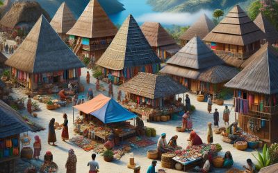
Cultural or Historical Sites of Timor-Leste: Important Cultural Landmarks or Historical Sites in Timor-Leste
Timor-Leste, also known as East Timor, is a small island nation located in Southeast Asia. Despite its size, Timor-Leste is rich in cultural and historical sites that offer a glimpse into the country’s fascinating past. From ancient archaeological sites to colonial-era buildings, these sites play a crucial role in understanding the history and culture of Timor-Leste. The cultural and historical sites in Timor-Leste are not only important for the local population but also for visitors from around the world. They provide a unique opportunity to learn about the country’s diverse heritage and the struggles it has faced throughout history. These sites serve as a reminder of the resilience and strength of the Timorese people. Summary Timor-Leste has a rich cultural and historical heritage, with numerous sites of significance. Historical sites play a crucial role in understanding Timor-Leste’s complex history and identity. Timor-Leste’s cultural heritage includes traditional music, dance, and crafts, as well as unique linguistic and religious traditions. Preserving Timor-Leste’s cultural and historical sites is essential for maintaining the country’s identity and promoting tourism. Timor-Leste has two UNESCO World Heritage Sites, including the historic city of Baucau and the prehistoric rock art of Lene Hara. The Significance of Historical Sites in Timor-Leste’s History Historical sites in Timor-Leste serve as markers of the country’s struggle for independence. During the 24-year-long Indonesian occupation, many historical sites were destroyed or damaged as a way to erase Timorese identity and suppress their desire for independence. However, these sites have become symbols of resistance and resilience for the Timorese people. Preserving historical sites is crucial for preserving the memory of Timor-Leste’s past. These sites...

Terrain and Topography of Timor-Leste: mountains, valleys, and plains.
Timor-Leste, also known as East Timor, is a small island nation located in Southeast Asia. It is known for its rugged and diverse terrain, which includes majestic mountains, lush valleys, and expansive plains. Understanding the geography of Timor-Leste is crucial for various reasons, including agriculture, tourism, and natural resource management. In this article, we will explore the different aspects of Timor-Leste’s terrain and topography and discuss their importance. Summary Timor-Leste’s terrain is rugged and diverse, with majestic mountains, lush plains, and deep valleys. The geology of Timor-Leste is complex, with a mix of volcanic and sedimentary rocks. The terrain has a significant impact on the country’s climate, with cooler temperatures in the mountains and hotter temperatures in the plains. The topography of Timor-Leste plays a crucial role in the country’s biodiversity, with unique species found in different elevations and habitats. Living in Timor-Leste’s rugged terrain can be challenging, with limited infrastructure and access to basic services. The Majestic Mountains of Timor-Leste Timor-Leste is home to several mountain ranges that traverse the country. The most prominent of these is the Central Cordillera, which runs along the spine of the island. This range is known for its stunning peaks, including Mount Ramelau, the highest point in Timor-Leste. The mountains not only provide breathtaking scenery but also offer excellent opportunities for hiking and trekking. Many tourists visit Timor-Leste specifically to explore these mountains and experience the thrill of reaching their summits. The mountains of Timor-Leste also hold great cultural and historical significance. They have been an integral part of the country’s identity for centuries. Local communities have developed unique traditions and practices...

History of Timor-Leste
Timor-Leste, also known as East Timor, is a small island nation located in Southeast Asia. It has a rich and complex history, marked by struggles for independence and periods of colonization and occupation. This article will provide a comprehensive overview of Timor-Leste’s history, from its early inhabitants to its current political and economic situation. Summary Timor-Leste was inhabited by Austronesian-speaking people for thousands of years before European contact. Portuguese colonization began in the 16th century and sparked resistance movements among Timorese leaders. During World War II, Timor-Leste was occupied by Japan, which committed numerous atrocities against the population. Indonesia invaded Timor-Leste in 1975 and occupied the country for 25 years, resulting in widespread violence and human rights abuses. The Catholic Church played a significant role in supporting Timorese independence, including sheltering and protecting activists. The Santa Cruz massacre in 1991 drew international attention to the situation in Timor-Leste and increased pressure for independence. The 1999 UN referendum resulted in overwhelming support for independence, but violence and destruction followed. Timor-Leste faces numerous challenges in the post-independence era, including poverty, corruption, and weak infrastructure. The Timorese Truth, Reception and Reconciliation Commission was established to address human rights abuses committed during the occupation. Timor-Leste’s current political and economic situation remains fragile, but the country has made progress in areas such as education and healthcare. The early inhabitants of Timor-Leste The indigenous people of Timor-Leste have a long and vibrant history. The island has been inhabited for thousands of years, with evidence of human settlement dating back to at least 42,000 years ago. The indigenous people of Timor-Leste are primarily of Austronesian descent,...

History of Timor-Leste
Timor-Leste, also known as East Timor, is a small island nation located in Southeast Asia. It has a rich and complex history that has shaped its present-day identity. Understanding the country’s past is crucial in order to comprehend its current challenges and prospects for the future. Summary The early inhabitants of Timor-Leste were likely of Melanesian and Polynesian descent. The arrival of the Portuguese in Timor-Leste in the 16th century marked the beginning of European colonization in the region. The Dutch occupation of Timor-Leste in the 19th and early 20th centuries led to increased economic development and infrastructure. The Japanese occupation of Timor-Leste during World War II resulted in significant loss of life and destruction of infrastructure. The struggle for independence from Portugal was a long and difficult process, culminating in a referendum in 1999 and eventual independence in 2002. The Early Inhabitants of Timor-Leste The indigenous people of Timor-Leste are believed to have migrated from Southeast Asia thousands of years ago. They developed a unique way of life and culture, with distinct languages and customs. The Timorese people were primarily subsistence farmers, relying on agriculture and fishing for their livelihoods. They had a strong sense of community and lived in small villages governed by traditional leaders. The Arrival of the Portuguese in Timor-Leste The Portuguese arrived in Timor-Leste in the early 16th century, seeking to establish a trading post in the region. They quickly gained control over the island and began to exploit its resources, particularly sandalwood and coffee. Portuguese colonization had a profound impact on the country, introducing Christianity and European customs to the indigenous population. The...