Explore the World Through Geography, Natural Resources & Daily History
Clear, reliable and engaging guides that help you understand our planet — from UK geography education to global natural resources and On This Day history events.
Explore, discover, and learn about the wonders of our world! At Earth Site, we’re passionate about bringing geography, history, and science to life for curious minds of all ages. Whether you’re delving into historical events, uncovering the mysteries of the natural world, or seeking interactive resources, you’re in the right place.
Here, you can uncover the stories behind historical events, explore the natural wonders of our planet, and gain valuable insights into how the Earth’s systems shape our daily lives. From the towering peaks of mountain ranges to the far-reaching impacts of human innovation, we aim to make every topic both engaging and informative.
Start your journey of discovery with us today, and let’s make learning an adventure!
What We Cover
Earth Site brings together engaging and accessible educational content designed to help you understand the world, its history, and its natural systems.
🌍 Geography Education (UK & Worldwide)
We publish clear, easy-to-understand geography resources for students, teachers and curious learners. Our guides support geography education in the UK and cover physical geography, climate, ecosystems, population, and global development.
⛏️ Natural Resources & Environmental Geography
Explore detailed country profiles covering natural resources, mining, energy, geology and global environmental challenges. We show how nations manage minerals, water, land and ecosystems, and why these resources matter.
📅 On This Day in History
Every day has a story. Our On This Day history series features major events, anniversaries, traditions, and cultural milestones from around the world — with timelines, context, and fun facts.
TIMELINE
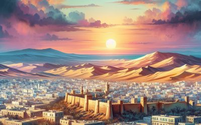
Tunisia
Tunisia, a North African nation bordered by the Mediterranean Sea, is a country rich in history, culture, and natural beauty.
Who Has Provided More to The Ukraine So Far in the War the EU or The US?
As of February 2025, European nations and institutions have collectively provided more financial aid to Ukraine than the United States. The European Union (EU) and its member states have committed approximately $267 billion in total assistance, encompassing military, financial, and humanitarian support. In contrast, the United States has allocated around $120 billion in aid to Ukraine. welt.destatista.com The Ukraine crisis, which erupted in 2014, has its roots in a complex interplay of historical, political, and social factors. The immediate catalyst was the Euromaidan protests, which began in November 2013 when then-President Viktor Yanukovych suspended an association agreement with the European Union in favour of closer ties with Russia. This decision ignited widespread discontent among Ukrainians who sought greater integration with Europe and a departure from the influence of Moscow. The protests escalated into a broader movement demanding democratic reforms and an end to corruption, culminating in Yanukovych’s ousting in February 2014. In the wake of this political upheaval, Russia annexed Crimea, a move that was met with international condemnation and led to a protracted conflict in Eastern Ukraine, particularly in the Donetsk and Luhansk regions. The crisis has not only reshaped Ukraine’s political landscape but has also had profound implications for regional stability and international relations. The conflict has drawn in various global powers, with the European Union and the United States playing pivotal roles in supporting Ukraine’s sovereignty and territorial integrity. The situation remains fluid, characterised by ongoing military confrontations, economic challenges, and a humanitarian crisis that has displaced millions. As Ukraine continues to navigate its path towards reform and integration with Western institutions, the involvement of...
Climate Zones of Togo: Exploring Togo’s Diverse Climates
Togo, a small West African nation, is characterised by a diverse range of climate zones that contribute to its rich biodiversity and agricultural potential. Stretching from the Atlantic coast in the south to the northern savannah regions, Togo‘s climate is influenced by its geographical position, topography, and the seasonal movements of the Intertropical Convergence Zone (ITCZ). This convergence zone plays a pivotal role in determining the rainfall patterns and temperature variations across the country. As a result, Togo experiences a variety of climatic conditions that range from humid tropical climates to semi-arid zones, each supporting distinct ecosystems and livelihoods. The climate of Togo can be broadly categorised into five main zones: coastal, savannah, mountain, semi-arid, and tropical rainforest. Each of these zones presents unique characteristics that not only shape the environment but also influence the socio-economic activities of the local populations. Understanding these climate zones is essential for appreciating Togo’s ecological diversity and the challenges posed by climate change. The interplay between these climatic conditions and human activities has significant implications for agriculture, wildlife conservation, and overall sustainability in the region. Summary Togo’s climate zones range from coastal to semi-arid, each with its own unique characteristics and impact on the environment. The coastal climate in Togo offers a tropical paradise with warm temperatures, high humidity, and lush vegetation, making it a popular tourist destination. Togo’s savannah climate is characterized by vast grasslands and a distinct dry season, providing a unique landscape for exploration and wildlife observation. The mountain climate in Togo brings cooler temperatures and higher rainfall, creating a refreshing escape from the heat of the lowlands. Togo’s semi-arid...
Exploring Togo’s Diverse Terrain: Mountains, Valleys, and Plains
Togo, a small West African nation, is often overshadowed by its larger neighbours, yet it boasts an astonishingly diverse terrain that captivates both locals and visitors alike. Stretching approximately 56,785 square kilometres, Togo‘s geography is a tapestry of mountains, valleys, plains, and coastal regions, each contributing to the country’s unique ecological and cultural landscape. The nation’s varied topography not only supports a rich biodiversity but also influences the lifestyles and traditions of its inhabitants. From the lush greenery of the hills in the north to the sandy beaches along the coast, Togo’s terrain is a reflection of its climatic zones and geological history. The geographical diversity of Togo is further enhanced by its climatic variations, which range from tropical in the south to savannah in the north. This climatic dichotomy fosters a wide array of flora and fauna, making Togo a microcosm of West African biodiversity. The country’s terrain is not merely a backdrop; it plays a crucial role in shaping the agricultural practices, economic activities, and cultural expressions of its people. As we delve deeper into Togo’s majestic mountains, serene valleys, and vast plains, we will uncover the intricate relationship between the land and its inhabitants, revealing how this small nation encapsulates the essence of West Africa’s natural beauty. Summary Togo’s diverse terrain includes majestic mountains, serene valleys, and vast plains, offering a range of natural beauty to explore. The majestic mountains of Togo provide stunning views and opportunities for hiking and adventure. The serene valleys of Togo offer peaceful and picturesque landscapes, perfect for relaxation and nature appreciation. The vast plains of Togo are home to diverse...
Exploring Togo’s Political Boundaries: Provinces, Districts, and Historical Divisions
Togo, a small West African nation bordered by Ghana to the west, Benin to the east, and Burkina Faso to the north, has a complex political landscape shaped by its geographical and historical context. The country spans approximately 56,785 square kilometres and is characterised by a narrow strip of land that extends from the Gulf of Guinea in the south to the northern savannah regions. Togo‘s political boundaries are not merely lines on a map; they represent a tapestry of ethnic diversity, colonial legacies, and contemporary governance challenges. Understanding these boundaries is crucial for comprehending the dynamics of power, identity, and resource distribution within the nation. The political boundaries of Togo have evolved over time, influenced by colonial rule, post-independence governance, and ongoing socio-political changes. The delineation of these boundaries has significant implications for the administration of the country, affecting everything from local governance to national policy-making. As Togo navigates its path towards greater stability and development, the examination of its political boundaries reveals insights into the challenges and opportunities that lie ahead for this vibrant yet complex nation. Summary Togo’s political boundaries are defined by its borders with Ghana, Benin, and Burkina Faso, and have evolved over time due to historical and geopolitical factors. The country is divided into five regions, which are further subdivided into 30 prefectures and one commune, each with its own administrative and political structure. Historical divisions, such as the separation of the north and south during colonial rule, have had a lasting impact on Togo’s political landscape, contributing to regional disparities and tensions. Traditional authorities, including chiefs and kings, play a significant role...

The Fascinating History of Togo
The early history of Togo is marked by the presence of various ethnic groups, each contributing to the rich tapestry of the region’s cultural and social landscape. The Ewe, Tem, and Kabyé peoples are among the most prominent groups that have inhabited the area for centuries. Archaeological evidence suggests that the region has been settled since at least the 12th century, with communities engaging in agriculture, trade, and craftsmanship. The Ewe people, for instance, are known for their intricate weaving and vibrant cultural practices, which continue to influence Togolese identity today. Trade routes traversed Togo, connecting it to larger empires and facilitating the exchange of goods and ideas. The coastal areas, particularly around the port city of Lomé, became significant trading hubs where local products such as palm oil and kola nuts were exchanged for European goods. This early interaction with external traders laid the groundwork for Togo’s later encounters with European powers. The indigenous societies developed complex social structures and governance systems, which were often disrupted by the arrival of foreign influences in the 19th century. Summary Togo’s early history is marked by the presence of various ethnic groups and the influence of the powerful Ashanti and Dahomey kingdoms. European colonization saw Togo being divided between Germany and France, leading to a period of exploitation and oppression of the local population. Togo’s struggle for independence was marked by resistance movements and political activism, eventually leading to independence from France in 1960. Political turmoil and dictatorship have plagued Togo, with the Gnassingbé family ruling the country for over 50 years, leading to widespread human rights abuses and political repression....
The Population Density of Togo: A Closer Look
Togo, a small West African nation bordered by Ghana, Benin, and Burkina Faso, has a unique demographic landscape that reflects its geographical and socio-economic characteristics. With a land area of approximately 56,785 square kilometres and a population exceeding 8 million, Togo‘s population density stands at around 140 people per square kilometre. This figure places Togo among the more densely populated countries in Africa, particularly when compared to its regional neighbours. The distribution of this population is not uniform, with significant concentrations in urban areas, particularly in the capital city of Lomé, which serves as the economic and administrative hub of the country. The implications of Togo’s population density are multifaceted, influencing various aspects of life, including economic development, social services, and environmental sustainability. Understanding the dynamics of population density in Togo requires an exploration of the factors that contribute to it, the distribution between urban and rural areas, and the resultant challenges and opportunities that arise from this demographic reality. As Togo continues to develop, the interplay between its population density and economic growth will be crucial in shaping its future trajectory. Summary Togo has a high population density, with over 140 people per square kilometer, making it one of the most densely populated countries in Africa. Factors contributing to Togo’s high population density include limited arable land, high fertility rates, and rural-urban migration. Togo’s population is predominantly rural, with over 60% of the population living in rural areas, leading to challenges in infrastructure and service provision. The high population density in Togo has both positive and negative impacts on the economy, including increased labour force and strain on...

Natural Resources of Togo: Locations and Types
Togo, a small West African nation bordered by Ghana, Benin, and Burkina Faso, is endowed with a variety of natural resources that play a crucial role in its economy and the livelihoods of its people. The country’s geographical diversity, ranging from coastal plains to mountainous regions, contributes to a rich tapestry of ecosystems that support agriculture, forestry, fisheries, and mineral extraction. Despite its modest size, Togo‘s natural resources are significant not only for domestic consumption but also for export, providing vital income and employment opportunities for its population. The management and sustainable utilisation of these resources are paramount for Togo’s development. As the nation grapples with the challenges of economic growth, environmental sustainability, and social equity, understanding the full spectrum of its natural resources becomes essential. This article delves into the various natural resources found in Togo, exploring their potential and the challenges associated with their management. By examining agricultural, mineral, forestry, water, energy, and fisheries resources, we can gain insight into how Togo can harness these assets for sustainable development. Summary Togo is rich in natural resources, including agricultural, mineral, forestry, water, energy, and fisheries resources. The agricultural sector in Togo is a significant contributor to the country’s economy, with key crops including cotton, coffee, and cocoa. Togo has significant mineral resources, including phosphates, limestone, and marble, which are important for the country’s industrial development. The forestry sector in Togo is important for timber production and contributes to the country’s environmental conservation efforts. Togo’s water resources are essential for agriculture, industry, and domestic use, but the country faces challenges in managing and conserving these resources sustainably. Togo has...

Discovering Togo’s Cultural and Historical Sites
Togo, a small West African nation bordered by Ghana, Benin, and Burkina Faso, is a treasure trove of cultural and historical sites that reflect its rich heritage and diverse traditions. Despite its modest...
Togo
Togo, a small West African nation, is often overshadowed by its larger neighbours, yet it possesses a unique charm and a rich tapestry of culture and history.

Terrain and Topography of Thailand: mountains, valleys, and plains.
Thailand, a Southeast Asian nation known for its rich cultural heritage and vibrant landscapes, boasts a diverse terrain that significantly influences its climate, agriculture, and human settlements. The country’s topography is characterised by a mix of mountainous regions, fertile valleys, expansive plains, and plateaus, each contributing to the ecological and cultural tapestry of the nation. Spanning approximately 513,000 square kilometres, Thailand‘s geographical features range from the rugged peaks of the Himalayas in the north to the tropical beaches of the south, creating a unique interplay between natural beauty and human activity. The varied terrain of Thailand not only shapes its physical landscape but also plays a crucial role in determining the livelihoods of its inhabitants. The distribution of natural resources, agricultural practices, and settlement patterns are all influenced by the topographical features of the land. Understanding the intricacies of Thailand’s terrain is essential for appreciating the country’s environmental diversity and the ways in which its people have adapted to their surroundings over centuries. Summary Thailand’s terrain is diverse, consisting of mountains, valleys, lowlands, plains, and plateaus. The mountainous regions of Thailand are found in the northern and western parts of the country, with peaks reaching over 2,000 meters in height. The valleys and lowlands of Thailand are located in the central and northeastern regions, with fertile soil suitable for agriculture. The plains and plateaus of Thailand are mainly situated in the central and eastern parts of the country, providing important agricultural land. Thailand’s varied terrain has a significant impact on its climate and agriculture, influencing factors such as temperature, rainfall, and crop suitability. The Mountainous Regions of Thailand The...

Climate Zones of Thailand: Different climate regions Of Thailand
Thailand, a nation renowned for its rich cultural heritage and stunning landscapes, is also characterised by a diverse range of climate zones. This diversity is primarily influenced by its geographical location, topography, and the monsoon winds that sweep across the region. The country can be broadly divided into four main climate zones: tropical, monsoon, subtropical, and highland. Each of these zones exhibits distinct weather patterns, temperatures, and precipitation levels, which in turn shape the ecosystems and human activities within them. Understanding Thailand‘s climate zones is crucial for various sectors, including agriculture, tourism, and environmental conservation. The interplay between these climatic conditions and the natural environment has profound implications for the flora and fauna that thrive in each region. Furthermore, as global climate change continues to impact weather patterns worldwide, Thailand’s climate zones are also experiencing shifts that could have long-term consequences for its biodiversity and economy. Summary Thailand has four main climate zones: tropical, monsoon, subtropical, and highland, each with its own unique characteristics and impact on the environment. Southern Thailand experiences a tropical climate with high temperatures and humidity, making it ideal for beach tourism but challenging for agriculture. Central Thailand has a monsoon climate, with heavy rainfall during the wet season and dry, hot weather during the dry season, affecting rice cultivation and wildlife habitats. Northern Thailand has a subtropical climate, with cooler temperatures and distinct seasons, influencing the cultivation of temperate crops and the migration patterns of wildlife. Northeastern Thailand has a highland climate, with cooler temperatures and unique flora and fauna, making it a popular destination for ecotourism and adventure activities. Tropical Climate Zone in...