World Geography
Geography is the study of the Earth’s landscapes, environments, and the relationships between people and their surroundings. It encompasses both the physical aspects of the Earth, such as its landforms, bodies of water, and climate, as well as the human aspects, including population distribution, cultures, and economies. World geography is a broad field that seeks to understand the complexities of our planet and how humans interact with it. By studying world geography, we can gain a deeper appreciation for the diversity of our planet and the interconnectedness of its various regions.
Geography is a multidisciplinary field that draws on elements of physical science, social science, and humanities. It involves the use of maps, spatial analysis, and geographic information systems (GIS) to understand the Earth’s surface and the processes that shape it. World geography also encompasses the study of human geography, which examines the ways in which people and their activities are distributed across the Earth. By understanding world geography, we can better appreciate the environmental, cultural, and economic challenges facing different regions of the world. This knowledge is crucial for addressing global issues such as climate change, resource management, and international development.
The Five Oceans and Seven Continents
The Earth’s surface is divided into five major oceans: the Pacific, Atlantic, Indian, Southern (or Antarctic), and Arctic Oceans. These vast bodies of water play a crucial role in regulating the Earth’s climate and supporting diverse marine ecosystems. The oceans also serve as important transportation routes and a source of food and other natural resources for human societies around the world.
In addition to the oceans, the Earth’s landmasses are divided into seven continents: Africa, Antarctica, Asia, Europe, North America, Australia (or Oceania), and South America. Each continent has its own unique physical and cultural characteristics, shaped by millions of years of geological processes and human history. From the deserts of Africa to the rainforests of South America, the continents offer a rich tapestry of landscapes and environments for exploration and study.
Major Mountain Ranges and Deserts
The Earth’s surface is also marked by major mountain ranges and deserts that have shaped the planet’s physical and cultural landscapes. The Himalayas, for example, are the highest mountain range in the world and are home to diverse ecosystems and cultures in countries such as India, Nepal, and Bhutan. The Andes in South America, the Rockies in North America, and the Alps in Europe are other prominent mountain ranges that have influenced human settlement patterns and economic activities.
Deserts cover about one-third of the Earth’s land surface and are characterized by low precipitation and extreme temperatures. The Sahara Desert in Africa is the largest hot desert in the world, while the Gobi Desert in Asia is one of the largest cold deserts. Deserts are not only home to unique flora and fauna but have also been important trade routes and cultural crossroads throughout history.
Climate Zones and Biomes
The Earth’s climate is influenced by a variety of factors, including latitude, altitude, ocean currents, and prevailing winds. As a result, the planet is divided into different climate zones, each with its own characteristic weather patterns and ecosystems. The equator, for example, experiences a tropical climate with high temperatures and heavy rainfall, while the polar regions have a cold and dry climate.
These climate zones give rise to different biomes, or large ecological areas characterized by distinct plant and animal communities. The tropical rainforest biome, found near the equator, is home to a diverse array of species and is vital for regulating the Earth’s climate. The grasslands biome, found in regions such as the African savannah and North American prairies, supports grazing animals and has been important for human agriculture throughout history.
Human Geography and Population Distribution
Human geography examines the ways in which people and their activities are distributed across the Earth’s surface. It encompasses topics such as population growth, migration patterns, urbanization, and cultural diversity. Understanding human geography is crucial for addressing global challenges such as poverty, inequality, and environmental degradation.
Population distribution is uneven across the world, with some regions experiencing rapid population growth while others are declining. The majority of the world’s population lives in Asia, particularly in countries such as China and India. Urban areas are also growing rapidly, with more than half of the world’s population now living in cities. This trend has significant implications for infrastructure development, resource management, and social inequality.
Historical and Cultural Geography
Historical geography examines how human activities have shaped the Earth’s landscapes over time. It explores topics such as colonialism, trade routes, and the rise and fall of empires. Cultural geography focuses on how human cultures have developed in different regions of the world and how they interact with their environments.
The Silk Road, for example, was an ancient trade route that connected China with Europe and facilitated the exchange of goods, ideas, and technologies across Eurasia. This historical trade route had a profound impact on the development of cultures and economies along its path. Similarly, cultural geographers study how different societies have adapted to their environments through practices such as agriculture, architecture, and religious beliefs.
The Importance of Geographic Knowledge
Geographic knowledge is crucial for addressing global challenges such as climate change, resource management, and international development. By understanding world geography, we can better appreciate the environmental, cultural, and economic challenges facing different regions of the world. This knowledge is crucial for addressing global issues such as climate change, resource management, and international development.
Geographic knowledge also helps us to understand our interconnectedness with other regions of the world. By studying world geography, we can gain a deeper appreciation for the diversity of our planet and the interconnectedness of its various regions. This understanding can foster a sense of global citizenship and empathy for people from different cultures and backgrounds.
In conclusion, world geography is a complex and multifaceted field that encompasses both physical and human aspects of the Earth’s landscapes. By studying world geography, we can gain a deeper appreciation for the diversity of our planet and the interconnectedness of its various regions. This knowledge is crucial for addressing global challenges such as climate change, resource management, and international development. It also helps us to understand our interconnectedness with other regions of the world and fosters a sense of global citizenship.
FAQs
What is world geography?
World geography is the study of the Earth’s landscapes, environments, and the relationships between people and their environments. It encompasses the physical features of the Earth, as well as the human activity that takes place on it.
Why is world geography important?
World geography is important because it helps us understand the world around us. It provides insights into the physical and human processes that shape our planet, and helps us make informed decisions about how to interact with our environment.
What are the main branches of world geography?
The main branches of world geography include physical geography, which focuses on the Earth’s natural features and processes, and human geography, which examines the relationships between people and their environments.
How does world geography impact our daily lives?
World geography impacts our daily lives in numerous ways, from influencing the weather and climate we experience, to shaping the availability of natural resources and influencing the distribution of populations and cultures around the world.
What are some key concepts in world geography?
Key concepts in world geography include location, place, human-environment interaction, movement, and region. These concepts help geographers understand and interpret the world around them.

Political Boundaries of Moldova: Provinces, Districts, or Historical Boundaries.
Moldova, a small landlocked country in Eastern Europe, shares borders with Romania to the west and Ukraine to the north, east and south. The political boundaries of Moldova are delineated by its administrative divisions, which comprise regions and districts. These boundaries are fundamental to the country’s governance and administration, determining resource allocation, representation and decision-making processes. A thorough understanding of Moldova’s political boundaries is crucial for comprehending the nation’s historical, cultural and political dynamics. The political boundaries of Moldova have undergone changes over time, influenced by historical, geographical and geopolitical factors. The regions and districts of Moldova are essential components of the country’s governance structure, providing a framework for local administration and representation. As Moldova continues to develop as an independent nation, its political boundaries play a significant role in shaping the country’s future direction. Summary Moldova’s political boundaries are defined by its borders with Ukraine and Romania, as well as the breakaway region of Transnistria. Moldova is divided into 32 districts, each with its own administrative centre and local government. The historical boundaries of Moldova have fluctuated over time, with periods of expansion and contraction. A comparison of provinces, districts, and historical boundaries reveals the complex and dynamic nature of Moldova’s political landscape. The impact of political boundaries on Moldova’s governance is significant, influencing issues such as regional development and decentralisation. The future of Moldova’s political boundaries is uncertain, with ongoing debates about potential changes to the country’s administrative divisions. Provinces of Moldova Administrative Structure The remainder of Moldova is divided into nine counties, each with its own administrative centre and local government. Role of Provinces in Governance...

Climate Zones Of Moldova: Different climate regions Of Moldova
Moldova, a small landlocked country in Eastern Europe, is characterised by diverse climate zones. Situated between the 45th and 48th parallels north, the country lies within the temperate climate zone. Moldova‘s climate is influenced by its proximity to the Black Sea, the Carpathian Mountains, and the continental landmass of Eastern Europe. Consequently, the country experiences a range of climatic conditions, from continental to subtropical. These varied climate zones significantly impact the nation’s agriculture, natural resources, and overall way of life. Moldova can be divided into five primary climate zones: the continental climate of central Moldova, the moderately continental climate of southern Moldova, the subtropical climate of the Black Sea coast, the alpine climate of the Carpathian Mountains, and the transitional climate zone between the Carpathian Mountains and the rest of the country. Each of these climate zones possesses distinct characteristics and influences on the local environment. A thorough understanding of these climate zones is essential for comprehending the country’s agricultural practices, natural resources, and environmental challenges. Summary Moldova has a diverse range of climate zones, including continental, moderately continental, subtropical, and alpine. Central Moldova experiences a continental climate with hot summers and cold winters, making it suitable for growing wheat and sunflower crops. Southern Moldova has a moderately continental climate with milder winters and warmer summers, ideal for vineyards and fruit orchards. The Black Sea coast of Moldova has a subtropical climate, with mild winters and hot summers, creating a favourable environment for tourism and agriculture. The Carpathian Mountains in Moldova have an alpine climate, with cold temperatures and heavy snowfall, impacting the region’s natural resources and wildlife. The...

Terrain and Topography of Moldova: mountains, valleys, and plains.
Moldova, a small landlocked country in Eastern Europe, is renowned for its diverse and varied terrain. The nation’s topography is characterised by a mixture of mountains, valleys, hills and plains, rendering it a unique and intriguing destination for nature enthusiasts. Moldova‘s terrain has been shaped by geological processes over millions of years, resulting in a landscape that is both picturesque and diverse. From the rugged Carpathian Mountains in the north to the flat Bugeac Plain in the south, Moldova’s terrain offers a wide range of natural features that merit exploration. Moldova’s terrain is not only visually striking but also plays a crucial role in shaping the country’s climate, flora and fauna. The diverse topography of the nation has created a variety of ecosystems, each with its own unique characteristics and biodiversity. From dense forests to fertile river valleys, Moldova’s terrain provides a habitat for a wide range of plant and animal species. Understanding the country’s topography is essential for appreciating its natural beauty and comprehending the challenges and opportunities it presents for the people who call it home. Summary Moldova’s terrain is diverse, with mountains, river valleys, hills, and plains. The Carpathian Mountains form Moldova’s northern border, providing a rugged and picturesque landscape. The Nistru River Valley cuts through the central lowland of Moldova, offering fertile land for agriculture. The Prut River Valley in the southern lowland is another important agricultural region in Moldova. The Codri Hills in the western part of Moldova offer a scenic and hilly landscape, rich in biodiversity. The Bugeac Plain in the southernmost region of Moldova is characterized by flat and open terrain, suitable...

History of Moldova
Moldova’s history extends to ancient times, with archaeological evidence of human habitation in the region dating to the Palaeolithic era. Various tribes and peoples, including the Thracians, Dacians and Celts, inhabited the area. In the 4th century BC, the region came under Roman Empire control and was known as Dacia. The Romans constructed fortresses and roads in the area, leaving an enduring impact on the region’s culture and infrastructure. Following the Roman Empire’s decline, Moldova experienced invasions and settlements by various peoples, including the Huns, Goths and Slavs. In the 14th century, the principality of Moldavia emerged as a formidable state under Prince Dragos’s rule. The principality expanded its territory and became a significant regional power, engaging in trade and diplomacy with neighbouring states. The capital city of Suceava developed into a centre of culture and learning, attracting scholars and artists from across Europe. Summary Early settlements in Moldova date back to ancient times, with evidence of human habitation from as early as the Paleolithic era. Ottoman and Russian rule significantly shaped Moldova’s history, with the region being part of the Ottoman Empire and later falling under Russian control. Moldova declared independence from the Soviet Union in 1991, marking the beginning of a new era for the country. The Transnistrian conflict, which began in 1990, continues to be a major issue in Moldova, with the breakaway region seeking independence from the rest of the country. Moldova has faced challenges in recent years, including political instability and economic struggles, but has also made efforts to strengthen ties with the European Union and improve its economy. Ottoman and Russian Rule The...

Natural Resources of Moldova: Where Natural Resources are Located in Moldova
Moldova, a small landlocked country in Eastern Europe, possesses a variety of natural resources that contribute to its economy and the well-being of its citizens. From fertile agricultural land to mineral deposits and abundant water resources, Moldova‘s natural wealth plays a crucial role in the country’s development. The diverse range of natural resources in Moldova has also made it an attractive destination for investment and trade, further bolstering its economic growth. This article will explore the different natural resources that Moldova possesses, their significance, and the efforts made towards their conservation and sustainable use. Moldova’s natural resources have been a cornerstone of its economy for centuries, with agriculture being a major contributor to the country’s GDP. The fertile soil and favourable climate in Moldova make it ideal for the cultivation of a variety of crops, including grapes, fruits, vegetables, and grains. The agricultural sector not only provides food security for the population but also contributes significantly to the country’s exports, earning valuable foreign exchange. In addition to agriculture, Moldova is also rich in mineral resources such as limestone, gypsum, and clay, which are essential for the construction and manufacturing industries. The abundance of water resources, including rivers and lakes, further enhances the country’s potential for agricultural and industrial development. With its diverse natural resources, Moldova has the foundation for sustainable economic growth and development. Summary Moldova is rich in natural resources, including agricultural, mineral, water, forest, and energy resources. The agricultural sector in Moldova is a significant contributor to the country’s economy, with a focus on wine production, fruits, and vegetables. Moldova has mineral resources such as limestone, gypsum,...

Cultural or Historical Sites of Moldova: Important Cultural Landmarks or Historical Sites in Moldova
Moldova, a small landlocked country in Eastern Europe, possesses a wealth of cultural and historical sites that reflect its diverse and intriguing history. From ancient archaeological complexes to mediaeval fortresses and monasteries, Moldova‘s cultural and historical sites provide insight into the country’s past and its vibrant cultural heritage. The nation’s strategic location at the crossroads of various civilisations has left an enduring mark on its architecture, art and traditions. Visitors to Moldova can explore a wide range of cultural and historical sites that showcase the country’s unique identity and rich heritage. Moldova’s cultural and historical sites stand as a testament to the country’s resilience and enduring spirit. Despite facing numerous challenges throughout its history, Moldova has preserved its cultural treasures and continues to celebrate its heritage through these remarkable sites. Whether it is the ancient archaeological complex of Orheiul Vechi, the imposing Soroca Fortress, or the serene Capriana Monastery, each site offers a window into Moldova’s past and its enduring legacy. As visitors explore these sites, they can gain a deeper understanding of Moldova’s history, traditions and the influences that have shaped the country over the centuries. Summary Moldova is home to a rich cultural and historical heritage, with a variety of sites to explore. The Orheiul Vechi Archaeological Complex offers a glimpse into Moldova’s ancient past with its cave monastery and archaeological remains. The Soroca Fortress is a well-preserved example of medieval defensive architecture, offering visitors a chance to step back in time. The Capriana Monastery is a peaceful and picturesque site, with a history dating back to the 15th century. The National Museum of History of Moldova...

Population Density of Moldova
Moldova, a small landlocked country in Eastern Europe, is characterised by its high population density. With a population exceeding 4 million inhabitants and a land area of 33,846 square kilometres, Moldova possesses one of the highest population densities in Europe. This concentration of people within a relatively compact area presents various social, economic and environmental challenges. It is crucial to comprehend the factors contributing to this high population density, its impact on infrastructure and resources, and the efforts to manage and mitigate its effects for the sustainable development of the country. The population density of Moldova is a consequence of various historical, social and economic factors that have shaped the country’s demographic landscape. The impact of this high population density is evident in the strain it places on infrastructure and resources, as well as the challenges it poses for sustainable development. Efforts to manage and mitigate the effects of high population density in Moldova are essential for the country’s future growth and prosperity. Looking ahead, projections for Moldova’s population density indicate the need for strategic planning and policy interventions to address the challenges associated with high population density. Summary Moldova has one of the highest population densities in Europe, with over 1200 people per square mile. Factors contributing to Moldova’s high population density include high birth rates, limited emigration, and a small land area. The high population density in Moldova puts a strain on infrastructure and resources, leading to challenges in housing, transportation, and access to clean water. Compared to other European countries, Moldova’s population density is significantly higher, with only a few countries like the Netherlands and Belgium...
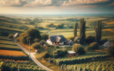
Moldova
Moldova (Republica Moldova (Republic of Moldova)) Capital: Chişinău Population (Estimated July 2012): 3,656,843 Area: 33,843km2 or 13,067mi2 Currency: Moldovan Leu (Plural Lei) Official Language: Moldovan Political Information: Parliamentary Republic Official Religion: No Official Religion(approximately 98% of the population are Eastern Orthodox, 1.5% are Jewish and 0.5% follow other faiths) Highest Point: Balanesti Hill at 430m or 1,411ft GDP Official Exchange Rate (OER is more precise at gauging a countries economic power) (Estimated 2011): $7.1 billion (US$) or (GBP) GDP (OER) Per Capita (per member of the population estimated 2011): (US$) or (GBP) GDP Purchasing Power Parity (PPP is good for gauging living conditions and the use of resources but not as accurate as OER. This data has been calculated based on the sum value of all goods and services produced in the country valued at prices prevailing in the United States) (Estimated 2011): $11.93 billion (US$) or (GBP) GDP (PPP) Per Capita (per member of the population estimated 2011): $3,400 (US$) or (GBP) Time Zone (GMT/UTC): -5:00 Wildlife: Counties/Provinces/States: 14 parishes; Clarendon, Hanover, Kingston, Manchester, Portland, Saint Andrew, Saint Ann, Saint Catherine, Saint Elizabeth, Saint James, Saint Mary, Saint Thomas, Trelawny, Westmorelandnote: for local government purposes, Kingston and Saint Andrew were amalgamated in 1923 into the present single corporate body known as the Kingston and Saint Andrew Corporation Leaders: H.M. Queen Elizabeth II with Governor-General Sir Patrick Allen and Prime Minister Portia Simpson-Miller Additional: Gained Independence from the UK on the 6th of August 1962. Sources: CIA World Fact Book, Encyclopaedia Britannica. Moldova Moldova is a landlocked country located in Eastern Europe, with a diverse landscape that includes rolling hills, fertile plains, and river valleys. The country is bordered by Romania to the west and Ukraine...
Political Boundaries of Micronesia: Provinces, Districts, or Historical Boundaries.
Micronesia is a region in the western Pacific Ocean, comprising thousands of small islands. It is divided into several political entities, including the Federated States of Micronesia (FSM), the Republic of the Marshall Islands, and the Republic of Palau. The region is renowned for its exceptional natural beauty, rich cultural heritage, and distinctive political landscape. Micronesia has a complex history of colonialism, with various European powers, Japan, and the United States exerting influence over different parts of the region. Today, Micronesia represents a blend of traditional island cultures and modern political systems, making it a captivating and diverse area to study. The political boundaries in Micronesia reflect its intricate history and the diverse cultures that inhabit the region. The Federated States of Micronesia comprises four states: Yap, Chuuk, Pohnpei, and Kosrae. Each state has its own government and is further divided into municipalities and districts. The Republic of the Marshall Islands and the Republic of Palau also possess their own unique political boundaries and administrative divisions. These political entities have their own governments and are responsible for managing their own affairs, whilst also maintaining relationships with each other and with external powers. The political boundaries in Micronesia play a crucial role in shaping the region’s governance, economy, and social dynamics. Summary Micronesia is a region in the western Pacific Ocean, comprising thousands of small islands. The political boundaries in Micronesia are complex, with different countries and territories having control over various islands. Micronesia is divided into four states: Yap, Chuuk, Pohnpei, and Kosrae, each with its own government and administrative structure. Within each state, there are further divisions into...
Climate Zones Of Micronesia: Different climate regions Of Micronesia
Micronesia, a region in the western Pacific Ocean, comprises thousands of small islands. The climate in Micronesia is remarkably diverse, with a range of different climate zones present across the various islands. The climate is influenced by the warm waters of the Pacific Ocean, as well as the trade winds that blow across the region. The combination of these factors results in a variety of climate zones, each with its own unique characteristics and weather patterns. From tropical rainforests to subtropical climates, Micronesia offers a wide range of environments for both residents and visitors to experience. Summary Micronesia is a diverse region with a variety of climate zones, each with its own unique characteristics and weather patterns. The Tropical Rainforest Climate in Micronesia is characterised by high temperatures, heavy rainfall, and lush vegetation, making it a haven for biodiversity. The Tropical Savanna Climate in Micronesia features a distinct wet and dry season, with grasslands and scattered trees dominating the landscape. The Tropical Monsoon Climate in Micronesia is marked by a distinct rainy season, bringing heavy rainfall and strong winds to the region. The Tropical Marine Climate in Micronesia is influenced by the surrounding ocean, resulting in warm temperatures, high humidity, and frequent rainfall. Tropical Rainforest Climate in Micronesia Characteristics of the Tropical Rainforest Climate One of the climate zones present in Micronesia is the tropical rainforest climate, characterised by high temperatures and heavy rainfall throughout the year. The islands that experience this climate zone are lush and green, with dense vegetation and a wide variety of plant and animal species. Flora and Fauna in the Tropical Rainforest The high...
History of Micronesia
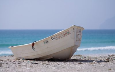
Micronesia, a region in the western Pacific Ocean, has a rich history of early settlement and colonisation. The islands of Micronesia were first settled by Austronesian peoples around 1500-1000 BCE, who migrated from Southeast Asia and brought with them their unique culture and language. These early settlers were skilled navigators and seafarers, using traditional outrigger canoes to traverse the vast expanse of the Pacific Ocean. They established thriving communities on the islands, engaging in fishing, agriculture, and trade with neighbouring islands. European explorers first made contact with the islands of Micronesia in the 16th century, when Spanish navigator Ferdinand Magellan sighted the islands during his circumnavigation of the globe. Subsequent Spanish expeditions led to the colonisation of the region, with the Spanish establishing control over the islands in the late 19th century. The Spanish influence on Micronesia was profound, as they introduced Christianity, Spanish language, and European customs to the indigenous population. However, Spanish rule was short-lived, as the islands were sold to Germany in 1899 as part of the Treaty of Paris, marking the beginning of a new era of colonisation for Micronesia. The German colonial period brought significant changes to the islands, as the Germans sought to exploit the natural resources and establish plantations for copra and other cash crops. The indigenous population endured harsh labour conditions and were subjected to forced labour and cultural assimilation. Despite these challenges, the German influence on Micronesia can still be observed today in the architecture, language, and cultural practices of the region. The legacy of early settlement and colonisation continues to shape the identity and development of Micronesia to this...
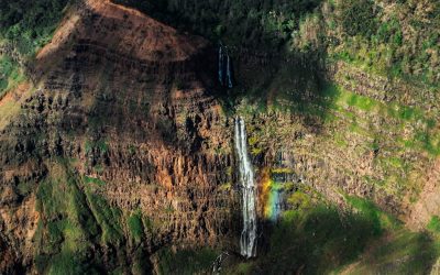
Terrain and Topography of Micronesia: mountains, valleys, and plains.
Micronesia, a region in the western Pacific Ocean, comprises thousands of small islands and atolls. The terrain and topography of Micronesia are remarkably diverse, ranging from mountainous islands to low-lying atolls. The islands form part of the larger volcanic archipelago known as the Micronesian Islands, which includes the Caroline Islands, the Marshall Islands, and the Mariana Islands. The topography of Micronesia is shaped by its volcanic origins, with many of the islands having been formed by volcanic activity. The region’s terrain is characterised by rugged mountains, deep valleys, and coastal plains, making it a unique and fascinating area to explore. The diverse terrain of Micronesia results from its volcanic origins and tectonic activity. The islands are situated on the Pacific Ring of Fire, a region renowned for its high levels of seismic and volcanic activity. This has led to the formation of rugged mountain ranges, deep valleys, and coastal plains across the region. The islands are also surrounded by vast stretches of ocean, with many of them being low-lying atolls that are barely above sea level. This distinctive combination of volcanic activity and oceanic influences has created a diverse and dynamic landscape that is unlike any other in the world. Consequently, Micronesia’s terrain and topography are not only visually striking but also play a crucial role in shaping the region’s culture and society. Summary Micronesia’s terrain is diverse, with mountain ranges, valleys, lowlands, and coastal plains. The mountain ranges of Micronesia are home to unique flora and fauna, some of which are found nowhere else in the world. The valleys and lowlands of Micronesia are important for agriculture and...