World Geography
Geography is the study of the Earth’s landscapes, environments, and the relationships between people and their surroundings. It encompasses both the physical aspects of the Earth, such as its landforms, bodies of water, and climate, as well as the human aspects, including population distribution, cultures, and economies. World geography is a broad field that seeks to understand the complexities of our planet and how humans interact with it. By studying world geography, we can gain a deeper appreciation for the diversity of our planet and the interconnectedness of its various regions.
Geography is a multidisciplinary field that draws on elements of physical science, social science, and humanities. It involves the use of maps, spatial analysis, and geographic information systems (GIS) to understand the Earth’s surface and the processes that shape it. World geography also encompasses the study of human geography, which examines the ways in which people and their activities are distributed across the Earth. By understanding world geography, we can better appreciate the environmental, cultural, and economic challenges facing different regions of the world. This knowledge is crucial for addressing global issues such as climate change, resource management, and international development.
The Five Oceans and Seven Continents
The Earth’s surface is divided into five major oceans: the Pacific, Atlantic, Indian, Southern (or Antarctic), and Arctic Oceans. These vast bodies of water play a crucial role in regulating the Earth’s climate and supporting diverse marine ecosystems. The oceans also serve as important transportation routes and a source of food and other natural resources for human societies around the world.
In addition to the oceans, the Earth’s landmasses are divided into seven continents: Africa, Antarctica, Asia, Europe, North America, Australia (or Oceania), and South America. Each continent has its own unique physical and cultural characteristics, shaped by millions of years of geological processes and human history. From the deserts of Africa to the rainforests of South America, the continents offer a rich tapestry of landscapes and environments for exploration and study.
Major Mountain Ranges and Deserts
The Earth’s surface is also marked by major mountain ranges and deserts that have shaped the planet’s physical and cultural landscapes. The Himalayas, for example, are the highest mountain range in the world and are home to diverse ecosystems and cultures in countries such as India, Nepal, and Bhutan. The Andes in South America, the Rockies in North America, and the Alps in Europe are other prominent mountain ranges that have influenced human settlement patterns and economic activities.
Deserts cover about one-third of the Earth’s land surface and are characterized by low precipitation and extreme temperatures. The Sahara Desert in Africa is the largest hot desert in the world, while the Gobi Desert in Asia is one of the largest cold deserts. Deserts are not only home to unique flora and fauna but have also been important trade routes and cultural crossroads throughout history.
Climate Zones and Biomes
The Earth’s climate is influenced by a variety of factors, including latitude, altitude, ocean currents, and prevailing winds. As a result, the planet is divided into different climate zones, each with its own characteristic weather patterns and ecosystems. The equator, for example, experiences a tropical climate with high temperatures and heavy rainfall, while the polar regions have a cold and dry climate.
These climate zones give rise to different biomes, or large ecological areas characterized by distinct plant and animal communities. The tropical rainforest biome, found near the equator, is home to a diverse array of species and is vital for regulating the Earth’s climate. The grasslands biome, found in regions such as the African savannah and North American prairies, supports grazing animals and has been important for human agriculture throughout history.
Human Geography and Population Distribution
Human geography examines the ways in which people and their activities are distributed across the Earth’s surface. It encompasses topics such as population growth, migration patterns, urbanization, and cultural diversity. Understanding human geography is crucial for addressing global challenges such as poverty, inequality, and environmental degradation.
Population distribution is uneven across the world, with some regions experiencing rapid population growth while others are declining. The majority of the world’s population lives in Asia, particularly in countries such as China and India. Urban areas are also growing rapidly, with more than half of the world’s population now living in cities. This trend has significant implications for infrastructure development, resource management, and social inequality.
Historical and Cultural Geography
Historical geography examines how human activities have shaped the Earth’s landscapes over time. It explores topics such as colonialism, trade routes, and the rise and fall of empires. Cultural geography focuses on how human cultures have developed in different regions of the world and how they interact with their environments.
The Silk Road, for example, was an ancient trade route that connected China with Europe and facilitated the exchange of goods, ideas, and technologies across Eurasia. This historical trade route had a profound impact on the development of cultures and economies along its path. Similarly, cultural geographers study how different societies have adapted to their environments through practices such as agriculture, architecture, and religious beliefs.
The Importance of Geographic Knowledge
Geographic knowledge is crucial for addressing global challenges such as climate change, resource management, and international development. By understanding world geography, we can better appreciate the environmental, cultural, and economic challenges facing different regions of the world. This knowledge is crucial for addressing global issues such as climate change, resource management, and international development.
Geographic knowledge also helps us to understand our interconnectedness with other regions of the world. By studying world geography, we can gain a deeper appreciation for the diversity of our planet and the interconnectedness of its various regions. This understanding can foster a sense of global citizenship and empathy for people from different cultures and backgrounds.
In conclusion, world geography is a complex and multifaceted field that encompasses both physical and human aspects of the Earth’s landscapes. By studying world geography, we can gain a deeper appreciation for the diversity of our planet and the interconnectedness of its various regions. This knowledge is crucial for addressing global challenges such as climate change, resource management, and international development. It also helps us to understand our interconnectedness with other regions of the world and fosters a sense of global citizenship.
FAQs
What is world geography?
World geography is the study of the Earth’s landscapes, environments, and the relationships between people and their environments. It encompasses the physical features of the Earth, as well as the human activity that takes place on it.
Why is world geography important?
World geography is important because it helps us understand the world around us. It provides insights into the physical and human processes that shape our planet, and helps us make informed decisions about how to interact with our environment.
What are the main branches of world geography?
The main branches of world geography include physical geography, which focuses on the Earth’s natural features and processes, and human geography, which examines the relationships between people and their environments.
How does world geography impact our daily lives?
World geography impacts our daily lives in numerous ways, from influencing the weather and climate we experience, to shaping the availability of natural resources and influencing the distribution of populations and cultures around the world.
What are some key concepts in world geography?
Key concepts in world geography include location, place, human-environment interaction, movement, and region. These concepts help geographers understand and interpret the world around them.
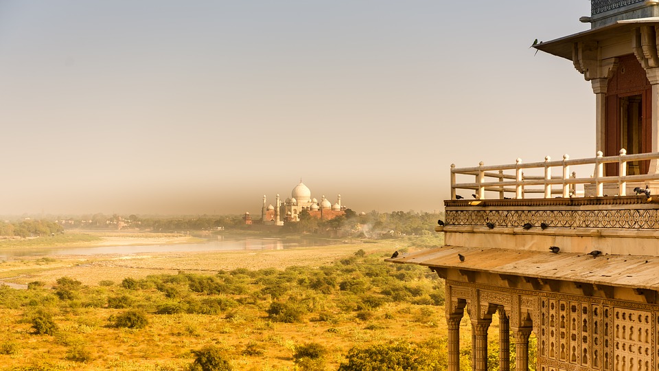
Terrain and Topography of India: mountains, valleys, and plains.
Terrain and Topography of India: mountains, valleys, and plains. India is a land of diverse and varied terrain, with its topography ranging from majestic mountain ranges to vast plains, coastal regions, and plateaus. The country’s terrain has played a significant role in shaping its history, culture, and economy. From the towering peaks of the Himalayas in the north to the fertile plains of the Indo-Gangetic region, India’s landscape is as diverse as its people. The country’s topography has also influenced its climate, biodiversity, and agricultural practices, making it a fascinating subject for study and exploration.The diverse terrain of India has also contributed to the country’s rich biodiversity, with a wide range of flora and fauna thriving in different ecosystems. The varied topography has also led to the development of unique cultures and traditions in different regions of the country. From the snow-capped peaks of the Himalayas to the lush green valleys of the Ganges and Brahmaputra rivers, India’s terrain is a source of inspiration and wonder. In this article, we will explore the different aspects of India’s topography, from its majestic mountain ranges to its fertile plains and coastal regions, and delve into the significance of each in shaping the country’s landscape and culture. Summary India’s terrain and topography are incredibly diverse, ranging from majestic mountain ranges to vast plains and lush valleys. The Great Himalayas, India’s highest and most majestic mountain range, are home to some of the world’s highest peaks, including Mount Everest. The Indo-Gangetic Plain is India’s most fertile region, known for its rich agricultural output and as the heartland of Indian civilization. The Western and...
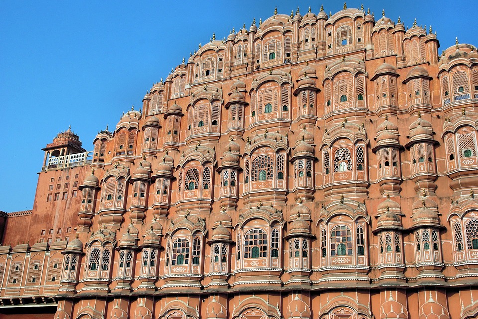
History of India
History of India The Indus Valley Civilization, also known as the Harappan Civilization, was one of the world’s earliest urban societies. It flourished in the Indus River basin in what is now Pakistan and northwest India from about 2500 to 1700 BCE. The civilization was characterized by its advanced urban planning, sophisticated drainage systems, and impressive brick-built cities. The people of the Indus Valley were skilled in trade, with evidence of their goods reaching as far as Mesopotamia. They also had a system of writing, although it has not yet been fully deciphered.The cities of the Indus Valley Civilization were well-planned, with streets laid out in a grid pattern and buildings constructed from standardized bricks. The largest of these cities, Mohenjo-Daro and Harappa, were both home to tens of thousands of people. The people of the Indus Valley engaged in agriculture, with evidence of wheat, barley, and domesticated animals such as cattle and sheep. They also had a sophisticated system of weights and measures, indicating a high level of economic organization. Despite these advancements, the decline of the Indus Valley Civilization remains a mystery, with theories ranging from environmental factors such as climate change to invasion by outside forces. Nonetheless, the legacy of the Indus Valley Civilization lives on in India’s rich cultural heritage and its contributions to early human civilization. Summary The Indus Valley Civilization was one of the world’s earliest urban societies, with advanced infrastructure and trade networks. The Maurya Empire, under the rule of Ashoka, saw the spread of Buddhism and the development of art, architecture, and literature. The Mughal Empire brought about a flourishing of...
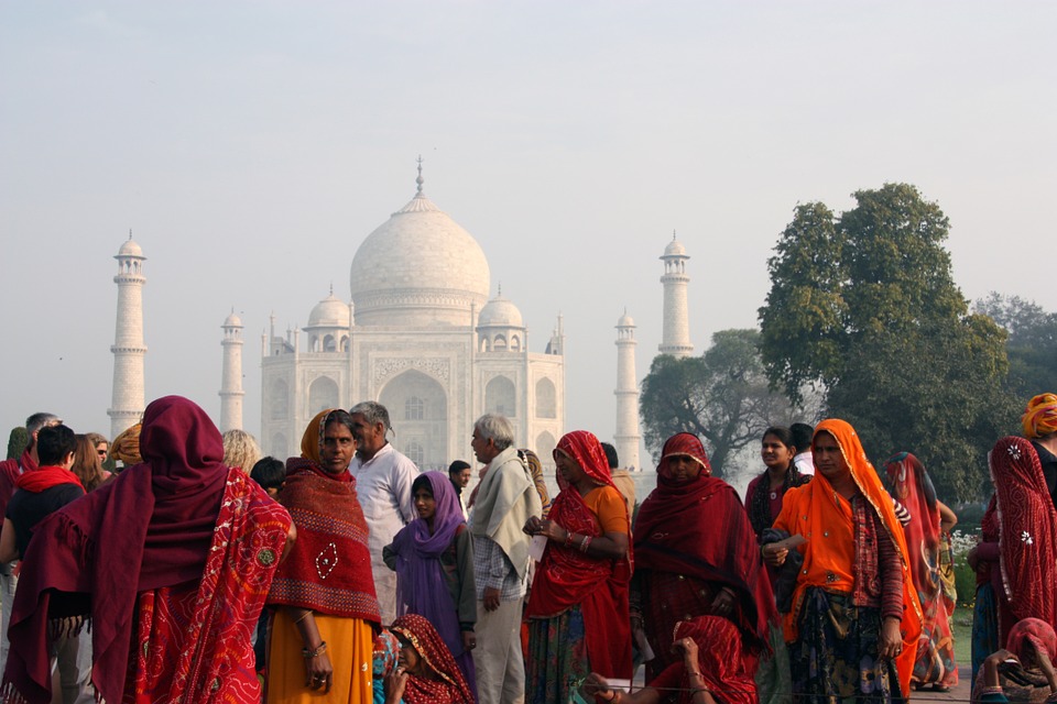
Population Density of India
Population Density of India India is the second most populous country in the world, with a population of over 1.3 billion people. The population density of India is the highest among the major countries of the world, with an average of 450 people per square kilometre. The population density varies greatly across different regions of the country, with some areas being densely populated while others are sparsely populated. The high population density in India has significant implications for the country’s infrastructure, resources, and environment. Understanding the factors affecting population density, the differences between urban and rural population density, regional variations, and the impact on infrastructure and resources is crucial for policymakers and planners to manage and sustain the growing population in India effectively. Summary India is the second most populous country in the world, with a high population density of over 450 people per square kilometre. Factors affecting population density in India include fertility rates, migration, urbanisation, and government policies. Urban population density in India is much higher than rural population density, leading to overcrowding and strain on resources in cities. Regional variations in population density exist, with the northern and western regions being more densely populated than the central and eastern regions. High population density in India puts pressure on infrastructure, water resources, and healthcare, leading to challenges for sustainable development. Factors Affecting Population Density in India Several factors contribute to the high population density in India. Firstly, the fertility rate in India has been historically high, although it has been declining in recent years. The cultural and social norms, lack of access to family planning services, and...

Cultural or Historical Sites of Iceland: Important Cultural Landmarks or Historical Sites In Iceland
Cultural or Historical Sites of Iceland: Important Cultural Landmarks or Historical Sites In Iceland Cultural and historical sites in Iceland hold immense importance in preserving the rich heritage and traditions of the country. These sites serve as a window into the past, allowing visitors to gain a deeper understanding of Iceland’s history, culture, and way of life. They also play a crucial role in promoting tourism and attracting visitors from all over the world, contributing to the country’s economy. Furthermore, these sites are a source of national pride and identity, serving as a reminder of Iceland’s unique and diverse cultural heritage.The preservation of cultural and historical sites in Iceland is essential for maintaining a connection to the past and passing on traditions to future generations. These sites provide a tangible link to the country’s history, allowing visitors to experience the customs, beliefs, and practices of earlier generations. They also serve as educational resources, offering valuable insights into the social, political, and economic aspects of Icelandic society. Additionally, cultural and historical sites contribute to the overall cultural landscape of Iceland, enriching the country’s cultural tapestry and fostering a sense of belonging and pride among its people. Summary Cultural and historical sites in Iceland are important for preserving the country’s heritage and attracting tourists. The ancient settlement of Þingvellir is a UNESCO World Heritage site and holds great historical significance for Iceland. Gullfoss is a magnificent waterfall that showcases the natural beauty of Iceland and is a popular tourist attraction. Reykjavik’s historic architecture reflects the city’s rich history and is a must-see for visitors. The mysterious stone structures of Hvalsey Church...

Natural Resources of Iceland: Where Natural Resources are Located in Iceland
Natural Resources of Iceland: Where Natural Resources are Located in Iceland Geothermal energy is a renewable source of power that harnesses the heat from the Earth’s core to generate electricity. This form of energy is considered to be sustainable and environmentally friendly, as it produces minimal greenhouse gas emissions. Geothermal power plants use the natural heat from the Earth to produce steam, which drives turbines to generate electricity. This process is highly efficient and reliable, providing a constant source of energy without being dependent on weather conditions or sunlight.Furthermore, geothermal energy has the potential to reduce reliance on fossil fuels and decrease carbon emissions, making it a crucial component in the transition towards a more sustainable energy future. The utilization of geothermal energy also has the added benefit of creating local job opportunities and stimulating economic growth in regions with geothermal resources. In addition, geothermal power plants have a small physical footprint and can be integrated into existing infrastructure, making them a viable option for meeting the increasing global energy demand. Overall, geothermal energy represents a promising solution for addressing the challenges of climate change and ensuring a secure and sustainable energy supply for future generations.Geothermal energy is a valuable resource that has the potential to play a significant role in meeting the world’s energy needs in a sustainable and environmentally friendly manner. By tapping into the Earth’s natural heat, geothermal power plants can generate electricity without relying on finite fossil fuels or contributing to greenhouse gas emissions. This makes geothermal energy an attractive option for countries looking to reduce their carbon footprint and transition towards cleaner energy sources....

Political Boundaries of Iceland: Provinces, Districts, or Historical Boundaries.
Political Boundaries of Iceland: Provinces, Districts, or Historical Boundaries. Iceland, a Nordic island country located in the North Atlantic Ocean, is known for its stunning natural landscapes, including geysers, hot springs, waterfalls, and volcanoes. The country is also renowned for its unique political boundaries, which have evolved over centuries. Iceland’s political boundaries are defined by its provinces and districts, which play a crucial role in the governance and administration of the country. Understanding the political boundaries of Iceland is essential for comprehending the country’s history, culture, and governance. Summary Iceland’s political boundaries are defined by its geographical location in the North Atlantic Ocean and its historical ties to Denmark. The country is divided into 8 provinces, each with its own unique characteristics and cultural identity. Within these provinces, there are 23 districts, each with its own local government and administrative functions. Iceland’s historical boundaries have been shaped by various factors, including Viking settlements, medieval kingdoms, and colonial rule. The evolution of Iceland’s political boundaries has been influenced by independence movements, international treaties, and changes in governance structures. Provinces of Iceland Iceland is divided into eight geographical regions known as provinces. These provinces are Austurland, Hofudhborgarsvaedhi, Nordhurland Eystra, Nordhurland Vestra, Sudhurland, Sudhurnes, Vestfirdhir, and Vesturland. Each province has its own unique characteristics and cultural heritage, contributing to the diversity of the country. The provinces are further divided into districts, which are responsible for local administration and governance. The provinces of Iceland play a significant role in the distribution of resources, infrastructure development, and regional planning. They also serve as important administrative units for the implementation of government policies and programs.The...

Climate Zones of Iceland: Different climate regions Of Iceland
Climate Zones of Iceland: Different climate regions Of Iceland Iceland is a country known for its diverse and unique climate zones. The island’s location near the Arctic Circle and its proximity to the Gulf Stream create a variety of weather patterns and temperature ranges. There are six main climate zones in Iceland, each with its own distinct characteristics and landscapes. These climate zones include the coastal, highland, arctic, subarctic, continental, and microclimates. Understanding the different climate zones in Iceland is essential for anyone planning to visit or explore the country, as it can greatly impact travel plans and outdoor activities. Summary Iceland has diverse climate zones, each with its own unique characteristics and weather patterns. The Coastal Climate Zone experiences milder temperatures and more precipitation due to its proximity to the ocean. The Highland Climate Zone is characterized by cooler temperatures and less precipitation, making it a harsh environment for vegetation. The Arctic Climate Zone has extremely cold temperatures and is covered in ice and snow for most of the year. The Subarctic Climate Zone has cool summers and cold winters, with more precipitation than the Arctic Zone but less than the Coastal Zone. The Coastal Climate Zone The coastal climate zone in Iceland is characterized by mild temperatures and relatively high levels of precipitation. This climate zone is influenced by the warm waters of the Gulf Stream, which helps to moderate temperatures along the coast. The coastal areas of Iceland are home to lush green landscapes, abundant vegetation, and diverse wildlife. The mild climate also makes the coastal regions popular for outdoor activities such as hiking, birdwatching, and...

Terrain and Topography of Iceland: mountains, valleys, and plains.
Terrain and Topography of Iceland: mountains, valleys, and plains. Iceland is a land of diverse and stunning landscapes, with a terrain that is shaped by volcanic activity, glaciers, and tectonic plate movements. The country is located on the Mid-Atlantic Ridge, where the North American and Eurasian tectonic plates meet, making it a hotspot for geological activity. This unique positioning has resulted in a rugged and varied topography, with mountains, valleys, plains, and geothermal features dotting the landscape. The terrain of Iceland is a testament to the powerful forces of nature that have shaped the island over millions of years, creating a land of unparalleled beauty and wonder.The topography of Iceland is characterized by its dramatic contrasts, with towering mountains, deep valleys, and vast plains all coexisting within a relatively small area. The country’s landscape is dominated by volcanic peaks, many of which are covered in snow and ice year-round. Glaciers carve their way through the mountains, leaving behind deep valleys and fjords that add to the country’s natural beauty. The plains of Iceland are also a sight to behold, with vast expanses of moss-covered lava fields and fertile farmland stretching out towards the horizon. The diverse terrain of Iceland is a testament to the country’s geological history and its ongoing transformation by natural forces. Summary Iceland’s terrain is characterized by a diverse range of landscapes including mountains, valleys, and plains. The majestic mountains of Iceland offer breathtaking views and are a popular destination for hikers and nature enthusiasts. The enchanting valleys of Iceland are home to lush greenery, rivers, and waterfalls, creating a picturesque and serene atmosphere. The vast...

History of Iceland
History of Iceland Iceland, the land of fire and ice, has a rich and fascinating history that dates back to the early settlement period. The first inhabitants of Iceland were Irish monks who arrived in the 8th century, but it was the Norse Vikings who established the first permanent settlement in the late 9th century. Led by the legendary explorer, Ingólfur Arnarson, the Vikings set foot on the shores of Iceland and began to build their new home.The Viking Age in Iceland was a time of great exploration and expansion. The settlers established farms and communities, and they relied on fishing, farming, and trade for their livelihood. The harsh and unforgiving landscape of Iceland presented many challenges, but the Vikings were resourceful and resilient, and they managed to thrive in this new environment. The early settlers also brought with them their rich cultural heritage, including their language, literature, and religious beliefs, which would have a lasting impact on the development of Icelandic society. Summary Early settlement in Iceland was primarily by Norse and Celtic people, with the Viking Age playing a significant role in shaping the island’s culture and society. The establishment of the Althing in 930 AD marked the beginning of Iceland’s parliamentary system and is considered one of the oldest in the world. The Christianization of Iceland in the 11th century brought about significant changes in religious and cultural practices, leading to the decline of pagan beliefs. The Icelandic Commonwealth, also known as the Free State, was a period of independence and self-governance from 930 to 1262, characterized by a decentralized political system. The union with Norway...

Population Density of Iceland
Population Density of Iceland Iceland is a Nordic island country located in the North Atlantic Ocean. With a land area of 103,000 square kilometres, it is the most sparsely populated country in Europe, with a population density of only 3.5 people per square kilometre. The majority of Iceland’s population is concentrated in the capital city of Reykjavik and its surrounding areas, leaving vast expanses of uninhabited land. This low population density has both positive and negative implications for the country, impacting its infrastructure, services, and overall development. Summary Iceland has one of the lowest population densities in the world, with only 3 people per square kilometre. Factors contributing to Iceland’s low population density include harsh climate, limited arable land, and geographical isolation. The low population density in Iceland poses challenges for infrastructure and service provision, particularly in remote areas. Despite challenges, low population density in Iceland also presents opportunities for sustainable development and preservation of natural resources. Iceland’s population density is significantly lower than other European countries, such as the United Kingdom and Germany. Factors Contributing to Iceland’s Low Population Density Several factors contribute to Iceland’s low population density. The country’s harsh and unforgiving climate, with long, cold winters and short, cool summers, makes it difficult for people to settle in many parts of the country. Additionally, the rugged and mountainous terrain of Iceland presents challenges for infrastructure development and agricultural activities, limiting the potential for human habitation in certain areas. Furthermore, the historical isolation of Iceland from the rest of Europe has also played a role in shaping its population density, as the country has not experienced the...

Iceland
Iceland (Lýdhveldidh Ísland (Republic of Iceland)) Capital: Reykjavik Population (Estimated July 2012): 313,183 Area: 103,000 km2 or 39,769 mi2 Currency: Icelandic Króna (ISK) Official Language: Icelandic Political Information: Parliamentary Republic Official Religion: Evangelical Lutheran(approximately 80.7% of the population are Lutheran, 2.5% are Roman Catholic, 2.4% follow the Reykjavik Free Church, 1.6% follow the Hafnarfjorour Free Church and 14.4% have other or unspecified religious beliefs) Highest Mountain: Öræfajökull at 2,109.6m or 6,921ft GDP Official Exchange Rate (OER is more precise at gauging a country’s economic power) (Estimated 2011): $14.1 billion (US$) or (GBP) GDP (OER) Per Capita (per member of the population estimated 2011): (US$) or (GBP) GDP Purchasing Power Parity (PPP is good for gauging living conditions and the use of resources but is not as accurate as OER. This data has been calculated based on the sum value of all goods and services produced in the country valued at prices prevailing in the United States) (Estimated 2011): $12.33 billion (US$) or (GBP) GDP (PPP) Per Capita (per member of the population estimated 2011): $38,000 (US$) or (GBP) Time Zone (GMT/UTC): GMT Wildlife: Counties/Provinces/States: 8 regions; Austurland, Hofudhborgarsvaedhi, Nordhurland Eystra, Nordhurland Vestra, Sudhurland, Sudhurnes, Vestfirdhir and Vesturland. Leaders: President Ólafur Ragnar Grimsson with Prime Minister Jóhanna Sigurõttir. Sources: CIA World Fact Book, Encyclopaedia Britannica. Iceland Iceland, located in the North Atlantic Ocean, is a Nordic island country known for its stunning natural landscapes, including geysers, hot springs, waterfalls, and volcanoes. The country is situated at the juncture of the North American and Eurasian tectonic plates, which has resulted in a unique geological landscape. The capital city, Reykjavik, is the northernmost capital of a sovereign state in the world. The...

Countries of the World
Countries of the world Countries are the basic units of the world’s political geography. They are defined by their borders, government, and sovereignty. There are 195 countries in the world today, each with its own unique culture, history, and geography. These countries vary greatly in terms of population, size, diversity, wealth, and tourism. Understanding the different characteristics of countries can provide valuable insights into the global landscape and the diversity of human civilisation. A AfghanistanAlbaniaAlgeriaAndorraAngolaAntigua and BarbudaArgentinaArmeniaAustraliaAustriaAzerbaijan B BahamasBahrainBangladeshBarbadosBelarusBelgiumBelizeBeninBhutanBoliviaBosnia and HerzegovinaBotswanaBrazilBruneiBulgariaBurkina FasoBurundi C Cabo VerdeCambodiaCameroonCanadaCentral African RepublicChadChileChinaColombiaComorosCongo, Democratic Republic of theCongo, Republic of theCosta RicaCote d’IvoireCroatiaCubaCyprusCzech Republic D DenmarkDjiboutiDominicaDominican Republic E East Timor (Timor-Leste)EcuadorEgyptEl SalvadorEnglandEquatorial GuineaEritreaEstoniaEswatini (formerly Swaziland)Ethiopia F FijiFinlandFrance G GabonGambiaGeorgiaGermanyGhanaGreeceGrenadaGuadeloupeGuatemalaGuineaGuinea-BissauGuyana H HaitiHondurasHungary I IcelandIndiaIndonesiaIranIraqIrelandIsraelItaly J JamaicaJapanJordan K KazakhstanKenyaKiribatiKorea, NorthKorea, SouthKosovoKuwaitKyrgyzstan L LaosLatviaLebanonLesothoLiberiaLibyaLiechtensteinLithuaniaLuxembourg M MadagascarMalawiMalaysiaMaldivesMaliMaltaMarshall IslandsMauritaniaMauritiusMexicoMicronesiaMoldovaMonacoMongoliaMontenegroMoroccoMozambiqueMyanmar (Burma) N NamibiaNauruNepalNetherlandsNew ZealandNicaraguaNigerNigeriaNorth Macedonia (formerly Macedonia)Norway O Oman P PakistanPalauPanamaPapua New GuineaParaguayPeruPhilippinesPolandPortugal Q Qatar R RomaniaRussiaRwanda S Saint Kitts and NevisSaint LuciaSaint Vincent and the GrenadinesSamoaSan MarinoSao Tome and PrincipeSaudi ArabiaScotlandSenegalSerbiaSeychellesSierra LeoneSingaporeSlovakiaSloveniaSolomon IslandsSomaliaSouth AfricaSouth SudanSpainSri LankaSudanSurinameSwedenSwitzerlandSyria T TaiwanTajikistanTanzaniaThailandTimor-Leste (East Timor)TogoTongaTrinidad and TobagoTunisiaTurkeyTurkmenistanTuvalu U UgandaUkraineUnited Arab EmiratesUnited KingdomUnited States of AmericaUruguayUzbekistan V VanuatuVatican City (Holy See)VenezuelaVietnam Y Yemen Z ZambiaZimbabwe The Most Populous Countries The most populous countries in the world are China, India, and the United States. China is the most populous country with over 1.4 billion people, followed closely by India with over 1.3 billion people. The United States comes in third with over 330 million people. These countries have large populations due to a combination of high birth rates, large land areas, and...