World Geography
Geography is the study of the Earth’s landscapes, environments, and the relationships between people and their surroundings. It encompasses both the physical aspects of the Earth, such as its landforms, bodies of water, and climate, as well as the human aspects, including population distribution, cultures, and economies. World geography is a broad field that seeks to understand the complexities of our planet and how humans interact with it. By studying world geography, we can gain a deeper appreciation for the diversity of our planet and the interconnectedness of its various regions.
Geography is a multidisciplinary field that draws on elements of physical science, social science, and humanities. It involves the use of maps, spatial analysis, and geographic information systems (GIS) to understand the Earth’s surface and the processes that shape it. World geography also encompasses the study of human geography, which examines the ways in which people and their activities are distributed across the Earth. By understanding world geography, we can better appreciate the environmental, cultural, and economic challenges facing different regions of the world. This knowledge is crucial for addressing global issues such as climate change, resource management, and international development.
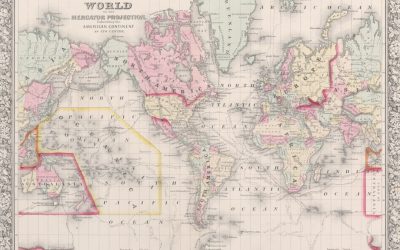
The Five Oceans and Seven Continents
The Earth’s surface is divided into five major oceans: the Pacific, Atlantic, Indian, Southern (or Antarctic), and Arctic Oceans. These vast bodies of water play a crucial role in regulating the Earth’s climate and supporting diverse marine ecosystems. The oceans also serve as important transportation routes and a source of food and other natural resources for human societies around the world.
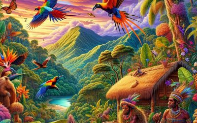
In addition to the oceans, the Earth’s landmasses are divided into seven continents: Africa, Antarctica, Asia, Europe, North America, Australia (or Oceania), and South America. Each continent has its own unique physical and cultural characteristics, shaped by millions of years of geological processes and human history. From the deserts of Africa to the rainforests of South America, the continents offer a rich tapestry of landscapes and environments for exploration and study.
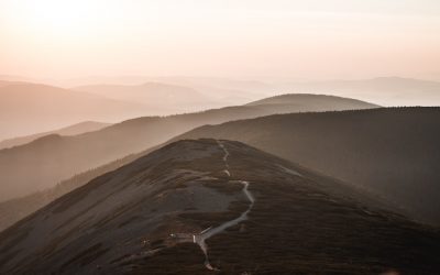
Major Mountain Ranges and Deserts
The Earth’s surface is also marked by major mountain ranges and deserts that have shaped the planet’s physical and cultural landscapes. The Himalayas, for example, are the highest mountain range in the world and are home to diverse ecosystems and cultures in countries such as India, Nepal, and Bhutan. The Andes in South America, the Rockies in North America, and the Alps in Europe are other prominent mountain ranges that have influenced human settlement patterns and economic activities.
Deserts cover about one-third of the Earth’s land surface and are characterized by low precipitation and extreme temperatures. The Sahara Desert in Africa is the largest hot desert in the world, while the Gobi Desert in Asia is one of the largest cold deserts. Deserts are not only home to unique flora and fauna but have also been important trade routes and cultural crossroads throughout history.
Climate Zones and Biomes
The Earth’s climate is influenced by a variety of factors, including latitude, altitude, ocean currents, and prevailing winds. As a result, the planet is divided into different climate zones, each with its own characteristic weather patterns and ecosystems. The equator, for example, experiences a tropical climate with high temperatures and heavy rainfall, while the polar regions have a cold and dry climate.
These climate zones give rise to different biomes, or large ecological areas characterized by distinct plant and animal communities. The tropical rainforest biome, found near the equator, is home to a diverse array of species and is vital for regulating the Earth’s climate. The grasslands biome, found in regions such as the African savannah and North American prairies, supports grazing animals and has been important for human agriculture throughout history.
Human Geography and Population Distribution
Human geography examines the ways in which people and their activities are distributed across the Earth’s surface. It encompasses topics such as population growth, migration patterns, urbanization, and cultural diversity. Understanding human geography is crucial for addressing global challenges such as poverty, inequality, and environmental degradation.
Population distribution is uneven across the world, with some regions experiencing rapid population growth while others are declining. The majority of the world’s population lives in Asia, particularly in countries such as China and India. Urban areas are also growing rapidly, with more than half of the world’s population now living in cities. This trend has significant implications for infrastructure development, resource management, and social inequality.
Historical and Cultural Geography
Historical geography examines how human activities have shaped the Earth’s landscapes over time. It explores topics such as colonialism, trade routes, and the rise and fall of empires. Cultural geography focuses on how human cultures have developed in different regions of the world and how they interact with their environments.
The Silk Road, for example, was an ancient trade route that connected China with Europe and facilitated the exchange of goods, ideas, and technologies across Eurasia. This historical trade route had a profound impact on the development of cultures and economies along its path. Similarly, cultural geographers study how different societies have adapted to their environments through practices such as agriculture, architecture, and religious beliefs.
The Importance of Geographic Knowledge
Geographic knowledge is crucial for addressing global challenges such as climate change, resource management, and international development. By understanding world geography, we can better appreciate the environmental, cultural, and economic challenges facing different regions of the world. This knowledge is crucial for addressing global issues such as climate change, resource management, and international development.
Geographic knowledge also helps us to understand our interconnectedness with other regions of the world. By studying world geography, we can gain a deeper appreciation for the diversity of our planet and the interconnectedness of its various regions. This understanding can foster a sense of global citizenship and empathy for people from different cultures and backgrounds.
In conclusion, world geography is a complex and multifaceted field that encompasses both physical and human aspects of the Earth’s landscapes. By studying world geography, we can gain a deeper appreciation for the diversity of our planet and the interconnectedness of its various regions. This knowledge is crucial for addressing global challenges such as climate change, resource management, and international development. It also helps us to understand our interconnectedness with other regions of the world and fosters a sense of global citizenship.
FAQs
What is world geography?
World geography is the study of the Earth’s landscapes, environments, and the relationships between people and their environments. It encompasses the physical features of the Earth, as well as the human activity that takes place on it.
Why is world geography important?
World geography is important because it helps us understand the world around us. It provides insights into the physical and human processes that shape our planet, and helps us make informed decisions about how to interact with our environment.
What are the main branches of world geography?
The main branches of world geography include physical geography, which focuses on the Earth’s natural features and processes, and human geography, which examines the relationships between people and their environments.
How does world geography impact our daily lives?
World geography impacts our daily lives in numerous ways, from influencing the weather and climate we experience, to shaping the availability of natural resources and influencing the distribution of populations and cultures around the world.
What are some key concepts in world geography?
Key concepts in world geography include location, place, human-environment interaction, movement, and region. These concepts help geographers understand and interpret the world around them.

The Water Cycle: How Water Moves on Earth
The water cycle, also known as the hydrological cycle, is the continuous movement of water on, above and below the surface of the Earth. It is a complex process that involves the evaporation of water from the Earth’s surface, the formation of clouds through condensation, precipitation in the form of rain, snow, sleet or hail, and the movement of water through infiltration and runoff. The water cycle is essential for sustaining life on Earth as it regulates the distribution of water across the planet, replenishes freshwater sources and supports ecosystems. Understanding the water cycle is crucial for managing water resources, predicting weather patterns and mitigating the impacts of climate change. The water cycle begins with the heat from the sun causing water to evaporate from oceans, rivers, lakes and other bodies of water. This water vapour rises into the atmosphere where it cools and condenses to form clouds. When the clouds become saturated with water vapour, precipitation occurs in the form of rain, snow, sleet or hail. The precipitation then infiltrates into the ground or runs off into rivers and streams, eventually making its way back to the oceans. This continuous movement of water is vital for sustaining life on Earth and maintaining the balance of ecosystems. In this article, we will explore each stage of the water cycle in detail and discuss its significance for life on our planet. Summary The water cycle is the continuous movement of water on, above, and below the surface of the Earth. Evaporation is the process by which water changes from a liquid to a gas, primarily from the sun’s heat. Condensation...
Papua New Guinea
Papua New Guinea (Independent State of Papua New Guinea) Capital: Port Moresby Population (Estimated July 2012): 6,310,129 Area: 462,840km2 or 178,704mi2 Currency: Kina (K) Official Language: English, Hiri Motu and Tok Pisin Political Information: Constitutional Monarchy with Democratic Parliament Official Religion: No Official Religion(approximately 69.4% of the population are Protestant, 27% are Roman Catholic and 3.6% have other religious beliefs) Highest Mountain: Mount Wilhelm at 4,509m or 14,793ft GDP Official Exchange Rate (OER is more precise at gauging a country’s economic power) (Estimated 2011): $11.4 billion (US$) or (GBP) GDP (OER) Per Capita (per member of the population estimated 2011): (US$) or (GBP) GDP Purchasing Power Parity (PPP is good for gauging living conditions and the use of resources but is not as accurate as OER. This data has been calculated based on the sum value of all goods and services produced in the country valued at prices prevailing in the United States) (Estimated 2011): $16.7 billion (US$) or (GBP) GDP (PPP) Per Capita (per member of the population estimated 2011): $2,500 (US$) or (GBP) Time Zone (GMT/UTC): +10:00 Wildlife: Counties/Provinces/States: 18 provinces, 1 autonomous region*, and 1 district**; Bougainville*, Central, Chimbu, Eastern Highlands, East New Britain, East Sepik, Enga, Gulf, Madang, Manus, Milne Bay, Morobe, National Capital**, New Ireland, Northern, Sandaun, Southern Highlands, Western, Western Highlands, West New Britain Leaders: (Head of State) H.M. Queen Eliuzabeth II represented by Governor Michael OGIO; Prime Ministers Peter O’Neill Additional: Gained independence from an Australian-administered UN trusteeship on the 16th of September 1975. Sources: CIA World Fact Book, Encyclopaedia Britannica. Papua New Guinea Papua New Guinea is a nation situated in the southwestern Pacific Ocean,...
Different Types of Rocks and the Rock Cycle
Rocks are naturally occurring solid aggregates of minerals or mineraloids. They constitute the fundamental components of the Earth’s crust and are continuously formed, broken down, and reformed through various geological processes. Rocks can be categorised into three main types: igneous, sedimentary, and metamorphic. Each rock type possesses unique characteristics and formation processes, which are influenced by factors such as temperature, pressure, and the presence of water and other fluids. Understanding the different types of rocks and their formation is essential for geologists and other earth scientists to interpret the Earth’s history and predict future geological events. Rocks are an integral part of the Earth’s geology and play a crucial role in shaping the planet’s surface and supporting life. They are also valuable resources that have been utilised by humans for thousands of years for construction, tools, and artistic expression. The study of rocks and their properties is known as petrology, and it provides important insights into the Earth’s history, natural hazards, and the formation of natural resources such as oil, gas, and minerals. This article will explore the different types of rocks, their formation processes, and their significance in the Earth’s geology and human society. Summary Rocks are naturally occurring solid materials made up of minerals and can be classified into three main types: igneous, sedimentary, and metamorphic. Igneous rocks are formed from the cooling and solidification of molten rock, and can be further classified into intrusive and extrusive types. Sedimentary rocks are formed from the accumulation and compression of sediments, and can be further classified into clastic, chemical, and organic types. Metamorphic rocks are formed from the alteration...
How Geography Affects Travel: Weather, Terrain, and Culture
The weather and climate of a destination can significantly influence travel plans and experiences. For instance, tropical destinations with hot and humid weather may necessitate that travellers pack lightweight, breathable clothing and remain well-hydrated. Conversely, destinations with cold and snowy weather may require travellers to pack warm clothing and be prepared for potential travel delays due to weather-related issues. Moreover, extreme weather conditions such as hurricanes, typhoons, or monsoons can disrupt travel plans and pose safety risks for travellers. It is crucial for travellers to research and understand the typical weather patterns of their destination to pack appropriately and plan for any potential weather-related challenges. Furthermore, the climate of a destination can also impact the types of activities and experiences available to travellers. For example, destinations with a tropical climate may offer opportunities for beach activities, water sports, and wildlife viewing, whilst destinations with a temperate climate may offer opportunities for hiking, skiing, and exploring natural landscapes. Understanding the climate of a destination can help travellers to plan and prepare for the activities and experiences that are best suited to the local weather conditions. Overall, the weather and climate of a destination play a crucial role in shaping the travel experience, and it is important for travellers to consider these factors when planning their trips. Summary Weather can significantly impact travel plans, so it’s important to research and prepare for the climate of your destination. Navigating different terrains requires careful planning and consideration of the local geography and topography. Embracing local traditions and customs is essential for a meaningful and respectful travel experience. Geography can affect transportation options, so...
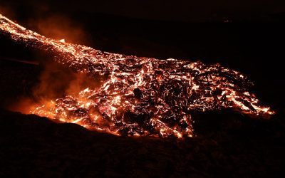
What Are Volcanoes and How Do They Form?
Volcanoes are natural phenomena that have captivated and alarmed humans for centuries. These magnificent geological formations are created by the movement of tectonic plates and the release of pressure from the Earth’s mantle. They are renowned for their explosive eruptions, which can cause widespread destruction and have a significant impact on the environment. Volcanoes can be found on every continent and even on the ocean floor, and they play a crucial role in shaping the Earth’s landscape. From the iconic Mount Vesuvius in Italy to the towering Mauna Loa in Hawaii, volcanoes come in various shapes and sizes, each with its own unique characteristics and history. Volcanoes have captured the imagination of people throughout history, with many cultures incorporating them into their myths and legends. They have been both feared and revered, seen as both destructive and creative forces of nature. The study of volcanoes, known as volcanology, has become an important field of scientific research, as understanding these powerful natural phenomena is crucial for predicting and mitigating their potential hazards. In this article, we shall explore the formation of volcanoes, the different types of volcanoes, volcanic eruptions, the hazards they pose, and the methods used to monitor volcanic activity. Understanding these aspects of volcanoes is essential for safeguarding communities living near these geological wonders and for advancing our knowledge of the Earth’s dynamic processes. Summary Volcanoes are natural formations that result from the eruption of magma from the Earth’s mantle. Volcanoes can form through various processes, including subduction, hotspots, and rift zones. There are different types of volcanoes, including shield volcanoes, stratovolcanoes, and cinder cone volcanoes. Volcanic eruptions...

Understanding Plate Tectonics and Earthquakes
Plate tectonics is the scientific theory that explains the movement of the Earth’s lithosphere, which comprises several large and small tectonic plates. These plates float on the semi-fluid asthenosphere beneath them and are in constant motion, interacting with one another at their boundaries. The theory of plate tectonics has revolutionised our understanding of the Earth’s geology and has provided a framework for explaining a wide range of geological phenomena, including earthquakes, volcanic activity, and the formation of mountain ranges. The concept of plate tectonics was first proposed in the early 20th century, but it was not until the 1960s that it gained widespread acceptance among geologists. The theory was developed through a combination of geological, geophysical, and palaeontological evidence, including the discovery of mid-ocean ridges, deep-sea trenches, and the distribution of fossils and rock formations across different continents. Today, plate tectonics is a fundamental principle of geology and is used to explain the dynamic processes that have shaped the Earth’s surface over millions of years. Summary Plate tectonics is the scientific theory that explains the movement of the Earth’s lithosphere and the formation of continents and oceans. The Earth’s structure consists of the crust, mantle, and core, and plate boundaries are the areas where tectonic plates interact, leading to earthquakes and volcanic activity. Earthquakes are caused by the sudden release of energy along faults in the Earth’s crust, and they can have devastating effects such as tsunamis, landslides, and structural damage. Monitoring and predicting earthquakes involve the use of seismometers, GPS, and other technologies to track seismic activity and assess the likelihood of future earthquakes. Mitigating the impact of...
The Layers of the Earth: Crust, Mantle, Core
The Earth comprises several distinct layers, each possessing unique characteristics and properties. These layers consist of the crust, mantle, outer core and inner core. A comprehensive understanding of the composition and attributes of these layers is essential for comprehending the Earth’s structure and its functions. The study of Earth’s layers provides crucial insights into geological processes, including plate tectonics, volcanic activity and seismic waves. This article shall examine each layer of the Earth in detail, exploring their composition, characteristics and significance within the broader context of Earth science. Summary The Earth is made up of several layers, each with its own unique composition and characteristics. The Earth’s crust is the outermost layer and is the thinnest layer of the Earth. The mantle is the thickest layer of the Earth and is composed of solid rock that can flow over long periods of time. The outer core is a liquid layer made up of iron and nickel, and it is responsible for generating the Earth’s magnetic field. The inner core is the Earth’s solid centre, composed mainly of iron and nickel, and it is extremely hot and under immense pressure. Understanding the layers of the Earth is important for understanding geological processes, natural disasters, and the Earth’s magnetic field. The Earth’s Crust: The Outermost Layer Composition and Characteristics On the other hand, the oceanic crust is thinner and denser, mainly composed of basalt rocks. The crust is also where all life on Earth exists, as it provides a solid surface for living organisms to thrive. It is also where most geological activities, such as earthquakes and volcanic eruptions, occur. Importance...
Physical Geography
Physical geography is the study of the Earth’s natural features and processes, including landforms, weather, climate and natural resources. It is a branch of geography that focuses on the physical aspects of the Earth and how they interact with one another. Physical geography is concerned with understanding the processes that shape the Earth’s surface, such as erosion, weathering and plate tectonics. It also examines the distribution of natural resources and how they are utilised by human societies. This field of study is essential for understanding the natural environment and how it influences human activities. Physical geography encompasses a wide range of topics, including geomorphology, hydrology, climatology and biogeography. Geomorphology is the study of landforms and the processes that create and change them, such as erosion, deposition and tectonic activity. Hydrology focuses on the distribution and movement of water on the Earth’s surface, including rivers, lakes and groundwater. Climatology examines the long-term patterns of weather and climate, including factors such as temperature, precipitation and atmospheric circulation. Biogeography studies the distribution of plants and animals on the Earth’s surface and how they are influenced by physical factors such as climate and topography. Overall, physical geography provides a comprehensive understanding of the Earth’s natural systems and processes. Summary Physical geography is the study of the Earth’s natural features and processes. The Earth’s surface is shaped by landforms such as mountains, valleys, and plains. Weather and climate play a crucial role in shaping the Earth’s surface and landforms. Natural resources such as water, minerals, and forests are studied in physical geography. Human interaction with the environment has a significant impact on the Earth’s...

Political Boundaries of Panama: Provinces, Districts, or Historical Boundaries.
Panama, a nation situated in Central America, is characterised by its diverse and intricate political boundaries. The country shares borders with Costa Rica to the west and Colombia to the southeast, whilst being bounded by the Caribbean Sea to the north and the Pacific Ocean to the south. Panama‘s political boundaries are not solely defined by its geographical borders but also by its administrative divisions, comprising provinces and districts. These boundaries are integral to the nation’s governance, administration and socio-economic development. A comprehensive understanding of Panama’s political boundaries is crucial for appreciating the country’s history, culture and contemporary issues. The political boundaries of Panama have undergone significant changes over time, shaped by historical events, colonial influences and geopolitical factors. The country’s varied topography, which includes mountains, rainforests and coastal plains, has also played a role in the formation of its political boundaries. This article will examine the provinces and districts of Panama, explore the historical and evolutionary aspects of its political boundaries, and address the challenges and controversies surrounding them. Through a thorough analysis of these topics, one can gain a more profound understanding of the importance of political boundaries in Panama and their impact on the nation’s governance and society. Summary Panama’s political boundaries are defined by its borders with Costa Rica to the west, Colombia to the southeast, the Caribbean Sea to the north, and the Pacific Ocean to the south. The provinces of Panama are divided into 10 administrative regions, each with its own unique characteristics and cultural identity. The districts of Panama are further subdivisions within the provinces, each with its own local government and...

Natural Resources of Panama: Where Natural Resources are Located in Panama
Panama is a country situated in Central America, bordered by Costa Rica to the west and Colombia to the southeast. It is renowned for its abundant natural resources, which play a crucial role in the nation’s economy and biodiversity. The varied landscape of Panama encompasses verdant rainforests, productive agricultural land, and plentiful water resources, rendering it a centre of biodiversity and natural wealth. The country’s natural resources have been utilised for centuries by indigenous communities and continue to be an essential component of Panama’s economy and environment. From the rich biodiversity of its flora and fauna to the abundance of water resources and mineral deposits, Panama’s natural resources are a source of national pride and significance. Panama’s natural resources have been a driving force behind the country’s economic development, providing opportunities for agriculture, mining, and tourism. The sustainable management of these resources is crucial for the preservation of the environment and the well-being of the population. As Panama continues to grow and develop, it is essential to balance economic progress with the conservation of its natural resources. This article will explore the diverse natural resources of Panama, their significance, and the importance of sustainable management for the future of the country. Summary Panama is rich in natural resources, including biodiversity, water, minerals, energy, forests, and agriculture. The country’s biodiversity is one of the richest in the world, with a wide variety of flora and fauna. Panama has an abundance of water resources, including rivers, lakes, and a vast coastline, making it a key player in the global water supply. The country also has significant mineral and energy resources, including...

Cultural or Historical Sites of Panama: Important Cultural Landmarks or Historical Sites In Panama
Panama, a nation in Central America, boasts a wealth of cultural and historical sites that provide insight into its diverse and dynamic history. From ancient archaeological locations to colonial-era districts, Panama‘s cultural heritage demonstrates its rich past and the convergence of various cultures. The country’s strategic position as a link between the Americas has rendered it a melting pot of indigenous, European, African and Asian influences, all of which have left an indelible mark on its cultural landscape. Visitors to Panama can explore a wide array of historical sites, each offering a unique perspective on the country’s history and its people. Panama’s cultural and historical sites are not only significant for understanding the nation’s past, but also for appreciating its present-day diversity and vibrancy. From the remnants of ancient civilisations to the colonial architecture of its cities, Panama’s cultural heritage is a source of national pride and a draw for visitors from across the globe. By exploring these sites, visitors can gain a deeper understanding of Panama’s history and the forces that have shaped its identity. Whether it be the ancient ruins of Panama Viejo, the historic district of Casco Viejo, or the engineering marvel of the Panama Canal, each site offers a unique window into Panama’s cultural and historical legacy. Summary Panama is home to a rich cultural and historical heritage, with a variety of sites to explore. Panama Viejo, the old Panama City, offers a glimpse into the country’s colonial past and the ruins of the first European settlement on the Pacific coast of the Americas. Casco Viejo, the historic district of Panama City, is a UNESCO...

Climate Zones of Panama: Different Climate Regions Of Panama
Panama, situated in Central America, is renowned for its diverse climate zones. The nation’s distinctive geographical position, with coastlines on both the Caribbean Sea and the Pacific Ocean, contributes to the variety of climates found within its borders. Panama‘s climate can be broadly categorised into five main zones: tropical rainforest, tropical monsoon, tropical savanna, subtropical highland, and variations within these zones. Each of these climate zones possesses its own distinct characteristics, including temperature, precipitation, and vegetation. Comprehending these climate zones is crucial for anyone planning to visit or reside in Panama, as it can significantly impact activities, agriculture, and overall lifestyle. Summary Panama has diverse climate zones, including tropical rainforest, tropical monsoon, tropical savanna, and subtropical highland climates. The tropical rainforest climate in Panama is characterised by high temperatures, heavy rainfall, and high humidity, making it ideal for lush vegetation and diverse wildlife. The tropical monsoon climate in Panama experiences a distinct wet and dry season, with heavy rainfall during the wet season and drier conditions during the dry season. The tropical savanna climate in Panama is characterised by a long dry season and a shorter wet season, with grasslands and scattered trees dominating the landscape. The subtropical highland climate in Panama is characterised by cooler temperatures and lower humidity, making it suitable for agriculture and outdoor activities. Tropical Rainforest Climate Characteristics of the Climate The tropical rainforest climate zone in Panama is marked by high temperatures and heavy rainfall throughout the year. This climate zone is found in the eastern part of the country, including the Darien region and parts of the Caribbean coast. The average temperature in...