Explore the World Through Geography, Natural Resources & Daily History
Clear, reliable and engaging guides that help you understand our planet — from UK geography education to global natural resources and On This Day history events.
Explore, discover, and learn about the wonders of our world! At Earth Site, we’re passionate about bringing geography, history, and science to life for curious minds of all ages. Whether you’re delving into historical events, uncovering the mysteries of the natural world, or seeking interactive resources, you’re in the right place.
Here, you can uncover the stories behind historical events, explore the natural wonders of our planet, and gain valuable insights into how the Earth’s systems shape our daily lives. From the towering peaks of mountain ranges to the far-reaching impacts of human innovation, we aim to make every topic both engaging and informative.
Start your journey of discovery with us today, and let’s make learning an adventure!
What We Cover
Earth Site brings together engaging and accessible educational content designed to help you understand the world, its history, and its natural systems.
🌍 Geography Education (UK & Worldwide)
We publish clear, easy-to-understand geography resources for students, teachers and curious learners. Our guides support geography education in the UK and cover physical geography, climate, ecosystems, population, and global development.
⛏️ Natural Resources & Environmental Geography
Explore detailed country profiles covering natural resources, mining, energy, geology and global environmental challenges. We show how nations manage minerals, water, land and ecosystems, and why these resources matter.
📅 On This Day in History
Every day has a story. Our On This Day history series features major events, anniversaries, traditions, and cultural milestones from around the world — with timelines, context, and fun facts.
TIMELINE
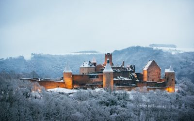
Cultural or Historical Sites of Belarus: Important Cultural Landmarks or Historical Sites In Belarus
Belarus, located in Eastern Europe, is a country rich in culture and history. Over the centuries, it has been influenced by various civilizations and empires, resulting in a unique blend of traditions and customs. From its medieval castles to its vibrant art scene, Belarusian culture is a testament to the resilience and creativity of its people. Preserving this cultural heritage is of utmost importance, as it allows future generations to connect with their roots and understand the country’s rich history. Summary Belarusian National Arts Museum showcases the country’s rich artistic heritage. Brest Fortress stands as a symbol of Belarusian resistance against Nazi invasion. Mir Castle Complex is a UNESCO World Heritage Site and a stunning example of medieval architecture. Nesvizh Castle was once the residence of the powerful Radziwill family and is now a popular tourist attraction. The Great Synagogue of Slonim is a testament to Belarusian Jewish heritage and a reminder of the country’s diverse cultural history. Belarusian National Arts Museum: A Hub of Art and Culture The Belarusian National Arts Museum, located in Minsk, is a hub of art and culture in the country. Established in 1939, the museum houses an extensive collection of Belarusian and international art, spanning from the 12th century to the present day. Its collections include paintings, sculptures, graphic art, decorative art, and folk art. One of the highlights of the museum is its collection of Belarusian icons, which provides a glimpse into the country’s religious and artistic traditions. These icons are not only beautiful works of art but also important religious artifacts that have played a significant role in Belarusian culture. Another...
Discover the Natural Resources of Belarus: From Water to Mineral Resources In Belarus
Discover the Natural Resources of Belarus: From Water to Mineral Resources In Belarus Belarus, a landlocked country in Eastern Europe, holds a surprisingly diverse array of natural resources, from rich peat deposits and limestone to essential water resources and mineral resources. This article delves into the natural resources of Belarus, explaining what they are, where they’re found, how they’re used, and why they matter for both the Belarusian economy and its geopolitical significance. Whether you’re interested in the energy sector, environmental topics, or economic development, this is an essential read for understanding how Belarus leverages its natural wealth and what challenges lie ahead. Article Outline 1. What Natural Resources Are Found in Belarus? 2. Where Are the Major Peat Deposits in Belarus Located? 3. How Do Belarus’ Water Resources Influence Its Economy? 4. What Role Do Mineral Deposits Play in Belarus’ Industry? 5. How Important Is Natural Gas to Belarus’ Energy Sector? 6. What Are the Key Environmental Concerns Tied to Resource Extraction? 7. What is the Role of Timber and the Forestry Sector in Belarus? 8. How Does Belarus Balance Resource Use and Environmental Protection? 9. What Is the Import-Export Balance of Belarus in Natural Resources? 10. How Do Belarus’ Natural Resources Affect Its Relations with Neighbours? 1. What Natural Resources Are Found in Belarus? The Republic of Belarus may not be the first country that comes to mind when discussing resource-rich nations, but it possesses a variety of natural resources that support key economic sectors. These include peat, potash, limestone, timber, and significant water resources such as rivers and wetlands. Despite being landlocked, Belarus has leveraged...
Population Density of Bangladesh
Bangladesh, a small country located in South Asia, is known for its high population density. With a land area of just 147,570 square kilometers, it is one of the most densely populated countries in the world. The population density of Bangladesh is estimated to be around 1,252 people per square kilometer. This means that for every square kilometer of land, there are over 1,000 people living in it. This high population density has significant implications for the country’s development and poses various challenges that need to be addressed. Summary Bangladesh has one of the highest population densities in the world, with over 160 million people living in an area roughly the size of Iowa. Population density is a crucial factor in determining a country’s economic and social development, as it affects access to resources, infrastructure, and services. Bangladesh’s population has grown rapidly over the past century, from around 30 million in 1900 to over 160 million today, due to factors such as improved healthcare and declining mortality rates. Despite efforts to control population growth, Bangladesh’s population is projected to continue growing in the coming decades, with urbanization and migration from rural areas contributing to high population density in cities. High population density poses significant challenges for Bangladesh, including pressure on resources, environmental degradation, and social and economic inequality, but the government has implemented measures to address these issues, such as family planning programs and urban development initiatives. Understanding Population Density and its Importance Population density refers to the number of people living in a specific area, usually measured per square kilometer or square mile. It is an important demographic...
Population Density of Barbados
Barbados, a small island nation located in the Caribbean, has a population density of approximately 660 people per square kilometer. This makes it one of the most densely populated countries in the world. Understanding population density is crucial for policymakers and planners as it helps them make informed decisions regarding resource allocation, infrastructure development, and social services provision. Summary Barbados has a population density of approximately 670 people per square kilometre. The population density of Barbados has steadily increased since the 1800s due to factors such as immigration and urbanization. Factors influencing population density in Barbados include economic opportunities, access to resources, and government policies. Urbanization has led to higher population density in urban areas, while rural areas have experienced a decline in population density. Population density in Barbados is closely linked to economic development and social issues such as poverty and inequality. Historical trends in population density Barbados has experienced significant changes in population density over the years. In the early 17th century, when the island was first settled by the British, the population density was relatively low. However, with the introduction of sugar plantations and the subsequent influx of enslaved Africans, the population density began to increase rapidly. During the 18th and 19th centuries, Barbados had one of the highest population densities in the world due to the high demand for sugar and the large number of enslaved Africans working on the plantations. However, with the abolition of slavery in 1834 and the decline of the sugar industry in the late 19th century, there was a significant decrease in population density. Factors influencing population density in Barbados...
Climate Zones of Barbados: Different climate regions Of Barbados
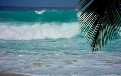
Barbados, a small island nation located in the Caribbean, is known for its beautiful beaches, vibrant culture, and diverse ecosystems. The climate in Barbados is tropical, with warm temperatures and high humidity throughout the year. Understanding the different climate zones in Barbados is important for several reasons. Firstly, it helps us understand the unique characteristics of each zone and the impact they have on the environment. Secondly, it allows us to better appreciate and protect the diverse ecosystems that exist on the island. Lastly, it helps us prepare for and mitigate the effects of climate change, which is a growing concern for Barbados and other small island nations. Summary Barbados has a diverse range of climate zones, including tropical rainforest, monsoon, savanna, humid subtropical, semi-arid, arid, coastal, and mountain. The tropical rainforest climate zone is characterized by high rainfall and humidity, with temperatures ranging from 23-31°C. The tropical monsoon climate zone experiences a wet season from June to November and a dry season from December to May, with temperatures ranging from 23-31°C. The tropical savanna climate zone has a distinct wet and dry season, with temperatures ranging from 23-31°C. The humid subtropical climate zone experiences mild winters and hot summers, with temperatures ranging from 18-31°C. Climate change is expected to have significant impacts on Barbados’ climate zones, including increased temperatures, sea level rise, and changes in precipitation patterns. Tropical Rainforest Climate Zone in Barbados The tropical rainforest climate zone in Barbados is characterized by high temperatures, heavy rainfall, and lush vegetation. This climate zone is found primarily along the eastern coast of the island, where the prevailing winds bring...
Terrain and Topography of Barbados: mountains, valleys, and plains.
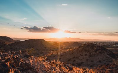
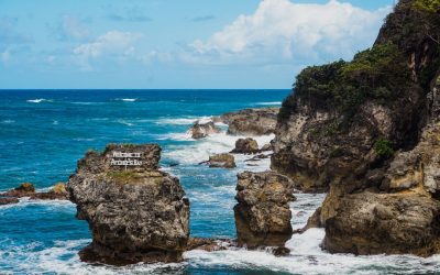
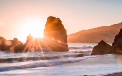
Barbados, a small island nation located in the Caribbean, is known for its stunning beaches, vibrant culture, and warm hospitality. However, beyond its beautiful coastline lies a diverse and unique terrain that is worth exploring. Understanding the geography of Barbados is essential for appreciating the island’s natural beauty and for promoting sustainable development. From the flat coastal plains to the rugged cliffs and rock formations, Barbados offers a range of landscapes that are not only visually captivating but also play a crucial role in supporting various industries such as tourism and agriculture. Summary Barbados has a diverse terrain and topography, ranging from flat coastal plains to central uplands and unique formations like the Scotland District. Mount Hillaby is the highest point in Barbados, offering stunning views and challenging hiking trails. Barbados is home to limestone caves and underground lakes, as well as coastal cliffs and rock formations. The island’s topography has a significant impact on its climate and vegetation, making it a unique and valuable ecosystem. It is important to preserve Barbados’ diverse terrain and topography for future generations to enjoy and appreciate. The Flat Coastal Plains of Barbados The coastal plains of Barbados are characterized by low-lying areas that stretch along the island’s perimeter. These plains are made up of sandy beaches, coral reefs, and mangrove swamps. The flat terrain of these areas makes them ideal for tourism, as they provide easy access to the beach and offer breathtaking views of the Caribbean Sea. Many resorts and hotels are located along these coastal plains, attracting tourists from around the world. In addition to their importance for tourism, the...
Political Boundaries of Barbados: Provinces, Districts, or Historical Boundaries.
Understanding the political boundaries of Barbados is crucial for a variety of reasons. These boundaries define the jurisdiction and governance of the island, and they play a significant role in shaping the political, social, and cultural landscape of Barbados. By understanding these boundaries, we can gain insight into the historical, geographical, and administrative divisions that have shaped the island’s development. This article will provide an in-depth overview of Barbados’ political boundaries, including its provinces, districts, and parish councils. It will also explore the historical evolution of these boundaries and their impact on Barbadian culture and society. Additionally, it will discuss the challenges and opportunities in managing these boundaries and provide insights into future trends and developments. Summary Barbados is divided into 11 parishes, each with its own distinct political boundaries. The provinces of Barbados were established in the 17th century and were originally used for taxation purposes. The districts of Barbados are smaller subdivisions within the parishes and are used for administrative purposes. Parish councils play an important role in managing local affairs and maintaining the political boundaries of Barbados. Barbados’ political boundaries have evolved over time due to factors such as colonialism, migration, and urbanization. Understanding the Political Boundaries of Barbados: An Overview Political boundaries refer to the lines that demarcate the jurisdictional areas within a country or region. These boundaries define the territories over which governments have authority and control. In the case of Barbados, its political boundaries determine the governance structure and administrative divisions of the island. Barbados is a small island nation located in the Caribbean Sea. It is part of the Lesser Antilles and...
Barbados Natural Resources: Fishing and Natural Resources of Barbados
Barbados Natural Resources: Fishing and Natural Resources of Barbados Barbados, a small island nation located in the Caribbean, is blessed with a variety of natural resources that contribute to its economy and the well-being of its people. These resources include land, water, minerals, agriculture, renewable energy, and coastal areas. The management and sustainable use of these resources are crucial for the country’s economic development and the preservation of its natural environment. Summary Barbados has a diverse range of natural resources, including land, water, coastal areas, minerals, agriculture, renewable energy, and tourism. The coastal resources of Barbados are particularly important, providing habitats for marine life and supporting the island’s fishing industry. Barbados has limited mineral resources, but there are opportunities for sustainable extraction and processing of materials such as clay and limestone. Agriculture is a significant contributor to Barbados’ economy and natural resource sector, with crops such as sugarcane, vegetables, and fruits grown on the island. Renewable energy is a growing sector in Barbados, with solar and wind power playing an increasingly important role in the island’s energy mix. Overview of Barbados’ Land and Water Resources Barbados has a total land area of approximately 430 square kilometres, making it one of the smallest countries in the world. The island is mostly flat with some rolling hills in the central part. The topography of Barbados is characterised by coral limestone formations, which have been shaped by erosion over millions of years. These limestone formations provide a foundation for the island’s agriculture and construction industries. In terms of water resources, Barbados relies heavily on groundwater as its primary source of fresh...
Cultural or Historical Sites of Barbados: Important Cultural Landmarks or Historical Sites In Barbados
Introduction Barbados, a small island nation in the Caribbean, is known for its rich history and cultural heritage. From its colonial past to its vibrant present, Barbados has a wealth of historic sites and landmarks that showcase its unique identity. It is important to preserve and celebrate these sites as they provide a window into the island’s past and contribute to its cultural identity. This article will explore some of the most significant historic sites and landmarks in Barbados, highlighting their history, significance, and tourist attractions. The Historic Garrison Area: A UNESCO World Heritage Site in Barbados One of the most important historic sites in Barbados is the Historic Garrison Area, which has been designated as a UNESCO World Heritage Site. The Garrison Area has a long and storied history, dating back to the 17th century when it was established as a military base by the British. It played a crucial role in the defense of the island and the British Empire during various conflicts. Within the Garrison Area, there are several key landmarks and attractions that visitors can explore. One of the most notable is the George Washington House, where the first President of the United States once stayed during his visit to Barbados. The house offers a glimpse into Washington’s early life and his connection to the island. Another significant landmark in the Garrison Area is St. Ann’s Fort, which was built in 1705 to protect the island from potential invasions. Today, it serves as a museum where visitors can learn about Barbados’ military history and view artifacts from various periods. Bridgetown and Its Garrison: A Window...

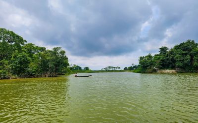
Terrain and Topography of Bangladesh: mountains, valleys, and plains.
Bangladesh, located in South Asia, is a country with a diverse and unique topography. From the mighty Himalayas in the north to the vast Ganges Delta in the south, Bangladesh’s terrain offers a wide range of landscapes and natural wonders. Understanding the country’s geography is crucial for various reasons, including agriculture, tourism, and environmental conservation. In this article, we will explore the different regions of Bangladesh and their significance. Summary Bangladesh is a country with diverse terrain and topography. The Himalayas form the northern boundary of Bangladesh. The Chittagong Hill Tracts offer scenic mountain ranges. The Brahmaputra-Jamuna Floodplain is a fertile plain. The Sundarbans is the world’s largest mangrove forest. The Mighty Himalayas: Bangladesh’s Northern Boundary The Himalayas, known as the “Roof of the World,” are a majestic mountain range that stretches across several countries, including Nepal, India, Bhutan, and Tibet. In Bangladesh, the Himalayas form its northern boundary, separating it from its neighboring countries. While Bangladesh does not have towering peaks like its Himalayan counterparts, the presence of these mountains has a significant impact on the country’s climate and landscape. The Himalayas act as a barrier to cold winds from the north, resulting in a relatively mild climate in Bangladesh. The mountains also play a crucial role in the country’s water resources. The melting snow from the Himalayas feeds several rivers that flow into Bangladesh, providing water for irrigation and other purposes. Additionally, the Himalayas contribute to the formation of fertile soil in the region through erosion and deposition processes. The Chittagong Hill Tracts: A Scenic Mountain Range Located in southeastern Bangladesh, the Chittagong Hill Tracts is a...
Climate Zones of Bangladesh: Different Climate Regions Of Bangladesh
Bangladesh, located in South Asia, is a country known for its diverse geography and climate. It is bordered by India to the west, north, and east, and by Myanmar to the southeast. The country is home to a wide range of climate zones, each with its own unique characteristics and weather patterns. Understanding these climate zones is crucial for various reasons, including agriculture, disaster management, and infrastructure development. Summary Bangladesh has diverse weather patterns due to its various climate zones. The tropical monsoon climate is the most common climate zone in Bangladesh. The subtropical highland climate offers cooler regions in Bangladesh. The semi-arid climate is prone to droughts in Bangladesh. The coastal climate has unique weather patterns in Bangladesh. The Tropical Monsoon Climate: Exploring Bangladesh’s Most Common Climate Zone The tropical monsoon climate is the most common climate zone in Bangladesh. It is characterized by high temperatures, heavy rainfall, and distinct wet and dry seasons. The wet season, known as the monsoon season, typically lasts from June to September, during which time the country experiences heavy rainfall and occasional flooding. The dry season, on the other hand, lasts from October to May and is characterized by lower temperatures and less rainfall. Regions in Bangladesh that experience the tropical monsoon climate include Dhaka, Chittagong, and Sylhet. These regions are known for their lush green landscapes and fertile soil, making them ideal for agriculture. However, the monsoon season can also bring about challenges such as flooding and landslides, which can have devastating effects on communities and infrastructure. The Subtropical Highland Climate: Discovering the Cooler Regions of Bangladesh The subtropical highland climate...
Political Boundaries of Bangladesh: Provinces, Districts, or Historical Boundaries.
Political boundaries refer to the demarcation lines that separate one political entity from another. These boundaries are crucial in defining the territorial limits of a country and determining its jurisdiction and governance. In the context of Bangladesh, understanding its political boundaries is of utmost importance due to its historical background and the impact it has on various aspects of the country’s development. Summary Bangladesh’s political boundaries have evolved over time due to various historical, social, and political factors. The country is currently divided into eight administrative divisions and 64 districts, each with its own unique characteristics and significance. Local government plays a crucial role in shaping and implementing policies at the grassroots level in Bangladesh. Political boundaries have a significant impact on the country’s economy, particularly in terms of trade and investment. There are ongoing controversies surrounding the demarcation of Bangladesh’s borders, including disputes with neighboring countries. Historical Overview of Bangladesh’s Political Boundaries Bangladesh’s political boundaries have evolved over time, shaped by historical events and political changes. Prior to its independence, Bangladesh was a part of British India and did not have its own distinct political identity. However, with the partition of India in 1947, Bengal was divided into two regions – West Bengal, which became a part of India, and East Bengal, which became a part of Pakistan as East Pakistan. The division of Bengal was met with significant challenges and tensions between East and West Pakistan due to cultural, linguistic, and economic differences. This eventually led to the Liberation War in 1971, during which East Pakistan fought for its independence from West Pakistan. The war resulted in...