Explore the World Through Geography, Natural Resources & Daily History
Clear, reliable and engaging guides that help you understand our planet — from UK geography education to global natural resources and On This Day history events.
Explore, discover, and learn about the wonders of our world! At Earth Site, we’re passionate about bringing geography, history, and science to life for curious minds of all ages. Whether you’re delving into historical events, uncovering the mysteries of the natural world, or seeking interactive resources, you’re in the right place.
Here, you can uncover the stories behind historical events, explore the natural wonders of our planet, and gain valuable insights into how the Earth’s systems shape our daily lives. From the towering peaks of mountain ranges to the far-reaching impacts of human innovation, we aim to make every topic both engaging and informative.
Start your journey of discovery with us today, and let’s make learning an adventure!
What We Cover
Earth Site brings together engaging and accessible educational content designed to help you understand the world, its history, and its natural systems.
🌍 Geography Education (UK & Worldwide)
We publish clear, easy-to-understand geography resources for students, teachers and curious learners. Our guides support geography education in the UK and cover physical geography, climate, ecosystems, population, and global development.
⛏️ Natural Resources & Environmental Geography
Explore detailed country profiles covering natural resources, mining, energy, geology and global environmental challenges. We show how nations manage minerals, water, land and ecosystems, and why these resources matter.
📅 On This Day in History
Every day has a story. Our On This Day history series features major events, anniversaries, traditions, and cultural milestones from around the world — with timelines, context, and fun facts.
TIMELINE
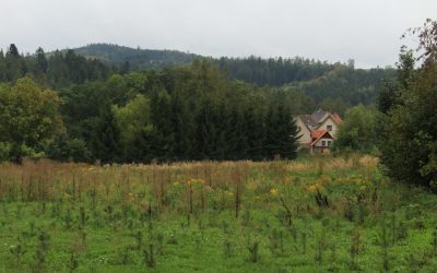
Exploring the Rich Flora and Fauna of Slovakia
Slovakia, a landlocked country in Central Europe, boasts a remarkable array of ecosystems that reflect its varied topography and climatic conditions. The country is characterised by the Carpathian Mountains, which stretch across its northern border, and the lowland plains that dominate the south. This geographical diversity creates a mosaic of habitats, ranging from alpine meadows and dense forests to wetlands and river valleys. Each of these ecosystems supports a unique assemblage of plant and animal life, making Slovakia a treasure trove for biodiversity. The mountainous regions, particularly the High Tatras, are home to subalpine and alpine ecosystems. These areas are characterised by rugged terrain, glacial lakes, and a climate that can be harsh, with cold winters and short growing seasons. In contrast, the lowland areas, such as the Danube River basin, feature fertile soils and a milder climate, supporting rich agricultural landscapes and diverse wetland habitats. The interplay between these ecosystems not only contributes to the overall biodiversity of Slovakia but also plays a crucial role in maintaining ecological balance and providing essential services such as water purification and carbon sequestration. Summary Slovakia boasts a diverse range of ecosystems, including mountains, forests, wetlands, and caves, providing habitats for a wide variety of flora and fauna. The unique flora of Slovakia includes over 2,600 species of vascular plants, with the Tatra Mountains being a hotspot for alpine and subalpine species. Slovakia is home to a fascinating array of fauna, including brown bears, lynx, wolves, and the critically endangered European ground squirrel. The country’s national parks and protected areas, such as the Tatra National Park and Slovak Paradise National Park, play...
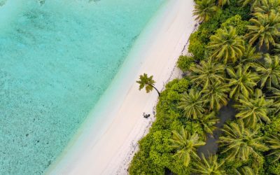
Discovering the Rich Biodiversity of the Maldives
The Maldives, an archipelago of 26 atolls in the Indian Ocean, is renowned for its stunning natural beauty, characterised by white sandy beaches, crystal-clear turquoise waters, and vibrant coral reefs. This tropical paradise, located southwest of Sri Lanka and India, comprises over 1,000 coral islands, many of which are uninhabited. The nation’s unique geographical formation and its isolation have fostered a rich tapestry of biodiversity, making it a focal point for marine and terrestrial life. The Maldives is not only a popular tourist destination but also a critical ecological zone that supports a myriad of species, some of which are endemic to the region. The cultural heritage of the Maldives is as rich as its natural environment. The Maldivian people, predominantly Sunni Muslims, have a history that intertwines with trade routes across the Indian Ocean, leading to a blend of influences from Africa, the Middle East, and South Asia. This cultural diversity is reflected in the local cuisine, traditional music, and vibrant festivals. However, the allure of the Maldives extends beyond its cultural richness; it is the ecological significance of this island nation that draws attention from conservationists and ecologists alike. The delicate balance between human activity and environmental preservation is a pressing concern as tourism continues to thrive in this idyllic setting. Summary The Maldives is an archipelago nation in the Indian Ocean known for its stunning coral reefs and crystal-clear waters, making it a popular tourist destination. The marine biodiversity of the Maldives is incredibly diverse, with over 2000 species of fish, 187 species of coral, and a wide variety of marine life including sharks, rays, and...
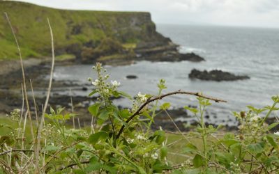
Exploring the Rich Flora and Fauna of Isle of Man
The Isle of Man, a small yet ecologically rich island situated in the Irish Sea, boasts a remarkable array of biodiversity that is both unique and significant. Covering approximately 572 square kilometres, the island is home to a variety of habitats, ranging from rugged coastlines and sandy beaches to lush woodlands and heathlands. This diverse landscape supports an impressive range of flora and fauna, some of which are endemic to the island. The Isle of Man’s biodiversity is not merely a collection of species; it represents a complex web of interactions between organisms and their environments, shaped by both natural processes and human influences over centuries. The island’s geographical position, coupled with its varied topography and microclimates, has fostered the development of distinct ecosystems. The influence of the North Atlantic Ocean moderates the climate, creating conditions that support a rich tapestry of life. The Isle of Man is also notable for its commitment to conservation and sustainable practices, which have helped preserve its natural heritage. As we delve deeper into the unique flora and fauna of the Isle of Man, we will uncover the intricate relationships that define its ecosystems and the ongoing efforts to protect this biodiversity for future generations. Summary The Isle of Man is home to a rich and diverse range of flora and fauna, making it a hotspot for biodiversity in the British Isles. The unique flora of the Isle of Man includes rare orchids, wildflowers, and ancient oak woodlands, providing a stunning natural landscape. The diverse fauna of the Isle of Man includes a variety of bird species, seals, basking sharks, and dolphins, offering...
Exploring the Flora and Fauna of Christmas Island
Christmas Island, an Australian territory located in the Indian Ocean, is a remote paradise that boasts a unique blend of natural beauty and ecological significance. Spanning approximately 135 square kilometres, this island is situated about 2,600 kilometres northwest of Perth and 500 kilometres south of Java, Indonesia. Its isolation has fostered a rich tapestry of biodiversity, making it a focal point for scientists and nature enthusiasts alike. The island was discovered on Christmas Day in 1643 by Captain William Mynors, and it has since become known for its stunning landscapes, including rugged cliffs, dense rainforests, and pristine beaches. The island’s geographical isolation has resulted in a distinctive ecosystem that is home to numerous species found nowhere else on Earth. The combination of its tropical climate and varied topography creates a unique habitat that supports a wide range of flora and fauna. Christmas Island is particularly famous for its annual red crab migration, where millions of crabs traverse the island to breed, creating a spectacular natural phenomenon. This event not only highlights the island’s ecological importance but also draws visitors from around the globe who wish to witness this extraordinary migration. Summary Christmas Island is a remote Australian territory known for its unique flora and fauna, making it a haven for nature enthusiasts. The island is home to over 600 species of native plants, including rare orchids and unique rainforest species. Christmas Island boasts a diverse range of fauna, including the iconic red crab migration, seabird colonies, and numerous species of land crabs. The island is a hotspot for endemic species, with many plants and animals found nowhere else in...
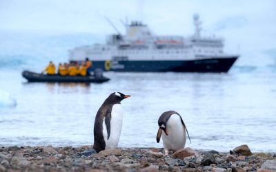
Exploring the Flora and Fauna of Antarctica
Antarctica, often referred to as the last great wilderness on Earth, is a continent that presents an extraordinary and unique ecosystem. Encompassing an area of approximately 14 million square kilometres, it is the fifth-largest continent and is predominantly covered by ice, which holds about 60% of the world’s fresh water. The extreme climatic conditions, characterised by frigid temperatures, strong winds, and prolonged periods of darkness during winter, create a challenging environment for life. Despite these harsh conditions, Antarctica is home to a remarkable array of flora and fauna that have adapted in fascinating ways to survive. The ecosystem of Antarctica is not merely defined by its ice and snow; it is a complex web of interdependent species that thrive in this seemingly inhospitable environment. The continent’s isolation has led to the evolution of unique species that are found nowhere else on the planet. The Antarctic ecosystem plays a crucial role in global climate regulation and oceanic systems, making it a vital area for scientific research and conservation efforts. Understanding the intricacies of this ecosystem is essential for appreciating its significance and the challenges it faces in the modern world. Summary Antarctica’s unique ecosystem is home to a wide variety of flora and fauna that have adapted to extreme conditions. The flora of Antarctica has evolved to survive in harsh conditions, including extreme cold, high winds, and limited sunlight. The fauna of Antarctica, including penguins, seals, and whales, have developed special adaptations to thrive in the challenging environment. Research and conservation efforts in Antarctica are crucial for understanding and protecting the delicate ecosystem of the region. Threats to the flora...
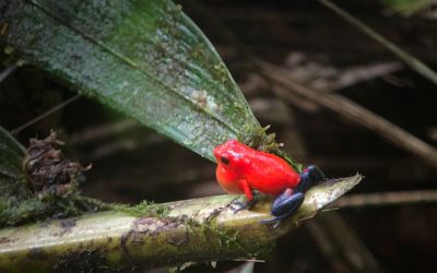
Exploring the Flora and Fauna of American Samoa
American Samoa, a territory of the United States located in the South Pacific Ocean, is renowned for its rich and diverse biodiversity. This archipelago comprises five main islands—Tutuila, Aunu’u, Ofu, Olosega, and Ta‘ū—along with several smaller islets. The unique geographical positioning of American Samoa, combined with its tropical climate, has fostered an environment where a plethora of species thrive. The islands are characterised by lush rainforests, coral reefs, and volcanic landscapes, all of which contribute to the ecological richness of the region. The biodiversity here is not only significant in terms of species variety but also in the ecological roles these species play within their respective habitats. The intricate web of life in American Samoa is a testament to millions of years of evolution, resulting in a complex interplay between flora and fauna. The islands are home to numerous endemic species, which are organisms that are found nowhere else on Earth. This uniqueness is a result of the islands’ isolation and varied ecosystems, which have allowed species to adapt specifically to their environments. However, this biodiversity is under threat from various human activities and environmental changes, making conservation efforts crucial for preserving the natural heritage of American Samoa. Summary American Samoa is home to a rich and diverse range of flora and fauna, making it a hotspot for biodiversity in the Pacific region. The unique flora of American Samoa includes a variety of indigenous plants, such as the national flower, the Paogo (Plumeria samoensis), and the rare Samoan chestnut (Inocarpus fagifer). The diverse fauna of American Samoa includes a wide array of bird species, marine life, and land animals,...
Exploring the Rich Flora and Fauna of Mauritius
Mauritius, an island nation located in the Indian Ocean, is renowned for its extraordinary biodiversity, which has evolved in isolation over millions of years. This unique geographical setting has fostered a rich tapestry of ecosystems, ranging from lush forests and wetlands to coral reefs and coastal mangroves. The island’s biodiversity is not only significant for its ecological value but also for its cultural and economic importance. The interplay between the island’s flora and fauna has created a delicate balance that supports various forms of life, many of which are found nowhere else on Earth. The biodiversity of Mauritius is particularly noteworthy due to its high level of endemism. Many species have adapted to the island’s specific environmental conditions, resulting in a unique evolutionary path. However, this rich biodiversity faces numerous threats, including habitat destruction, invasive species, and climate change. Understanding the intricate web of life in Mauritius is crucial for both conservation efforts and the sustainable development of the island, as it plays a vital role in maintaining ecological balance and supporting local communities. Summary Mauritius is home to a rich and diverse range of flora and fauna, making it a hotspot for biodiversity. The unique flora of Mauritius includes rare and endangered species such as the iconic dodo tree and the delicate orchids. The diverse fauna of Mauritius includes the famous pink pigeon, giant tortoises, and a variety of marine life in its surrounding waters. Mauritius is known for its high number of endemic species, with many found nowhere else in the world. Conservation efforts in Mauritius are focused on protecting and restoring the island’s unique ecosystems, with...

Exploring the Flora and Fauna of Israel
Israel, a small yet remarkably diverse country, is often referred to as a biodiversity hotspot due to its unique geographical position and varied climatic conditions. Situated at the crossroads of Europe, Asia, and Africa, Israel boasts a wide range of ecosystems, from Mediterranean forests and coastal plains to arid deserts and mountainous regions. This geographical diversity contributes to an impressive array of flora and fauna, making Israel a fascinating case study for ecologists and nature enthusiasts alike. The country is home to over 2,500 species of plants, 500 species of birds, and numerous mammals, reptiles, and amphibians, many of which are endemic or have significant populations within its borders. The significance of Israel’s biodiversity extends beyond its natural beauty; it plays a crucial role in the ecological balance of the region. The various habitats support complex interactions among species, contributing to the resilience of ecosystems in the face of environmental changes. Furthermore, Israel’s biodiversity is not only vital for ecological health but also holds cultural and historical importance. Many species are intertwined with the heritage and traditions of the local communities, reflecting a deep connection between the land and its people. As such, understanding and preserving this biodiversity is essential for both ecological sustainability and cultural identity. Summary Israel is home to a rich and diverse range of flora and fauna, making it a hotspot for biodiversity. The unique flora of Israel includes species such as the Judean date palm and the Sabra cactus, which are found only in this region. Israel’s diverse fauna includes species such as the Arabian leopard, the Nubian ibex, and the Syrian brown bear,...

Discovering the Biodiversity of Curaçao: The Flora and Fauna
Curaçao, a small island located in the southern Caribbean Sea, is renowned for its vibrant culture, stunning landscapes, and rich biodiversity. As part of the ABC islands—Aruba, Bonaire, and Curaçao—this territory of the Netherlands boasts a unique blend of ecosystems that have evolved over millennia. The island’s geographical position, coupled with its varied topography, creates a mosaic of habitats ranging from arid scrublands to lush coastal mangroves. This diversity is not merely a backdrop for the island’s human activities; it plays a crucial role in maintaining ecological balance and supporting the livelihoods of local communities. The biodiversity of Curaçao is characterised by a remarkable array of species, many of which are adapted to the island’s specific environmental conditions. The interplay between the island’s climate, geology, and human influence has shaped its ecosystems, resulting in a unique assemblage of flora and fauna. Understanding this biodiversity is essential not only for conservation efforts but also for appreciating the cultural and economic significance it holds for the island’s inhabitants. As we delve deeper into the unique flora and fauna of Curaçao, we will uncover the intricate relationships that define this Caribbean paradise. Summary Curaçao is home to a rich and diverse range of flora and fauna, making it a hotspot for biodiversity in the Caribbean. The unique flora of Curaçao includes cacti, succulents, and other drought-resistant plants that have adapted to the island’s arid climate. The diverse fauna of Curaçao includes a variety of bird species, reptiles, and marine life, with many species found nowhere else in the world. Conservation efforts in Curaçao face challenges such as habitat loss, invasive species, and...

Discovering the Biodiversity of Armenia: The Flora and Fauna
Armenia, a landlocked country nestled in the South Caucasus region, boasts a remarkable array of biodiversity that reflects its unique geographical position and varied climatic conditions. The country is characterised by its mountainous terrain, which ranges from the lush valleys of the Ararat Plain to the rugged peaks of the Lesser Caucasus. This diverse topography, combined with a range of microclimates, has fostered a rich tapestry of ecosystems that support a wide variety of plant and animal species. The biodiversity of Armenia is not only significant for its ecological value but also for its cultural heritage, as many species are intertwined with the traditions and livelihoods of local communities. The significance of Armenia’s biodiversity extends beyond its borders, contributing to global ecological health. The country is part of the Caucasus biodiversity hotspot, an area recognised for its high levels of endemism and species richness. This hotspot is home to numerous species that are found nowhere else on Earth, making Armenia a critical area for conservation efforts. Understanding and preserving this biodiversity is essential not only for maintaining ecological balance but also for ensuring the sustainability of natural resources that local populations depend upon. Summary Armenia is home to a rich and diverse range of flora and fauna, making it a hotspot for biodiversity. The flora of Armenia includes over 3,500 species of plants, many of which are endemic to the region. The diverse fauna of Armenia includes over 17,000 species, including mammals, birds, reptiles, and amphibians. Armenia is home to several endangered species, including the Armenian mouflon and the Armenian viper, which are the focus of conservation efforts. Conservation...

Exploring Argentina’s Rich Flora and Fauna
Argentina, the eighth largest country in the world, is a land of remarkable contrasts and rich biodiversity. Spanning a vast array of ecosystems, from the arid expanses of Patagonia to the lush subtropical forests of Misiones, Argentina is home to an extraordinary variety of plant and animal species. The country’s geographical diversity, which includes mountains, plains, rivers, and coastlines, creates a multitude of habitats that support a wide range of life forms. This ecological wealth is not only significant for the environment but also plays a crucial role in the cultural and economic fabric of the nation. The biodiversity of Argentina is a reflection of its complex climatic zones, which range from the temperate regions in the south to the tropical areas in the north. The Andes mountain range, which runs along the western border, acts as a barrier that influences weather patterns and creates distinct ecological niches. As a result, Argentina boasts an impressive array of endemic species—organisms that are found nowhere else on Earth. This unique biodiversity is vital for maintaining ecological balance and provides essential resources for local communities, including food, medicine, and materials for traditional crafts. Summary Argentina is home to a rich and diverse range of flora and fauna, making it a hotspot for biodiversity. The unique flora of Argentina includes the iconic Pampas grasslands, Andean forests, and the colourful array of Patagonian flowers. The diverse fauna of Argentina includes the elusive jaguar, the majestic Andean condor, and the adorable guanaco. Conservation efforts in Argentina are focused on protecting its unique ecosystems and wildlife, with initiatives such as reforestation and wildlife corridors. Argentina’s national...

Mariana Trench: Depth Map of the Deepsea Challenger Deep
What is the Mariana Trench, and where is it located? The Mariana Trench is an astonishing geological feature — a crescent-shaped oceanic trench in the western Pacific Ocean. Located east of the Mariana Islands, this trench stretches approximately 1,550 miles (2,500 km) in length and 43 miles (69 km) in width. The Mariana Trench in the Pacific lies closer to the southern end of the Mariana Islands chain. It’s classified as an oceanic trench, a deep depression in the ocean floor formed by tectonic plate movements. Within the trench lies its most famous feature, the Challenger Deep — the deepest point known on Earth. How Deep is the Mariana Trench Compared to Mount Everest? If you placed Mount Everest at the bottom of the Mariana Trench, the mountain’s peak would still be submerged by more than 1.2 miles (2 km) of water! That’s how vast the depth of the trench is. The depths of the Mariana Trench reach around 36,070 feet (about 10,994 meters). In contrast, Mount Everest stands at 29,032 feet above sea level. The bottom of the Mariana Trench is so deep that the atmospheric pressure at sea level is multiplied hundreds of times — precisely about 1,000 times the standard atmospheric pressure at sea. This comparison helps visualize just how extraordinarily deep the Mariana Trench truly is. What is Challenger Deep and Why is it Famous? The Challenger Deep is the ultimate highlight of the Mariana Trench. Located near the southern end of the trench, it plunges to an astonishing depth of around 36,070 feet — roughly 7 miles deep. The deepest part of the ocean...