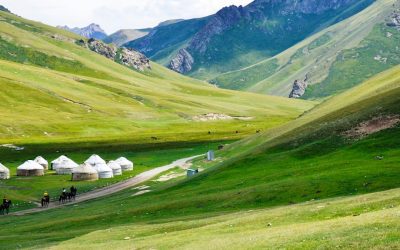
Discovering the Hidden Gems of Kyrgyzstan: A Journey Through Central Asia’s Best-Kept Secret
Nestled in the heart of Central Asia, Kyrgyzstan is a country that often goes unnoticed by travelers. However, those who do venture to this hidden gem are rewarded with a wealth of cultural richness, natural wonders, and unique experiences. From its diverse cultural...

Uncovering the Wonders of Scandium: A British Perspective
Scandium is a fascinating element that has gained increasing attention in recent years due to its unique properties and potential applications. It is a silvery-white metal that is classified as a transition metal and is found in small amounts in various minerals....
Exploring the Rich Culture and History of Serbia: A Journey Through the Heart of the Balkans
Serbia, located in the heart of the Balkans, is a country that often goes unnoticed by travelers. However, this hidden gem is a destination that should not be overlooked. With its rich history, diverse culture, and stunning natural landscapes, Serbia offers a unique...
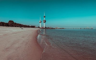
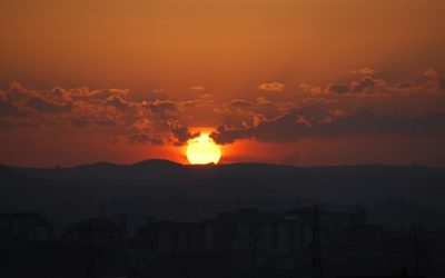
Discovering the Hidden Gems of Kuwait: A Journey Through the Land of Contrasts
Kuwait, a small country located in the Arabian Peninsula, is often overlooked as a tourist destination. However, this hidden gem is a land of contrasts, offering a unique blend of rich cultural heritage, natural wonders, modern architecture, and a thriving art and...
Discovering the Vibrant Culture and Rich Heritage of Senegal: A Journey Through West Africa
Located on the westernmost point of the African continent, Senegal is a country that is rich in history, culture, and natural beauty. Bordered by Mauritania to the north, Mali to the east, Guinea to the southeast, and Guinea-Bissau to the southwest, Senegal has a...
Exploring the Hidden Gems of Kosovo: A Journey Through the Heart of the Balkans
Nestled in the heart of the Balkans, Kosovo is a hidden gem waiting to be discovered. This small landlocked country is located in Southeastern Europe and shares borders with Serbia, Albania, North Macedonia, and Montenegro. Despite its tumultuous history, Kosovo has...
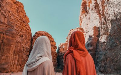
Exploring the Rich Culture and Traditions of Saudi Arabia: A Journey Through the Land of the Two Holy Mosques
Saudi Arabia, located in the Middle East, is a country known for its rich culture and traditions. With a land area of approximately 2.15 million square kilometers, it is the largest country in the Middle East and the 13th largest in the world. The country is bordered...
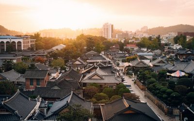
Discovering the Beauty and Culture of South Korea: A British Traveller’s Journey
South Korea, a country known for its rich cultural heritage, vibrant cities, and stunning natural landscapes, has always been on my travel bucket list. Last year, I finally had the opportunity to embark on a journey to this fascinating country. In this blog post, I...

Discovering the Hidden Gems of Sao Tome and Principe: A Journey to the Enchanting Islands
Sao Tome and Principe is a small island nation located in the Gulf of Guinea, off the western coast of Central Africa. Comprising of two main islands, Sao Tome and Principe, as well as several smaller islets, this hidden gem is often overlooked by travelers in favor...
Discovering the Fascinating World of Xenarthra: The Slow-Moving Sloths, Armoured Armadillos and Unique True Anteaters
Xenarthra is a diverse group of mammals that includes sloths, armadillos, and anteaters. The name “Xenarthra” comes from the Greek words “xenos” meaning strange or different, and “arthron” meaning joint. This name reflects the...
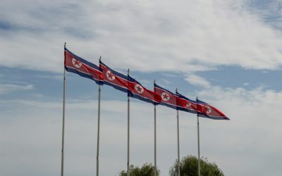
Exploring the Enigmatic: A Journey Through North Korea
North Korea, officially known as the Democratic People’s Republic of Korea (DPRK), is a country located on the Korean Peninsula in East Asia. It is bordered by China to the north, Russia to the northeast, and South Korea to the south. With a population of...
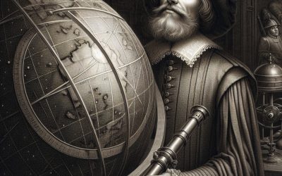
Uncovering the Genius of Galileo Galilei: Exploring the Life and Legacy of the Father of Modern Science
Galileo Galilei, born on February 15, 1564, in Pisa, Italy, was a renowned astronomer, physicist, mathematician, and philosopher. He is often referred to as the “father of modern science” due to his groundbreaking contributions to the fields of astronomy...