Explore the World Through Geography, Natural Resources & Daily History
Clear, reliable and engaging guides that help you understand our planet — from UK geography education to global natural resources and On This Day history events.
Explore, discover, and learn about the wonders of our world! At Earth Site, we’re passionate about bringing geography, history, and science to life for curious minds of all ages. Whether you’re delving into historical events, uncovering the mysteries of the natural world, or seeking interactive resources, you’re in the right place.
Here, you can uncover the stories behind historical events, explore the natural wonders of our planet, and gain valuable insights into how the Earth’s systems shape our daily lives. From the towering peaks of mountain ranges to the far-reaching impacts of human innovation, we aim to make every topic both engaging and informative.
Start your journey of discovery with us today, and let’s make learning an adventure!
What We Cover
Earth Site brings together engaging and accessible educational content designed to help you understand the world, its history, and its natural systems.
🌍 Geography Education (UK & Worldwide)
We publish clear, easy-to-understand geography resources for students, teachers and curious learners. Our guides support geography education in the UK and cover physical geography, climate, ecosystems, population, and global development.
⛏️ Natural Resources & Environmental Geography
Explore detailed country profiles covering natural resources, mining, energy, geology and global environmental challenges. We show how nations manage minerals, water, land and ecosystems, and why these resources matter.
📅 On This Day in History
Every day has a story. Our On This Day history series features major events, anniversaries, traditions, and cultural milestones from around the world — with timelines, context, and fun facts.
TIMELINE

Political Boundaries of United Kingdom: Provinces, Districts, or Historical Boundaries.
Political boundaries in the United Kingdom are not merely lines on a map; they represent a complex interplay of history, culture, and governance that has evolved over centuries. The UK is composed of four distinct nations: England, Scotland, Wales, and Northern Ireland, each with its own unique identity and political framework. These boundaries have been shaped by historical events, social movements, and economic factors, leading to a multifaceted political landscape. Understanding these boundaries is crucial for comprehending the governance and administrative divisions that characterise the UK today. The significance of political boundaries extends beyond mere geography; they influence the distribution of power, resources, and representation within the UK. The delineation of these boundaries has profound implications for local governance, national identity, and even international relations. As the UK navigates contemporary challenges such as devolution, Brexit, and regional autonomy, the role of political boundaries becomes increasingly pertinent. This article delves into the various dimensions of political boundaries in the UK, exploring their historical context, current structure, and future implications. Summary The United Kingdom is made up of four countries: England, Scotland, Wales, and Northern Ireland, each with its own political boundaries and governance structures. The United Kingdom is divided into nine regions and 48 ceremonial counties, each with its own unique identity and local government responsibilities. Local government in the United Kingdom is organized into districts, unitary authorities, and metropolitan boroughs, each with its own set of powers and responsibilities. Historical boundaries, such as the Act of Union in 1707 and the partition of Ireland in 1921, continue to influence the political structure and governance of the United Kingdom. Political...

Population Density of United Kingdom
Population density, defined as the number of individuals living per unit area, serves as a critical metric for understanding demographic patterns and urban planning in the United Kingdom. The UK, with its rich tapestry of history, culture, and geography, presents a unique case study in population distribution. As of the latest census data, the UK has an average population density of approximately 277 people per square kilometre, but this figure belies significant regional disparities. The interplay between urbanisation, economic opportunities, and historical migration patterns has shaped the population landscape, leading to densely populated urban centres juxtaposed against sparsely populated rural areas. The implications of population density extend beyond mere numbers; they influence social dynamics, economic development, and environmental sustainability. In cities like London, where the density can soar to over 5,500 people per square kilometre, the challenges of housing, transportation, and public services become increasingly pronounced. Conversely, rural areas in Scotland or Wales may have densities as low as 10 people per square kilometre, raising questions about resource allocation and community support. Understanding these dynamics is essential for policymakers and planners as they navigate the complexities of a rapidly changing demographic landscape. Summary The United Kingdom has a population density of around 270 people per square kilometre, making it one of the most densely populated countries in Europe. Factors affecting population density in the UK include urbanisation, economic opportunities, and historical settlement patterns. Urban areas in the UK have much higher population densities compared to rural areas, with London being the most densely populated city. Regional variations in population density exist, with the South East of England being the...

Natural Resources of United Kingdom: Where Natural Resources are located In United Kingdom
Natural resources are the foundation of any nation’s economy and environmental health, and the United Kingdom is no exception. The UK is endowed with a diverse array of natural resources that have played a pivotal role in its historical development and continue to shape its economic landscape. From fossil fuels that powered the Industrial Revolution to the burgeoning renewable energy sector, the management and utilisation of these resources are crucial for sustainable development. The geographical diversity of the UK, encompassing mountains, valleys, rivers, and coastlines, contributes to a rich tapestry of natural resources that include minerals, agricultural land, water, and forests. The significance of these resources extends beyond mere economic value; they are integral to the cultural and social fabric of the nation. The way in which the UK harnesses and conserves its natural resources reflects its commitment to environmental stewardship and sustainability. As global concerns about climate change and resource depletion intensify, the UK faces the challenge of balancing economic growth with ecological preservation. This article delves into the various natural resources found in the UK, exploring their distribution, significance, and the ongoing efforts to manage them sustainably. Summary The United Kingdom is rich in natural resources, including fossil fuels, renewable energy sources, agricultural resources, mineral resources, water resources, forestry and timber resources. The distribution of fossil fuels in the United Kingdom is mainly concentrated in the North Sea, with significant reserves of oil and natural gas. Renewable energy sources in the United Kingdom, such as wind, solar, and hydroelectric power, are increasingly being developed to reduce reliance on fossil fuels and combat climate change. Agricultural resources in...

Cultural or Historical Sites of United Kingdom: Important Cultural Landmarks or Historical Sites In United Kingdom
Stonehenge, located on the Salisbury Plain in Wiltshire, England, stands as one of the most iconic and enigmatic prehistoric monuments in the world. This ancient structure, composed of a ring of standing stones, each around 4 metres high and weighing approximately 25 tons, has puzzled historians, archaeologists, and visitors alike for centuries. The construction of Stonehenge is believed to have begun around 3000 BC, with the site evolving over the millennia into the form we recognise today. The precise purpose of Stonehenge remains a topic of debate; theories range from it being an astronomical observatory to a ceremonial site for ancient rituals. The alignment of the stones with the movements of the sun is particularly striking. During the summer solstice, the sun rises directly above the Heel Stone, casting its first rays into the heart of the monument. This phenomenon suggests that the builders possessed advanced knowledge of astronomy and celestial events. Excavations around the site have revealed burial mounds and artefacts, indicating that Stonehenge may have served as a place of worship or a burial ground for important individuals. The mystery surrounding its construction techniques also captivates researchers; how did prehistoric people transport such massive stones from as far away as Wales? Theories abound, but no definitive answers have been found, adding to the allure of this ancient site. Summary Stonehenge is a mysterious prehistoric monument with unknown origins and purpose, making it a fascinating archaeological site. Buckingham Palace serves as the official residence of the British monarch and is a symbol of the British monarchy and its traditions. The Tower of London has a rich history as...

Cultural or Historical Sites of Tunisia: Important Cultural Landmarks or Historical Sites In Tunisia
Carthage, once a formidable power in the ancient Mediterranean, is a site steeped in history and intrigue. Founded by the Phoenicians in the 9th century BCE, it became a thriving hub of trade and culture, rivaling even Rome at its zenith. The city was strategically located on the coast of present-day Tunisia, allowing it to control maritime routes and establish a vast trading empire that extended across the Mediterranean. The wealth generated from trade enabled Carthage to develop into a sophisticated urban centre, complete with impressive architecture, advanced agricultural techniques, and a complex social structure. The ruins of Carthage today offer a glimpse into its glorious past. Visitors can explore the remnants of the Punic ports, where ships once docked laden with goods from distant lands. The Tophet, a sacred burial ground for children, reveals the religious practices of the Carthaginians, who worshipped deities such as Baal and Tanit. The impressive Antonine Baths, built during the Roman period, showcase the architectural prowess of the time, featuring intricate mosaics and expansive bathing complexes. As one wanders through the archaeological site, it becomes evident that Carthage was not merely a city but a symbol of resilience and cultural exchange that shaped the course of history. Summary Carthage was a powerful ancient city known for its strategic location and rich history. The Medina of Tunis is a UNESCO World Heritage site and one of the best-preserved Islamic cities in the world. The Amphitheatre of El Jem is a well-preserved Roman amphitheatre and a testament to the ancient city’s grandeur. The Kairouan Mosque is one of the most important Islamic monuments in North...

Natural Resources of Tunisia: Where Natural Resources are Located in Tunisia
Tunisia, a North African nation bordered by the Mediterranean Sea, is endowed with a diverse array of natural resources that play a crucial role in its economy and development. The country’s geographical position, coupled with its varied climate, has resulted in a rich tapestry of natural assets, including minerals, hydrocarbons, agricultural land, and renewable energy potential. The effective management and sustainable utilisation of these resources are vital...

Political Boundaries of Tunisia: Provinces, Districts, or Historical Boundaries.
Political boundaries serve as the framework within which a nation operates, delineating areas of governance, administration, and jurisdiction. In Tunisia, a country located in North Africa, these boundaries have been shaped by a complex interplay of historical, cultural, and political factors. The geographical positioning of Tunisia, bordered by the Mediterranean Sea to the north and east, and sharing land borders with Algeria and Libya, has significantly influenced its political landscape. The establishment of political boundaries in Tunisia is not merely a matter of geography; it reflects the historical legacies of colonialism, the struggles for independence, and the ongoing quest for national identity. The significance of political boundaries in Tunisia extends beyond mere lines on a map. They are instrumental in defining the relationship between the state and its citizens, impacting everything from resource allocation to representation in government. As Tunisia navigates its post-revolutionary landscape, understanding the evolution and implications of these boundaries becomes crucial for comprehending the current political climate and the challenges that lie ahead. The intricate tapestry of Tunisia’s political boundaries is woven with threads of history, culture, and socio-economic factors that continue to shape its governance and development. Summary Tunisia is divided into 24 provinces, each with its own administrative structure and local government. The historical boundaries of Tunisia have had a significant influence on modern politics, shaping the country’s governance and development. The evolution of political boundaries in Tunisia has been marked by challenges and controversies, reflecting the complex nature of the country’s political landscape. The impact of political boundaries on governance and development in Tunisia is significant, with implications for local government and administrative...

Terrain and Topography of Tunisia: mountains, valleys, and plains.
Tunisia, a North African nation, boasts a diverse and captivating landscape that reflects its rich geological history and climatic variations. The country’s terrain is a tapestry woven from mountains, valleys, plains, and deserts, each contributing to the unique ecological and cultural fabric of the region. Spanning approximately 163,610 square...

History of Tunisia
The history of Tunisia is deeply intertwined with the legacy of the Carthaginian Empire, which emerged as a dominant power in the western Mediterranean during the first millennium BCE. Founded by Phoenician settlers from Tyre around 814 BCE, Carthage quickly evolved into a thriving city-state, renowned for its maritime prowess and extensive trade networks. The Carthaginians established colonies across North Africa, Sicily, Sardinia, and even parts of Spain, facilitating a rich exchange of goods, culture, and ideas. Their economy was bolstered by agriculture, particularly the cultivation of olives and grains, which were exported throughout the Mediterranean. Carthage’s political structure was sophisticated, featuring a complex system of governance that included elected officials and a council of elders. The city-state was ruled by a series of powerful generals and statesmen, with figures like Hamilcar Barca and his son Hannibal becoming legendary for their military strategies. Hannibal’s audacious crossing of the Alps during the Second Punic War (218-201 BCE) remains one of the most celebrated military feats in history. Despite their initial successes against Rome, the Carthaginians ultimately succumbed to Roman forces in 146 BCE, leading to the city’s destruction and marking the end of Carthaginian dominance in the region. Summary Carthage was the capital of the ancient Carthaginian Empire, known for its powerful navy and trade network. Roman rule brought prosperity to Tunisia, with impressive ruins such as the amphitheatre in El Djem still standing today. The Islamic conquest in the 7th century led to the establishment of the Berber dynasties, shaping Tunisia’s culture and architecture. Ottoman rule and the Barbary Coast saw Tunisia become a major hub for piracy and...

Population Density of Tunisia
Population density is a critical demographic metric that reflects the number of individuals living per unit area, typically expressed in persons per square kilometre. It serves as a vital indicator of how populated a region is and can significantly influence various socio-economic factors, including resource allocation, urban planning, and environmental sustainability. In Tunisia, a country located in North Africa, population density varies considerably across its regions, shaped by historical, geographical, and socio-economic factors. Understanding the nuances of population density in Tunisia is essential for grasping the broader implications for development, governance, and social cohesion. The concept of population density is not merely a statistical figure; it encapsulates the dynamics of human settlement and interaction with the environment. In Tunisia, where the Mediterranean coastline attracts a significant portion of the population, the distribution of people is uneven. Urban areas tend to be densely populated due to economic opportunities and better access to services, while rural regions often experience lower density levels. This disparity raises important questions about resource management, infrastructure development, and the overall quality of life for residents in both urban and rural settings. Summary Population density refers to the number of people living per square kilometre and is a key indicator of urbanisation and development. Factors affecting population density in Tunisia include natural resources, economic opportunities, and government policies. Urban areas in Tunisia have higher population density compared to rural areas due to better access to services and employment opportunities. Major cities like Tunis and Sfax have the highest population density in Tunisia, leading to increased pressure on infrastructure and services. High population density in Tunisia poses challenges...

Climate Zones of Tunisia: Different Climate Regions Of Tunisia
Tunisia, a North African nation bordered by the Mediterranean Sea to the north and east, is characterised by a diverse range of climate zones that significantly influence its ecology, agriculture, and tourism. The geographical positioning of Tunisia, along with its varied topography, creates a mosaic of climatic conditions that range from the humid Mediterranean in the north to the arid desert in the south. This climatic diversity not only shapes the natural landscape but also plays a crucial role in determining the livelihoods of its inhabitants and the types of crops that can be cultivated. The climate zones in Tunisia can be broadly categorised into several distinct types: the Mediterranean climate zone, the desert climate zone, the semi-arid climate zone, the mountainous climate zone, the coastal climate zone, and the steppe climate zone. Each of these zones exhibits unique characteristics that affect local weather patterns, vegetation, and human activities. Understanding these climate zones is essential for comprehending how they impact agriculture, tourism, and overall economic development in Tunisia. Summary Tunisia has a diverse range of climate zones, each with its own unique characteristics and challenges. The Mediterranean climate zone in Tunisia is characterized by mild, wet winters and hot, dry summers, making it ideal for agriculture and tourism. The desert climate zone in Tunisia experiences extremely high temperatures and very low rainfall, posing challenges for agriculture and tourism development. The semi-arid climate zone in Tunisia has limited rainfall and high temperatures, making it suitable for certain types of agriculture and tourism activities. The mountainous climate zone in Tunisia has cooler temperatures and higher rainfall, providing opportunities for unique agriculture...
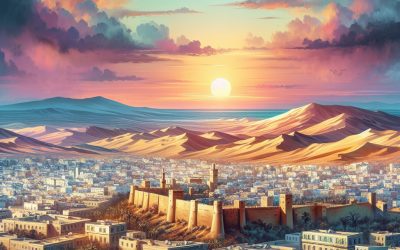
Tunisia
Tunisia, a North African nation bordered by the Mediterranean Sea, is a country rich in history, culture, and natural beauty.