World Geography
Geography is the study of the Earth’s landscapes, environments, and the relationships between people and their surroundings. It encompasses both the physical aspects of the Earth, such as its landforms, bodies of water, and climate, as well as the human aspects, including population distribution, cultures, and economies. World geography is a broad field that seeks to understand the complexities of our planet and how humans interact with it. By studying world geography, we can gain a deeper appreciation for the diversity of our planet and the interconnectedness of its various regions.
Geography is a multidisciplinary field that draws on elements of physical science, social science, and humanities. It involves the use of maps, spatial analysis, and geographic information systems (GIS) to understand the Earth’s surface and the processes that shape it. World geography also encompasses the study of human geography, which examines the ways in which people and their activities are distributed across the Earth. By understanding world geography, we can better appreciate the environmental, cultural, and economic challenges facing different regions of the world. This knowledge is crucial for addressing global issues such as climate change, resource management, and international development.
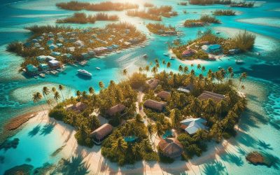
The Five Oceans and Seven Continents
The Earth’s surface is divided into five major oceans: the Pacific, Atlantic, Indian, Southern (or Antarctic), and Arctic Oceans. These vast bodies of water play a crucial role in regulating the Earth’s climate and supporting diverse marine ecosystems. The oceans also serve as important transportation routes and a source of food and other natural resources for human societies around the world.
In addition to the oceans, the Earth’s landmasses are divided into seven continents: Africa, Antarctica, Asia, Europe, North America, Australia (or Oceania), and South America. Each continent has its own unique physical and cultural characteristics, shaped by millions of years of geological processes and human history. From the deserts of Africa to the rainforests of South America, the continents offer a rich tapestry of landscapes and environments for exploration and study.
Major Mountain Ranges and Deserts
The Earth’s surface is also marked by major mountain ranges and deserts that have shaped the planet’s physical and cultural landscapes. The Himalayas, for example, are the highest mountain range in the world and are home to diverse ecosystems and cultures in countries such as India, Nepal, and Bhutan. The Andes in South America, the Rockies in North America, and the Alps in Europe are other prominent mountain ranges that have influenced human settlement patterns and economic activities.
Deserts cover about one-third of the Earth’s land surface and are characterized by low precipitation and extreme temperatures. The Sahara Desert in Africa is the largest hot desert in the world, while the Gobi Desert in Asia is one of the largest cold deserts. Deserts are not only home to unique flora and fauna but have also been important trade routes and cultural crossroads throughout history.
Climate Zones and Biomes
The Earth’s climate is influenced by a variety of factors, including latitude, altitude, ocean currents, and prevailing winds. As a result, the planet is divided into different climate zones, each with its own characteristic weather patterns and ecosystems. The equator, for example, experiences a tropical climate with high temperatures and heavy rainfall, while the polar regions have a cold and dry climate.
These climate zones give rise to different biomes, or large ecological areas characterized by distinct plant and animal communities. The tropical rainforest biome, found near the equator, is home to a diverse array of species and is vital for regulating the Earth’s climate. The grasslands biome, found in regions such as the African savannah and North American prairies, supports grazing animals and has been important for human agriculture throughout history.
Human Geography and Population Distribution
Human geography examines the ways in which people and their activities are distributed across the Earth’s surface. It encompasses topics such as population growth, migration patterns, urbanization, and cultural diversity. Understanding human geography is crucial for addressing global challenges such as poverty, inequality, and environmental degradation.
Population distribution is uneven across the world, with some regions experiencing rapid population growth while others are declining. The majority of the world’s population lives in Asia, particularly in countries such as China and India. Urban areas are also growing rapidly, with more than half of the world’s population now living in cities. This trend has significant implications for infrastructure development, resource management, and social inequality.
Historical and Cultural Geography
Historical geography examines how human activities have shaped the Earth’s landscapes over time. It explores topics such as colonialism, trade routes, and the rise and fall of empires. Cultural geography focuses on how human cultures have developed in different regions of the world and how they interact with their environments.
The Silk Road, for example, was an ancient trade route that connected China with Europe and facilitated the exchange of goods, ideas, and technologies across Eurasia. This historical trade route had a profound impact on the development of cultures and economies along its path. Similarly, cultural geographers study how different societies have adapted to their environments through practices such as agriculture, architecture, and religious beliefs.
The Importance of Geographic Knowledge
Geographic knowledge is crucial for addressing global challenges such as climate change, resource management, and international development. By understanding world geography, we can better appreciate the environmental, cultural, and economic challenges facing different regions of the world. This knowledge is crucial for addressing global issues such as climate change, resource management, and international development.
Geographic knowledge also helps us to understand our interconnectedness with other regions of the world. By studying world geography, we can gain a deeper appreciation for the diversity of our planet and the interconnectedness of its various regions. This understanding can foster a sense of global citizenship and empathy for people from different cultures and backgrounds.
In conclusion, world geography is a complex and multifaceted field that encompasses both physical and human aspects of the Earth’s landscapes. By studying world geography, we can gain a deeper appreciation for the diversity of our planet and the interconnectedness of its various regions. This knowledge is crucial for addressing global challenges such as climate change, resource management, and international development. It also helps us to understand our interconnectedness with other regions of the world and fosters a sense of global citizenship.
FAQs
What is world geography?
World geography is the study of the Earth’s landscapes, environments, and the relationships between people and their environments. It encompasses the physical features of the Earth, as well as the human activity that takes place on it.
Why is world geography important?
World geography is important because it helps us understand the world around us. It provides insights into the physical and human processes that shape our planet, and helps us make informed decisions about how to interact with our environment.
What are the main branches of world geography?
The main branches of world geography include physical geography, which focuses on the Earth’s natural features and processes, and human geography, which examines the relationships between people and their environments.
How does world geography impact our daily lives?
World geography impacts our daily lives in numerous ways, from influencing the weather and climate we experience, to shaping the availability of natural resources and influencing the distribution of populations and cultures around the world.
What are some key concepts in world geography?
Key concepts in world geography include location, place, human-environment interaction, movement, and region. These concepts help geographers understand and interpret the world around them.

England
England Capital: London Population (Estimated 2012): 52,656,400 Area: 130,395 km2 or 50,346 mi2 Currency: Pound Sterling (GBP(£)) Official Language: English Political Information: Constitutional Monarchy and Democratic Parliament Official Religion: No Official Religion (approximately 77.7% of the population are Christian, 3.2% are Muslim, 1.2% are Hindu, 1.8% have other religious beliefs and 16.1% have no religious beliefs Based on 2001 Census for England and Wales) Highest Mountain: Scafell Pike at 978m or 3,209ft GDP Official Exchange Rate (OER is more precise at gauging a countries economic power) (Estimated 2011): (US$) or (GBP) GDP (OER) Per Capita (per member of the population estimated 2011): (US$) or (GBP) GDP Purchasing Power Parity (PPP is good for gauging living conditions and use of resources but not as accurate as OER. This data has been calculated based on the sum value of all goods and services produced in the country valued at prices prevailing in the United States) (Estimated 2011): (US$) or (GBP) GDP (PPP) Per Capita (per member of the population estimated 2011): (US$) or (GBP) Time Zone (GMT/UTC): GMT Counties/Provinces/States: (Counties)Bedfordshire, Berkshire, Buckinghamshire, Cambridgeshire, Cheshire, Cornwall, Cumbria, Derbyshire, Devon, Dorset, Durham, East Riding, East Sussex, East Yorkshire, Essex, Gloucestershire, Greater London, Hampshire, Hertfordshire, Huntingdonshire, Kent, Lancashire, Leicestershire, Lincolnshire, Merseyside, Middlesex, Norfolk, Northamptonshire, Northumberland, Nottinghamshire, Oxfordshire, Rutland, Shropshire, Somerset, South Yorkshire, Staffordshire, Suffolk, Surrey, Tyne and Wear, Warwickshire, Westmorland, Wiltshire, Worcestershire, West Sussex and West Yorkshire. Leaders: H.M. Queen ELIZABETH II (since 6 February 1952); Heir Apparent Prince CHARLES, son of the queen (born 14 November 1948); Prime Minister Theresa MAY (Conservative) (since 13 July 2016) England The history...
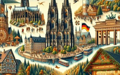
Germany
Germany (Bundesrepublik Deutschland (Federal Republic of Germany)) Capital: Berlin Population (Estimated July 2012): 81,305,856 Area: 357,104 km2 or 137,879 mi2 Currency: Euro (€) Official Language: German Political Information: Federal Parliamentary Constitutional Republic Official Religion: No Official Religion (approximately 34% of the population are Protestant, 34% are Roman Catholic, 3.7% are Muslim and 28.3% have other religious beliefs) Highest Mountain: Zugspitze at 2,963m or 9,721ft GDP Official Exchange Rate (OER is more precise at gauging a countries economic power) (Estimated 2011): $3.629 trillion (US$) or (GBP) GDP (OER) Per Capita (per member of the population estimated 2011): (US$) or (GBP) GDP Purchasing Power Parity (PPP is good for gauging living conditions and use of resources but not as accurate as OER. This data has been calculated based on the sum value of all goods and services produced in the country valued at prices prevailing in the United States) (Estimated 2011): $3.085 trillion (US$) or (GBP) GDP (PPP) Per Capita (per member of the population estimated 2011): $37,900 (US$) or (GBP) Time Zone (GMT/UTC): +1:00 Counties/Provinces/States: 16 states (Laender, singular – Land); Baden-Wurttemberg, Bayern (Bavaria), Berlin, Brandenburg, Bremen, Hamburg, Hessen (Hesse), Mecklenburg-Vorpommern (Mecklenburg-Western Pomerania), Niedersachsen (Lower Saxony), Nordrhein-Westfalen (North Rhine-Westphalia), Rheinland-Pfalz (Rhineland-Palatinate), Saarland, Sachsen (Saxony), Sachsen-Anhalt (Saxony-Anhalt), Schleswig-Holstein, Thuringen (Thuringia); note – Bayern, Sachsen, and Thuringen refer to themselves as free states (Freistaaten, singular – Freistaat) Leaders: Acting President Horst Seehofer with Chancellor Angela Merkel. Sources: CIA World Fact Book, Encyclopaedia Britannica. Germany Germany, officially known as the Federal Republic of Germany, is a country located in the heart of Europe. It is bordered by nine...
United States of America
United States of America Capital: Washington, D.C. Population (Estimated July 2012): 313,847,465 Area: 9,526,468km2 or 3,678,190mi2 Currency: United States Dollar (U.S.$) Official Language: No official (English Predominantly spoken) Political Information: Federal Presidential Republic Official Religion: No Official Religion (approximately 51.3% of the population is Protestant, 23.9% are Roman Catholic, 1.6% are other Christian, 1.7% are Mormon, 1.7% are Jewish, 0.7% are Buddhist, 0.7% are Muslim, 14.6% have other or unspecified religious beliefs and 4% have no religious beliefs) Highest Mountain: Mount McKinley, Churchill Peaks and South Peak at 6,105m or 20,029.5ft GDP Official Exchange Rate (OER is more precise at gauging a countries economic power) (Estimated 2011): $15.06 trillion (US$) or (GBP) GDP (OER) Per Capita (per member of the population estimated 2011): (US$) or (GBP) GDP Purchasing Power Parity (PPP is good for gauging living conditions and use of resources but not as accurate as OER. This data has been calculated based on the sum value of all goods and services produced in the country valued at prices prevailing in the United States) (Estimated 2011): $15.04 trillion (US$) or (GBP) GDP (PPP) Per Capita (per member of the population estimated 2011): $48,100 (US$) or (GBP) Time Zone (GMT/UTC): Between -5:00 and -10:00 Counties/Provinces/States: 50 states and 1 district*;~ Alabama, Alaska, Arizona, Arkansas, California, Colorado, Connecticut, Delaware, District of Columbia*, Florida, Georgia, Hawaii, Idaho, Illinois, Indiana, Iowa, Kansas, Kentucky, Louisiana, Maine, Maryland, Massachusetts, Michigan, Minnesota, Mississippi, Missouri, Montana, Nebraska, Nevada, New Hampshire, New Jersey, New Mexico, New York, North Carolina, North Dakota, Ohio, Oklahoma, Oregon, Pennsylvania, Rhode Island, South Carolina, South Dakota, Tennessee, Texas,...
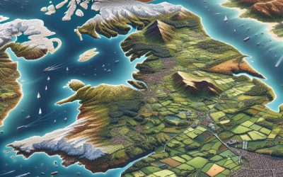
United Kingdom
United Kingdom (United Kingdom of Great Britain and Northern Ireland) Capital: London Population (Estimated July 2012): 63,047,162 Area: 243,073km2 or 93,851mi2 Currency: Pound Sterling (£) Official Language: English Political Information: Constitutional Monarchy with Democratic Parliament Official Religion: No Official Religion (approximately 71.6% of the population is Christian, 23.1% have unspecified or no religious beliefs, 2.7% are Muslim, 1% are Hindu and a small minority are Jedi) Highest Mountain: Ben Nevis (in Scotland) at 1,344m or 4,377ft GDP Official Exchange Rate (OER is more precise at gauging a countries economic power) (Estimated 2011): $2.481 (US$) or (GBP) GDP (OER) Per Capita (per member of the population estimated 2011): (US$) or (GBP) GDP Purchasing Power Parity (PPP is good for gauging living conditions and use of resources but not as accurate as OER. This data has been calculated based on the sum value of all goods and services produced in the country valued at prices prevailing in the United States) (Estimated 2011): $2.25 trillion (US$) or (GBP) GDP (PPP) Per Capita (per member of the population estimated 2011): $36,600 (US$) or (GBP) Time Zone (GMT/UTC): GMTWildlife: Counties/Provinces/States: England: 27 two-tier counties, 32 London boroughs and 1 City of London or Greater London, 36 metropolitan districts, 56 unitary authorities (including 4 single-tier counties*) two-tier counties: Buckinghamshire, Cambridgeshire, Cumbria, Derbyshire, Devon, Dorset, East Sussex, Essex, Gloucestershire, Hampshire, Hertfordshire, Kent, Lancashire, Leicestershire, Lincolnshire, Norfolk, North Yorkshire, Northamptonshire, Nottinghamshire, Oxfordshire, Somerset, Staffordshire, Suffolk, Surrey, Warwickshire, West Sussex, Worcestershire London boroughs and City of London or Greater London: Barking and Dagenham, Barnet, Bexley, Brent, Bromley, Camden, Croydon, Ealing, Enfield, Greenwich, Hackney, Hammersmith and Fulham,...
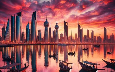
Kuwait
Kuwait (Dawlat al-Kuwayt (State of Kuwait)) Capital: Kuwait (City) Population (Estimated July 2012): 2,646,314 Area: 17,818 km2 or 6,880 mi2 Currency: Kuwaiti Dinar (KD) Official Language: Arabic Political Information: Hereditary Constitutional Monarchy Official Religion: Islam (approximately 85% of the population are Muslim and 15% have other religious beliefs) GDP Official Exchange Rate (OER is more precise at gauging a countries economic power) (Estimated 2011): $171.1 billion (US$) or (GBP) GDP (OER) Per Capita (per member of the population estimated 2011): (US$) or (GBP) GDP Purchasing Power Parity (PPP is good for gauging living conditions and use of resources but not as accurate as OER. This data has been calculated based on the sum value of all goods and services produced in the country valued at prices prevailing in the United States) (Estimated 2011): $149.8 billion (US$) or (GBP) GDP (PPP) Per Capita (per member of the population estimated 2011): $40,700 (US$) or (GBP) Time Zone (GMT/UTC): +3:00 Counties/Provinces/States: 6 governorates (muhafazat, singular – muhafazah); Al Ahmadi, Al ‘Asimah, Al Farwaniyah, Al Jahra’, Hawalli, Mubarak al Kabir Leaders: Amir SABAH al-Ahmad al-Jabir al-Sabah (since 29 January 2006); Crown Prince NAWAF al-Ahmad al-Jabir al-Sabah (born 25 June 1937), with Prime Minister JABIR AL-MUBARAK al-Hamad al-Sabah (since 30 November 2011); First Deputy Prime Minister NASIR al-Sabah al-Ahmad al-Sabah (since 12 December 2017); Deputy Prime Ministers SABAH al-KHALD al-Sabah (since 4 August 2013), KHALD al-Jarrah al-Sabah (since December 2016), Anas al-SALEH (since 2015) Additional: Gained independence from the UK on the 19th of June 1961. Sources: CIA World Fact Book, Encyclopaedia Britannica. Kuwait Kuwait, officially known...
Cayman Islands
Cayman Islands Capital of Cayman Islands: George Town Population (Estimated July 2012): 52,560 Area: 264 km2 or 102 mi2 Currency: Cayman Islands Dollar (CI$) Official Language: English Political Information: British Overseas Territory Official Religion: No Official Religion (approximately 67.7% of the population are Protestant, 12.6% are Roman Catholic, 13.3% have other religious beliefs and 6.1% have no religious beliefs) Highest Point: The Bluff on Cayman Brac at 43m or 141ft GDP Official Exchange Rate (OER is more precise at gauging a countries economic power) (Estimated 2011): $2.25 Billion (US$) or (GBP) GDP (OER) Per Capita (per member of the population estimated 2011): (US$) or (GBP) GDP Purchasing Power Parity (PPP is good for gauging living conditions and use of resources but not as accurate as OER. This data has been calculated based on the sum value of all goods and services produced in the country valued at prices prevailing in the United States) (Estimated 2008): $2.25 Billion (US$) or (GBP) GDP (PPP) Per Capita (per member of the population estimated 2004): $43,800 (US$) or (GBP) Time Zone (GMT/UTC): -5:00 Counties/Provinces/States: 8 districts; Creek, Eastern, Midland, South Town, Spot Bay, Stake Bay, West End, Western Leaders: H.M. Queen ELIZABETH II (since 6 February 1952); represented by acting Governor Franz MANDERSON (since 13 June 2018); note – Anwar CHOUDHURY was suspended from office as governor on 13 June 2018 with Premier Alden MCLAUGHLIN (since 29 May 2013). Sources: CIA World Fact Book, Encyclopaedia...
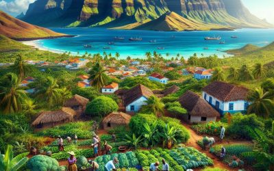
Cape Verde
Cape Verde (República de Cabo Verde (Republic of Cape Verde)) Capital of Cape Verde: Praia Population (Estimated July 2012): 523,568 Area: 4,033 km2 or 1,557 mi2 Currency: Escudo (C.V.Esc.) Official Language: Portuguese Political Information: Parliamentary Republic Official Religion: No Official Religion (But mainly Roman Catholic and Protestant) Highest Mountain: Mt. Fogo (a volcano) at 2,829m or 9,281ft GDP Official Exchange Rate (OER is more precise at gauging a countries economic power) (Estimated 2011): $1.9 billion (US$) or (GBP) GDP (OER) Per Capita (per member of the population estimated 2011): (US$) or (GBP) GDP Purchasing Power Parity (PPP is good for gauging living conditions and use of resources but not as accurate as OER. This data has been calculated based on the sum value of all goods and services produced in the country valued at prices prevailing in the United States) (Estimated 2011): $2.04 billion (US$) or (GBP) GDP (PPP) Per Capita (per member of the population estimated 2011): $4,000 (US$) or (GBP) Time Zone (GMT/UTC): -1:00 Counties/Provinces/States: 17 municipalities (concelhos, singular – concelho); Boa Vista, Brava, Maio, Mosteiros, Paul, Porto Novo, Praia, Ribeira Brava, Ribeira Grande, Ribeira Grande de Santiago, Sal, Santa Catarina, Santa Catarina do Fogo, Santa Cruz, Sao Domingos, Sao Filipe, Sao Lourenco dos Orgaos, Sao Miguel, Sao Salvador do Mundo, Sao Vicente, Tarrafal, Tarrafal de Sao Nicolau Leaders: President Jorge Carlos FONSECA (since 9 September 2011) with Prime Minister Ulisses CORREIA E. SILVA (since 22 April 2016) Sources: CIA World Fact Book, Encyclopaedia Britannica. Cabo Verde Cabo Verde, also known as Cape Verde, is a group of islands located off the coast...
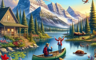
Canada
Canada Capital: Ottawa Population (Estimated July 2012): 34,300,083 Area: 9,984,670 km2 or 3,855,103 mi2 Currency: Canadian Dollar (Can$) Official Language: English and French Political Information: Federal Parliamentary Democracy and Constitutional Monarchy Official Religion: No Official Religion (approximately 42.6% of the population is Roman Catholic, 23.3% are Protestant, 4.4% have other Christian Beliefs, 1.9% are Muslim, 11.8% have other or unspecified religious beliefs and 16% have no religious beliefs) Highest Mountain: Mount Logan at 5,959m or 19,551ft GDP Official Exchange Rate (OER is more precise at gauging a countries economic power) (Estimated 2011): $1.759 trillion (US$) or (GBP) GDP (OER) Per Capita (per member of the population estimated 2011): (US$) or (GBP) GDP Purchasing Power Parity (PPP is good for gauging living conditions and use of resources but not as accurate as OER. This data has been calculated based on the sum value of all goods and services produced in the country valued at prices prevailing in the United States) (Estimated 2011): $1.389 trillion (US$) or (GBP) GDP (PPP) Per Capita (per member of the population estimated 2011): $40,300 (US$) or (GBP) Time Zone (GMT/UTC): Between -3:30 to -8:00 Counties/Provinces/States: 10 provinces and 3 territories*; Alberta, British Columbia, Manitoba, New Brunswick, Newfoundland and Labrador, Northwest Territories*, Nova Scotia, Nunavut*, Ontario, Prince Edward Island, Quebec, Saskatchewan, Yukon Territory* Leaders: H.M. Queen ELIZABETH II (since 6 February 1952); represented by Governor General Julie PAYETTE (since 2 October 2017) with Prime Minister Justin Pierre James TRUDEAU (Liberal Party) (since 4 November 2015) Sources: CIA World Fact Book, Encyclopaedia Britannica. Canada Canada is the second-largest country in the world, spanning...
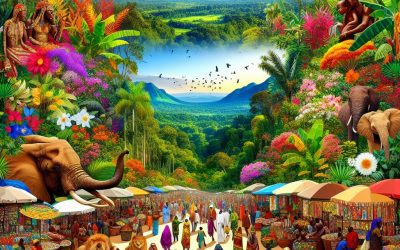
Cameroon
Cameroon (République du Cameroun (French); Republic of Cameroon (English)) Capital: Yaoundé Population (Estimated July 2012): 20,129,878 Area: 476,350 km2 or 183,920 mi2 Currency: CFA franc (CFAF) Official Language: French and English Political Information: Republic Official Religion: No Official Religion (approximately 40% of the population have indigenous beliefs, 40% are Christian, and 20% are Muslim) Highest Mountain: Cameroon Mountain at 4,040m or 13,255ft GDP Official Exchange Rate (OER is more precise at gauging a countries economic power) (Estimated 2011): $25.8 billion (US$) or (GBP) GDP (OER) Per Capita (per member of the population estimated 2011): (US$) or (GBP) GDP Purchasing Power Parity (PPP is good for gauging living conditions and use of resources but not as accurate as OER. This data has been calculated based on the sum value of all goods and services produced in the country valued at prices prevailing in the United States) (Estimated 2011): $47.12 billion (US$) or (GBP) GDP (PPP) Per Capita (per member of the population estimated 2011): $2,300 (US$) or (GBP) Time Zone (GMT/UTC): +1:00 Counties/Provinces/States: 10 regions (regions, singular – region); Adamaoua, Centre, Est, Extreme-Nord, Littoral, Nord, North-West (Nord-Ouest), Ouest, Sud, South-West (Sud-Ouest) Leaders: President Paul BIYA (since 6 November 1982) with Philémon Yang as Prime Minister (since 30 June 2009); Deputy Prime Minister Amadou ALI (since 2014)and Jean NKUETE Sources: CIA World Fact Book, Encyclopaedia Britannica. Cameroon Cameroon, located in West Africa, is a country with a rich history and cultural heritage. It is bordered by Nigeria to the west, Chad to the northeast, the Central African Republic to the east, and Equatorial Guinea, Gabon, and the Republic of the...
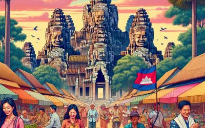
Cambodia
Cambodia (Preahreacheanachakr Kampuchea (Kingdom of Cambodia)) Capital: Phnom Penh Population (Estimated July 2012): 14,952,665 Area: 181,035 km2 or 69,898 mi2 Currency: Riel (KHR) Official Language: Khmer Political Information: Parliamentary Democracy and Constitutional Monarchy Official Religion: Buddhism (approximately 96.4% of the population are Buddhist, 2.1% are Muslim, 1.3% have other religious beliefs and 0.2% have unspecified religious beliefs) Highest Mountain: Phnum Aoral at 1,810m or 5,938ft GDP Official Exchange Rate (OER is more precise at gauging a countries economic power) (Estimated 2011): $13.2 billion (US$) or (GBP) GDP (OER) Per Capita (per member of the population estimated 2011): (US$) or (GBP) GDP Purchasing Power Parity (PPP is good for gauging living conditions and use of resources but not as accurate as OER. This data has been calculated based on the sum value of all goods and services produced in the country valued at prices prevailing in the United States) (Estimated 2011): $32.95 billion (US$) or (GBP) GDP (PPP) Per Capita (per member of the population estimated 2011): $2,300 (US$) or (GBP) Time Zone (GMT/UTC): +7:00 Counties/Provinces/States: 23 Provinces (khett, singular and plural) and 1 municipality (krong, singular and plural) Provinces: Banteay Mean Choay, Batdambang, Kampong Cham, Kampong Chhnang, Kampong Spoe, Kampong Thum, Kampot, Kandal, Kaoh Kong, Keb, Krachen, Mondol Kiri, Otdar Mean Choay, Pailin, Pouthisat, Preah Seihanu (Sihanoukville), Preah Vihear, Prey Veng, Rotanokiri, Siem Reab, Stoeng Treng, Svay Rieng, Takev Municipalities: Phnum Penh (Phnom Penh) Leaders: King Norodom SIHAMONI (since 29 October 2004) and Prime Minister HUN SEN (since 14 January 1985); Permanent Deputy Prime Minister MEN SAM AN (since 25 September 2008);...
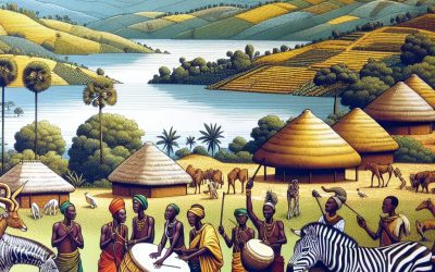
Burundi
Burundi (Republika y’u Burundi (Rundi); République du Burundi (French) (Republic of Burundi)) Capital of Burundi : Bujumbura Population (Estimated July 2012): 10,557,259 Area: 27,816 km2 or 10,740 mi2 Currency: Burundi Franc (FBu) Official Language: Rundi; French Political Information: Presidential Republic Official Religion: No Official Religion (approximately 67% of the population are Christian, 23% have indigenous beliefs and 10% are Muslim) Highest Mountain: Mount Heha at 2,670m 8,760ft GDP Official Exchange Rate (OER is more precise at gauging a countries economic power) (Estimated 2011): $1.7 billion (US$) or £1,020 million(GBP) GDP (OER) Per Capita (per member of the population estimated 2011): (US$) or (GBP) GDP Purchasing Power Parity (PPP is good for gauging living conditions and use of resources but not as accurate as OER. This data has been calculated based on the sum value of all goods and services produced in the country valued at prices prevailing in the United States) (Estimated 2011): $3.672 billion (US$) or £2,203.2 million (GBP) GDP (PPP) Per Capita (per member of the population estimated 2011): $400 (US$) or £240(GBP) Time Zone (GMT/UTC): +2:00 Counties/Provinces/States: 17 provinces; Bubanza, Bujumbura Mairie, Bujumbura Rural, Bururi, Cankuzo, Cibitoke, Gitega, Karuzi, Kayanza, Kirundo, Makamba, Muramvya, Muyinga, Mwaro, Ngozi, Rutana, Ruyigi Leaders: President Pierre Nkurunziza with Terence Sinunguruza as 1st Vice President and Gervais Rufyikiri as 2nd Vice President. Additional: Gained Independence from Belgium on the 1st of July 1962. Sources: CIA World Fact Book, Encyclopaedia Britannica. Burundi Burundi is a small landlocked country located in East Africa. It is bordered by Rwanda to the north, Tanzania to the east and south, and the Democratic...
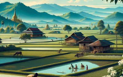
Burma
Burma Capital: Rangoon (Yangon) Note: Nay Pyi Taw is the administrative capital Population (Estimated July 2012): 54,584,650 Area: 676,577km2 or 261,228mi2 Currency: Myanmar Kyat (K) Official Language: Myanmar (Burmese) Political Information: Presidential Republic Official Religion: No Official Religion (approximately 89% of the population is Buddhist, 4% is Christian, 4% is Muslim, 1% is Animist and 2% follow other faiths). Highest Mountain: Hkakabo Razi at 5,881m or 19,295ft GDP Official Exchange Rate (OER is more precise at gauging a countries economic power) (Estimated 2011): $50.2 billion (US$) or £30,120 million (GBP) GDP (OER) Per Capita (per member of the population estimated 2011): (US$) or (GBP) GDP Purchasing Power Parity (PPP is good for gauging living conditions and use of resources but not as accurate as OER. This data has been calculated based on the sum value of all goods and services produced in the country valued at prices prevailing in the United States) (Estimated 2011): $82.72 billion (US$) or £49,632 million (GBP) GDP (PPP) Per Capita (per member of the population estimated 2011): $1,300 (US$) or £780 (GBP) Time Zone (GMT/UTC): +6:30 Counties/Provinces/States: 7 regions (taing-myar, singular – taing) and 7 states (pyi ne-myar, singular – pyi ne) regions: Ayeyarwady, Bago, Magway, Mandalay, Sagaing, Tanintharyi, Yangon states: Chin, Kachin, Kayah, Kayin, Mon, Rakhine (Arakan), Shan Leaders: President WIN MYINT (since 30 March 2018); Vice Presidents President MYINT SWE (since 16 March 2016) and HENRY VAN THIO (since 30 March 2016); note – President HTIN KYAW (since 30 March 2016) resigned on 21 March 2018; the president is both chief of state and head of...