World Geography
Geography is the study of the Earth’s landscapes, environments, and the relationships between people and their surroundings. It encompasses both the physical aspects of the Earth, such as its landforms, bodies of water, and climate, as well as the human aspects, including population distribution, cultures, and economies. World geography is a broad field that seeks to understand the complexities of our planet and how humans interact with it. By studying world geography, we can gain a deeper appreciation for the diversity of our planet and the interconnectedness of its various regions.
Geography is a multidisciplinary field that draws on elements of physical science, social science, and humanities. It involves the use of maps, spatial analysis, and geographic information systems (GIS) to understand the Earth’s surface and the processes that shape it. World geography also encompasses the study of human geography, which examines the ways in which people and their activities are distributed across the Earth. By understanding world geography, we can better appreciate the environmental, cultural, and economic challenges facing different regions of the world. This knowledge is crucial for addressing global issues such as climate change, resource management, and international development.
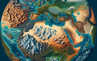
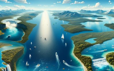
The Five Oceans and Seven Continents
The Earth’s surface is divided into five major oceans: the Pacific, Atlantic, Indian, Southern (or Antarctic), and Arctic Oceans. These vast bodies of water play a crucial role in regulating the Earth’s climate and supporting diverse marine ecosystems. The oceans also serve as important transportation routes and a source of food and other natural resources for human societies around the world.
In addition to the oceans, the Earth’s landmasses are divided into seven continents: Africa, Antarctica, Asia, Europe, North America, Australia (or Oceania), and South America. Each continent has its own unique physical and cultural characteristics, shaped by millions of years of geological processes and human history. From the deserts of Africa to the rainforests of South America, the continents offer a rich tapestry of landscapes and environments for exploration and study.
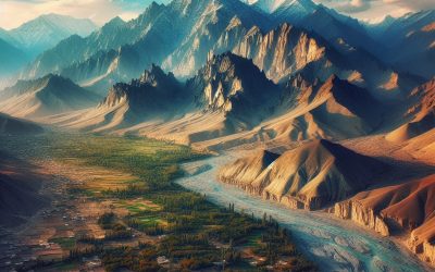
Major Mountain Ranges and Deserts
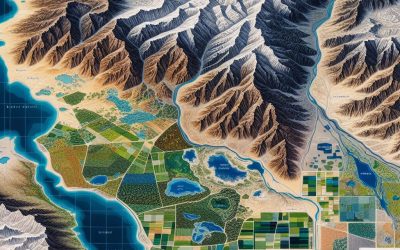
The Earth’s surface is also marked by major mountain ranges and deserts that have shaped the planet’s physical and cultural landscapes. The Himalayas, for example, are the highest mountain range in the world and are home to diverse ecosystems and cultures in countries such as India, Nepal, and Bhutan. The Andes in South America, the Rockies in North America, and the Alps in Europe are other prominent mountain ranges that have influenced human settlement patterns and economic activities.
Deserts cover about one-third of the Earth’s land surface and are characterized by low precipitation and extreme temperatures. The Sahara Desert in Africa is the largest hot desert in the world, while the Gobi Desert in Asia is one of the largest cold deserts. Deserts are not only home to unique flora and fauna but have also been important trade routes and cultural crossroads throughout history.
Climate Zones and Biomes
The Earth’s climate is influenced by a variety of factors, including latitude, altitude, ocean currents, and prevailing winds. As a result, the planet is divided into different climate zones, each with its own characteristic weather patterns and ecosystems. The equator, for example, experiences a tropical climate with high temperatures and heavy rainfall, while the polar regions have a cold and dry climate.
These climate zones give rise to different biomes, or large ecological areas characterized by distinct plant and animal communities. The tropical rainforest biome, found near the equator, is home to a diverse array of species and is vital for regulating the Earth’s climate. The grasslands biome, found in regions such as the African savannah and North American prairies, supports grazing animals and has been important for human agriculture throughout history.
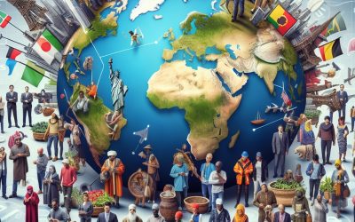
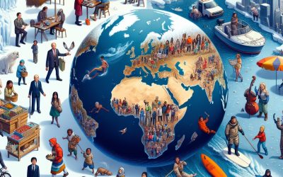
Human Geography and Population Distribution
Human geography examines the ways in which people and their activities are distributed across the Earth’s surface. It encompasses topics such as population growth, migration patterns, urbanization, and cultural diversity. Understanding human geography is crucial for addressing global challenges such as poverty, inequality, and environmental degradation.
Population distribution is uneven across the world, with some regions experiencing rapid population growth while others are declining. The majority of the world’s population lives in Asia, particularly in countries such as China and India. Urban areas are also growing rapidly, with more than half of the world’s population now living in cities. This trend has significant implications for infrastructure development, resource management, and social inequality.
Historical and Cultural Geography
Historical geography examines how human activities have shaped the Earth’s landscapes over time. It explores topics such as colonialism, trade routes, and the rise and fall of empires. Cultural geography focuses on how human cultures have developed in different regions of the world and how they interact with their environments.
The Silk Road, for example, was an ancient trade route that connected China with Europe and facilitated the exchange of goods, ideas, and technologies across Eurasia. This historical trade route had a profound impact on the development of cultures and economies along its path. Similarly, cultural geographers study how different societies have adapted to their environments through practices such as agriculture, architecture, and religious beliefs.
The Importance of Geographic Knowledge
Geographic knowledge is crucial for addressing global challenges such as climate change, resource management, and international development. By understanding world geography, we can better appreciate the environmental, cultural, and economic challenges facing different regions of the world. This knowledge is crucial for addressing global issues such as climate change, resource management, and international development.
Geographic knowledge also helps us to understand our interconnectedness with other regions of the world. By studying world geography, we can gain a deeper appreciation for the diversity of our planet and the interconnectedness of its various regions. This understanding can foster a sense of global citizenship and empathy for people from different cultures and backgrounds.
In conclusion, world geography is a complex and multifaceted field that encompasses both physical and human aspects of the Earth’s landscapes. By studying world geography, we can gain a deeper appreciation for the diversity of our planet and the interconnectedness of its various regions. This knowledge is crucial for addressing global challenges such as climate change, resource management, and international development. It also helps us to understand our interconnectedness with other regions of the world and fosters a sense of global citizenship.
FAQs
What is world geography?
World geography is the study of the Earth’s landscapes, environments, and the relationships between people and their environments. It encompasses the physical features of the Earth, as well as the human activity that takes place on it.
Why is world geography important?
World geography is important because it helps us understand the world around us. It provides insights into the physical and human processes that shape our planet, and helps us make informed decisions about how to interact with our environment.
What are the main branches of world geography?
The main branches of world geography include physical geography, which focuses on the Earth’s natural features and processes, and human geography, which examines the relationships between people and their environments.
How does world geography impact our daily lives?
World geography impacts our daily lives in numerous ways, from influencing the weather and climate we experience, to shaping the availability of natural resources and influencing the distribution of populations and cultures around the world.
What are some key concepts in world geography?
Key concepts in world geography include location, place, human-environment interaction, movement, and region. These concepts help geographers understand and interpret the world around them.
Afghanistan: A National Profile in the Shadow of War, Terrorism, and Recovery
Afghanistan: A National Profile in the Shadow of War, Terrorism, and Recovery (Islamic Republic of Afghanistan (Jomhūrī-ye Eslāmī-ye Afghānestān [Dari]); Da Afghanestan Eslami Jamhuriyat (Pashto)) Capital of Afghanistan: Kabul Population (Estimated July 2023): 41,419,928 Area of Afghanistan: 652,864km2 or 252,072mi2 Currency: Afghani (AFN) Official Language: Dari and Pashto Political Information: Islamic Republic Official Religion: Islam (approximately 99% of the population is Muslim and 1% have other religious beliefs) Highest Mountain: The Hindu Kush at 7,492 m or 24,580ft Longest River: Amu Darya 1,415km Time Zone (GMT/UTC): + 4:30 Wildlife: Alta Weasel, Asiatic Black Bear, Asiatic Brown Bear, Caracal, Eurasian Otter, Geoffroy’s Bat, Gray Wolf, Hare, Ibex, Kashmir Cave Bat, Leopard, Lesser Horseshoe Bat, Long-Tailed Marmat, Lynx, Marco Polo Sheep, Markhor, Mehely’s Horseshoe Bat, Mouflon, Pallas’ Cat, Pikas, Red Fox, Sind Bat, Snow Leopard, Stoat, Stone Marten, Wild Goat and Zarudny’s Jird. Counties/Provinces/States:Badakhshan, Badghis, Baghlan, Balkh, Bamyan, Daykundi, Farah, Faryab, Ghazni, Ghor, Helmand, Herat, Jowzjan, Kabul, Kandahar, Kapisa, Khost, Kunar, Kunduz, Laghman, Logar, Nangarhar, Nimruz, Nuristan, Oruzgan, Paktia, Paktika, Panjshir, Parwan, Samangan, Sar-e Pol, Takhar, Wardak and Zabul. Leaders: President Hamid Karzai Sources: CIA World Fact Book, Encyclopaedia Britannica, Afghanistan Afghanistan, a country long known for its strategic location and rugged terrain, has remained at the centre of global attention for decades. From the war in Afghanistan to the current political instability under the Taliban, this nation’s complex history, ongoing humanitarian crises, and shifting alliances continue to shape international policy. With the World Bank highlighting Afghanistan’s economic fragility, and the U.S. government’s introduction of Temporary Protected Status for Afghanistan, this article offers a timely and comprehensive country...
Global Economies
Many factors or indicators can affect or be used to measure the economies of the world. This article explains these factors/indicators and explains how they effect the global economies. Creation of Money Gross Domestic Product Official Exchange Rate GDP Purchasing Power Parity GDP Difference and accuracy of OER and PPP Calculating GDP Economic Growth Calculating Aggregate Demand Interactive Map of Global Economies GDP growth (annual %) Gross savings (% of GDP) Current account balance (BoP, current US$) Government Borrowing The World Bank The International Monetary Fund (IMF) Government Bonds Interactive Map of National Debt Central Government Debt, Total (% of GDP) External Debt Stocks, Total (DOD, current US$) The Creation of Money Thousands of years ago various goods and services would have been bartered or swapped for other such items as required. A fisherman who had a good day may have far too many fish which without the storage facilities the fish would be wasted, however these excess goods were traded for other goods or services that were required. As far back as 12,000 BC the Earliest civilisation in Anatolia (modern day Asian part of Turkey) used to barter with obsidian or cows for goods and services. These items were very useful in their time (the stone obsidian was turned into tools or weapons) which is why they were largely accepted in payment. It is believed that cowrie shells had been used in China as currency from around 2,500 BC but by around 1,200 BC various Kingdoms within China had created coins which had set values and created for the...

Global Food Production
Despite global food production being adequate to meet demand more people died of hunger, or hunger related diseases, than died of AIDS, malaria and tuberculosis combined. Global Food Production Interactive Map of Global Food Production Chronic Undernourishment Global Food Production According to the World Food Programme the global food production is enough food to feed our 7 billion population (1) which through improved techniques has seen a 17% increase in food per person in the last 30 years (according to Oxfam). The increased use of fertilisers and improved irrigation has been responsible for a 70% increase in yield of crops in recent years. But this apparent abundance of food is not likely to last. Population growth, globally, has remained steady since 1975 with the addition of 1 billion every 12 years since then reaching 7 billion in 2011. The Food and Agriculture Organisation (FAO) predict that if global populations reach 9 billion (which, based on current population growth, is more likely to be 10 Billion) we will need to 60% more food (taking into account wastage etc). This may prove an impossible task if the populations eating habits and production methods don’t change dramatically. As populations rise the need for more urban land to house them is reducing the amount of agricultural land available. Additionally the demand for certain foods like meat require more land not only to be used to raise cattle but also land to grow the grain to feed them. It is believed that only 43% of cereal produced is used for direct human consumption while the remaining 47% is used to feed...
Global Population
Since the last catasphrophic event that hugely affected global population some 70,000 years ago it took the human race until 1804 (69,800 years)to reach a population of 1 billion and only 211 years to grow to 7 billion. World Human Population Global Population Interactive Data Map Origin of Humans Extinction Events Reaching 7 Billion Life expectancy Tuberculosis Life expectancy Interactive Data Map Factors that affect Life Expectancy Globa Population Demographics Global Population Demographics Interactive Map World Human Population Year (at the start of) World Population total World Population Growth (%) Percent of Population Aged 0-14 Percent of Population Aged 15-64 2013 7,124,543,962 1.16 26.31 65.75 2012 7,043,105,591 1.127 26.415 65.756 2011 6,964,638,027 1.179 26.548 65.716 2010 6,883,512,372 1.172 26.712 65.638 2009 6,803,742,004 1.18 26.905 65.521 2008 6,724,646,992 1.188 27.127 65.365 2007 6,645,716,553 1.184 27.385 65.170 2006 6,567,959,806 1.198 27.683 64.935 2005 6,490,176,815 1.211 28.024 64.663 2004 6,412,516,968 1.222 28.412 64.353 2003 6,335,086,088 1.235 28.841 64.009 2002 6,257,804,216 1.259 29.295 63.646 2001 6,180,015,757 1.278 29.750 63.280 2000 6,102,001,950 1.311 30.187 62.925 1999 6,023,047,888 1.347 30.599 62.588 1998 5,943,024,724 1.383 30.986 62.269 1997 5,861,934,009 1.418 31.344 61.975 1996 5,779,968,275 1.439 31.670 61.713 1995 5,697,950,314 1.490 31.960 61.488 1994 5,614,317,064 1.492 32.214 61.301 1993 5,531,794,369 1.535 32.430 61.155 Use the global population interactive data map below for more information about each country’s population records for the last 50 years. All data sourced from the World Bank – a trusted source for many...
Geography of Earth
The Geography of Earth is unique in our solar system in that it is predominantly covered by water with the oceans covering 70.1% of the surface and with only 29.1% dry land (this is without taking into account all the lakes and rivers etc). Land Mass Continents Six continent of the world Seven continents Islands Lines of Latitude Lines of Longitude Time Zones Interactive map of World Geography Earth’s Environment Temperature variations Topography Atmospheric Pressure The Geography of Earth is unique in our solar system in that it is predominantly covered by water with the oceans covering 70.1% of the surface and with only 29.1% dry land (this is without taking into account all the lakes and rivers etc). Land Masses Continents The land masses of the world are normally divided into seven continents. The term continent comes from the Latin “terra continens” meaning continuous land and this ambiguous term has led to many variations as to the number of continents. Six continent of the world There are a few variations in the six continent description of the world’s landmass. In the past it was considered that both North and South America as a single continent and this led to the Olympic symbol of five interlocking circles (Antarctica not included). This view has now changed but some now consider Europe and Asia to be a single continent known as Eurasia as they are a single landmass. However this logic would also revert thinking back to America as a single continent and Africa being combined with Asia and Europe to form a super continent. This would allow...
Bodies of Water
The geography of earth includes many bodies of water from streams, rivers and lakes to channels, seas and oceans with many of these terms overlapping in their definitions. Bodies of Water Streams Rivers Watersheds and Drainage basin Ponds Lakes Lochs Is The Caspian Sea a Lake? Lagoons Water Bodies Interactive Data Map Seas Oceans Bodies of Water The geography of earth includes many bodies of water from streams, rivers and lakes to channels, seas and oceans with many of these terms overlapping in their definitions. Throughout human history all major civilisations built their cities near to large fresh water bodies, normally rivers, the most important natural resource for life. Sea or Oceans have also proved valuable to the economic growth of most civilisations and today they carry 90%of the world’s trade in huge ships (the exception to this was the ‘Silk Road’, a land based trade route set up to by various Chinese Dynasties to sell their goods). It was England’s and later Great Britain’s trade routes and Navy that allowed them to produce the largest Empire ever seen, an empire that covered a quarter of the globe and on which the sun never set. Streams The smallest body of water can be termed as a stream which describes a flowing channel of water that usually leads to a larger body of water. (This is not strictly true as it is also used to describe a warmer and faster moving body of water within other water bodies such as the gulfstream but this is not a common usage of the term stream). The term stream itself...
Geographical Land Use
Geographical land use is an article discussing the environmental features on Earth and how humans have adapted the environment to meet their requirements Geographical Land Use Urban land Advantages of Urbanisation Problems with Urbanisation Additional Effects of Urbanisation Rural Land Agricultural Land Arable Land Woodland Deserts How Are Deserts Formed? Convection Cells Coriolis Effect Rain Shadow Interactive World Map of Land Use Geographical Land Use Life on earth has evolved and adapted to suit their environment and continues to do so. This has been known for centuries, long before Charles Darwin took his famous journey, but what Darwin showed us was the mechanism by which this adaptation occurs. It is naturally occurring mutations that either benefit or hinder an animal’s survival and reproduction that determines if that mutation survives and in the case that it does a new better equipped sub-species is born. Public domain image of a termite mound However amazing and intricate these adaptations have become none are perfect and in a world with an ever changing environment most animals adapt their own habitat to some degree in order to aid their survival. From burrows to nests all are made from the surrounding resources perfectly designed for their inhabitants. Humans have taken this adaptation of the environment to new levels allowing them to live in almost any location on the earth and live with comforts beyond the comprehension of all other species. This has come at some cost to the planet but this topic is discussed in the world pollution section. This article about geographical land use is concerned with how we...
Meteorology – Understanding Weather
Meteorology is the study of weather; its patterns, causes and effects. The Study of meteorology has enabled us to predict the weather with remarkable accuracy. Temperature variations Airflow and Winds Rain The Water Cycle Evaporation Sublimation Transpiration Condensation Clouds Temperature variations Based on data from the World Meteorological Organization temperatures on dry land range from -89.2˚C (-128.6˚F), recorded at Vostok Station in Antarctica, to 56.7˚C (136.4˚F), recorded at Death Valley in the US. Temperatures in the ocean vary from around 36˚C (96.8˚F) in the Persian Gulf to -2˚C (28.5˚F) Antarctic waters (water on the deep ocean is between 0 to 3˚C). This means that temperatures on land vary by approximately 68˚C (with an average of 16˚C) while oceans vary 38˚C (with an average of 17˚C). Airflow and Winds Temperature variations are the main source of the winds that drive the movement of rain clouds and create hurricanes. As the hot and cold air attempt to equalise it moves and this creates the winds. When these temperature variations are extreme the hot and cold air encircle each other creating a cyclone When atoms or molecules are supplied with heat energy they move around and the more energy supplied the more they move. This movement causes the molecules to take up more space than their colder counterparts. The illustration above shows the relationship between the increase in temperature (energy) and the motion of the air molecules. The molecules do not move in such a uniform pattern but as shown they do take up more space when supplied with heat energy....
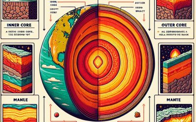
Structure of the Earth
Essentially the structure of the earth consists of a hard iron core which sits at the centre of a molten liquid sphere surrounded by a solid crust of rock. But there is much more to these layers each with very specific properties which are required for life on earth. Structure of the Earth The Inner Core The Outer Core The Mantle The Lower Mantle The Upper Mantle Asthenosphere Lithosphere The Mohorovicic discontinuity The Crust Oceanic Crust Continental Crust Structure of the Earth Essentially the structure of the earth consists of a hard iron core which sits at the centre of a molten liquid sphere surrounded by a solid crust of rock. But there is much more to these layers each with very specific properties which are required for life on earth. The Earth was formed around 4.5 billion years ago with along with the rest of our solar system (click on the link to learn how the solar system was formed) but due to impact with another planetoid shortly after (see origin of the earth) the earth reformed with a very large iron core. For many billions of years after its formation the earth was a very hot ball of molten rock with a molten iron core but over time through many processes the earth began to cool and new layers began to form the structure of the earth as we know it today. The Inner core The Inner core is the deepest layer in the structure of the earth. It consists of a solid ball, mostly iron with...