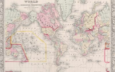
Explore the World Through Geography, Natural Resources & Daily History
Clear, reliable and engaging guides that help you understand our planet — from UK geography education to global natural resources and On This Day history events.
Explore, discover, and learn about the wonders of our world! At Earth Site, we’re passionate about bringing geography, history, and science to life for curious minds of all ages. Whether you’re delving into historical events, uncovering the mysteries of the natural world, or seeking interactive resources, you’re in the right place.
Here, you can uncover the stories behind historical events, explore the natural wonders of our planet, and gain valuable insights into how the Earth’s systems shape our daily lives. From the towering peaks of mountain ranges to the far-reaching impacts of human innovation, we aim to make every topic both engaging and informative.
Start your journey of discovery with us today, and let’s make learning an adventure!
What We Cover
Earth Site brings together engaging and accessible educational content designed to help you understand the world, its history, and its natural systems.
🌍 Geography Education (UK & Worldwide)
We publish clear, easy-to-understand geography resources for students, teachers and curious learners. Our guides support geography education in the UK and cover physical geography, climate, ecosystems, population, and global development.
⛏️ Natural Resources & Environmental Geography
Explore detailed country profiles covering natural resources, mining, energy, geology and global environmental challenges. We show how nations manage minerals, water, land and ecosystems, and why these resources matter.
📅 On This Day in History
Every day has a story. Our On This Day history series features major events, anniversaries, traditions, and cultural milestones from around the world — with timelines, context, and fun facts.
TIMELINE
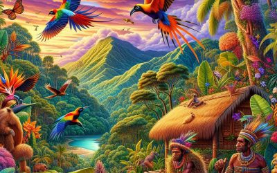
Papua New Guinea
Papua New Guinea (Independent State of Papua New Guinea) Capital: Port Moresby Population (Estimated July 2012): 6,310,129 Area: 462,840km2 or 178,704mi2 Currency: Kina (K) Official Language: English, Hiri Motu and Tok Pisin Political Information: Constitutional Monarchy with Democratic Parliament Official Religion: No Official Religion(approximately 69.4% of the population are Protestant, 27% are Roman Catholic and 3.6% have other religious beliefs) Highest Mountain: Mount Wilhelm at 4,509m or 14,793ft GDP Official Exchange Rate (OER is more precise at gauging a country’s economic power) (Estimated 2011): $11.4 billion (US$) or (GBP) GDP (OER) Per Capita (per member of the population estimated 2011): (US$) or (GBP) GDP Purchasing Power Parity (PPP is good for gauging living conditions and the use of resources but is not as accurate as OER. This data has been calculated based on the sum value of all goods and services produced in the country valued at prices prevailing in the United States) (Estimated 2011): $16.7 billion (US$) or (GBP) GDP (PPP) Per Capita (per member of the population estimated 2011): $2,500 (US$) or (GBP) Time Zone (GMT/UTC): +10:00 Wildlife: Counties/Provinces/States: 18 provinces, 1 autonomous region*, and 1 district**; Bougainville*, Central, Chimbu, Eastern Highlands, East New Britain, East Sepik, Enga, Gulf, Madang, Manus, Milne Bay, Morobe, National Capital**, New Ireland, Northern, Sandaun, Southern Highlands, Western, Western Highlands, West New Britain Leaders: (Head of State) H.M. Queen Eliuzabeth II represented by Governor Michael OGIO; Prime Ministers Peter O’Neill Additional: Gained independence from an Australian-administered UN trusteeship on the 16th of September 1975. Sources: CIA World Fact Book, Encyclopaedia Britannica. Papua New Guinea Papua New Guinea is a nation situated in the southwestern Pacific Ocean,...
Different Types of Rocks and the Rock Cycle
Rocks are naturally occurring solid aggregates of minerals or mineraloids. They constitute the fundamental components of the Earth’s crust and are continuously formed, broken down, and reformed through various geological processes. Rocks can be categorised into three main types: igneous, sedimentary, and metamorphic. Each rock type possesses unique characteristics and formation processes, which are influenced by factors such as temperature, pressure, and the presence of water and other fluids. Understanding the different types of rocks and their formation is essential for geologists and other earth scientists to interpret the Earth’s history and predict future geological events. Rocks are an integral part of the Earth’s geology and play a crucial role in shaping the planet’s surface and supporting life. They are also valuable resources that have been utilised by humans for thousands of years for construction, tools, and artistic expression. The study of rocks and their properties is known as petrology, and it provides important insights into the Earth’s history, natural hazards, and the formation of natural resources such as oil, gas, and minerals. This article will explore the different types of rocks, their formation processes, and their significance in the Earth’s geology and human society. Summary Rocks are naturally occurring solid materials made up of minerals and can be classified into three main types: igneous, sedimentary, and metamorphic. Igneous rocks are formed from the cooling and solidification of molten rock, and can be further classified into intrusive and extrusive types. Sedimentary rocks are formed from the accumulation and compression of sediments, and can be further classified into clastic, chemical, and organic types. Metamorphic rocks are formed from the alteration...

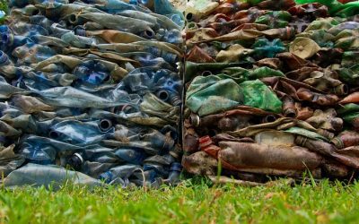
Plastic pollution reduction
Plastic pollution has become a significant environmental issue, with devastating effects on ecosystems and wildlife. The production and disposal of plastic products have led to widespread contamination of land and water bodies, posing a serious threat to the health of our planet. Plastic waste often ends up in oceans, where it breaks down into microplastics that are ingested by marine animals, causing harm to their digestive systems and leading to a decline in their populations. Furthermore, plastic pollution has a detrimental impact on terrestrial environments, as it can take hundreds of years to decompose, leading to the accumulation of non-biodegradable waste in landfills and natural habitats. In addition to the physical impact of plastic pollution, there are also chemical and toxicological concerns associated with the presence of plastics in the environment. Many plastic products contain harmful chemicals such as phthalates and bisphenol A (BPA), which can leach into the soil and water, posing a risk to human health and disrupting the balance of ecosystems. The accumulation of plastic waste also contributes to greenhouse gas emissions, as the production and incineration of plastics release harmful pollutants into the atmosphere, exacerbating climate change. Overall, the impact of plastic pollution on the environment is far-reaching and requires urgent action to mitigate its effects. Plastic pollution not only affects the natural environment but also has socio-economic implications. The presence of plastic waste in urban areas and rural communities can lead to reduced aesthetic appeal, impacting tourism and local economies. Moreover, the cost of managing and cleaning up plastic waste places a significant financial burden on governments and communities. The environmental degradation caused by...

How Geography Affects Travel: Weather, Terrain, and Culture
The weather and climate of a destination can significantly influence travel plans and experiences. For instance, tropical destinations with hot and humid weather may necessitate that travellers pack lightweight, breathable clothing and remain well-hydrated. Conversely, destinations with cold and snowy weather may require travellers to pack warm clothing and be prepared for potential travel delays due to weather-related issues. Moreover, extreme weather conditions such as hurricanes, typhoons, or monsoons can disrupt travel plans and pose safety risks for travellers. It is crucial for travellers to research and understand the typical weather patterns of their destination to pack appropriately and plan for any potential weather-related challenges. Furthermore, the climate of a destination can also impact the types of activities and experiences available to travellers. For example, destinations with a tropical climate may offer opportunities for beach activities, water sports, and wildlife viewing, whilst destinations with a temperate climate may offer opportunities for hiking, skiing, and exploring natural landscapes. Understanding the climate of a destination can help travellers to plan and prepare for the activities and experiences that are best suited to the local weather conditions. Overall, the weather and climate of a destination play a crucial role in shaping the travel experience, and it is important for travellers to consider these factors when planning their trips. Summary Weather can significantly impact travel plans, so it’s important to research and prepare for the climate of your destination. Navigating different terrains requires careful planning and consideration of the local geography and topography. Embracing local traditions and customs is essential for a meaningful and respectful travel experience. Geography can affect transportation options, so...
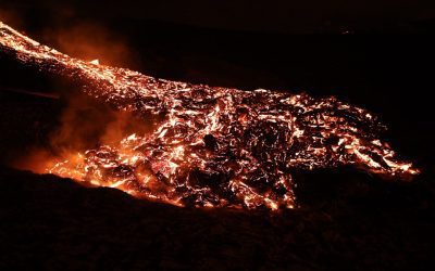
What Are Volcanoes and How Do They Form?
Volcanoes are natural phenomena that have captivated and alarmed humans for centuries. These magnificent geological formations are created by the movement of tectonic plates and the release of pressure from the Earth’s mantle. They are renowned for their explosive eruptions, which can cause widespread destruction and have a significant impact on the environment. Volcanoes can be found on every continent and even on the ocean floor, and they play a crucial role in shaping the Earth’s landscape. From the iconic Mount Vesuvius in Italy to the towering Mauna Loa in Hawaii, volcanoes come in various shapes and sizes, each with its own unique characteristics and history. Volcanoes have captured the imagination of people throughout history, with many cultures incorporating them into their myths and legends. They have been both feared and revered, seen as both destructive and creative forces of nature. The study of volcanoes, known as volcanology, has become an important field of scientific research, as understanding these powerful natural phenomena is crucial for predicting and mitigating their potential hazards. In this article, we shall explore the formation of volcanoes, the different types of volcanoes, volcanic eruptions, the hazards they pose, and the methods used to monitor volcanic activity. Understanding these aspects of volcanoes is essential for safeguarding communities living near these geological wonders and for advancing our knowledge of the Earth’s dynamic processes. Summary Volcanoes are natural formations that result from the eruption of magma from the Earth’s mantle. Volcanoes can form through various processes, including subduction, hotspots, and rift zones. There are different types of volcanoes, including shield volcanoes, stratovolcanoes, and cinder cone volcanoes. Volcanic eruptions...

Understanding Plate Tectonics and Earthquakes
Plate tectonics is the scientific theory that explains the movement of the Earth’s lithosphere, which comprises several large and small tectonic plates. These plates float on the semi-fluid asthenosphere beneath them and are in constant motion, interacting with one another at their boundaries. The theory of plate tectonics has revolutionised our understanding of the Earth’s geology and has provided a framework for explaining a wide range of geological phenomena, including earthquakes, volcanic activity, and the formation of mountain ranges. The concept of plate tectonics was first proposed in the early 20th century, but it was not until the 1960s that it gained widespread acceptance among geologists. The theory was developed through a combination of geological, geophysical, and palaeontological evidence, including the discovery of mid-ocean ridges, deep-sea trenches, and the distribution of fossils and rock formations across different continents. Today, plate tectonics is a fundamental principle of geology and is used to explain the dynamic processes that have shaped the Earth’s surface over millions of years. Summary Plate tectonics is the scientific theory that explains the movement of the Earth’s lithosphere and the formation of continents and oceans. The Earth’s structure consists of the crust, mantle, and core, and plate boundaries are the areas where tectonic plates interact, leading to earthquakes and volcanic activity. Earthquakes are caused by the sudden release of energy along faults in the Earth’s crust, and they can have devastating effects such as tsunamis, landslides, and structural damage. Monitoring and predicting earthquakes involve the use of seismometers, GPS, and other technologies to track seismic activity and assess the likelihood of future earthquakes. Mitigating the impact of...
The Layers of the Earth: Crust, Mantle, Core
The Earth comprises several distinct layers, each possessing unique characteristics and properties. These layers consist of the crust, mantle, outer core and inner core. A comprehensive understanding of the composition and attributes of these layers is essential for comprehending the Earth’s structure and its functions. The study of Earth’s layers provides crucial insights into geological processes, including plate tectonics, volcanic activity and seismic waves. This article shall examine each layer of the Earth in detail, exploring their composition, characteristics and significance within the broader context of Earth science. Summary The Earth is made up of several layers, each with its own unique composition and characteristics. The Earth’s crust is the outermost layer and is the thinnest layer of the Earth. The mantle is the thickest layer of the Earth and is composed of solid rock that can flow over long periods of time. The outer core is a liquid layer made up of iron and nickel, and it is responsible for generating the Earth’s magnetic field. The inner core is the Earth’s solid centre, composed mainly of iron and nickel, and it is extremely hot and under immense pressure. Understanding the layers of the Earth is important for understanding geological processes, natural disasters, and the Earth’s magnetic field. The Earth’s Crust: The Outermost Layer Composition and Characteristics On the other hand, the oceanic crust is thinner and denser, mainly composed of basalt rocks. The crust is also where all life on Earth exists, as it provides a solid surface for living organisms to thrive. It is also where most geological activities, such as earthquakes and volcanic eruptions, occur. Importance...
Physical Geography
Physical geography is the study of the Earth’s natural features and processes, including landforms, weather, climate and natural resources. It is a branch of geography that focuses on the physical aspects of the Earth and how they interact with one another. Physical geography is concerned with understanding the processes that shape the Earth’s surface, such as erosion, weathering and plate tectonics. It also examines the distribution of natural resources and how they are utilised by human societies. This field of study is essential for understanding the natural environment and how it influences human activities. Physical geography encompasses a wide range of topics, including geomorphology, hydrology, climatology and biogeography. Geomorphology is the study of landforms and the processes that create and change them, such as erosion, deposition and tectonic activity. Hydrology focuses on the distribution and movement of water on the Earth’s surface, including rivers, lakes and groundwater. Climatology examines the long-term patterns of weather and climate, including factors such as temperature, precipitation and atmospheric circulation. Biogeography studies the distribution of plants and animals on the Earth’s surface and how they are influenced by physical factors such as climate and topography. Overall, physical geography provides a comprehensive understanding of the Earth’s natural systems and processes. Summary Physical geography is the study of the Earth’s natural features and processes. The Earth’s surface is shaped by landforms such as mountains, valleys, and plains. Weather and climate play a crucial role in shaping the Earth’s surface and landforms. Natural resources such as water, minerals, and forests are studied in physical geography. Human interaction with the environment has a significant impact on the Earth’s...
Pollution Control and Waste Management
Pollution control and waste management are crucial for the preservation of the environment and the health of all living beings. Pollution, in its various forms, has a detrimental impact on air, water, and soil quality, leading to a range of health issues for humans and wildlife. Additionally, improper waste management can lead to the accumulation of non-biodegradable materials, which can take hundreds of years to decompose, further exacerbating environmental degradation. By implementing effective pollution control and waste management strategies, we can mitigate the negative impact on the environment and safeguard the health and well-being of current and future generations. Furthermore, pollution control and waste management are essential for the conservation of natural resources. By reducing pollution and managing waste effectively, we can minimise the depletion of natural resources such as water, minerals, and energy sources. This is particularly important in the face of increasing global population and industrialisation, which place significant pressure on the Earth’s resources. Through sustainable practices and responsible waste management, we can ensure that natural resources are preserved for future generations and that ecosystems remain in balance. Overall, pollution control and waste management play a vital role in protecting the environment, human health, and natural resources, making them essential components of sustainable development. Summary Pollution control and waste management are crucial for protecting the environment and public health. Different types of pollution, such as air, water, and soil pollution, have significant impacts on ecosystems and human health. Strategies for pollution control and waste management include reducing, reusing, and recycling, as well as implementing cleaner production processes. Government and legislation play a key role in enforcing environmental...
Groundwater depletion prevention
Groundwater depletion refers to the long-term reduction in the volume of water stored in subterranean aquifers. This phenomenon occurs when the rate of groundwater extraction surpasses the rate of replenishment. Groundwater is a crucial resource for potable water, agriculture, and industry, and its depletion can have severe consequences for both the environment and human populations. The primary causes of groundwater depletion are excessive extraction for agricultural and industrial purposes, as well as urbanisation and population growth. As the demand for water increases, particularly in arid and semi-arid regions, the strain on groundwater resources intensifies, leading to unsustainable depletion. Moreover, the depletion of groundwater can result in a range of adverse impacts, including land subsidence, saltwater intrusion, and the desiccation of wells and springs. Land subsidence occurs when the ground above a depleted aquifer sinks, causing damage to infrastructure and increasing the risk of flooding. Saltwater intrusion happens when over-pumping of groundwater near coastal areas allows saltwater to infiltrate the aquifer, rendering the water unsuitable for drinking or irrigation. Additionally, the drying up of wells and springs can have devastating effects on local communities that rely on these sources for their water supply. It is essential to comprehend the causes and consequences of groundwater depletion in order to implement effective conservation and management strategies. Summary Groundwater depletion is the excessive use of underground water sources, leading to a decline in water levels and quality. Groundwater conservation is crucial for maintaining water supply, supporting ecosystems, and reducing the risk of land subsidence. Strategies for groundwater recharge include rainwater harvesting, artificial recharge, and reducing surface water runoff. Sustainable groundwater management involves monitoring...

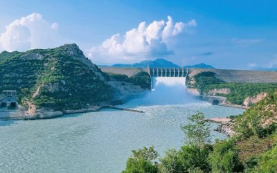
Freshwater ecosystem conservation (lakes, rivers)
Freshwater ecosystems are essential for the survival of all living organisms on Earth. These ecosystems encompass rivers, lakes, wetlands and groundwater, supporting a diverse array of plant and animal species. They provide crucial services to human communities, including potable water, irrigation for agriculture and energy production through hydropower. Moreover, freshwater ecosystems play a vital role in regulating the Earth’s climate and water cycle. They function as carbon sinks, absorbing and storing carbon dioxide from the atmosphere, and help maintain the balance of water in the environment by storing and releasing water during periods of drought and heavy rainfall. Furthermore, freshwater ecosystems are significant for biodiversity conservation. They harbour a diverse array of species, many of which are unique to these habitats. For instance, freshwater fish species constitute a substantial portion of the world’s total fish diversity, with many species found exclusively in specific freshwater habitats. Protecting these ecosystems is crucial for preserving the genetic diversity of these species and ensuring their survival for future generations. Additionally, freshwater ecosystems offer important recreational and cultural benefits to people worldwide, providing opportunities for angling, boating and other outdoor activities. Overall, the health and sustainability of freshwater ecosystems are vital for the well-being of both natural and human communities. Freshwater ecosystems are of paramount importance for the health and well-being of both natural and human communities. These ecosystems provide essential services such as clean drinking water, food and energy production, whilst also playing a critical role in regulating the Earth’s climate and water cycle. Moreover, freshwater ecosystems support a wide variety of plant and animal species, many of which are unique to these...

Political Boundaries of Panama: Provinces, Districts, or Historical Boundaries.
Panama, a nation situated in Central America, is characterised by its diverse and intricate political boundaries. The country shares borders with Costa Rica to the west and Colombia to the southeast, whilst being bounded by the Caribbean Sea to the north and the Pacific Ocean to the south. Panama‘s political boundaries are not solely defined by its geographical borders but also by its administrative divisions, comprising provinces and districts. These boundaries are integral to the nation’s governance, administration and socio-economic development. A comprehensive understanding of Panama’s political boundaries is crucial for appreciating the country’s history, culture and contemporary issues. The political boundaries of Panama have undergone significant changes over time, shaped by historical events, colonial influences and geopolitical factors. The country’s varied topography, which includes mountains, rainforests and coastal plains, has also played a role in the formation of its political boundaries. This article will examine the provinces and districts of Panama, explore the historical and evolutionary aspects of its political boundaries, and address the challenges and controversies surrounding them. Through a thorough analysis of these topics, one can gain a more profound understanding of the importance of political boundaries in Panama and their impact on the nation’s governance and society. Summary Panama’s political boundaries are defined by its borders with Costa Rica to the west, Colombia to the southeast, the Caribbean Sea to the north, and the Pacific Ocean to the south. The provinces of Panama are divided into 10 administrative regions, each with its own unique characteristics and cultural identity. The districts of Panama are further subdivisions within the provinces, each with its own local government and...