Bouvet Island
(Bouvetøya(Norwegian))
Capital: N/A
Population: Uninhabited
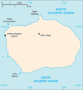
Area: 49 km2 or 19 mi2
Political Information: Dependant Territory
Official Religion: N/A
Highest Mountain: Olav Peak at 780m or 2,559ft
GDP: N/A
Time Zone (GMT/UTC): GMT
Leaders: Has the Norwegian Monarch (Harald V) and is administered by the Norwegian Polar Affairs Department.
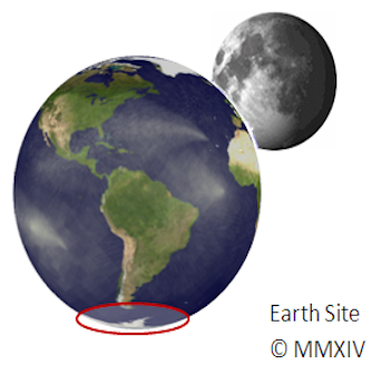
Additional: Bouvet Island is the most remote island on earth with the nearest inhabited land mass approximately 1,404 miles or 2260 kilometres away. The Island was discovered by Jean-Baptiste Charles Bouvet de Lozier on January 1, 1739.
Sources: CIA World Fact Book, Encyclopaedia Britannica.
No Results Found
The page you requested could not be found. Try refining your search, or use the navigation above to locate the post.


