World Geography
Geography is the study of the Earth’s landscapes, environments, and the relationships between people and their surroundings. It encompasses both the physical aspects of the Earth, such as its landforms, bodies of water, and climate, as well as the human aspects, including population distribution, cultures, and economies. World geography is a broad field that seeks to understand the complexities of our planet and how humans interact with it. By studying world geography, we can gain a deeper appreciation for the diversity of our planet and the interconnectedness of its various regions.
Geography is a multidisciplinary field that draws on elements of physical science, social science, and humanities. It involves the use of maps, spatial analysis, and geographic information systems (GIS) to understand the Earth’s surface and the processes that shape it. World geography also encompasses the study of human geography, which examines the ways in which people and their activities are distributed across the Earth. By understanding world geography, we can better appreciate the environmental, cultural, and economic challenges facing different regions of the world. This knowledge is crucial for addressing global issues such as climate change, resource management, and international development.
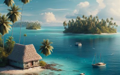
The Five Oceans and Seven Continents
The Earth’s surface is divided into five major oceans: the Pacific, Atlantic, Indian, Southern (or Antarctic), and Arctic Oceans. These vast bodies of water play a crucial role in regulating the Earth’s climate and supporting diverse marine ecosystems. The oceans also serve as important transportation routes and a source of food and other natural resources for human societies around the world.
In addition to the oceans, the Earth’s landmasses are divided into seven continents: Africa, Antarctica, Asia, Europe, North America, Australia (or Oceania), and South America. Each continent has its own unique physical and cultural characteristics, shaped by millions of years of geological processes and human history. From the deserts of Africa to the rainforests of South America, the continents offer a rich tapestry of landscapes and environments for exploration and study.
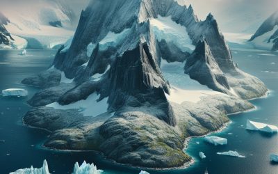
Major Mountain Ranges and Deserts
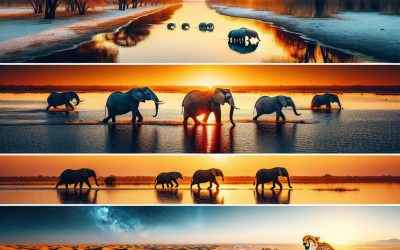
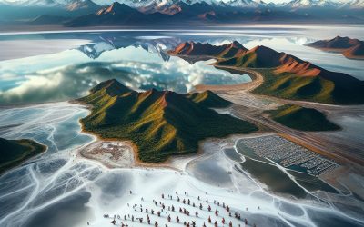
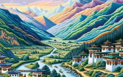
The Earth’s surface is also marked by major mountain ranges and deserts that have shaped the planet’s physical and cultural landscapes. The Himalayas, for example, are the highest mountain range in the world and are home to diverse ecosystems and cultures in countries such as India, Nepal, and Bhutan. The Andes in South America, the Rockies in North America, and the Alps in Europe are other prominent mountain ranges that have influenced human settlement patterns and economic activities.
Deserts cover about one-third of the Earth’s land surface and are characterized by low precipitation and extreme temperatures. The Sahara Desert in Africa is the largest hot desert in the world, while the Gobi Desert in Asia is one of the largest cold deserts. Deserts are not only home to unique flora and fauna but have also been important trade routes and cultural crossroads throughout history.
Climate Zones and Biomes
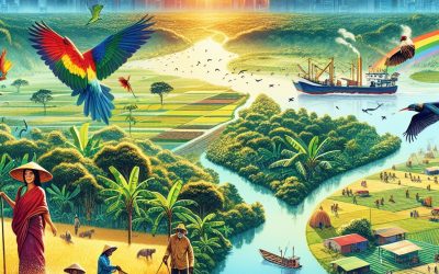
The Earth’s climate is influenced by a variety of factors, including latitude, altitude, ocean currents, and prevailing winds. As a result, the planet is divided into different climate zones, each with its own characteristic weather patterns and ecosystems. The equator, for example, experiences a tropical climate with high temperatures and heavy rainfall, while the polar regions have a cold and dry climate.
These climate zones give rise to different biomes, or large ecological areas characterized by distinct plant and animal communities. The tropical rainforest biome, found near the equator, is home to a diverse array of species and is vital for regulating the Earth’s climate. The grasslands biome, found in regions such as the African savannah and North American prairies, supports grazing animals and has been important for human agriculture throughout history.
Human Geography and Population Distribution
Human geography examines the ways in which people and their activities are distributed across the Earth’s surface. It encompasses topics such as population growth, migration patterns, urbanization, and cultural diversity. Understanding human geography is crucial for addressing global challenges such as poverty, inequality, and environmental degradation.
Population distribution is uneven across the world, with some regions experiencing rapid population growth while others are declining. The majority of the world’s population lives in Asia, particularly in countries such as China and India. Urban areas are also growing rapidly, with more than half of the world’s population now living in cities. This trend has significant implications for infrastructure development, resource management, and social inequality.
Historical and Cultural Geography
Historical geography examines how human activities have shaped the Earth’s landscapes over time. It explores topics such as colonialism, trade routes, and the rise and fall of empires. Cultural geography focuses on how human cultures have developed in different regions of the world and how they interact with their environments.
The Silk Road, for example, was an ancient trade route that connected China with Europe and facilitated the exchange of goods, ideas, and technologies across Eurasia. This historical trade route had a profound impact on the development of cultures and economies along its path. Similarly, cultural geographers study how different societies have adapted to their environments through practices such as agriculture, architecture, and religious beliefs.
The Importance of Geographic Knowledge
Geographic knowledge is crucial for addressing global challenges such as climate change, resource management, and international development. By understanding world geography, we can better appreciate the environmental, cultural, and economic challenges facing different regions of the world. This knowledge is crucial for addressing global issues such as climate change, resource management, and international development.
Geographic knowledge also helps us to understand our interconnectedness with other regions of the world. By studying world geography, we can gain a deeper appreciation for the diversity of our planet and the interconnectedness of its various regions. This understanding can foster a sense of global citizenship and empathy for people from different cultures and backgrounds.
In conclusion, world geography is a complex and multifaceted field that encompasses both physical and human aspects of the Earth’s landscapes. By studying world geography, we can gain a deeper appreciation for the diversity of our planet and the interconnectedness of its various regions. This knowledge is crucial for addressing global challenges such as climate change, resource management, and international development. It also helps us to understand our interconnectedness with other regions of the world and fosters a sense of global citizenship.
FAQs
What is world geography?
World geography is the study of the Earth’s landscapes, environments, and the relationships between people and their environments. It encompasses the physical features of the Earth, as well as the human activity that takes place on it.
Why is world geography important?
World geography is important because it helps us understand the world around us. It provides insights into the physical and human processes that shape our planet, and helps us make informed decisions about how to interact with our environment.
What are the main branches of world geography?
The main branches of world geography include physical geography, which focuses on the Earth’s natural features and processes, and human geography, which examines the relationships between people and their environments.
How does world geography impact our daily lives?
World geography impacts our daily lives in numerous ways, from influencing the weather and climate we experience, to shaping the availability of natural resources and influencing the distribution of populations and cultures around the world.
What are some key concepts in world geography?
Key concepts in world geography include location, place, human-environment interaction, movement, and region. These concepts help geographers understand and interpret the world around them.
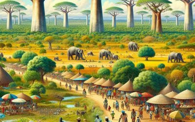
Burkina Faso
Burkina Faso bb.Capital of Burkina Faso : Ouagadougou Population (Estimated July 2012): 17,275,115 Area: 270,764 km2 or 104,543 mi2 Currency: CFA franc (CFAF) Official Language: French Political Information: Semi-Presidential Republic Official Religion: No Official Religion (approximately 60.5% of the population are Muslim, 19% are Catholic, 15.3% are Animist, 4.2% are Protestant, and 1% have other or no religious beliefs) Highest Mountain: Tena Kourou at 749m or 2,457ft GDP Official Exchange Rate (OER is more precise at gauging a countries economic power) (Estimated 2011): $10.1 billion (US$) or £6.06 billion (GBP) GDP (OER) Per Capita (per member of the population estimated 2011): (US$) or (GBP) GDP Purchasing Power Parity (PPP is good for gauging living conditions and use of resources but not as accurate as OER. This data has been calculated based on the sum value of all goods and services produced in the country valued at prices prevailing in the United States) (Estimated 2011): $21.83 billion (US$) or £13,098 billion(GBP) GDP (PPP) Per Capita (per member of the population estimated 2011): $1,500 (US$) or £900 (GBP) Time Zone (GMT/UTC): GMT Counties/Provinces/States: 13 regions; Boucle du Mouhoun, Cascades, Centre, Centre-Est, Centre-Nord, Centre-Ouest, Centre-Sud, Est, Hauts-Bassins, Nord, Plateau-Central, Sahel, Sud-Ouest Leaders: President Roch Marc Christian KABORE (since 29 December 2015) with Prime Minister Paul Kaba THIEBA (since 6 January 2016) Additional: Gained independence from France on the 5th of August 1960. Sources: CIA World Fact Book, Encyclopaedia Britannica. Burkina Faso, officially known as the Republic of Burkina Faso, is a landlocked country located in West Africa. It is bordered by six countries: Mali to the north, Niger to...
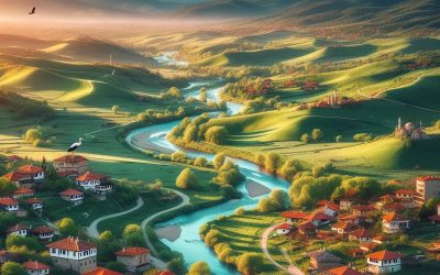
Bulgaria
Bulgaria (Republika Bŭlgaria (Republic of Bulgaria)) Capital of Bulgaria : Sofia Population (Estimated July 2012): 7,037,935 Area: 111,002 km2 or 42,858 mi2 Currency: Lev (Lv; Plural Leva) Official Language: Bulgarian Political Information: Parliamentary Democracy Official Religion: No Official Religion (approximately 82.6% of the population are Bulgarian Orthodox, 1.2% have other Christian beliefs, 12.2% are Muslim and 4% have other religious beliefs) Highest Mountain: Musala at 2,925m or 9,596ft GDP Official Exchange Rate (OER is more precise at gauging a countries economic power) (Estimated 2011): $54.3 billion (US$) or £32,580 million (GBP) GDP (OER) Per Capita (per member of the population estimated 2011): (US$) or (GBP) GDP Purchasing Power Parity (PPP is good for gauging living conditions and use of resources but not as accurate as OER. This data has been calculated based on the sum value of all goods and services produced in the country valued at prices prevailing in the United States) (Estimated 2011): $101.2 billion (US$) or £60,720 million(GBP) GDP (PPP) Per Capita (per member of the population estimated 2011): $13,500 (US$) or £8,100(GBP) Time Zone (GMT/UTC): +2:00 Counties/Provinces/States: 28 provinces (oblasti, singular – oblast); Blagoevgrad, Burgas, Dobrich, Gabrovo, Khaskovo, Kurdzhali, Kyustendil, Lovech, Montana, Pazardzhik, Pernik, Pleven, Plovdiv, Razgrad, Ruse, Shumen, Silistra, Sliven, Smolyan, Sofiya (Sofia), Sofiya-Grad (Sofia City), Stara Zagora, Turgovishte, Varna, Veliko Turnovo, Vidin, Vratsa, Yambol Leaders: President Rumen RADEV (since 22 January 2017); Vice President Iliana IOTOVA (since 22 January 2017). Prime Minister Boyko BORISSOV (since 4 May 2017); note – BORISSOV served 2 previous terms as prime minister (27 July 2009-13 March 2013 and 7 November 2014-27 January 2017) ...
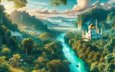
Brunei
Brunei (Negara Brunei Darussalam (State of Brunei Darussalam)) Capital of Brunei : Bandar Seri Begawan Population (Estimated July 2012): 408,786 Area: 5,765 km2 or 2,226 mi2 Currency: Brunei dollar (B$) Official Language: Malay Political Information: Malay Islamic Monarchy Official Religion: Muslim (approximately 67% of the population are Muslim, 13% are Buddhist, 10% are Christian and 10% have other religious beliefs) Highest Mountain: Bukit Pagon at 1,850m or 6,070ft GDP Official Exchange Rate (OER is more precise at gauging a countries economic power) (Estimated 2011): $15.6 billion (US$) or £9,360 million (GBP) GDP (OER) Per Capita (per member of the population estimated 2011): (US$) or (GBP) GDP Purchasing Power Parity (PPP is good for gauging living conditions and use of resources but not as accurate as OER. This data has been calculated based on the sum value of all goods and services produced in the country valued at prices prevailing in the United States) (Estimated 2011): $21.11 billion (US$) or £12,666 million (GBP) GDP (PPP) Per Capita (per member of the population estimated 2011): $49,400 (US$) or £29,640 (GBP) Time Zone (GMT/UTC): +8:00 Counties/Provinces/States: (Districts) Belait, Brunei-Muara, Temburong, Tutong Leaders: Sultan and the first Prime Minister Hassanal Bolkiah with the crown Prince Al-Muhtadee Billah. (since 5 October 1967) Sources: CIA World Fact Book, Encyclopaedia Britannica. Brunei, officially known as the Nation of Brunei, the Abode of Peace, is a small but prosperous country located on the island of Borneo in Southeast Asia. It is bordered by Malaysia and the South China Sea. Despite its small size, Brunei has a population of approximately 450,000 people. Brunei is known...
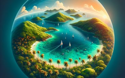
British Virgin Islands
British Virgin Islands Capital of the British Virgin Islands : Road Town, Tortola Population (Estimated July 2012): 31,148 Area: 153 km2 or 59 mi2 Currency: U.S. Dollar (U.S.$) Official Language: English Political Information: Overseas Territory of the UK Official Religion: No Official Religion (approximately 84% of the population are Protestant, 10% are Roman Catholic, 2% are Jehova’s Witness, 2% have other religious beliefs and 2% have no religious beliefs) Highest Mountain: Mount Sage at 521m or 1,709ft GDP Official Exchange Rate (OER is more precise at gauging a countries economic power) (Estimated 2008): $1.095 billion (US$) or £657 million (GBP) GDP (OER) Per Capita (per member of the population estimated 2011): (US$) or (GBP) GDP Purchasing Power Parity (PPP is good for gauging living conditions and use of resources but not as accurate as OER. This data has been calculated based on the sum value of all goods and services produced in the country valued at prices prevailing in the United States) (Estimated 2004): $853.4 million (US$) or £512 million (GBP) GDP (PPP) Per Capita (per member of the population estimated 2004): $38,500 (US$) or £23,100 (GBP) Time Zone (GMT/UTC): -4:00 Counties/Provinces/States: Four Large islands of Tortola, Anegada, Virgin Gorda and Jost Van Dyke. Thirty two small islands and islets including Great Tobago, Salt, Peter, Cooper, Norman, Guana, Beef, Great Thatch, Little Thatch, and Marina Cay. Leaders: H.M. Queen Elizabeth II with William Boyd McCleary as Governor, Vivian Inez Archibald as Deputy Governor and Orlando Smith as Premier Sources: CIA World Fact Book, Encyclopaedia...
British Indian Ocean Territory
British Indian Ocean Territory Capital of the British Indian Ocean Territories : N/A Population (Estimated February 2012): 2,800 US and UK military personnel. Area: 54,400 km2 or 21,004 mi2 Currency: United States Dollar (USD) Official Language: English Political Information: British Overseas Territory Official Religion: No Official Religion Highest Point: An unnamed region on Diego Garcia at 15m or 49ft GDP: N/A Counties/Provinces/States: Chagos Archipelago; (Islands)Danger, Diego Garcia, Eagle Island, Egmont Island, Nelson’s island, Peros Banhos, Salomon islands and Three Brothers. Leaders: H.M. Queen Elizabeth II; Commissioner Mr Colin Roberts and Mr John McManus as Administraitor Additional: The territory includes the Chagos Archipelago and is made up of over 55 islands. Sources: CIA World Fact Book, Encyclopaedia...
Brazil
Brazil (República Federativa do Brasil (Federative Republic of Brazil)) Capital of Brazil : Brasília Population (Estimated July 2012): 205,716,890 Area: 8,514,877 km2 or 3,287,612 mi2 Currency: Real (R$; plural Reais) Official Language: Portuguese Political Information: Federal Presidential Constitutional Republic Official Religion: No Official Religion (approximately 75%of the population are Roman Catholic) Highest Mountain: Pico da Neblina (Fog Peak) at 2,994m or 9,823ft GDP Official Exchange Rate (OER is more precise at gauging a countries economic power) (Estimated 2011): $2.518 trillion (US$) or £1.51 trillion (GBP) GDP (OER) Per Capita (per member of the population estimated 2011): (US$) or (GBP) GDP Purchasing Power Parity (PPP is good for gauging living conditions and use of resources but not as accurate as OER. This data has been calculated based on the sum value of all goods and services produced in the country valued at prices prevailing in the United States) (Estimated 2011): $2.309 trillion (US$) or £1.385 trillion (GBP) GDP (PPP) Per Capita (per member of the population estimated 2011): $11,600 (US$) or £6,960 (GBP) Time Zone GMT (UTC): -3:00 Counties/Provinces/States: 26 states (estados, singular – estado) and 1 federal district* (distrito federal); Acre, Alagoas, Amapa, Amazonas, Bahia, Ceara, Distrito Federal*, Espirito Santo, Goias, Maranhao, Mato Grosso, Mato Grosso do Sul, Minas Gerais, Para, Paraiba, Parana, Pernambuco, Piaui, Rio de Janeiro, Rio Grande do Norte, Rio Grande do Sul, Rondonia, Roraima, Santa Catarina, Sao Paulo, Sergipe, Tocantins Leaders: President is Dilma Rousseff and Michel Temer as Vice President. Sources: CIA World Fact Book, Encyclopaedia Britannica. Brazil, located in South America, is the largest country on the continent...
Bouvet Island
Bouvet Island (Bouvetøya(Norwegian)) Capital: N/A Population: Uninhabited Area: 49 km2 or 19 mi2 Political Information: Dependant Territory Official Religion: N/A Highest Mountain: Olav Peak at 780m or 2,559ft GDP: N/A Time Zone (GMT/UTC): GMT Leaders: Has the Norwegian Monarch (Harald V) and is administered by the Norwegian Polar Affairs Department. Additional: Bouvet Island is the most remote island on earth with the nearest inhabited land mass approximately 1,404 miles or 2260 kilometres away. The Island was discovered by Jean-Baptiste Charles Bouvet de Lozier on January 1, 1739. Sources: CIA World Fact Book, Encyclopaedia...
Bosnia and Herzegovina
Bosnia and Herzegovina (Bosna i Hercegovina (Bosnia and Herzegovina)) Capital of Bosnia and Herzegovina : Sarajevo Population (Estimated July 2012): 4,622,292 Area: 51,209 km2 or 19,772 mi2 Currency: Convertible Marka (KM) Official Language: Bosnian, Croation and Serbian Political Information: Federal Democratic Republic Official Religion: No Official Religion (approximately 40% of the population are Muslim, 31% are Orthodox, 15% are Roman Catholic and 14% have other religious beliefs) Highest Mountain: Mount Maglic at 2,386m or 7,828ft GDP Official Exchange Rate (OER is more precise at gauging a countries economic power) (Estimated 2011): $18.3 billion (US$) or £10.98 billion (GBP) GDP (OER) Per Capita (per member of the population estimated 2011): (US$) or (GBP) GDP Purchasing Power Parity (PPP is good for gauging living conditions and use of resources but not as accurate as OER. This data has been calculated based on the sum value of all goods and services produced in the country valued at prices prevailing in the United States) (Estimated 2011): $31.72 billion (US$) or £19.032 billion (GBP) GDP (PPP) Per Capita (per member of the population estimated 2011): $8,200 (US$) or £4,920 (GBP) Time Zone: + 1:00 Counties/Provinces/States: 2 first-order administrative divisions and 1 internationally supervised district* – Brcko district (Brcko Distrikt)*, the Bosniak/Croat Federation of Bosnia and Herzegovina (Federacija Bosna i Hercegovina) and the Bosnian Serb-led Republika Srpska; note – Brcko district is in northeastern Bosnia and is a self-governing administrative unit under the sovereignty of Bosnia and Herzegovina and formally held in condominium between the two entities; the District remains under international supervision. Leaders: High Representative is Valentin Inzko and Vjekoslav...
Botswana
Botswana (Republic of Botswana) Capital of Botswana: Gaborone Population (Estimated July 2012): 2,098,018 Area: 581,730 km2 or 224,607 mi2 Currency: Pula (P) Official Language: English Political Information: Democratic Parliamentary Republic Official Religion: No Official Religion (approximately 70% of the population are Christians, 20% have no religious beliefs, 6% have indigenous beliefs and 4% have other religious beliefs) Highest Point: Kwahu Hill at 1359m or 4,459ft GDP Official Exchange Rate (OER is more precise at gauging a countries economic power) (Estimated 2011): $16.4 billion (US$) or £9.84 billion (GBP) GDP (OER) Per Capita (per member of the population estimated 2011): (US$) or (GBP) GDP Purchasing Power Parity (PPP is good for gauging living conditions and use of resources but not as accurate as OER. This data has been calculated based on the sum value of all goods and services produced in the country valued at prices prevailing in the United States) (Estimated 2011): $30.09 billion (US$) or £18 billion (GBP) GDP (PPP) Per Capita (per member of the population estimated 2011): $16,300 (US$) or £9,780 (GBP) Time Zone: + 2:00 Wildlife: Counties/Provinces/States: 9 districts and 5 town councils*; Central, Francistown*, Gaborone*, Ghanzi, Jwaneng*, Kgalagadi, Kgatleng, Kweneng, Lobatse*, Northeast, Northwest, Selebi-Pikwe*, Southeast, Southern Leaders: President Ian Khama with Mompati Merafhe as Vice President Sources: CIA World Fact Book, Encyclopaedia Britannica. Botswana, officially known as the Republic of Botswana, is a landlocked country located in Southern Africa. It is bordered by South Africa to the south and southeast, Namibia to the west and north, and Zimbabwe to the northeast. With a population of approximately 2.3 million people, Botswana is one of the least densely populated countries in the world. Despite its small population,...
Bolivia
Bolivia (Estado Plurinacional de Bolivia (Plurinational State of Bolivia)) Capital of Bolivia : La Paz (Administrative), Sucre (Constitutional) Population (Estimated July 2012): 10,290,003 Area: 1,098,581 km2 or 424,164 mi2 Currency: Boliviano (Bs) Official Language: Spanish, Quechua, Aymara with several native languages also spoken. Political Information: Unitary Presidential Republic Official Religion: No Official Religion (approximately of 95% the population is Roman Catholic and 5% are Protestant) Highest Mountain: Nevado Sajama at 6,542m or 21,463ft GDP Official Exchange Rate (OER is more precise at gauging a countries economic power) (Estimated 2011): $24.4 billion (US$) or £14.64 billion (GBP) GDP (OER) Per Capita (per member of the population estimated 2011): (US$) or (GBP) GDP Purchasing Power Parity (PPP is good for gauging living conditions and use of resources but not as accurate as OER. This data has been calculated based on the sum value of all goods and services produced in the country valued at prices prevailing in the United States) (Estimated 2011): $51.46 billion (US$) or £30.876 billion (GBP) GDP (PPP) Per Capita (per member of the population estimated 2011): $4,800 (US$) or £2,880 (GBP) Time Zone: -4:00 Counties/Provinces/States: (departments or departamentos) Beni, Chuquisaca, Cochabamba, La Paz, Oruro, Pando, Potosi, Santa Cruz, Tarija Leaders:President Juan Evo MORALES Ayma (since 22 January 2006); Vice President Alvaro GARCIA Linera (since 22 January 2006) Sources: CIA World Fact Book, Encyclopaedia Britannica. Bolivia, located in the heart of South America, is a country known for its rich cultural heritage and diverse landscapes. With a population of over 11 million people, Bolivia is home to a variety of ethnic groups,...
Bhutan
Bhutan (Druk-Yul (Kingdom of Bhutan)) Capital of Bhutan : Thimphu Population (Estimated July 2012): 716,896 Area: 38,394 km2 or 14,824 mi2 Currency: Ngultrum (BTN) Official Language: Dzongkha (a Tibetan dialect) Political Information: Constitutional Monarchy Official Religion: No Official Religion (approximately 75% of the population are Lamaistic Buddhist and 25% Hindu) Highest Mountain: Gangkar Puensum at 7,570m or 24840ft GDP Official Exchange Rate (OER is more precise at gauging a countries economic power) (Estimated 2011): $1.83 billion (US$) or £1.098 billion(GBP) GDP (OER) Per Capita (per member of the population estimated 2011): (US$) or (GBP) GDP Purchasing Power Parity (PPP is good for gauging living conditions and use of resources but not as accurate as OER. This data has been calculated based on the sum value of all goods and services produced in the country valued at prices prevailing in the United States) (Estimated 2011): $4.284 billion (US$) or £2.57 billion(GBP) GDP (PPP) Per Capita (per member of the population estimated 2011): $6,000 (US$) or £3,600 (GBP) Time Zone: +6:00 Counties/Provinces/States: (districts or dzongkhag) Bumthang, Chhukha, Chirang, Daga, Gasa, Geylegphug, Ha, Lhuntshi, Mongar, Paro, Pemagatsel, Punakha, Samchi, Samdrup Jongkhar, Shemgang, Tashigang, Tashi Yangtse, Thimphu, Tongsa, Wangdi Phodrang Leaders:King Jigme Khesar Namgyel WANGCHUCK (since 14 December 2006); Prime Minister Tshering TOBGAY (since 27 July 2013) Sources: CIA World Fact Book, Encyclopaedia Britannica. Nestled in the eastern Himalayas, the small kingdom of Bhutan is a hidden gem waiting to be discovered. Known for its unique culture and approach to development, Bhutan has captivated the world with its commitment to Gross National Happiness (GNH) and sustainable practices. In this article, we...

Bermuda
Bermuda Capital of Bermuda : Hamilton Population (Estimated July 2012): 69,080 Area: 53.2km2 or 20.6mi2 Currency: Bermuda Dollar (Bd$) Official Language: English Political Information: Overseas Territory of the United Kingdom. Official Religion: No Official Religion (approximately 52% of the population are Protestant, 15% are Roman Catholic, 12% have other religious beliefs, 7% have unspecified or unaffiliated beliefs and 12% have no religious beliefs) Highest Point: Town Hill at 76m or 249ft GDP Official Exchange Rate (OER is more precise at gauging a countries economic power) (Estimated 2011): (US$) or (GBP) GDP (OER) Per Capita (per member of the population estimated 2011): (US$) or (GBP) GDP Purchasing Power Parity (PPP is good for gauging living conditions and use of resources but not as accurate as OER. This data has been calculated based on the sum value of all goods and services produced in the country valued at prices prevailing in the United States) (Estimated 2004): $4.5 billion (US$) or £2.7 billion (GBP) GDP (PPP) Per Capita (per member of the population estimated 2004): $69,900 (US$) or £41,940 (GBP) Time Zone (GMT/UTC): -4:00 Counties/Provinces/States: (Parishes) Devonshire, Hamilton, Paget, Pembroke, Saint George’s, Sandys, Smith’s, Southampton and Warwick; (Municipalities) Hamilton and Saint George’s, Leaders: Queen ELIZABETH II (since 6 February 1952); represented by Governor John RANKIN (since 5 December 2016) and Premier David BURT (since 19 July 2017) Sources: CIA World Fact Book, Encyclopaedia...