World Geography
Geography is the study of the Earth’s landscapes, environments, and the relationships between people and their surroundings. It encompasses both the physical aspects of the Earth, such as its landforms, bodies of water, and climate, as well as the human aspects, including population distribution, cultures, and economies. World geography is a broad field that seeks to understand the complexities of our planet and how humans interact with it. By studying world geography, we can gain a deeper appreciation for the diversity of our planet and the interconnectedness of its various regions.
Geography is a multidisciplinary field that draws on elements of physical science, social science, and humanities. It involves the use of maps, spatial analysis, and geographic information systems (GIS) to understand the Earth’s surface and the processes that shape it. World geography also encompasses the study of human geography, which examines the ways in which people and their activities are distributed across the Earth. By understanding world geography, we can better appreciate the environmental, cultural, and economic challenges facing different regions of the world. This knowledge is crucial for addressing global issues such as climate change, resource management, and international development.
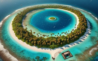
The Five Oceans and Seven Continents
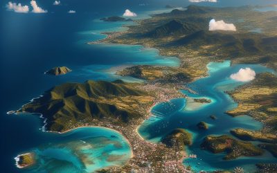
The Earth’s surface is divided into five major oceans: the Pacific, Atlantic, Indian, Southern (or Antarctic), and Arctic Oceans. These vast bodies of water play a crucial role in regulating the Earth’s climate and supporting diverse marine ecosystems. The oceans also serve as important transportation routes and a source of food and other natural resources for human societies around the world.
In addition to the oceans, the Earth’s landmasses are divided into seven continents: Africa, Antarctica, Asia, Europe, North America, Australia (or Oceania), and South America. Each continent has its own unique physical and cultural characteristics, shaped by millions of years of geological processes and human history. From the deserts of Africa to the rainforests of South America, the continents offer a rich tapestry of landscapes and environments for exploration and study.
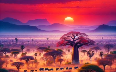
Major Mountain Ranges and Deserts
The Earth’s surface is also marked by major mountain ranges and deserts that have shaped the planet’s physical and cultural landscapes. The Himalayas, for example, are the highest mountain range in the world and are home to diverse ecosystems and cultures in countries such as India, Nepal, and Bhutan. The Andes in South America, the Rockies in North America, and the Alps in Europe are other prominent mountain ranges that have influenced human settlement patterns and economic activities.
Deserts cover about one-third of the Earth’s land surface and are characterized by low precipitation and extreme temperatures. The Sahara Desert in Africa is the largest hot desert in the world, while the Gobi Desert in Asia is one of the largest cold deserts. Deserts are not only home to unique flora and fauna but have also been important trade routes and cultural crossroads throughout history.
Climate Zones and Biomes
The Earth’s climate is influenced by a variety of factors, including latitude, altitude, ocean currents, and prevailing winds. As a result, the planet is divided into different climate zones, each with its own characteristic weather patterns and ecosystems. The equator, for example, experiences a tropical climate with high temperatures and heavy rainfall, while the polar regions have a cold and dry climate.
These climate zones give rise to different biomes, or large ecological areas characterized by distinct plant and animal communities. The tropical rainforest biome, found near the equator, is home to a diverse array of species and is vital for regulating the Earth’s climate. The grasslands biome, found in regions such as the African savannah and North American prairies, supports grazing animals and has been important for human agriculture throughout history.
Human Geography and Population Distribution
Human geography examines the ways in which people and their activities are distributed across the Earth’s surface. It encompasses topics such as population growth, migration patterns, urbanization, and cultural diversity. Understanding human geography is crucial for addressing global challenges such as poverty, inequality, and environmental degradation.
Population distribution is uneven across the world, with some regions experiencing rapid population growth while others are declining. The majority of the world’s population lives in Asia, particularly in countries such as China and India. Urban areas are also growing rapidly, with more than half of the world’s population now living in cities. This trend has significant implications for infrastructure development, resource management, and social inequality.
Historical and Cultural Geography
Historical geography examines how human activities have shaped the Earth’s landscapes over time. It explores topics such as colonialism, trade routes, and the rise and fall of empires. Cultural geography focuses on how human cultures have developed in different regions of the world and how they interact with their environments.
The Silk Road, for example, was an ancient trade route that connected China with Europe and facilitated the exchange of goods, ideas, and technologies across Eurasia. This historical trade route had a profound impact on the development of cultures and economies along its path. Similarly, cultural geographers study how different societies have adapted to their environments through practices such as agriculture, architecture, and religious beliefs.
The Importance of Geographic Knowledge
Geographic knowledge is crucial for addressing global challenges such as climate change, resource management, and international development. By understanding world geography, we can better appreciate the environmental, cultural, and economic challenges facing different regions of the world. This knowledge is crucial for addressing global issues such as climate change, resource management, and international development.
Geographic knowledge also helps us to understand our interconnectedness with other regions of the world. By studying world geography, we can gain a deeper appreciation for the diversity of our planet and the interconnectedness of its various regions. This understanding can foster a sense of global citizenship and empathy for people from different cultures and backgrounds.
In conclusion, world geography is a complex and multifaceted field that encompasses both physical and human aspects of the Earth’s landscapes. By studying world geography, we can gain a deeper appreciation for the diversity of our planet and the interconnectedness of its various regions. This knowledge is crucial for addressing global challenges such as climate change, resource management, and international development. It also helps us to understand our interconnectedness with other regions of the world and fosters a sense of global citizenship.
FAQs
What is world geography?
World geography is the study of the Earth’s landscapes, environments, and the relationships between people and their environments. It encompasses the physical features of the Earth, as well as the human activity that takes place on it.
Why is world geography important?
World geography is important because it helps us understand the world around us. It provides insights into the physical and human processes that shape our planet, and helps us make informed decisions about how to interact with our environment.
What are the main branches of world geography?
The main branches of world geography include physical geography, which focuses on the Earth’s natural features and processes, and human geography, which examines the relationships between people and their environments.
How does world geography impact our daily lives?
World geography impacts our daily lives in numerous ways, from influencing the weather and climate we experience, to shaping the availability of natural resources and influencing the distribution of populations and cultures around the world.
What are some key concepts in world geography?
Key concepts in world geography include location, place, human-environment interaction, movement, and region. These concepts help geographers understand and interpret the world around them.
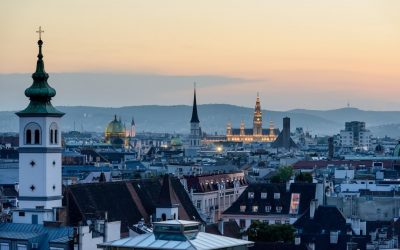
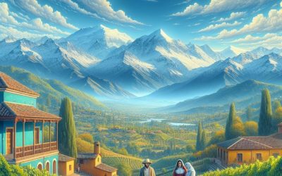
Discovering the Charms of Austria: A Traveler’s Guide to the Best Sights and Experiences
Austria is a country known for its natural beauty and cultural richness. Nestled in the heart of Europe, this small country is home to stunning alpine landscapes, charming cities, and a rich history that has influenced music, art, and architecture. From the imperial grandeur of Vienna to the alpine wonders of the Austrian Alps, there is something for everyone to explore and discover in Austria. Key Takeaways Austria is a country of natural beauty and cultural richness. Vienna is a city of music, art, and architecture with imperial history. The Austrian Alps offer skiing, hiking, and relaxation opportunities. Salzburg is the birthplace of Mozart and the setting of The Sound of Music. The Danube Valley is a scenic journey through Austria’s wine country. Exploring Vienna Vienna, the capital city of Austria, is a must-visit destination for any traveler. Known for its imperial history, Vienna was once the center of the Habsburg Empire and its influence can still be seen today in the city’s architecture and cultural offerings. The city is home to numerous palaces, museums, and concert halls that showcase its rich history. One of the must-see sights in Vienna is Schönbrunn Palace. This magnificent palace was once the summer residence of the Habsburgs and is now a UNESCO World Heritage site. Visitors can explore the palace’s opulent rooms, stroll through its beautiful gardens, and even catch a classical concert in the Orangery. Another iconic sight in Vienna is St. Stephen’s Cathedral. This stunning Gothic cathedral is located in the heart of the city and is known for its intricate architecture and beautiful stained glass windows. Visitors can climb...
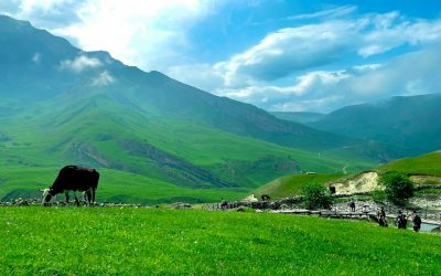
Discovering the Hidden Gems of Azerbaijan: A Journey Through its Rich Culture and Stunning Landscapes
Azerbaijan, a country located at the crossroads of Eastern Europe and Western Asia, is a hidden gem waiting to be discovered by travelers. While it may not be as well-known as its neighboring countries, Azerbaijan offers a wealth of attractions and experiences that are sure to captivate any visitor. From its rich culture and history to its stunning natural landscapes and delicious cuisine, Azerbaijan has something for everyone. Key Takeaways Azerbaijan’s hidden gems offer a unique travel experience blending East and West. Baku, the city of contrasts, is a must-see destination with its rich culture and history. Azerbaijan’s natural landscapes are breathtaking and offer a variety of outdoor activities. Sheki’s ancient wonders and rural villages are enchanting and offer a glimpse into Azerbaijan’s past. Azerbaijan’s cuisine, art, craftsmanship, and festivals are a treasure trove of traditions waiting to be discovered. Azerbaijan’s Rich Culture: A Blend of East and West Azerbaijan’s culture is a fascinating blend of Eastern and Western influences, shaped by its location on the Silk Road and its history of being ruled by various empires. The country’s history dates back thousands of years, with evidence of human habitation dating back to the Stone Age. Over the centuries, Azerbaijan has been influenced by Persian, Turkish, Russian, and Arab cultures, among others. One of the most prominent aspects of Azerbaijani culture is its traditional music, dance, and art forms. The mugham, a traditional form of music that combines poetry and instrumental music, is considered a masterpiece of oral and intangible heritage by UNESCO. Traditional dances, such as the yalli and the khanchobany, are also an important part of Azerbaijani...
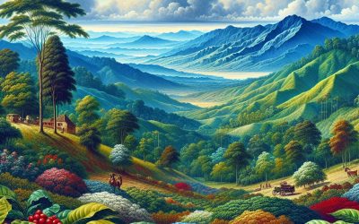
Colombia
Colombia (República de Colombia (Republic of Colombia)) Capital of Colombia: Bogotá Population (Estimated July 2012): 45,239,079 Area: 1,141,748 km2 or 440,831 mi2 Currency: Peso (Col$) Official Language: Spanish Political Information: Unitary Presidential Constitutional Republic Official Religion: No Official Religion (approximately 90% of the population are Roman Catholic and 10% have other religious beliefs) Highest Mountain: Pico Cristóbal Colón or Pico Simón Bolívar both at 5,775m or 18,947 GDP Official Exchange Rate (OER is more precise at gauging a countries economic power) (Estimated 2005): $321.5 billion (US$) GDP Purchasing Power Parity (PPP is good for gauging living conditions and use of resources but not as accurate as OER. This data has been calculated based on the sum value of all goods and services produced in the country valued at prices prevailing in the United States) (Estimated 2011): $470.7 billion (US$) GDP (PPP) Per Capita (per member of the population estimated 2011): $10,100 (US$) Time Zone (GMT/UTC): -5:00 Counties/Provinces/States: 32 departments (departamentos, singular – departamento) and 1 capital district* (distrito capital); Amazonas, Antioquia, Arauca, Atlantico, Bogota*, Bolivar, Boyaca, Caldas, Caqueta, Casanare, Cauca, Cesar, Choco, Cordoba, Cundinamarca, Guainia, Guaviare, Huila, La Guajira, Magdalena, Meta, Narino, Norte de Santander, Putumayo, Quindio, Risaralda, San Andres y Providencia, Santander, Sucre, Tolima, Valle del Cauca, Vaupes, Vichada Leaders: President Juan Manuel Santos with Vice President Angelino Garzón. Additional: $470.7 billion (US$) Sources: Independence from Spain was declared on the 20th of July 1810 but not recognised until the 7th of August 1819. Colombia Colombia, located in the northwestern part of South America, is a vibrant and diverse country with a rich history...
Cocos Islands
Cocos Islands (Territory of Cocos (Keeling) Islands) Capital: West Island Population (Estimated July 2012): 596 Area: 14 km2 or 5 mi2 Currency: Australian Dollar (AUD) Official Language: English Political Information: Territory of Australia Official Religion: No Official Religion (approximately 80% of the population are Muslim and 20% have other religious beliefs) Highest Point: Unnamed area at 5m or 16ft GDP: N/A Time Zone (GMT/UTC): +6:30 Leaders: Queen Elizabeth II represented by the Australian governor general. Administrator is Brian Lacy, a non resident on behalf of the Australian Department of Transport and Regional Services. Additional: Comprises of two coral Atolls, north Keeling Island and 26 islets. The Island’s waters are home to a vast number of marine life, both in species and abundance, including several species of shark. Due to mass fishing the marine life was under threat but thanks to the implementation of a exclusion zone (12 miles) around the island life has been restored. The coral surrounding the island is mainly dead due to a recent sudden increase of temperature from the El Niño effect but this has not seemed to of effected the growth of marine populations. Sources: CIA World Fact Book, Encyclopaedia...
Clipperton Island
Clipperton Island (Île de Clipperton or Île de la Passion (French), Isla de la Pasión (Spanish)) Population: Uninhabited Area: 5km2 or 2mi2 Political Information: French Overseas Possession Highest Point: Rocher Clipperton at 29 meters or 95 ft Discovery: Named After John Clipperton, the English mutineer and pirate, who used the Island in 1705. Time Zone (GMT/UTC): -8:00 Leaders: Brice Hortefeux Administers the Island as the current Minister of Overseas France (Ministre de l’Outre-Mer). Sources: CIA World Fact Book, Encyclopaedia...
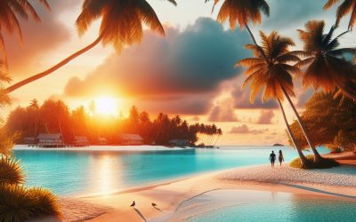
Guadeloupe
Guadeloupe (Département d’Outre-Mer de la Guadeloupe (Overseas Department of Guadeloupe)) Capital of Guadeloupe: Basse-Terre Population (Estimated July 2012): 454,000 Area: 1,630 km2 or 629 mi2 Currency: Euro (€) Official Language: French Political Information: Overseas Region of France Official Religion: No Official Religion Time Zone (GMT/UTC): Leaders: President François Hollande with President of the General Council Jacques Gillot and President of the Regional Council Victorin Lurel. Sources: CIA World Fact Book, Encyclopaedia Britannica. Guadeloupe Guadeloupe is a stunning archipelago located in the Caribbean, known for its beautiful beaches, lush rainforests, and vibrant culture. It is an overseas region of France and is composed of several islands, with the two main ones being Basse-Terre and Grande-Terre. The islands are surrounded by crystal-clear waters and offer a perfect blend of French and Caribbean influences. Guadeloupe is a popular destination for tourists seeking a tropical paradise with a touch of European charm. The islands of Guadeloupe are rich in history and culture, with a diverse population that includes people of African, European, and East Indian descent. The official language is French, but Creole is widely spoken and is an integral part of the local culture. The music, dance, and cuisine of Guadeloupe are a reflection of this cultural diversity, making it a fascinating destination for those interested in experiencing the unique blend of Caribbean and European influences. With its stunning natural beauty and rich cultural heritage, Guadeloupe offers a truly unforgettable experience for visitors. History and Culture of Guadeloupe The history of Guadeloupe is a complex tapestry of colonialism, slavery, and resistance. The islands were originally inhabited by the Arawak and Carib people before...
China
China (Zhonghua Renmin Gongheguo (People’s Republic of China)) Capital of China: Beijing (Peking) Population (Estimated July 2012): 1,343,239,923 Area: 9,572,900 km2 or 3,696,100 mi2 Currency: Renminbi (yuan) (Y) Official Language: Mandarin Chinese Political Information: Communist State Official Religion: No Official Religion Highest Mountain: Qowowuyag at 8,188m or 26,864 feet (Everest is partially in China but the peak is in Nepal) GDP Official Exchange Rate (OER is more precise at gauging a countries economic power) (Estimated 2011): $6.989 trillion (US$) or (GBP) GDP (OER) Per Capita (per member of the population estimated 2011): (US$) or (GBP) GDP Purchasing Power Parity (PPP is good for gauging living conditions and use of resources but not as accurate as OER. This data has been calculated based on the sum value of all goods and services produced in the country valued at prices prevailing in the United States) (Estimated 2011): $11.29 trillion (US$) or (GBP) GDP (PPP) Per Capita (per member of the population estimated 2011): $8,400 (US$) or (GBP) Time Zone (GMT/UTC): +8:00 Counties/Provinces/States: 23 provinces (sheng, singular and plural), 5 autonomous regions (zizhiqu, singular and plural), and 4 municipalities (shi, singular and plural) provinces: Anhui, Fujian, Gansu, Guangdong, Guizhou, Hainan, Hebei, Heilongjiang, Henan, Hubei, Hunan, Jiangsu, Jiangxi, Jilin, Liaoning, Qinghai, Shaanxi, Shandong, Shanxi, Sichuan, Yunnan, Zhejiang; (see note on Taiwan) autonomous regions: Guangxi, Nei Mongol (Inner Mongolia), Ningxia, Xinjiang Uygur, Xizang (Tibet) municipalities: Beijing, Chongqing, Shanghai, Tianjin note: China considers Taiwan its 23rd province; see separate entries for the special administrative regions of Hong Kong and Macau Leaders: Premier LI Keqiang (since 16 March 2013); Executive...
Chile
Chile (República de Chile (Republic of Chile)) Capital of Chile: Santiago Population (Estimated July 2012): 17,067,369 Area: 756,096 km2 or 291,930 mi2 Currency: Peso (Ch$) Official Language: Spanish Political Information: Unitary Presidential Republic Official Religion: No Official Religion (approximately 70% of the population are Roman Catholic, 15.1% are Evangelical, 1.1% are Jehovas Witnesses, 5.6% have other religious beliefs and 8.3% have no religious beliefs) Highest Mountain: Nevado Ojos del Salado at 6,880m or 22,572ft GDP Official Exchange Rate (OER is more precise at gauging a countries economic power) (Estimated 2011): $243 billion (US$) or (GBP) GDP (OER) Per Capita (per member of the population estimated 2011): (US$) or (GBP) GDP Purchasing Power Parity (PPP is good for gauging living conditions and use of resources but not as accurate as OER. This data has been calculated based on the sum value of all goods and services produced in the country valued at prices prevailing in the United States) (Estimated 2011): $281 billion (US$) or (GBP) GDP (PPP) Per Capita (per member of the population estimated 2011): $16,100 (US$) or (GBP) Time Zone (GMT/UTC): Between -4:00 and -6:00 Counties/Provinces/States: 15 regions (regiones, singular – region); Aisen del General Carlos Ibanez del Campo, Antofagasta, Araucania, Arica y Parinacota, Atacama, Biobio, Coquimbo, Libertador General Bernardo O’Higgins, Los Lagos, Los Rios, Magallanes y de la Antartica Chilena, Maule, Region Metropolitana (Santiago), Tarapaca, Valparaiso Leaders: President Sebastian PINERA Echenique (since 11 March 2018); note – the president is both chief of state and head of government. Additional: Declared Independence from Spain the 12th of February 1818 but not recognised until the...
Chad
Chad (Jumhūriyyah Tshad (Arabic); République du Tchad (French) (Republic of Chad)) Capital of Chad: N’Djamena Population (Estimated Jull 2012): 10,975,648 Area: 495,755 km2 or 495,755 mi2 Currency: CFA franc (CFAF) Official Language: Arabic; French Political Information: Presidential Republic Official Religion: No Official Religion (approximately 53.1% of the population are Muslim, 20.1% are Catholic, 14.2% are Protestant, 7.3% are Animist, 2.2% have other religious beliefs and 3.1% have no religious beliefs) Highest Mountain: Emi Koussi at 3,415m or 11,204ft GDP Official Exchange Rate (OER is more precise at gauging a countries economic power) (Estimated 2011): $9.6 billion (US$) or (GBP) GDP (OER) Per Capita (per member of the population estimated 2011): (US$) or (GBP) GDP Purchasing Power Parity (PPP is good for gauging living conditions and use of resources but not as accurate as OER. This data has been calculated based on the sum value of all goods and services produced in the country valued at prices prevailing in the United States) (Estimated 2011): $19.69 billion (US$) or (GBP) GDP (PPP) Per Capita (per member of the population estimated 2011): $1,900 (US$) or (GBP) Time Zone (GMT/UTC): +1:00 Counties/Provinces/States: 22 regions (regions, singular – region); Barh el Gazel, Batha, Borkou, Chari-Baguirmi, Ennedi, Guera, Hadjer-Lamis, Kanem, Lac, Logone Occidental, Logone Oriental, Mandoul, Mayo-Kebbi Est, Mayo-Kebbi Ouest, Moyen-Chari, Ouaddai, Salamat, Sila, Tandjile, Tibesti, Ville de N’Djamena, Wadi Fira Leaders: President Idriss DEBY Itno, Lt. Gen. (since 4 December 1990). Note: prime minister position eliminated under the 2018 constitution with Prime Minister Emmanuel Nadingar. Sources: CIA World Fact Book, Encyclopaedia Britannica. Chad Chad is a landlocked country located in Central...
Dominican Republic
Dominican Republic (República Dominicana) Capital: Santo Domingo Population (Estimated July 2012): 10,088,598 Area: 48,671 km2 or 18,792 mi2 Currency: Dominican Peso (RD$) Official Language: Spanish Political Information: Unitary Democratic Republic Official Religion: No Official Religion (approximately 95% of the population are Roman Catholic and 5% have other religious beliefs) Highest Mountain: Pico Duarte 3,175m or 10,417ft GDP Official Exchange Rate (OER is more precise at gauging a countries economic power) (Estimated 2011): $54.4 billion (US$) or (GBP) GDP (OER) Per Capita (per member of the population estimated 2011): (US$) GDP Purchasing Power Parity (PPP is good for gauging living conditions and use of resources but not as accurate as OER. This data has been calculated based on the sum value of all goods and services produced in the country valued at prices prevailing in the United States) (Estimated 2011): $93.23 billion (US$) or (GBP) GDP (PPP) Per Capita (per member of the population estimated 2011): (US$) $9,300 Time Zone (GMT/UTC): -4:00 Counties/Provinces/States: 31 provinces (provincias, singular – provincia) and 1 district* (distrito); Azua, Bahoruco, Barahona, Dajabon, Distrito Nacional*, Duarte, El Seibo, Elias Pina, Espaillat, Hato Mayor, Independencia, La Altagracia, La Romana, La Vega, Maria Trinidad Sanchez, Monsenor Nouel, Monte Cristi, Monte Plata, Pedernales, Peravia, Puerto Plata, Salcedo, Samana, San Cristobal, San Jose de Ocoa, San Juan, San Pedro de Macoris, Sanchez Ramirez, Santiago, Santiago Rodriguez, Santo Domingo, Valverde Leaders: President Danilo MEDINA Sanchez (since 16 August 2012); Vice President Margarita CEDENO DE FERNANDEZ (since 16 August 2012); note – the president is both chief of state and head of government. Additional: The Dominican Republic has been...
Dominica
Dominica (Commonwealth of Dominica) Capital: Roseau Population (Estimated July 2012): 73,126 Area: 751 km2 or 290 mi2 Currency: Eastern Caribbean dollar (EC$) Official Language: English Political Information: Parliamentary Republic Official Religion: No Official Religion (approximately 61.4% of the population are Roman Catholic, 20.6% are Protestant, 1.2% Jehovah’s witnesses, 7.7% are other Christian, 1.3% are Rastafarian, 1.6% have other religious beliefs and 6.1% have no religious beliefs) Highest Mountain: Morne Diablotins at 1,447m or 4,747ft GDP Official Exchange Rate (OER is more precise at gauging a countries economic power) (Estimated 2011): $500 million (US$) or (GBP) GDP (OER) Per Capita (per member of the population estimated 2011): (US$) or (GBP) GDP Purchasing Power Parity (PPP is good for gauging living conditions and use of resources but not as accurate as OER. This data has been calculated based on the sum value of all goods and services produced in the country valued at prices prevailing in the United States) (Estimated 2011): $1.02 billion (US$) or (GBP) GDP (PPP) Per Capita (per member of the population estimated 2011): $13,600 (US$) or (GBP) Time Zone (GMT/UTC): -4:00 Counties/Provinces/States: 10 parishes; Saint Andrew, Saint David, Saint George, Saint John, Saint Joseph, Saint Luke, Saint Mark, Saint Patrick, Saint Paul, Saint Peter Leaders: President Charles A. SAVARIN (since 2 October 2013) with Prime Minister Roosevelt SKERRIT (since 8 January 2004). Additional: Gained Independence from the UK on the 3rd of November 1978. Sources: CIA World Fact Book, Encyclopaedia Britannica. Dominica Dominica, also known as the Commonwealth of Dominica, is a small island nation located in the Caribbean Sea. It is part of...

Estonia
Estonia (Eesti Vabariik (Republic of Estonia)) Capital of Estonia: Tallinn Population (Estimated July 2012): 1,274,709 Area: 45,227 km2 or 17,462 mi2 Currency: Euro (€) Official Language: Estonian Political Information: Parliamentary Republic Official Religion: No Official Religion (approximately 13.6% of the population are Evangelical Lutheran, 12.8% Orthodox, 34.1% are unaffiliated, 33.4% have other religious beliefs and 6.1% have no religious beliefs) Highest Mountain: Suur Munamagi at 318m or 1,043ft GDP Official Exchange Rate (OER is more precise at gauging a countries economic power) (Estimated 2011): $22.5 billion (US$) or (GBP) GDP (OER) Per Capita (per member of the population estimated 2011): (US$) or (GBP) GDP Purchasing Power Parity (PPP is good for gauging living conditions and use of resources but not as accurate as OER. This data has been calculated based on the sum value of all goods and services produced in the country valued at prices prevailing in the United States) (Estimated 2011): $27.02 billion (US$) or (GBP) GDP (PPP) Per Capita (per member of the population estimated 2011): $20,200 (US$) or (GBP) Time Zone (GMT/UTC): +2:00 Counties/Provinces/States: 15 counties (maakonnad, singular – maakond); Harjumaa (Tallinn), Hiiumaa (Kardla), Ida-Virumaa (Johvi), Jarvamaa (Paide), Jogevamaa (Jogeva), Laanemaa (Haapsalu), Laane-Virumaa (Rakvere), Parnumaa (Parnu), Polvamaa (Polva), Raplamaa (Rapla), Saaremaa (Kuressaare), Tartumaa (Tartu), Valgamaa (Valga), Viljandimaa (Viljandi), Vorumaa (Voru) note: counties have the administrative center name following in parentheses Leaders: President Toomas Hendrik Ilves with Andrus Ansip as Prime Minister. Additional: Independence from Russia was officially recognised on the 2nd of February 1920 however due to World War II Soviet forces re-occupied Estonia between 1940 and 1941, then by the...